
MAINE, USA — "Let It Snow" has been playing in stores for at least a few weeks, if not longer. Some early adopters have been listening since Halloween!
In the meantime, though, snow totals have been paltry at best. Even Caribou, which usually sees over 2 feet of snow by now, is lagging behind.
As of Friday, Portland has only measured 0.9" of snow! Bangor is currently sitting at 6.6" of accumulation, roughly half of average for the date.
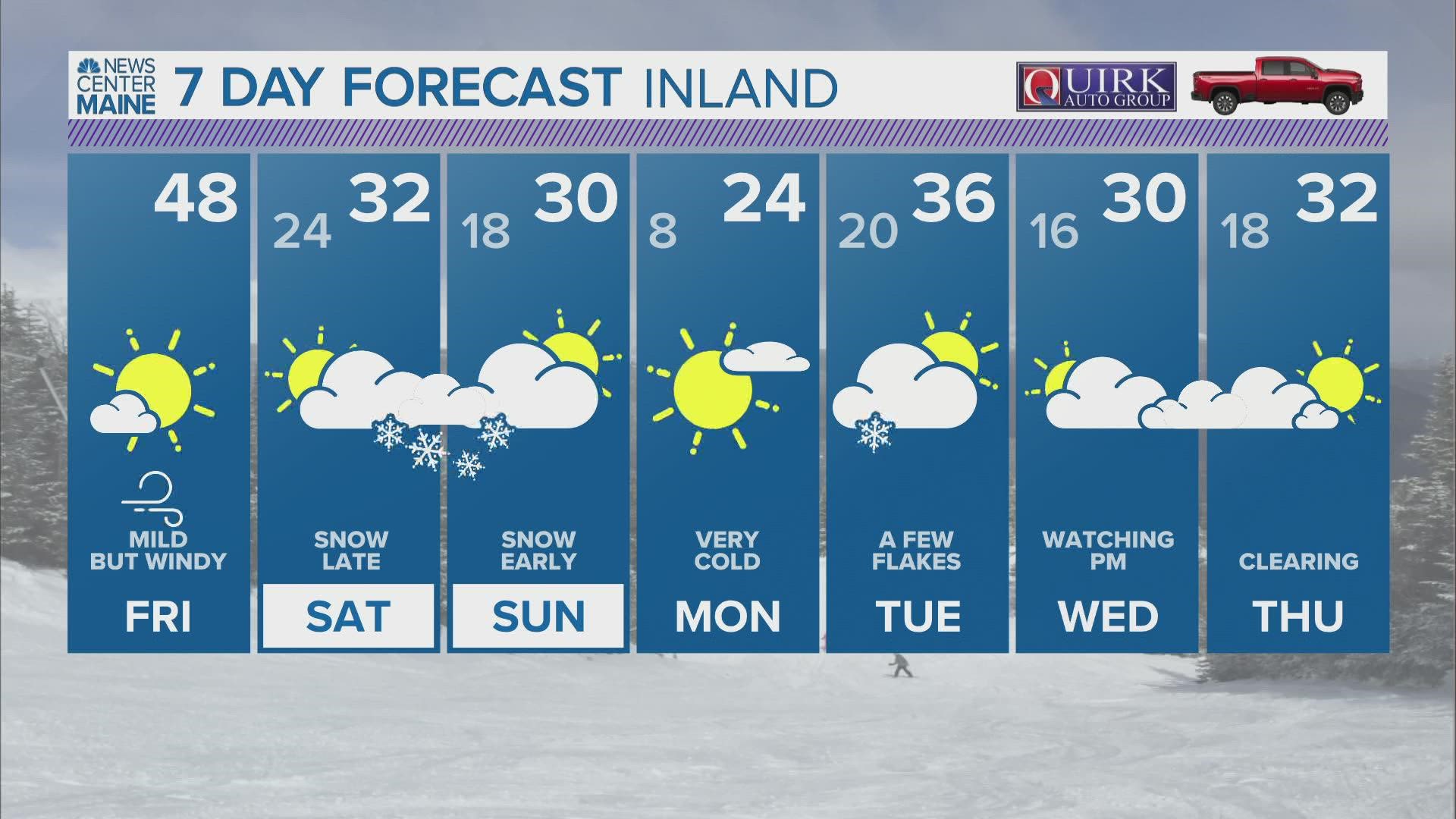
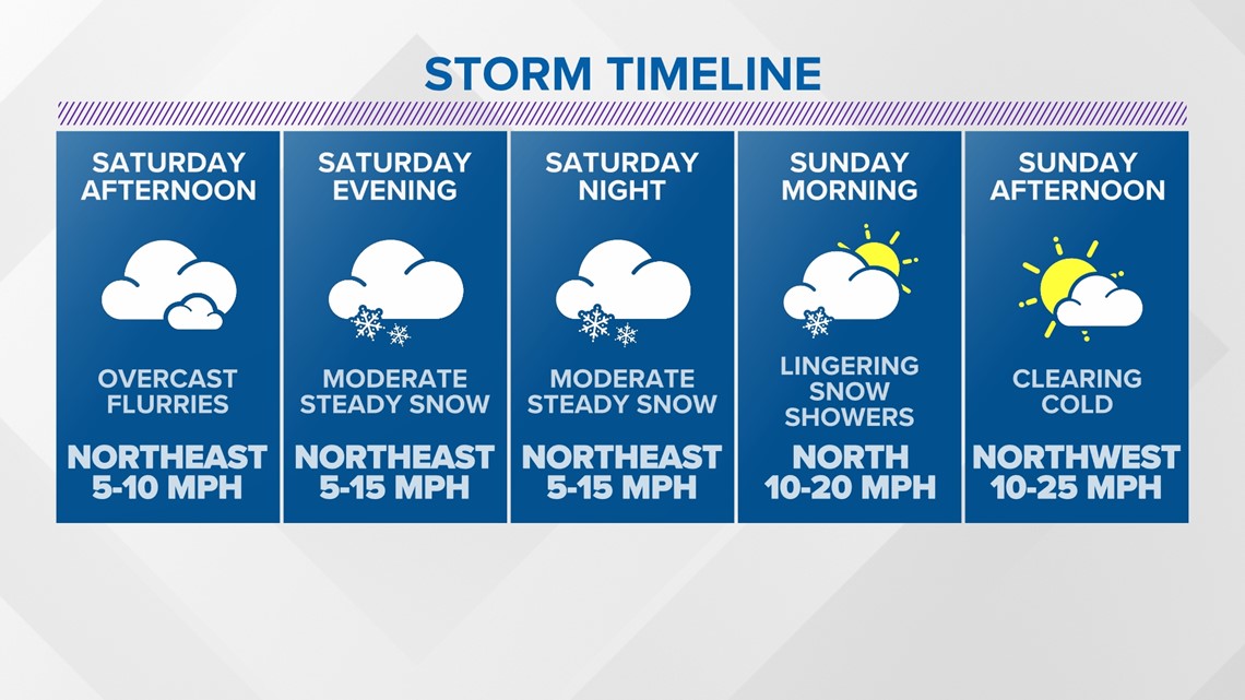
The wishes for a white Christmas and cries of "let it snow" come true this weekend. It all begins on Saturday afternoon.

I want to make this clear, right off the bat ...
This is not a big nor'easter. There is no potential for coastal flooding. There is no wind threat.
Still, a solid 3-8" of fluff is certainly enough to impact travel.

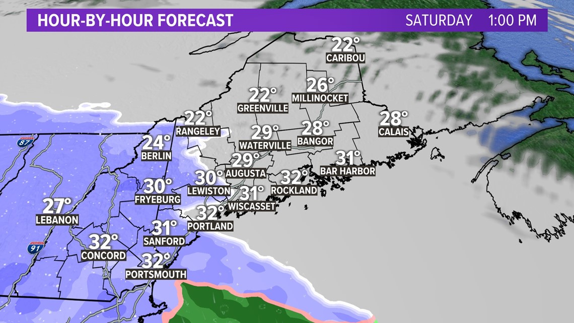
Through the afternoon, clouds thicken up while temperatures stay mostly in the 20s.
There could be a handful of flakes that sneak in shortly after noon, but most spots stay clear until mid-afternoon.
Western Maine will be the first area to see snow showers roll in.

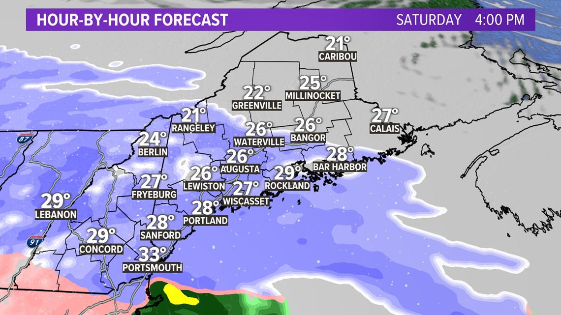
Steadier, moderate snow bands start to rotate through around 4 p.m. on Saturday, give or take an hour depending on how far east you live.
These first snow showers will be most impactful across western and southern Maine.
Snow showers will start to expand northeast, with Bangor seeing snow in the early evening.

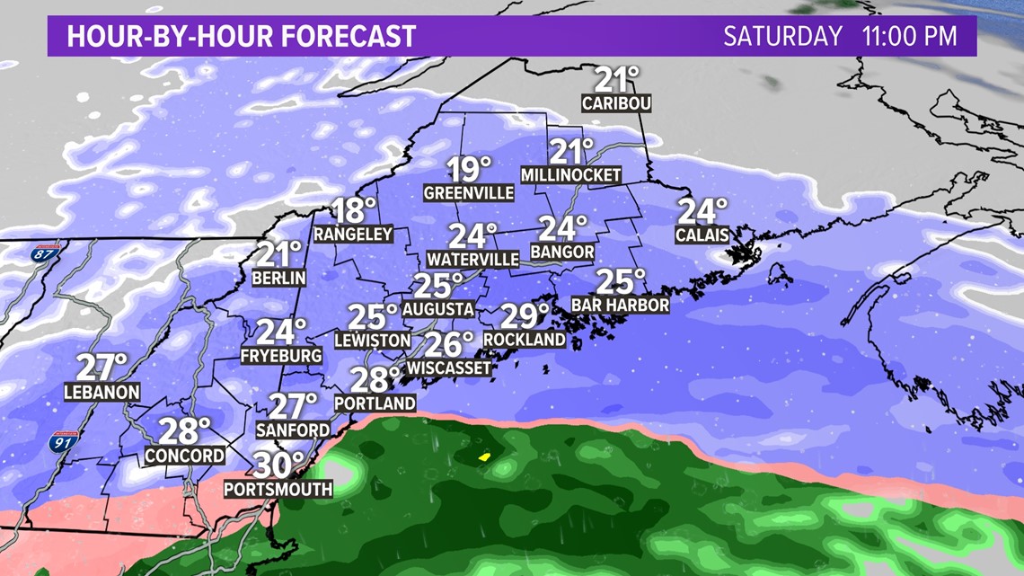
Steady snow continues right through the evening and into the overnight hours.
Overall, I expect slick roads and reduced visibility to be an ongoing issue starting around 6 p.m. and lasting straight through into Sunday morning.
With temperatures in the 20s and even upper teens, snow will have no issues sticking at all. Light, fluffy snow is really easy to move ... but it's also really slippery.

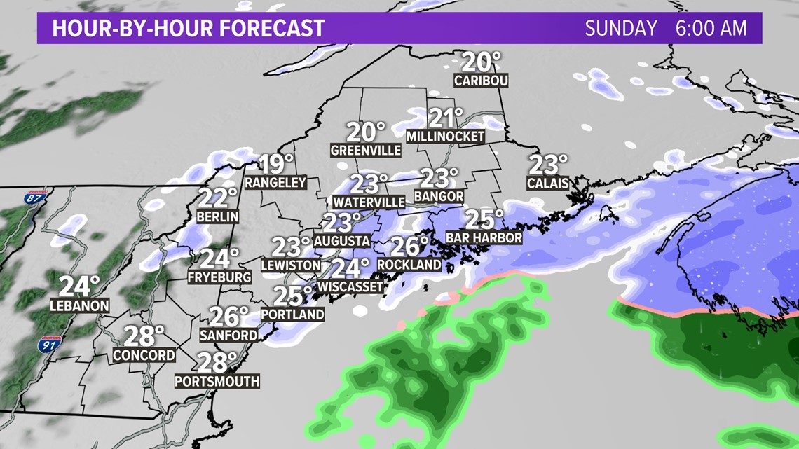
As snow showers taper on Sunday morning, road conditions will improve fairly quickly.
Sunshine is expected to peek out in the afternoon and that will help to melt some of the snow. That also means icy patches are possible all the way into the work week, unfortunately.

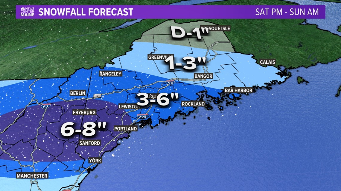
Jackpot totals are still expected to be in western Maine, extending from Fryeburg to Portland.
Overall, 6-8" is expected, with a handful of higher totals mixed in.
Augusta, Lewiston, and the Midcoast will end up in the 3-6" range.
A similar amount is in the forecast for western Maine, but some of the high peaks may see a little more fluff. Great news for skiers!
Bangor is arguably in the toughest spot, because a slight shift south will greatly cut back totals.
Still, totals right around 3" seem most likely.

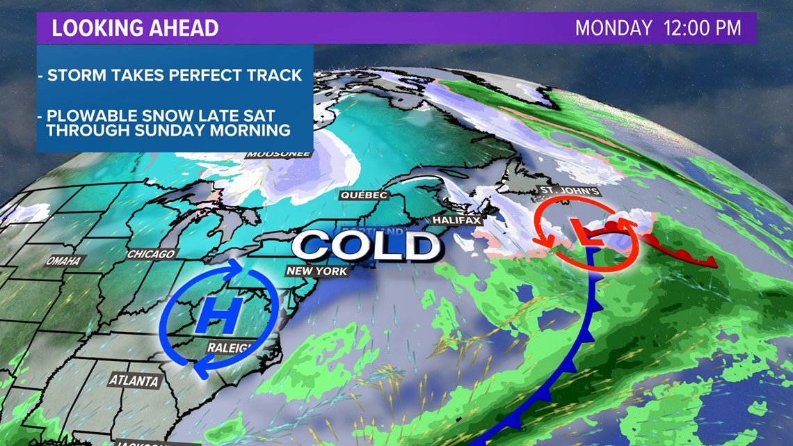
A blast of cold air to kick off the week and no signs of warmer days mean that this snow may last all the way to Christmas.
Cue up Bing Crosby, settle in for festive flakes and get ready to track reindeer prints next weekend.
For other weather data, follow me on Twitter, @MikeSliferWX.
RELATED: NEWS CENTER Maine Weather Forecast