MAINE, USA — Are you dreaming of a white Christmas? Do you hope that your yard will look like a Hallmark movie during the holidays?
This year, however, it might actually happen. Dust off the snow shovels, break out the boots, and get ready for some festive flakes this weekend.
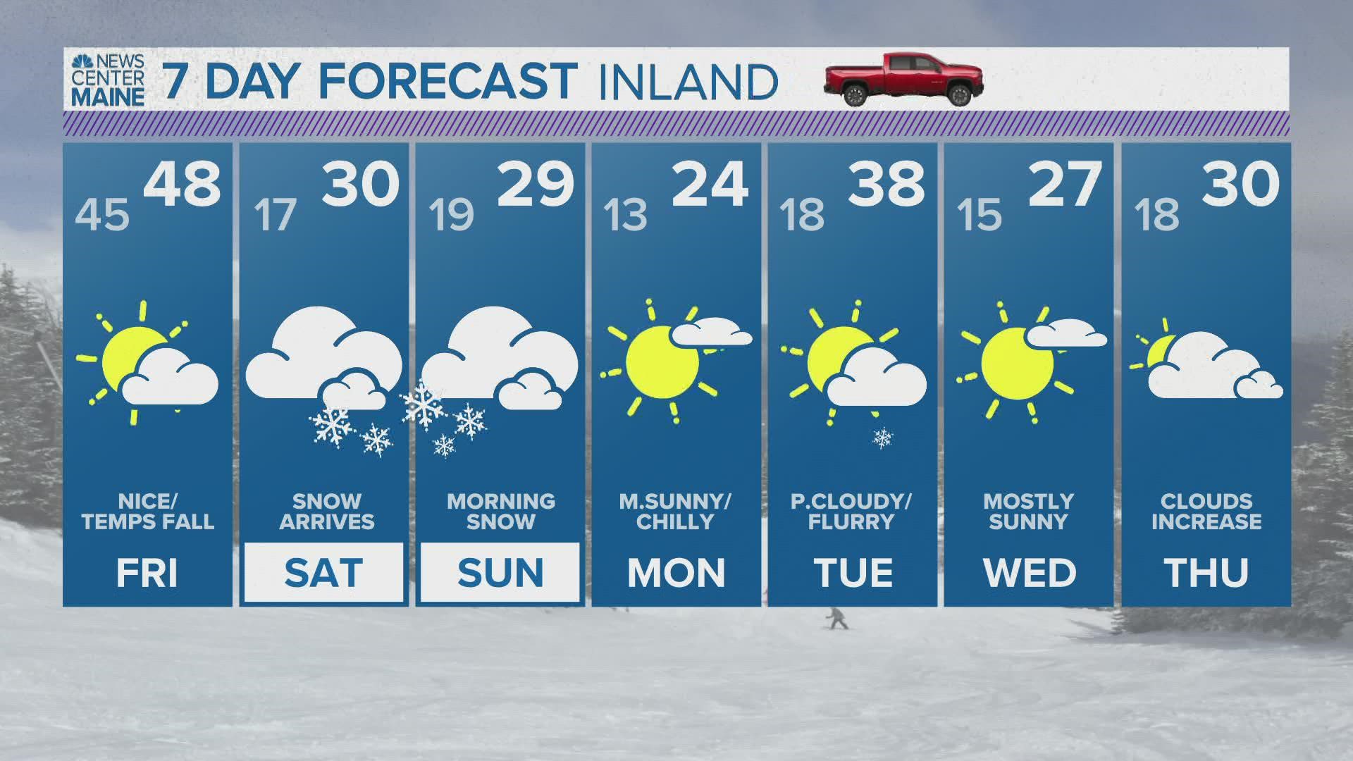
On Saturday, cold air will be locked in place across Maine. Temperatures themselves will not climb much and drop well into the 20s after sunset.
While cold air gets wedged into Maine, a storm will be traversing across the Mid-Atlantic.

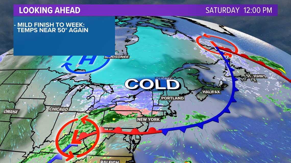
This will not be a huge nor'easter. In fact, wind gusts with this will be virtually nonexistent.
This storm does, however, take a nearly perfect track to put the cold air in Maine to good use.

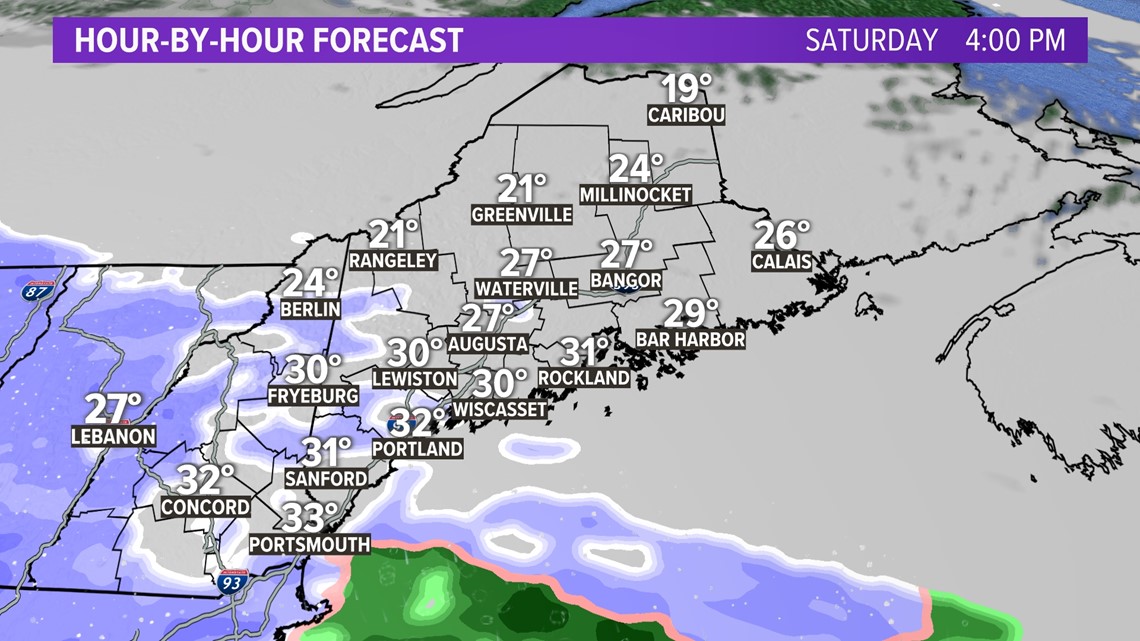
By late Saturday afternoon, thick clouds will be overhead as weak snow showers begin to move in. It will not take long for steadier snow to begin, though.
The first spots to see accumulation, and therefore the first spots to see roads get slick, will be across interior York and southern Oxford counties.


By 6 p.m. or 7 p.m., steadier snow moves in. This snow looks moderate, at best, but it should be very fluffy and light. That means clean-up will be easy, but it will get slick on the roads.
These moderate snow showers will continue for the next six hours or so.


Notice the rain snow line is close to southern Maine, but ultimately stays south. This is due to high pressure keeping that cold air locked in place, which should help keep this storm all snow.
There is still the potential for some mixing right along the water, but I think chances are pretty low.
Anyone traveling Saturday evening, take it slow out there.

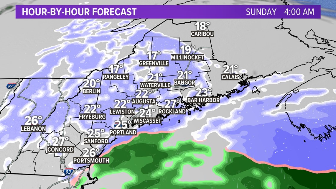
Early Sunday morning, steady snow will begin to break apart into snow showers.
I do expect some of these showers to last well into Sunday morning, but the bulk of the accumulation happens Saturday evening into Sunday morning.
So, just how much should we expect?


The bullseye for at least six inches is going to be in southern Oxford County into northern York County. Given the "fluff factor" potential, I wouldn't be surprised to see even eight inches or so get reported.
For southern and central Maine, a solid three to six inches are on the way. Bangor will probably end up right around three inches, but the lack of moisture north and east of Bangor means snow totals will be lower. It's just enough to cause some issues for travel, but roads should clean up pretty nicely for Sunday.


The reason I think this will help us achieve a white Christmas this year is because the pattern is finally flipping into something more wintry. While this is not an active pattern, it should stay cold enough throughout the entire following week to keep the snow on the ground. This is especially true for grassy and wooded spots.

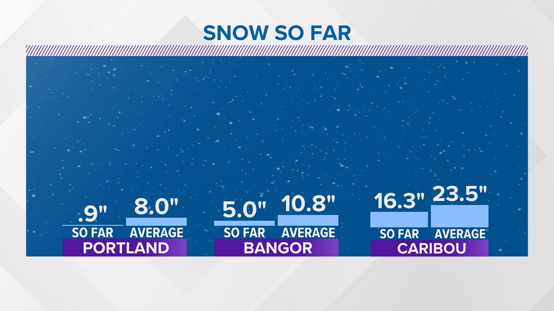
Obviously, this winter has been lackluster so far. All of Maine is sitting below normal for snow so far.
Given the forecast, Maine might not make up the entire difference, but at least the deficit will not be as big heading into the new year.
For more forecast info, follow me on Twitter, @MikeSliferWX.
RELATED: NEWS CENTER Maine Weather Forecast
RELATED: Download the NEWS CENTER Maine app

