OMAHA, Neb. — Less than a week after parts of Kentucky and other states were impacted by a December tornado outbreak, the upper Midwest is bracing for strong storms.
On Friday, a level four (out of five) severe risk was issued by the Storm Prediction Center.
These are pretty rare in December but can happen.
The following Wednesday, another level four out of five severe risk was issued by the Storm Prediction Center.
Two of these risk areas in December is very uncommon. To add to this, it was a few hundred miles north of the one on Friday.
While severe weather in the central US during La Niña winters is not all that uncommon, it is especially rare in the upper Midwest.

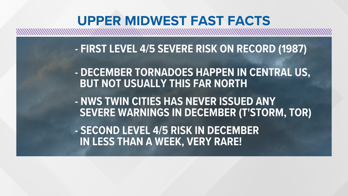
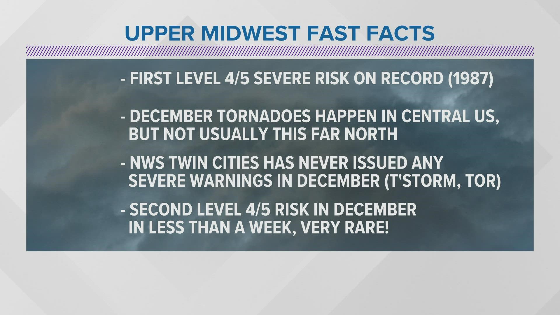
Before I get into the (admittedly fascinating) meteorology behind the whole event, here are some fast facts from the upper Midwest and how it all relates to the forecast.
This is the first severe risk of this level in December on record for this part of the country. Records date back to 1987.
It is exceptionally rare to see December tornadoes this far north. While they do happen, they're almost exclusively south of Iowa, let alone Minnesota.
To prove just how unlikely this event is, the National Weather Service office in the Twin Cities of Minnesota has never had to issue a tornado warning in December. They haven't ever even issued a severe thunderstorm warning in December!
And, as I mentioned before, it was rare to see such a high-level severe weather event last week. To have a second one in December is extremely impressive.

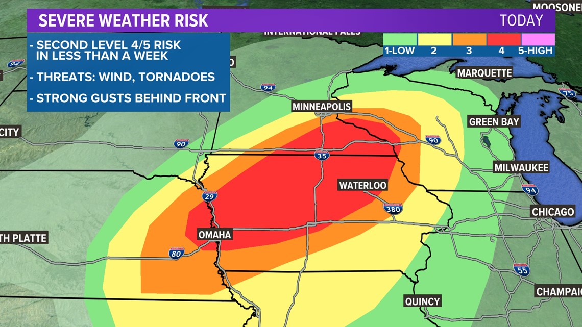
This was the outlook from the Storm Prediction Center on Wednesday afternoon, painting a bullseye of strong storms from Omaha, Nebraska, to Des Moines, Iowa, and up to the Twin Cities of Minnesota.
As the day progressed, wording from various National Weather Service offices in the affected area became increasingly more dire.
Various NWS offices and the Storm Prediction Center highlighted just how widespread gusts were expected to be as well as the potential for strong tornadoes to develop.
The verbiage used by the SPC was enough to turn heads. Severe weather events with this much confidence do not happen all that frequently.
All of this, of course, doesn't even highlight the fact that there is a snowpack in some areas expected to see rotating storms.

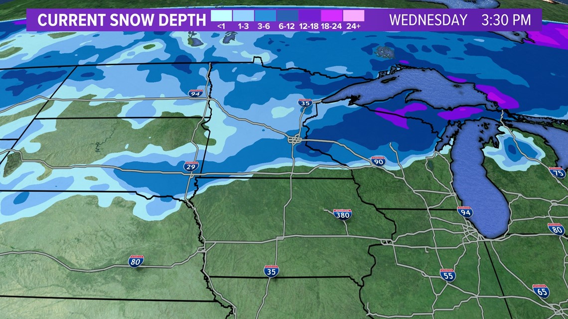
Here's a snapshot of the snowpack as of Wednesday morning.
Far northwestern Iowa and southern Minnesota have at least 3" of snow on the ground.
Parts of the Minnesota and Wisconsin border are in the 6-12" range for current snow depth!

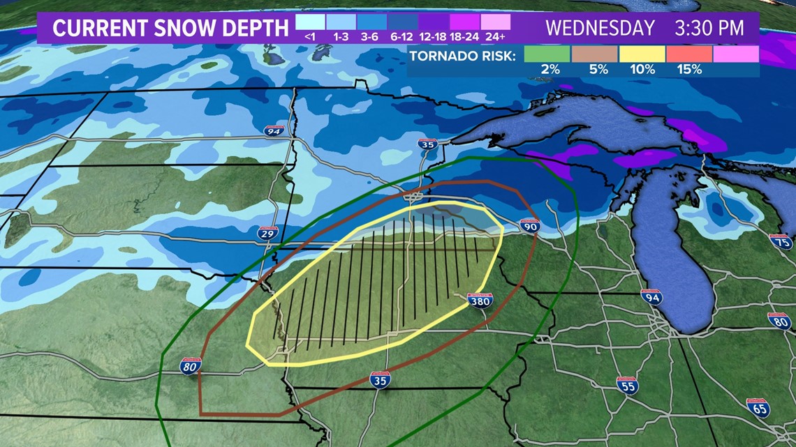
This graphic shows Wednesday's tornado outlook overlaid on the current snow depth.
The yellow hatched area, which is where the Storm Prediction Center was forecasting the highest likelihood of tornadoes, sits on top of the southern extent of the snowpack.
From what I could find, severe weather (and especially tornadoes) happening with snow on the ground has only been documented a handful of times. In other words, not even close to common.

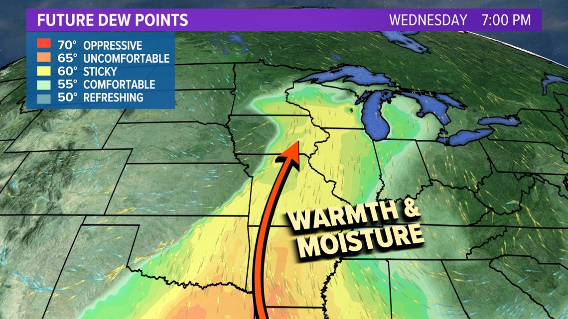
So, what allowed this all to happen?
Well, it's pretty complicated, but the biggest takeaway is this: there was a bunch of warm, moist air that was pushed up from the Gulf of Mexico all the way to the Great Lakes.
Warm temperature records were smashed in the upper Midwest. Des Moines, Iowa, had an old record high temperature of 59 degrees. Temperatures were in the mid-70s on Wednesday afternoon before storms rolled in, beating the old record by at least 15 degrees!
This happens more frequently in the summer. In the middle of December? Not so much.
The clash of cold air running into this warm air is what allowed these thunderstorms to fire off. The strong wind field pretty much guaranteed that powerful thunderstorms would develop and would probably rotate.
If you're looking for a deep dive into the meteorology behind this anomalous weather setup, check out my friend Tomer Burg on Twitter. This is an excellent (and totally nerdy) analysis:
Last, but certainly not least, is the link to climate change.
There has been a lot of discourse recently that is blaming tornadoes on climate change.
Well, it's not quite that simple. There is no simple "yes" or "no" answer to whether or not climate change is causing more (or fewer) tornadoes. There is still a ton of research that has to be done.
What we do know, however, is that climate change is impacting the environment in which storms form.
In other words, a warmer atmosphere could mean that these types of storms happen more frequently outside of their climatological norms. Instead of the severe weather season in the Midwest always wrapping up in the fall, it might get extended later and end in the winter.
The other piece, of course, is that it may also shift where these storms occur.
Once this event is done, we can see if any severe weather records are broken. If the forecast verifies, there are likely a lot of December severe weather records that stand to fall.
We do have sister stations in the Midwest if you'd like to follow along with their coverage.
You can also follow me on Twitter, @MikeSliferWX.

