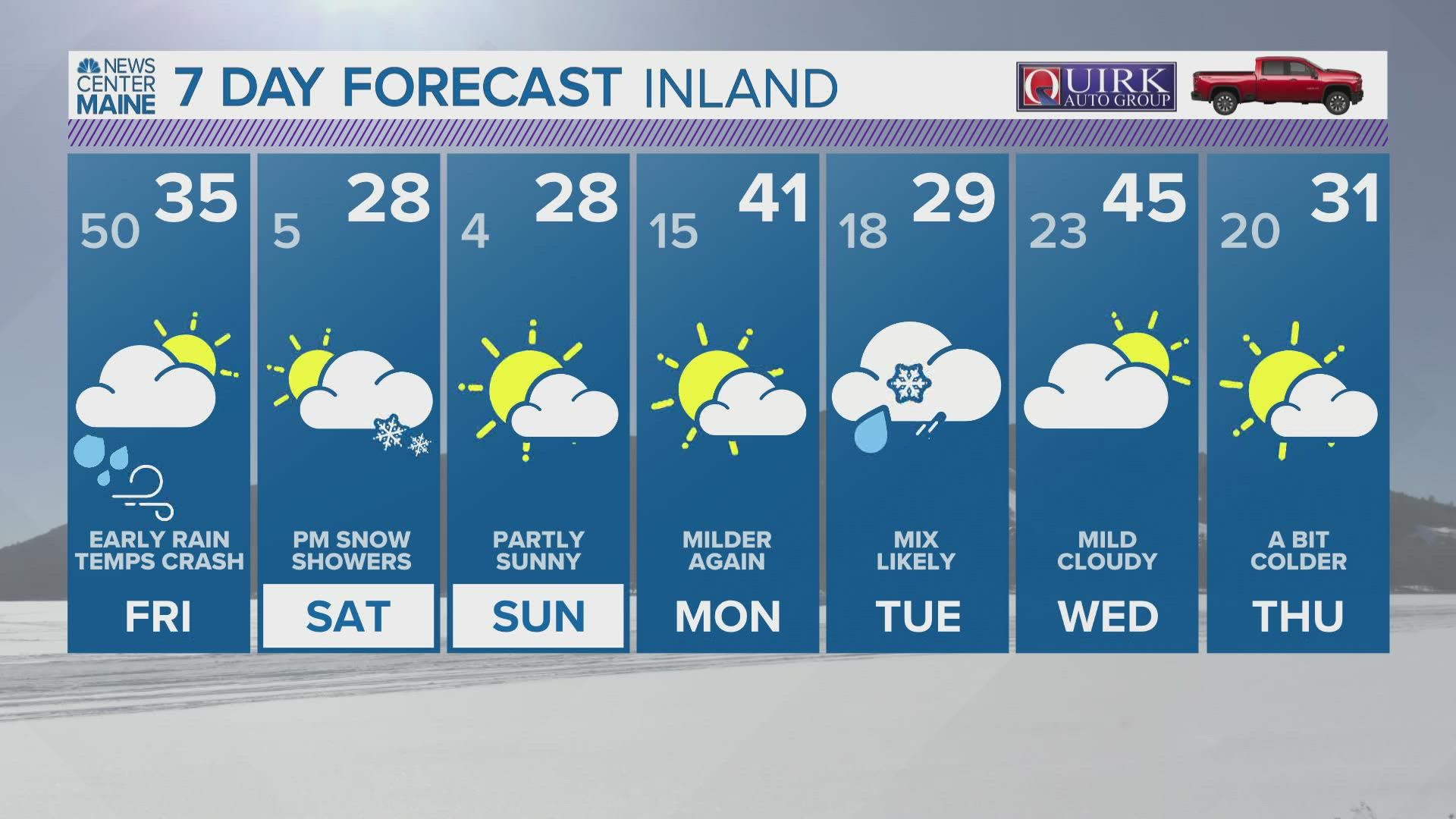
MAINE, USA — As I sit down to write this Thursday morning, temperatures are already well into the 40s and even 50s across Maine.
Dew points are not far behind, either. The combination of this warmer air mass and some wind has positioned Maine to lose quite a bit of its snowpack today and tonight.
In fact, the melting began on Wednesday evening and is accelerating.
The flood risk remains pretty low with this storm. The biggest risk would just be some standing water thanks to clogged storm drains. That's the good news.
The bad news is that strong wind gusts, especially toward the coast, could cause some power outages to pop up.
The Setup
Warm moisture-loaded air is being shoved into Maine and New Hampshire by some fairly strong winds.
With a setup like this, some spots in York county could easily make it to 60 degrees, even without sunshine.

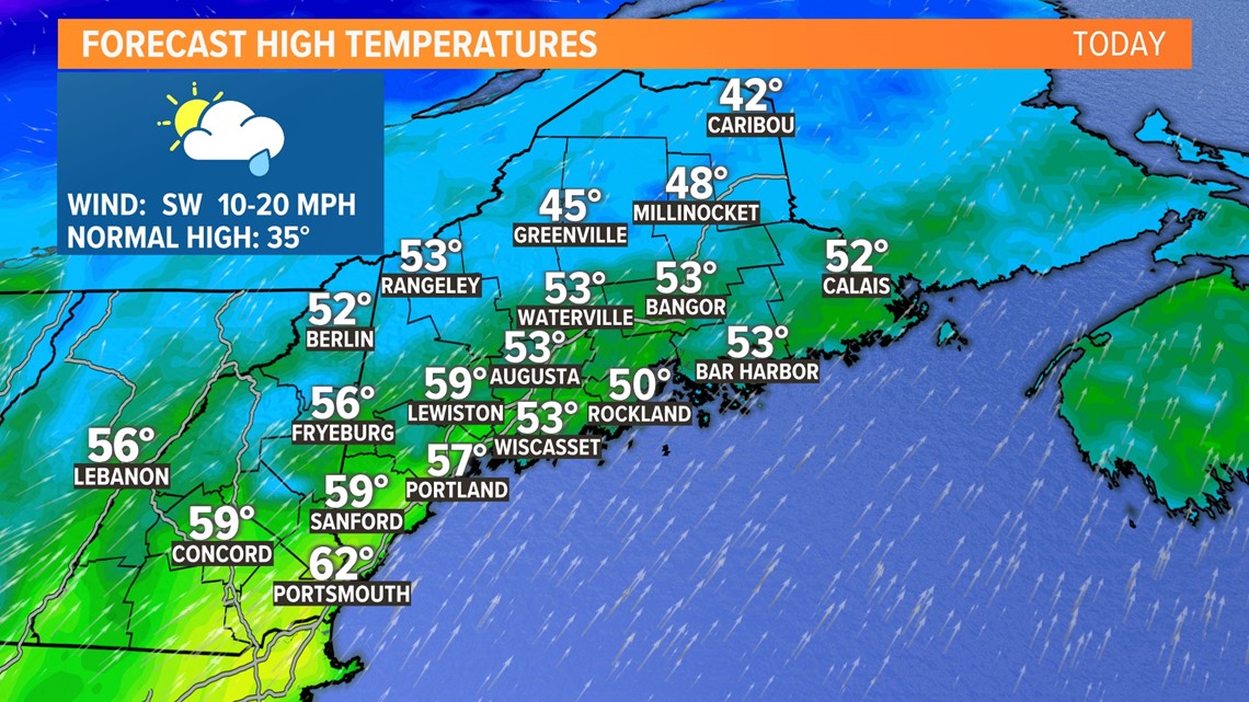
Temperatures will be high. The record in Portland is 58° set in 1981. The record in Bangor is also 58°. It was also set in 1981.
Both stand a chance at falling, but Portland is much more likely to actually get to (or above) 58° on Thursday.
Dew points will also be quite high, which is arguably more significant.
The higher dew points and gusty winds will help melt the snowpack. Or, if you're in southern Maine, the icepack.
Despite all this, the flooding threat still remains pretty low.

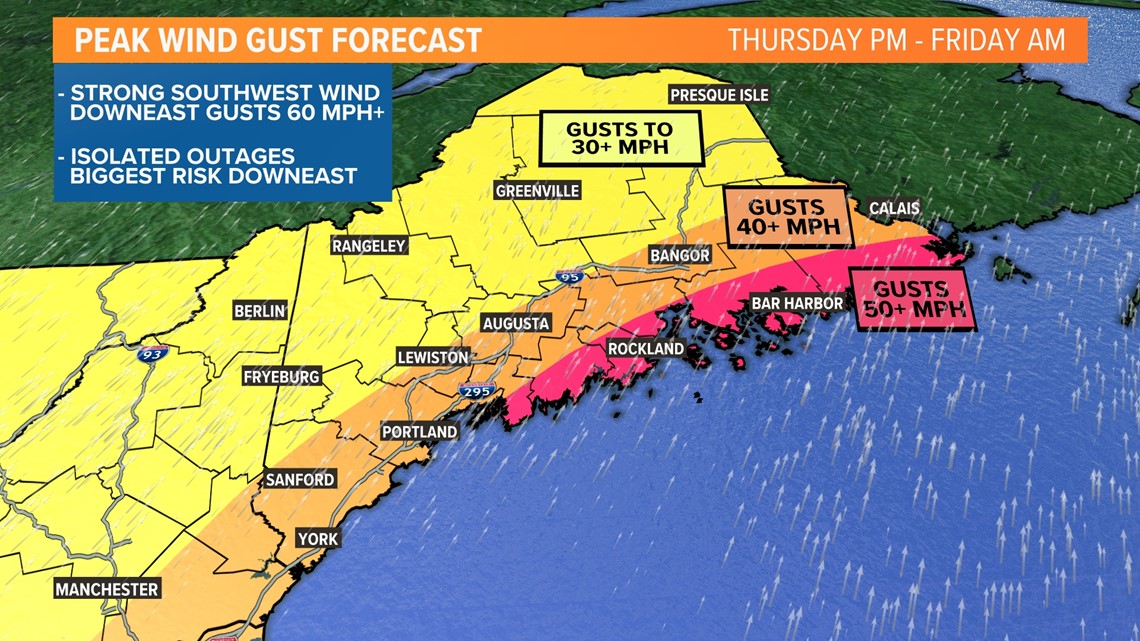
The bigger story comes with wind.
Gusts start to pick up out of the south and southwest later in the afternoon on Thursday and last into Friday morning.
The strongest gusts will likely be across the Midcoast and Downeast, where gusts could exceed 50 or even 55 mph.
With a wind direction like this, some outages are certainly possible. I have more details on that in the "impacts" section below.

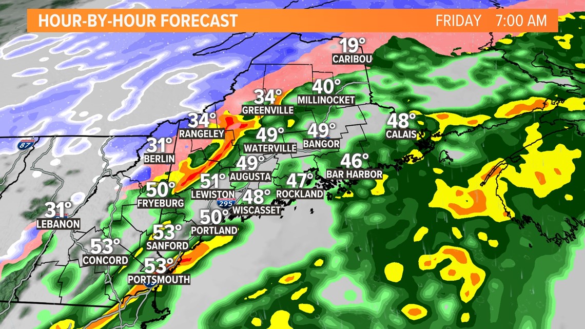
The cold front will pass through on Friday morning.
A line of storms will pop along the front. With milder air in place, some of these storms might even produce a little bit of thunder.

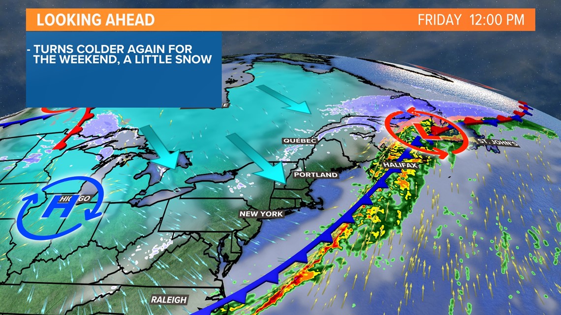
Colder air settles in very quickly behind the front, too.
Temperatures will drop from the 50s in the morning to the 20s by sunset. Watch for any standing water to freeze, but otherwise, I am not too worried about a big flash freeze. The breezy northwest wind will help dry most roads and sidewalks before the temperatures crash.
Impacts

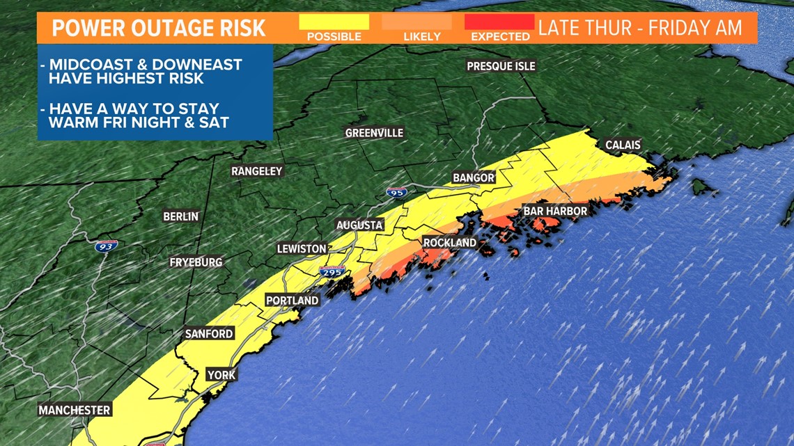
The biggest risk that I see is going to be power outages, especially for areas along the Midcoast and Penobscot Bay.
Gusts coming out of the south tend to cause power issues. Coastal communities, especially on the islands, stand the biggest risk of losing power.
Some spotty outages will be possible in York, Cumberland, and Kennebec counties, too.
The greater Bangor area should also prep, though I expect lower outage numbers there.
While it may be warm when you lose your power, temperatures will crash quickly.

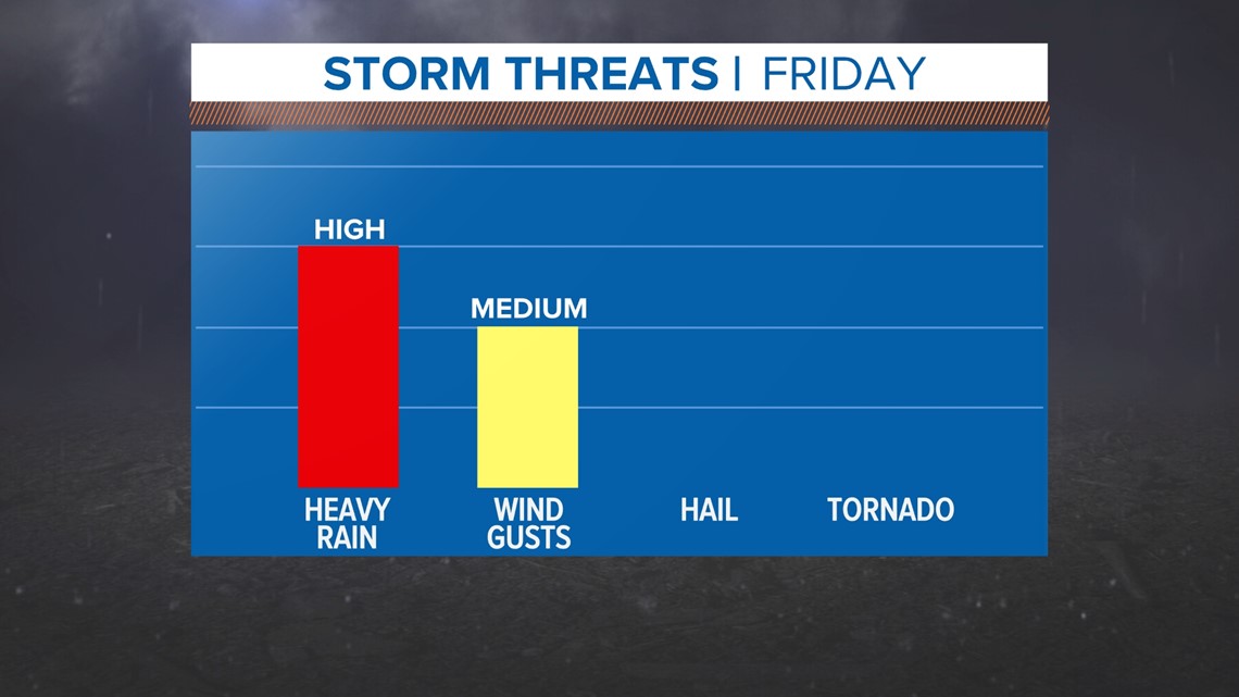
Overall, I think the flood risk is pretty low.
There could be some standing water near clogged drains, but ice jam and river flooding is pretty unlikely.

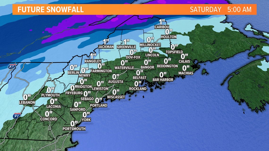
Some snow will fall on the cold side of this front.
Any snow accumulation is mostly going to be across parts of northern Maine and the Katahdin region.
Since temperatures rebound a bit on Saturday, I do not expect big impacts from this. Just keep an eye out for some slick spots.
It's also good news for the cross-country skiers and snowmobilers, as it will freshen up the snowpack a bit after the rain.
Be sure to follow NEWS CENTER Maine for updates. And remember, we love to know what's happening in your backyard! Send in your pictures (safely of course) to the NEAR ME section of our app.
For the latest breaking news, weather, and traffic alerts, download the NEWS CENTER Maine mobile app.
RELATED: NEWS CENTER Maine Weather Forecast

