MAINE, USA — A significant storm is on the way for Thursday and Friday. It's February in Maine, so I can understand why you might be preparing your snowblower or skis.
You may want to reconsider there, since this one will be warm. Wicked warm. The only potential for somewhat significant snow will be north of Millinocket on Friday as colder air starts to move into Maine.
Rain, strong wind gusts, and potentially record-setting warmth are all possible with this incoming storm.
Behind it, colder air does return, but this will not be a true Arctic airmass like the past few storms. Still, the rollercoaster of temperatures continues.
The Setup
Wednesday is the "transitionary day," as colder air from yesterday gets pushed out. Since it is February, however, it takes a while to build warmer air in, which is why temperatures on Wednesday only top out in the 30s.
The breeze on Wednesday will also become more noticeable as the day goes on.

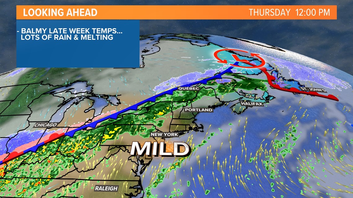
The core of warmer air settles in during the day on Thursday. Rain comes with it. Rain totals could be up to an inch, possibly even an inch and a half in areas that see repeated heavier showers move through.
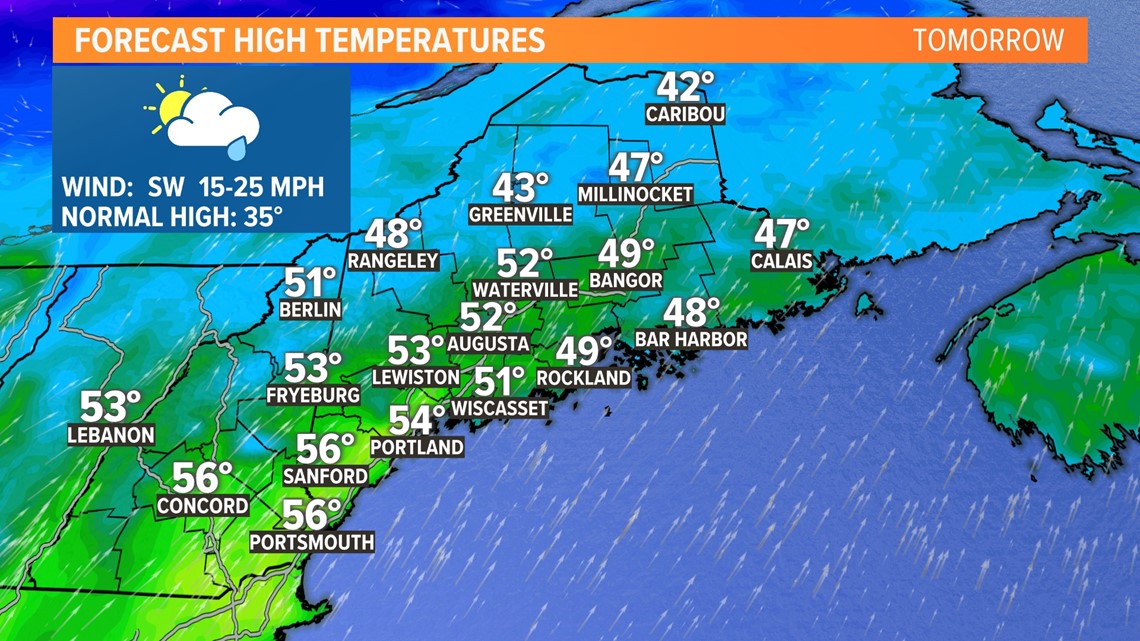
High temperatures on Thursday should make it into the upper 40s to low 50s for most, with some spots in southern Maine possibly even climbing above 55 degrees.

Take a look at that front off to the west, though ... that becomes the focal point for rain, potentially heavy at times, as it starts to move into Maine.
Rain, higher temps, and higher dew points will lead to quite a bit of melt-off. While I do not anticipate big issues, there might be some minor flooding on the off chance that a small ice jam forms.

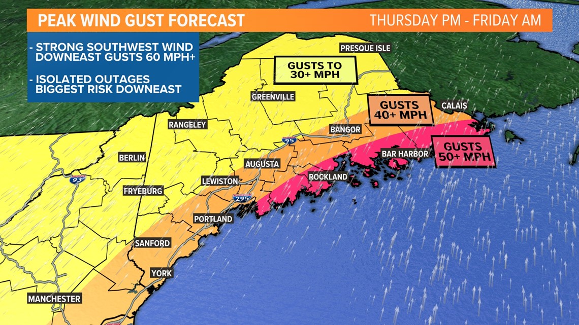
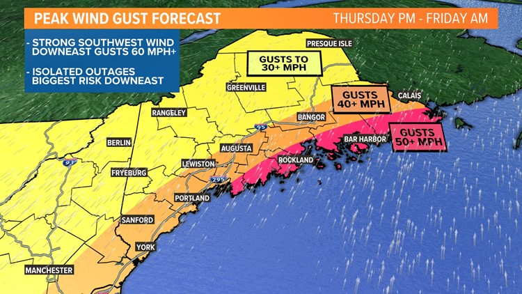
As day turns to night on Thursday, wind gusts will be picking up out of the southwest.
Gusts will peak along the Midcoast and Downeast, where they could exceed 50 mph. The rest of the coastline and some interior areas, such as Augusta and Bangor, will see gusts over 40 mph.
Elsewhere, expect gusts to 30 mph or so.
Southwest wind is kind of a weird wind direction for us. It's not all that often we get strong gusts out of the southwest. This might contribute to a slightly higher risk for outages, but the frozen ground will work to mitigate that a bit.
Still, expect at least some isolated outages.

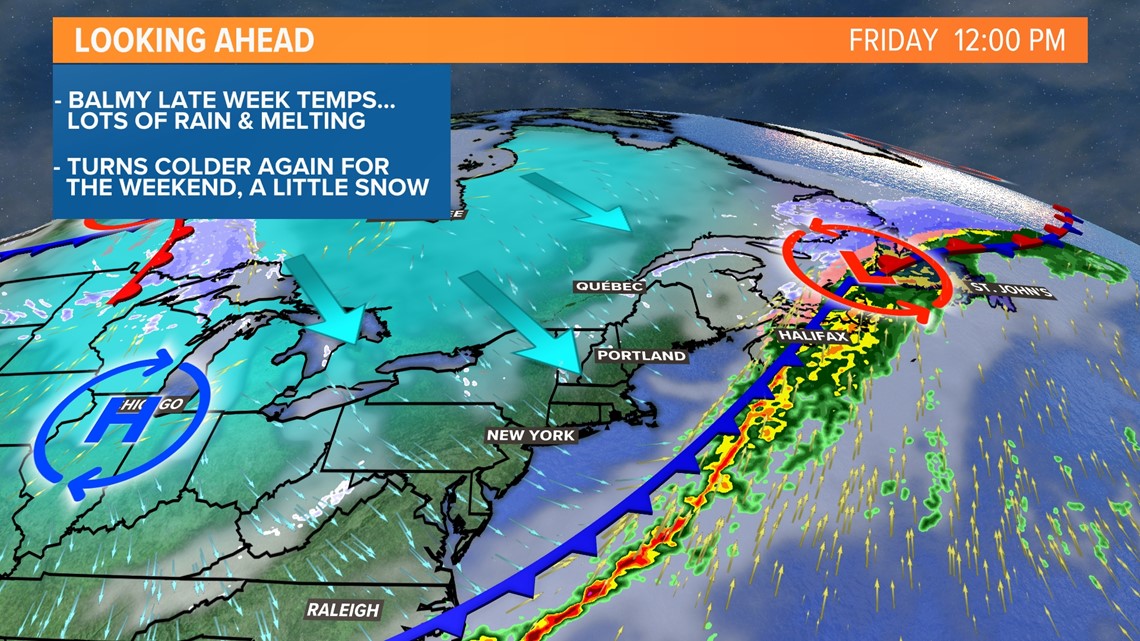
Colder air will move in quickly on Friday. Across western and northern Maine, rain quickly switches back to snow.
Accumulations will be quite low, except for northern Maine.
Elsewhere, the precip will most likely end before it gets cold enough for anything wintry.
Temperatures return to the 30s for Saturday and Sunday.
Impacts

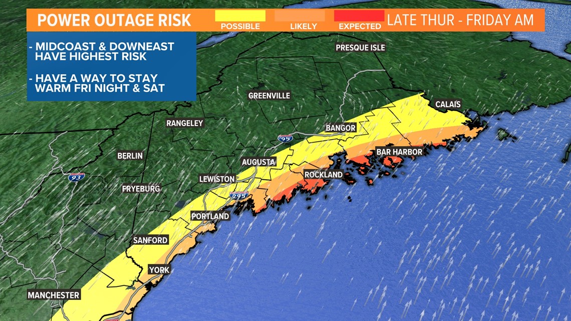
With the strongest gusts at the coastline, here is where I think the highest number of outages will be.
It seems the area right around the Penobscot Bay tends to have more issues with gusts out of the south, so I expect a few more issues in those areas.
Otherwise, isolated outages will be possible anywhere from Shapleigh to Topsfield, and everywhere in between. Areas north of this line will likely not see power issues.

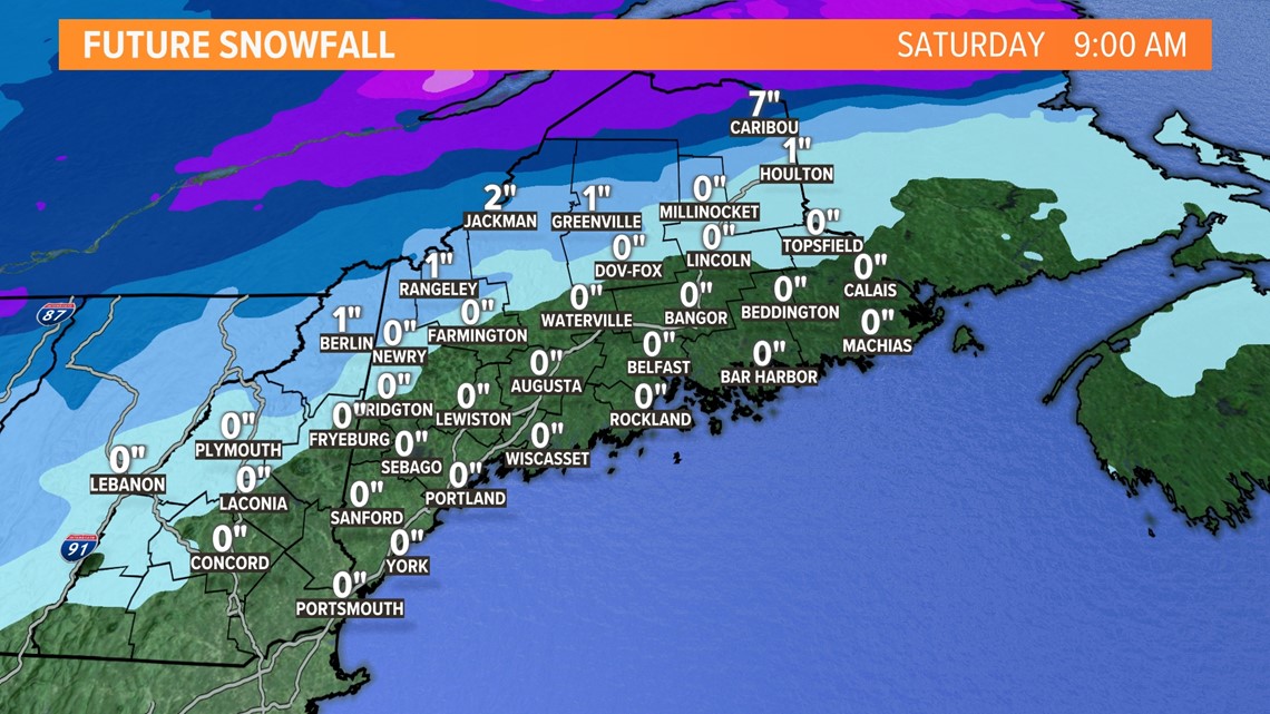
Any snow accumulation is mostly going to be across parts of northern Maine and the Katahdin region.
Since temperatures rebound a bit on Saturday, I do not expect big impacts from this. Just keep an eye out for some slick spots.
It's also good news for the cross country skiers and snowmobilers, as it will freshen up the snowpack a bit after the rain.
Be sure to follow NEWS CENTER Maine for updates. And remember, we love to know what's happening in your backyard! Send in your pictures (safely of course) to the NEAR ME section of our app.
For the latest breaking news, weather, and traffic alerts, download the NEWS CENTER Maine mobile app.
RELATED: NEWS CENTER Maine Weather Forecast

