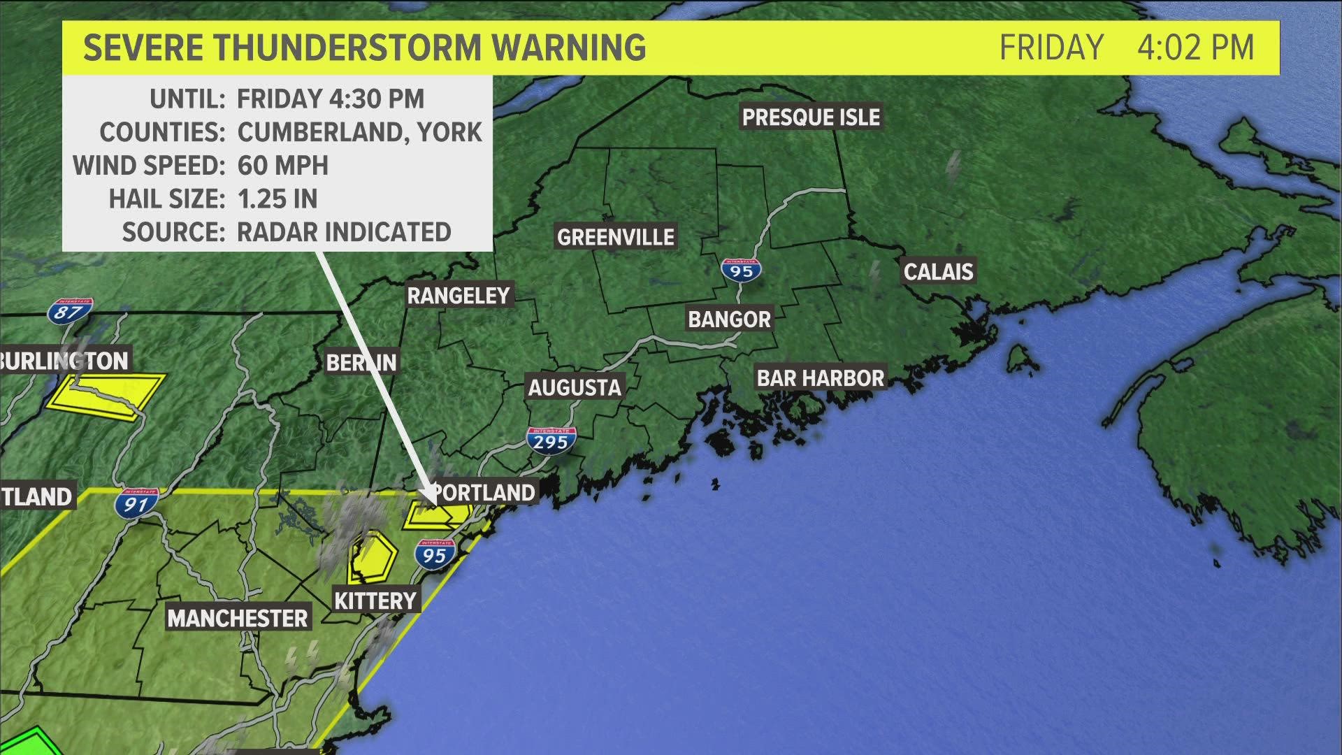
MAINE, USA — Friday's cold front is the key to another gorgeous summer weekend, but it comes at a price: thunderstorms.
As clouds break and sunshine starts heating things up, the amount of energy storms can tap into will increase.
In other words, stronger storms are a bit more likely as the amount of sunshine increases. The clouds are clearing quickly and the strong sun will easily be able to spike temperatures up.
Heavy rain, strong wind gusts, and maybe even a brief tornado are all in the cards this afternoon.

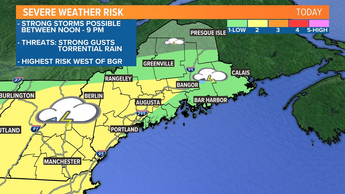
The Storm Prediction Center came out with an interesting update at 8 a.m. Friday, expanding the risk areas for severe weather.
This is most likely because of a local warm front and clearing clouds. The combination of a front nearby and a bit more instability (storm energy) makes some strong storms a little more likely.

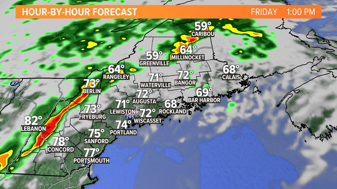
A line of strong to severe storms was expected to approach from the west around 1 p.m., likely strengthening as it moves east into the New Hampshire Lakes Region.

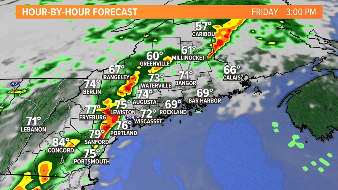
The line crosses the Maine/New Hampshire border around 3 p.m., bringing an increasing risk of heavy downpours and damaging wind gusts to western Maine around this time.
These storms will likely make it all the way to coastal York and Cumberland counties, but they may be weaker right along the shore.

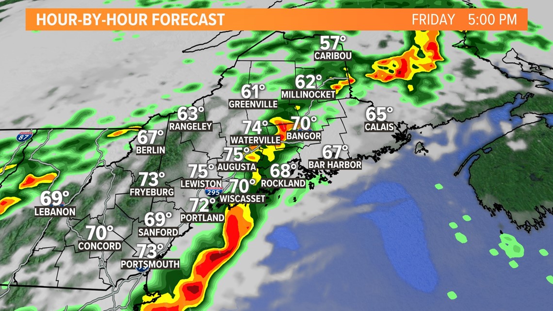
Storms will progress along I-95 and hit the Lewiston-Auburn and Augusta areas just in time for the evening rush hour.
At the very least, heavy downpours could lead to ponding on the roadways and an increased risk for hydroplaning.

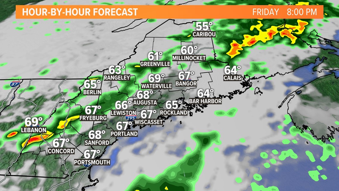
Storms continue east, but run out of support from daytime heating. Greater Bangor will see the first rain drops on the tail end of rush hour, with storms rolling through by 6 p.m.
As storms clear Downeast after 9 p.m., things will dry out pretty quickly.
Storms will be weaker as they head into eastern Maine, too.

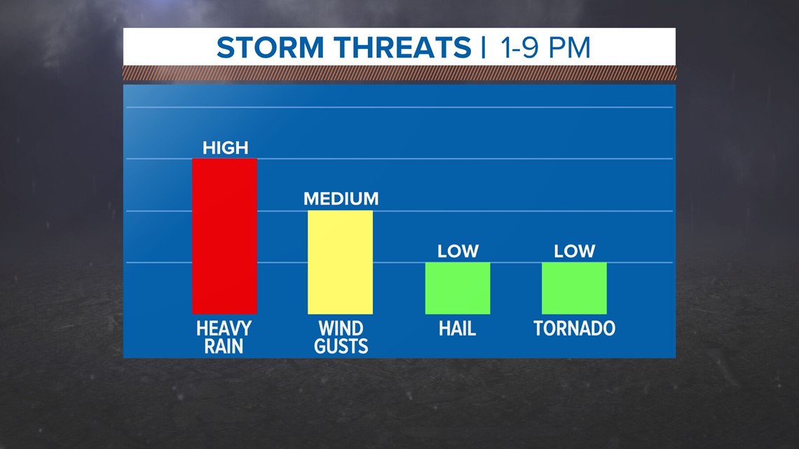
The biggest impact today is likely going to be downpours.
Some strong gusts could bring down a few limbs here or there, too. The highest risk will be in western Maine.
Given the nearby warm front, some rotation is possible in storms across New Hampshire. The overall tornado risk is quite low, but not quite zero. I'll be monitoring this situation closely and providing coverage should we need it.
Hail is possible in the strongest storms, too.

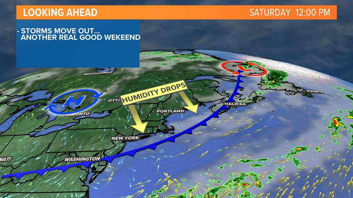
The weekend will be absolutely perfect after this, though! Stay safe and download the NEWS CENTER Maine app. It'll give you updates based off of your location.
You can use the radar to track storms, too.
- Mike Slifer, @MikeSliferWX
RELATED: NEWS CENTER Maine Weather Forecast
RELATED: More drenching storms expected

