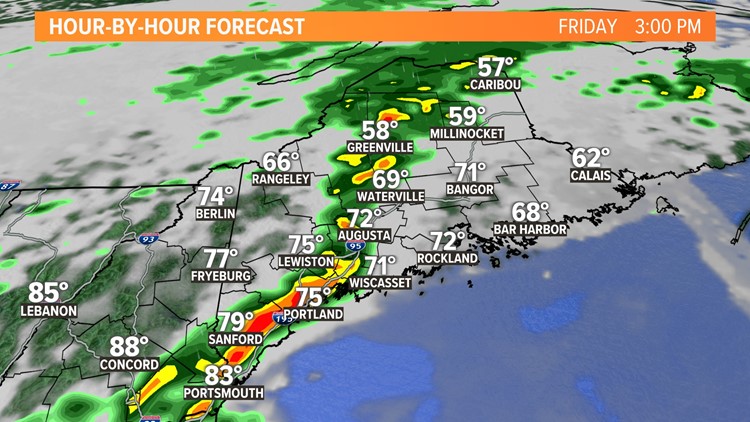
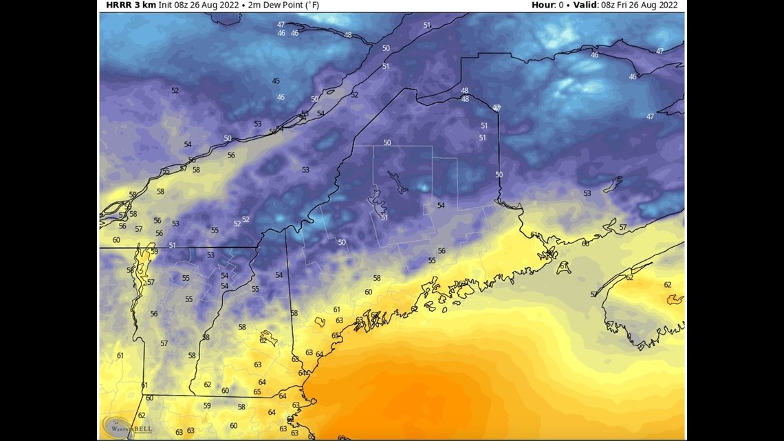
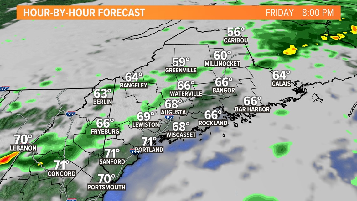
PORTLAND, Maine — The air has been very tropical this week but relief is on the way. In fact, dewpoints have already dropped across Northern Maine. Unfortunately, they haven't along the coast yet and it will stay quite uncomfortable all day long. Within the sticky air, rogue downpours will pop-up from time to time today. But the main focus will be this afternoon and evening when widespread showers and thunderstorms will form has a coldfront works in from the west.

The action should hold off until mid-afternoon when a line of stronger thunderstorms forms and works out of New Hampshire. It will likely weaken a bit as it gets deeper into Maine encountering some cooler air, but heavy rain and a few wind gusts will be possible.

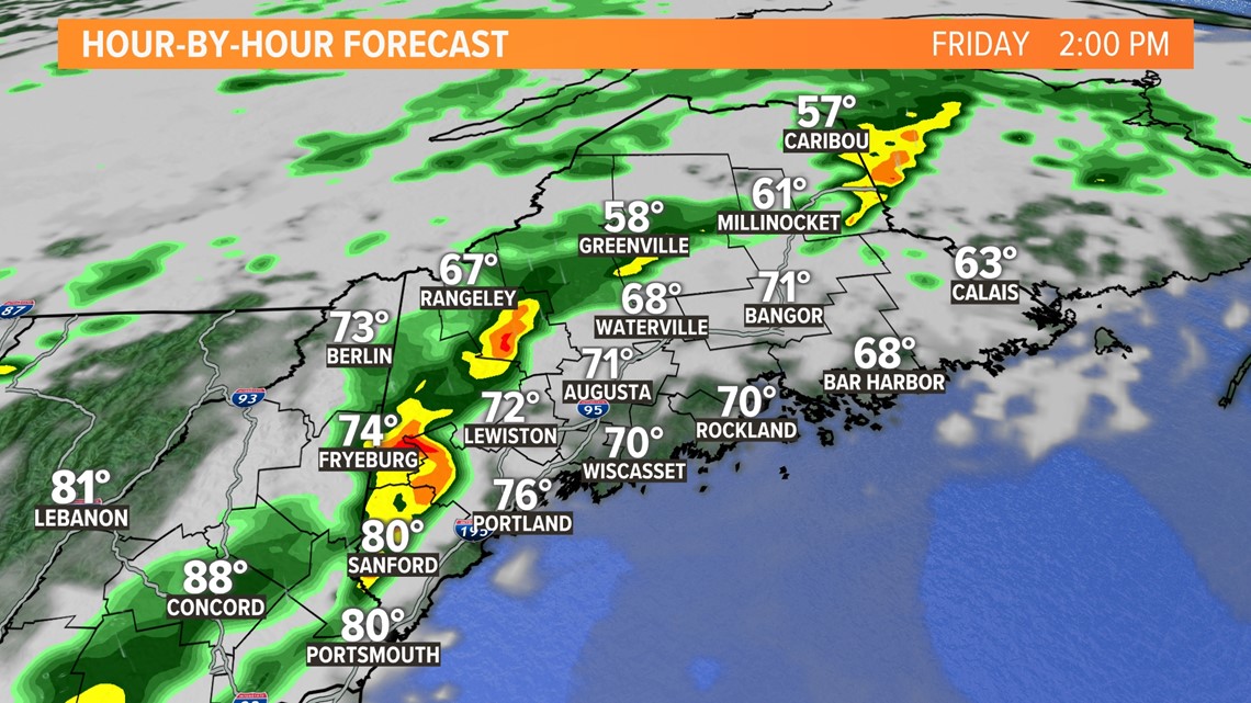

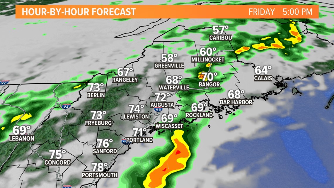
That line will work slide across the State and exit late in the afternoon. However, a second line will be possible with the coldfront in the evening and that too could have downpours and gusty winds. Thus, our risk sticks around deep into the evening threatening any outside plans.

Storms will be gone just in time for the weekend and I think you'll like it. Have a great weekend.
Todd - Here's my Instagram
RELATED: NEWS CENTER Maine Weather Forecast


