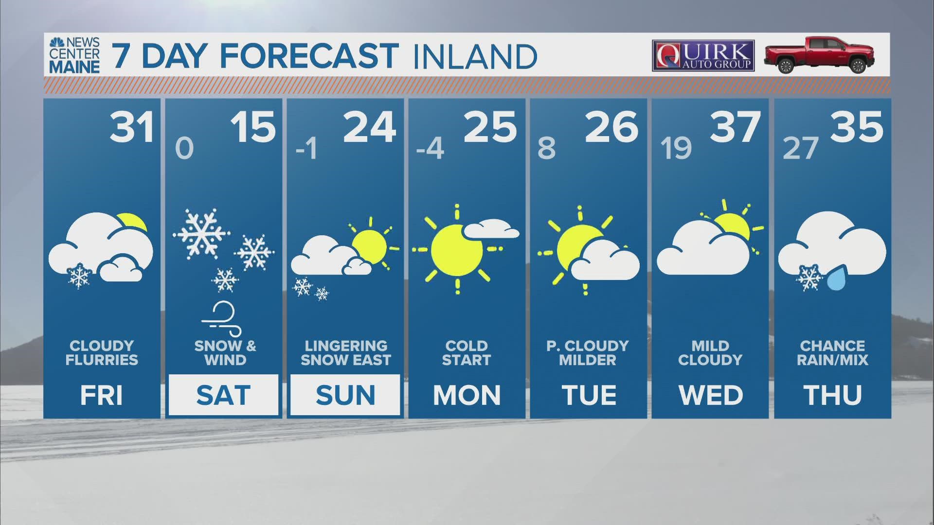
MAINE, USA — Here...we...go! Blizzard warnings and winter storm warnings are already posted ahead of the impactful nor'easter on Saturday.

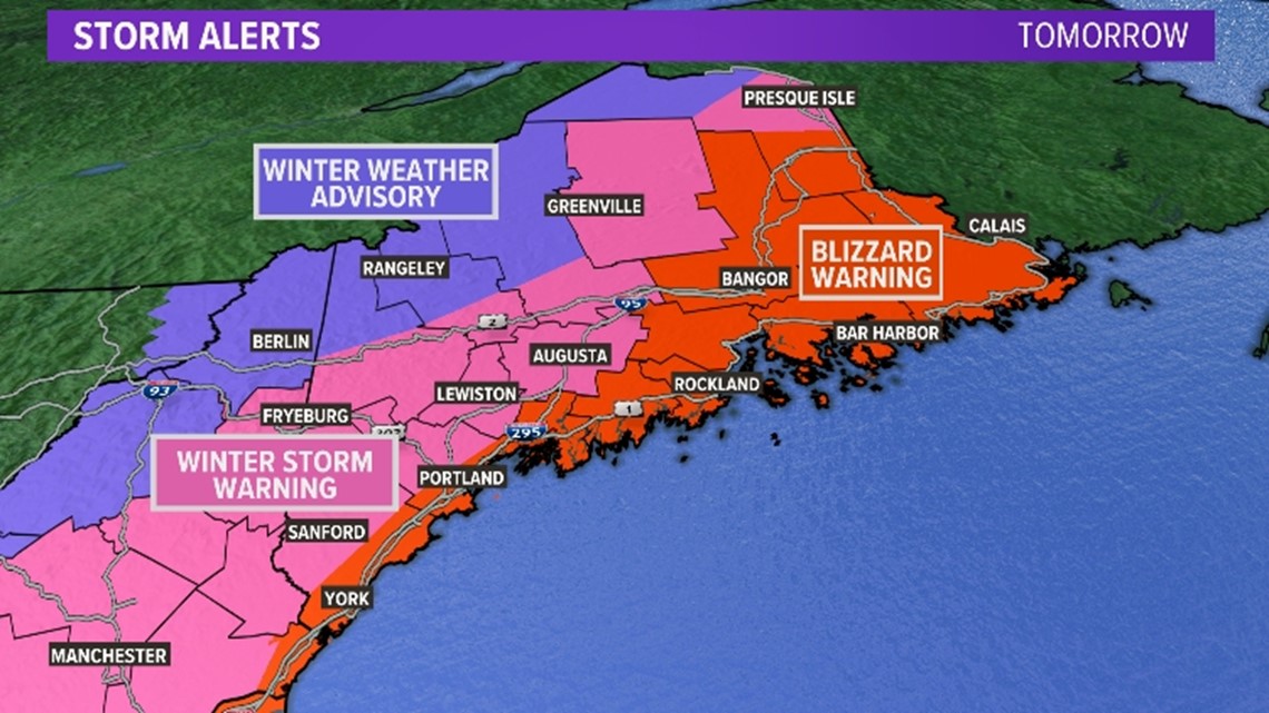
For those keeping track at home, the last time NWS Gray issued a blizzard warning was almost four years ago in March 2018. NWS Caribou issued one just a few weeks ago for areas Downeast.
As a reminder, blizzard conditions are independent of snowfall totals. A blizzard occurs when you have sustained (or frequent gusts) winds of 35 mph for at least three hours, with blowing snow and visibility at or below 1/4 mile.
However, this event will certainly bring a good bit of snow with it. Forecast snow totals have trended up, again.

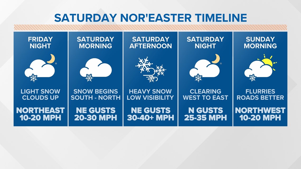
First, let's talk timing.

A few flakes could fall at the coast late on Friday as some ocean effect snow showers pop up. These would just be some bonus flakes out ahead of the main storm.
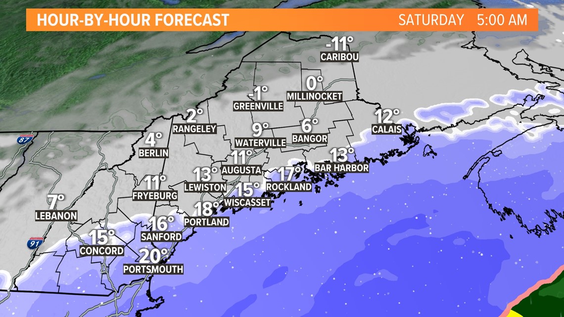
However, most coastal areas and even some inland sections of York and Cumberland counties will see snow begin before sunrise.
Notice the temperatures, too...single digits and low teens mean it will stick immediately and pile up quickly.

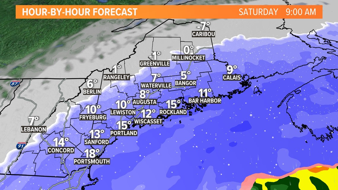
By 9 a.m., heavier snow bands start to rotate onshore. Snow will stack up quickly through southern and central Maine. Wind gusts will also pick up out of the northeast.
There are some signals that bands could end up dropping 1-2" per hour, if not a little more.
The highest chance of this occurring is at the coastline, and mostly in the late morning or early afternoon.

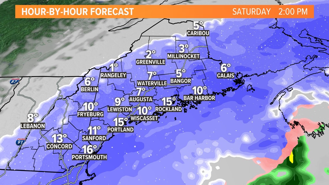
Snow continues spreading north and west through the early afternoon.
As heavier snow bands begin to spread east, snowfall rates will pick up along the Midcoast and toward Bangor.
Travel will be quite difficult statewide. It may be nearly impossible along the coastline, where wind gusts will be strongest. I don't use that word lightly.

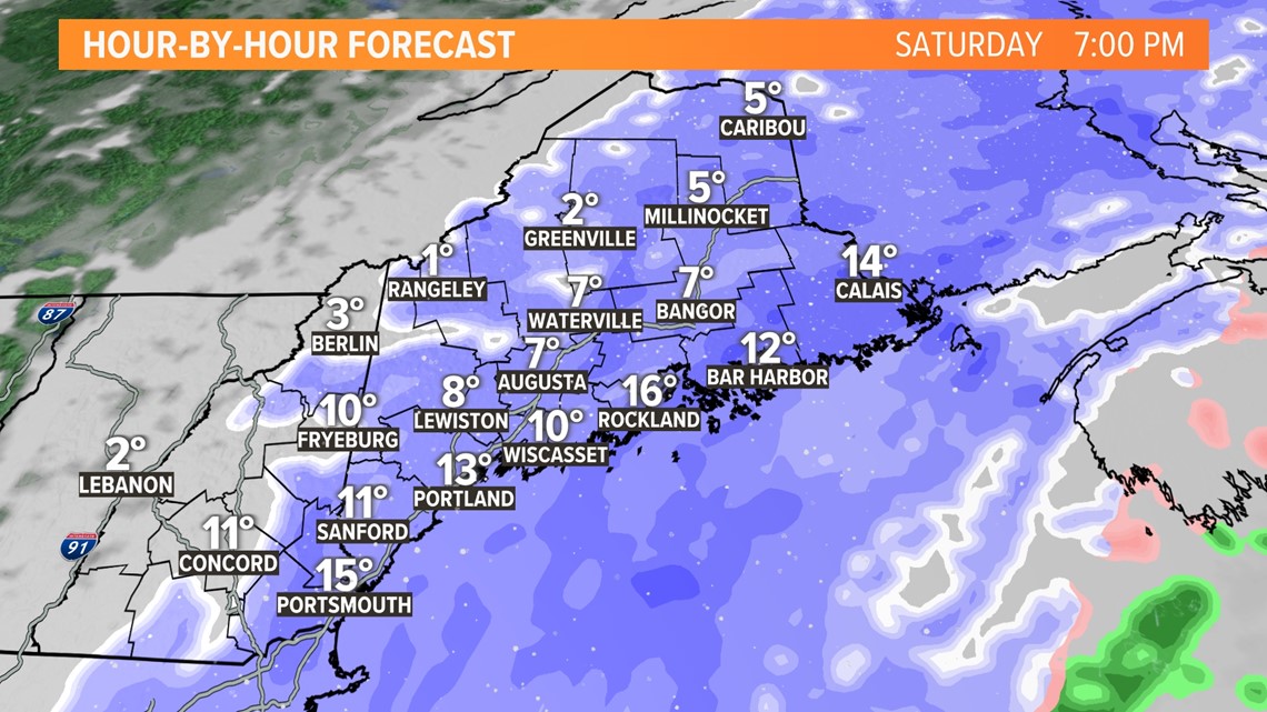
By the early evening, the storm shows signs of weakening.
This will clear western areas out first, with lingering snow showers east of Augusta.
Still, travel will be tough thanks to blowing snow.

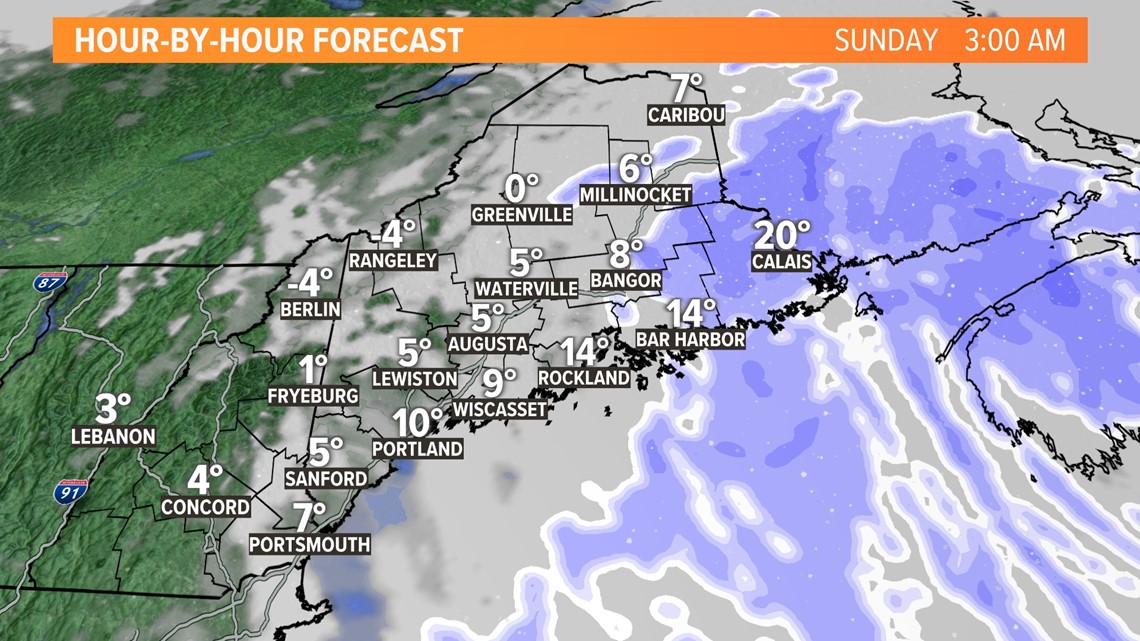
By late Saturday, most areas will be entirely cleared out from falling snow. The only places still dealing with snow will be Downeast.
Winds will shift to be out of the north. They could be strong enough to cause issues related to blowing snow.
I think most spots will be in much better shape come Sunday morning.

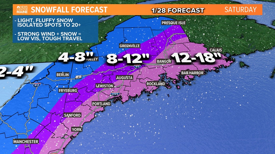
Here it is...the long-awaited snow map!
Totals went up across southern and central Maine, where a widespread 12-18" is expected.
A few towns might even end up with 20" or so under the heaviest bands.
This is still not a huge hit for most of the ski hills, but a solid 4-8" of pure powder is expected.

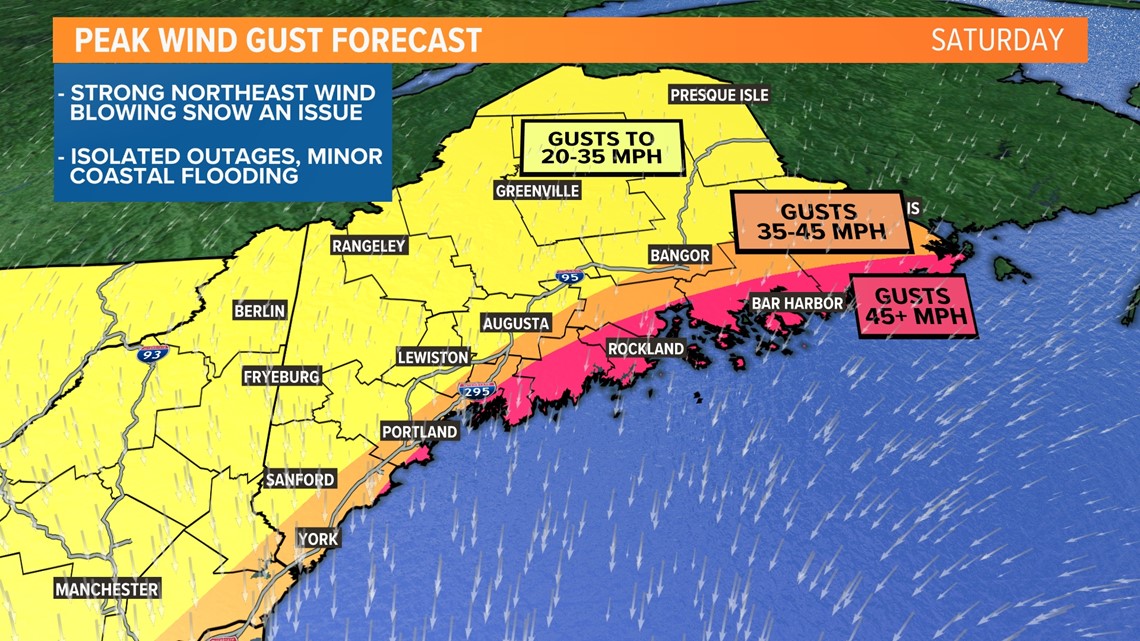
Wind gusts will be strongest during the day. They will come generally out of the northeast, switching to be out of the north as the storm passes through the Gulf of Maine.
Some isolated power issues are expected. The frozen ground and fluffy snow will help to mitigate this a little bit.
This will also keep wind chills in the -10° to 5° range. Wicked cold, and one of the colder storms we've seen in a while.
Minor coastal flooding is also expected, but the strongest wind gusts will happen during low tide. Vulnerable areas should expect some minor splash-over and beach erosion.
The bigger issue with wind is blowing and drifting snow. This will keep visibilities quite low, which is why there are active blizzard warnings already issued.
Based on the wind forecast alone, I would recommend staying home tomorrow. Only travel if it's completely necessary.

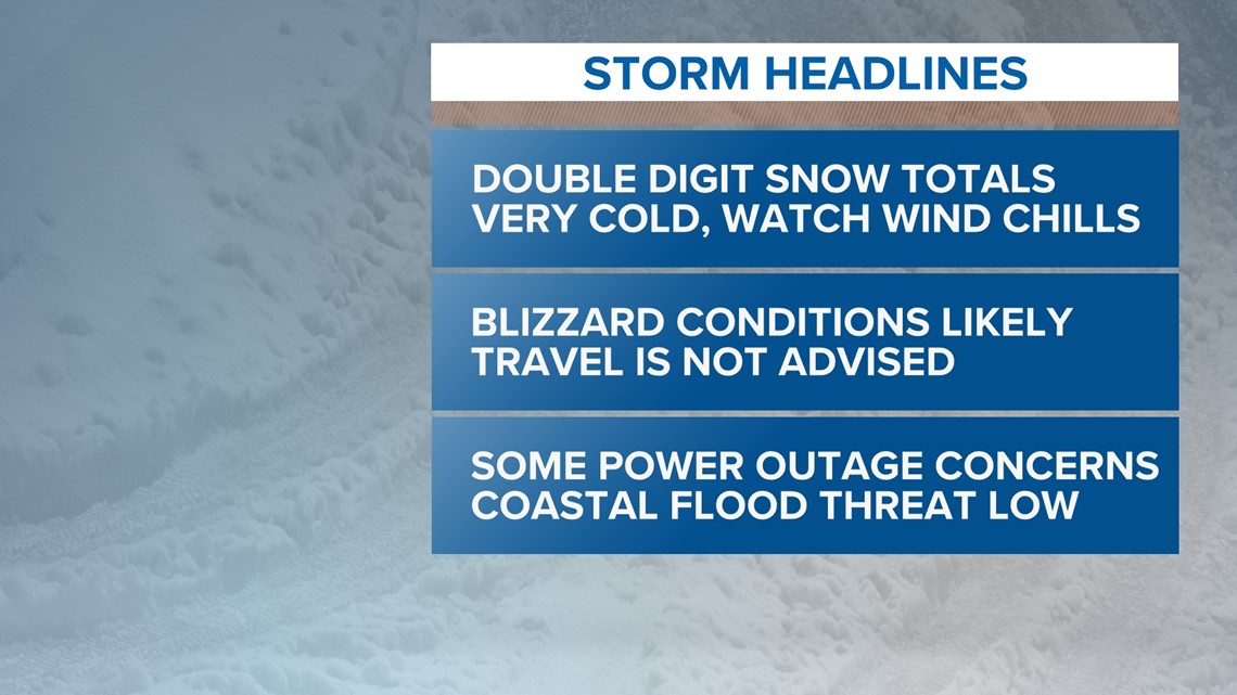
Here's your "one-stop-shop" with the most up-to-date info on Saturday's nor'easter.
Now is a good time to prep. It's quiet out there, and not too cold. Get the generators or snow blowers ready. Have a plan in case you lose power and need to stay warm.
You can follow along with updates right here on our website, on the NEWS CENTER Maine app, and on air.
If you have pictures to send in, you can do it right through the "Near ME" section of our app! Please only take pictures or videos if you can do so safely, and please take them horizontally rather than vertically with your phone.
Make sure you follow our whole team (Todd, Keith, and Jess) on social media for updates before then.
See you all tomorrow!
For the latest breaking news, weather and traffic alerts, download the NEWS CENTER Maine mobile app.
RELATED: NEWS CENTER Maine Weather Forecast

