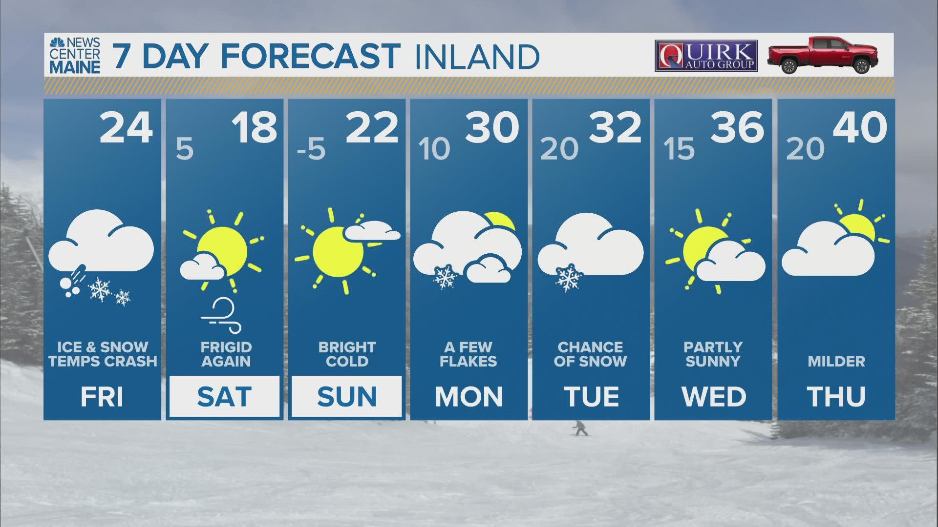
PORTLAND, Maine — There's no other way to put it: Friday is going to be a mess. We'll see all types of precipitation and it won't taper off until mid-afternoon.
An Arctic front has passed through and temps have been dropping like a rock all night. Along with heavy snow and sleet, we're seeing a flash freeze of Thursday's rain and melting. Please use caution navigating around this morning.
Historically, these synoptic setups produce a lot of ice (sleet and freezing rain). While it took a while for models to catch on to this, it's looking like that will be the case again Friday, and nobody likes ice.

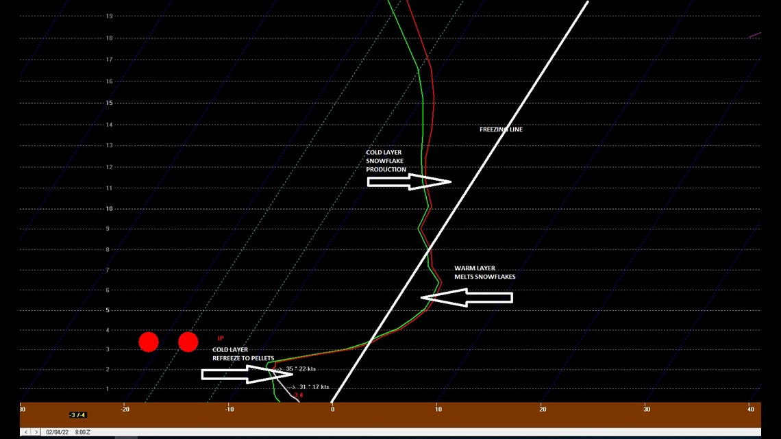
There will be a stubborn warm layer 5,000-7,000 feet above the ground. That warm layer will melt snowflakes into raindrops. The lowest at 5,000 feet are subfreezing and that refreezes the raindrop into an ice pellet...sleet bomb warning.

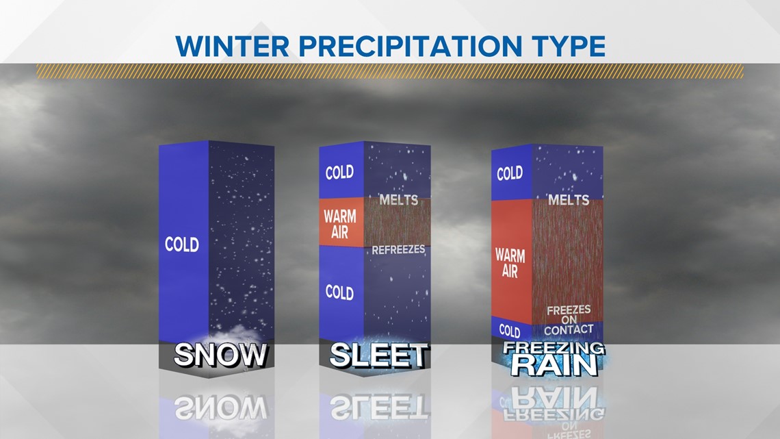
Sleet will be the predominant player for the coast Friday and there will be several inches of it.

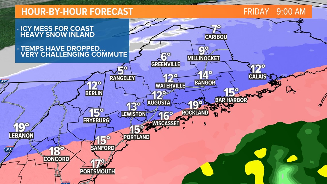
On the other side of the sleet line, heavy snow will fall. There will be efficient accumulation, too, as temps have dropped into the 20s and teens.

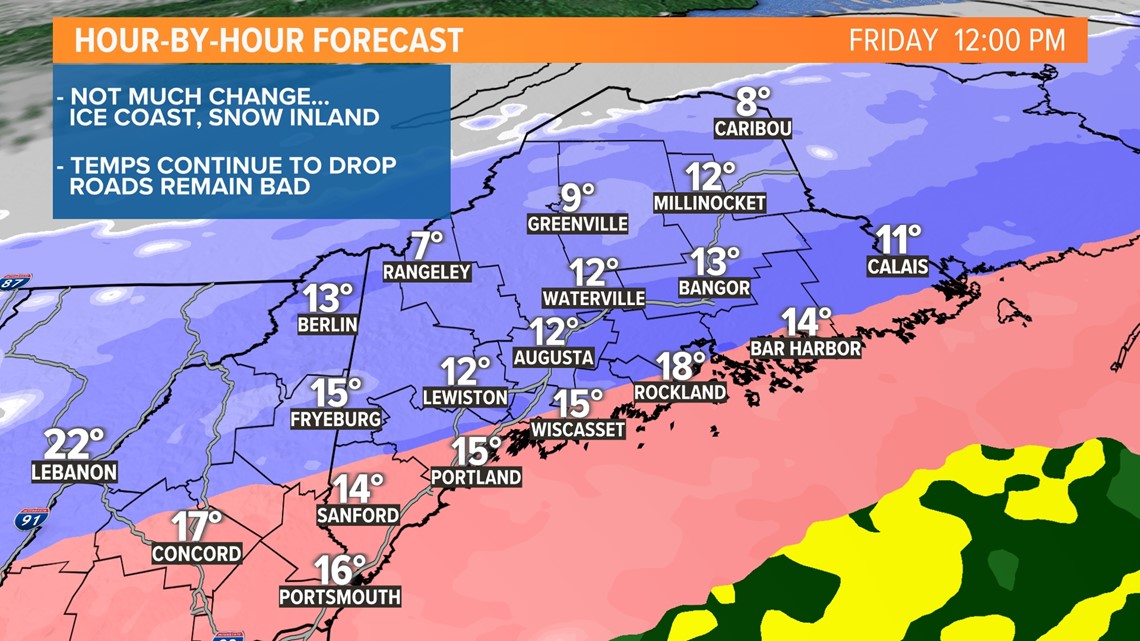
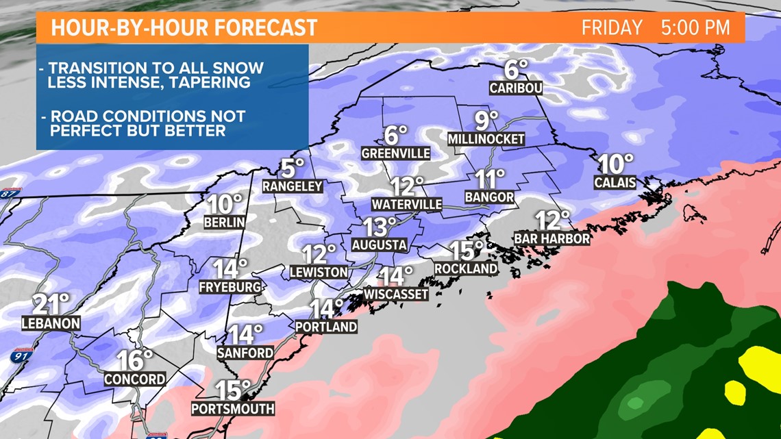
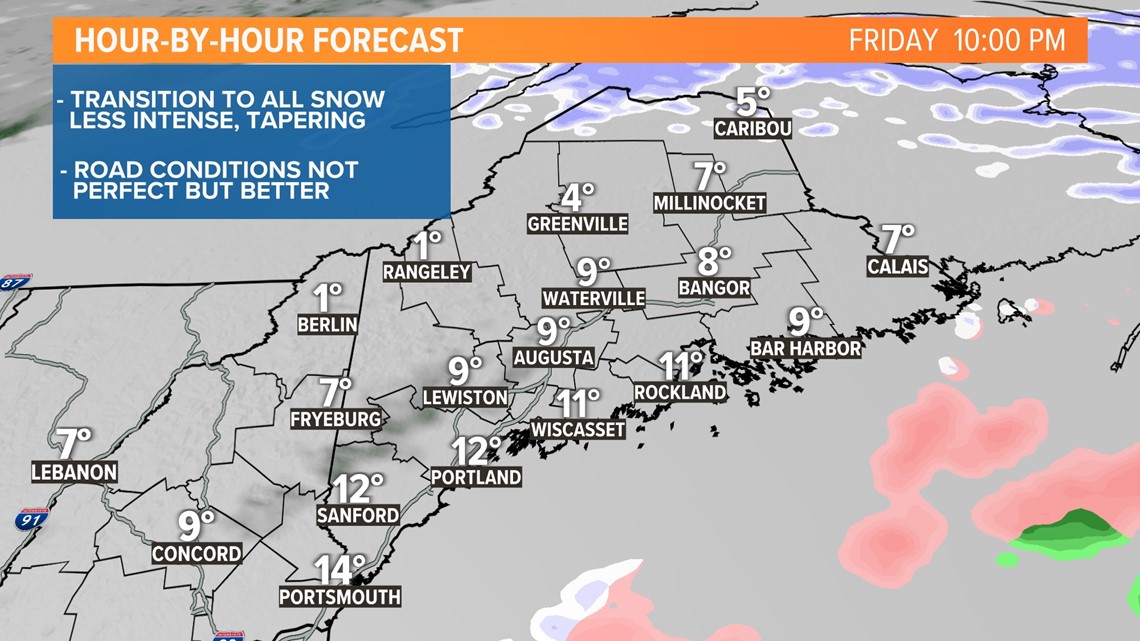
We'll finally chip away at that stubborn warm layer Friday afternoon and precip will complete the change to all snow as the storm winds down and tapers off Friday afternoon and evening.


For the latest breaking news, weather and traffic alerts, download the NEWS CENTER Maine mobile app.
RELATED: NEWS CENTER Maine Weather Forecast

