PORTLAND, Maine — With the recent storms and frigid air, there's a lot of winter fatigue going around right now. The good news is we are catching a break from the deep freeze right now and highs will be around 40 on Thursday. The bad news is the thaw comes with a price: a messy storm rolls in Thursday night.
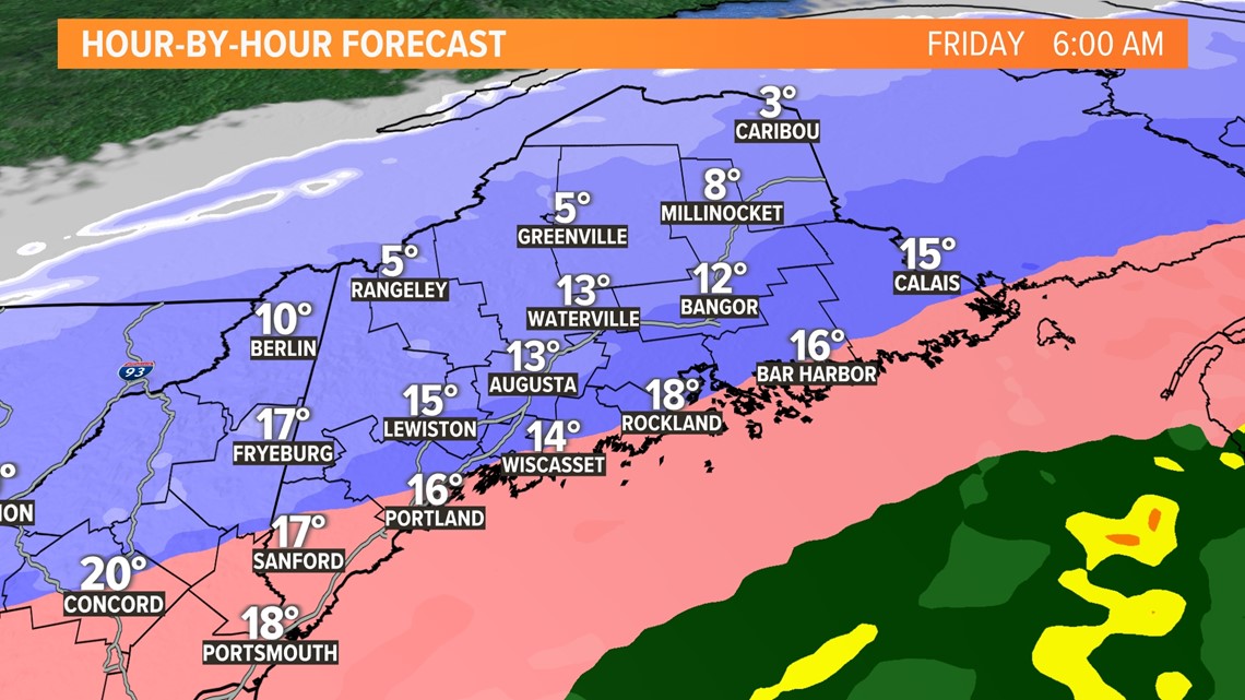
Preceding the front, temps will be around 40. But the front will pass through late this evening and temps will crash through the night well below freezing by Friday morning.

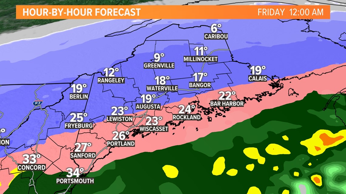
The cold will penetrate the surface layer first before taking out the mid-layer warmth. This will lead to a period of ice ... a sleet bomb. The million-dollar question is, how long will we stay sleet before flipping to snow?

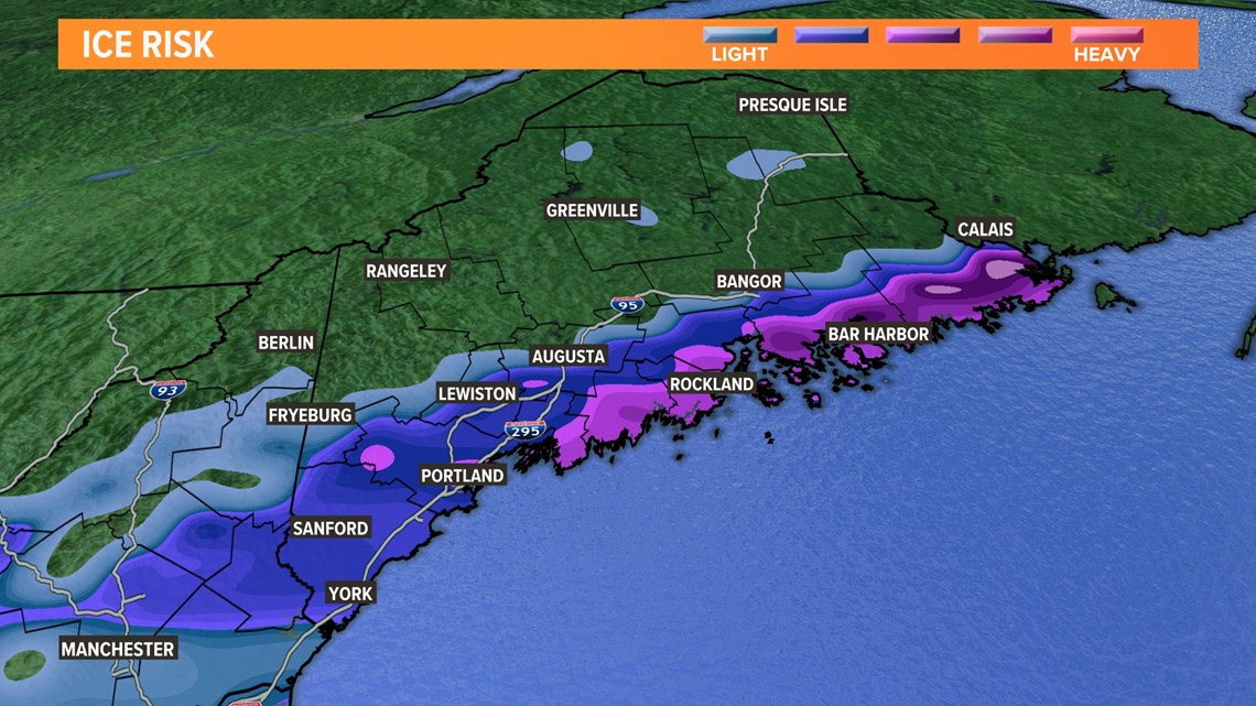

The duration of ice will no doubt have an impact on snow amounts. Historically, past storms would point to much lower snow amounts along the coast where the milder ocean air battles the cold air intrusion and ice hangs on longer. While this Arctic airmass is exceptionally impressive, I think sleet will be a big player near the coast.

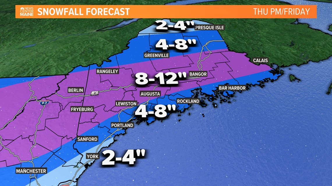
On the other side of the sleet line, we'll be ripping snow through midday Friday. At first the snow will be wet and sticky, but as temps drop, the snow will become dry and fluffy.

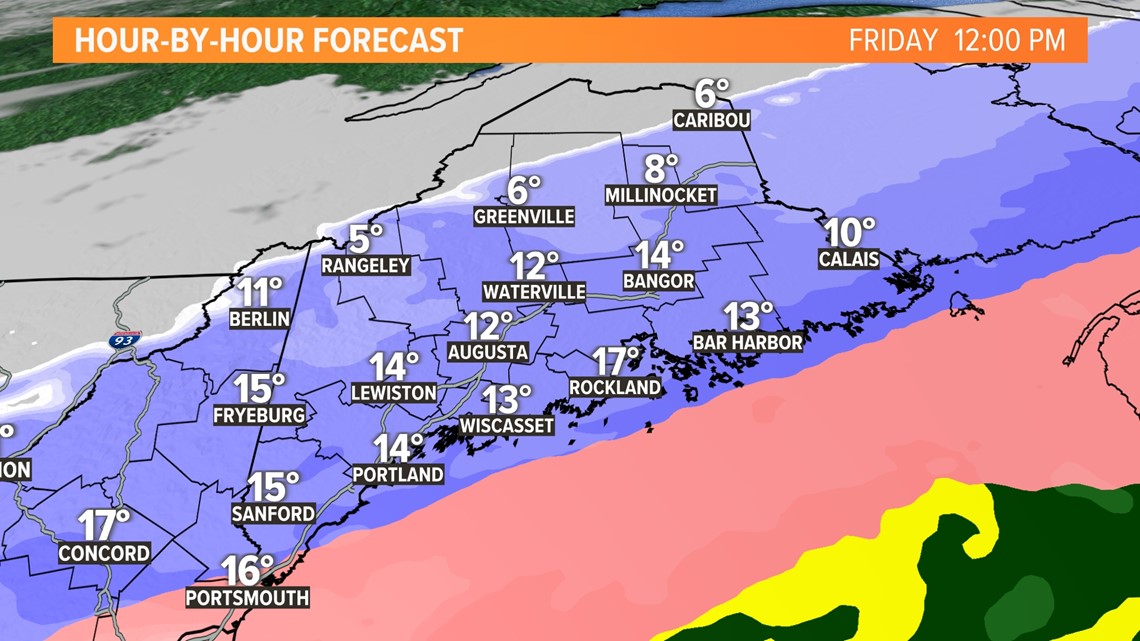

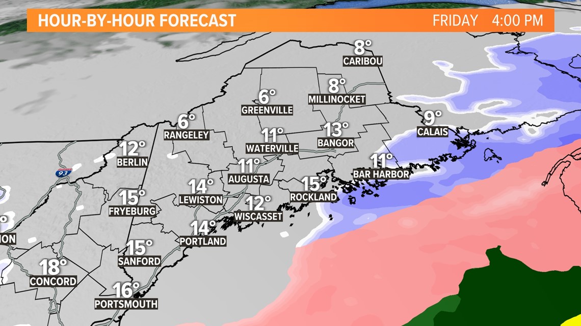
The storm will drift away during the afternoon and all snow will taper off. If adjustments are made from here, I'd anticipate they are along the coast where snow amounts may get trimmed even more.
RELATED: NEWS CENTER Maine Weather Forecast


