PORTLAND, Maine — We were on some ride around here. Temps were crazy warm with six days in the 60s and three days in the 70s over the first two weeks of the month. But just like that, the pattern has flipped, and there's no sign of a warm-up.
Not only will it be cold this week, but there's a solid chance that you see your first flakes of the season too.
First snows are always fun to forecast. There is so much more to consider when determining how much snow will accumulate. In the end, amounts usually vary greatly from region to region and town to town.

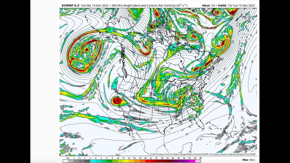
A mid-level shortwave will round the base of a trough and kick up low pressure in the Deep South. The low will then turn north up the East Coast, where it will run into abnormally cold mid-November air.

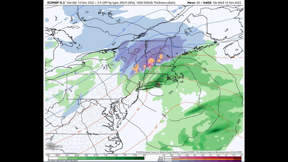
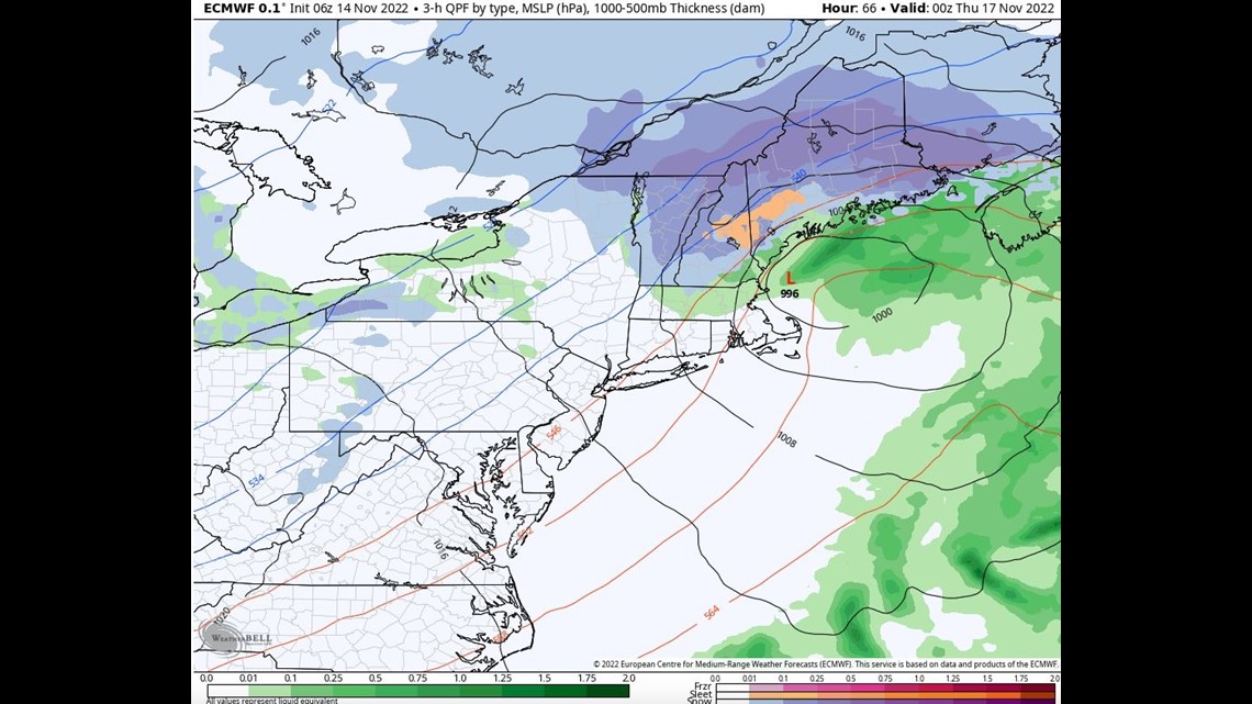
The factors aren't indicating big snow from this system. The ground still isn't frozen, and the low never gets that strong. The timing isn't ideal either. Most of the precipitation falls during daylight hours. However, the track may be perfect: just off the coastline and with a high to the north, meaning surface cold will be tough to dislodge.

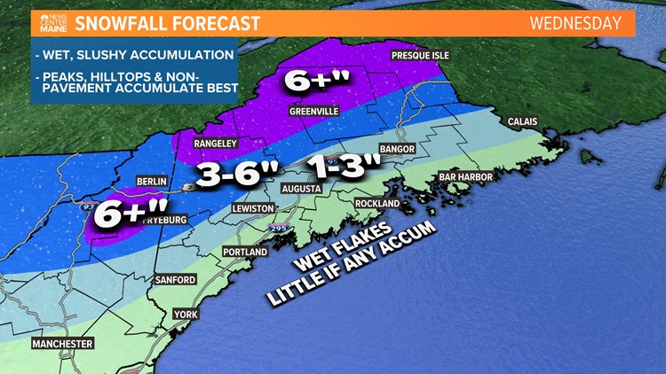
In the end, most will see their first snowflakes of the season, and many will get some sort of accumulation.

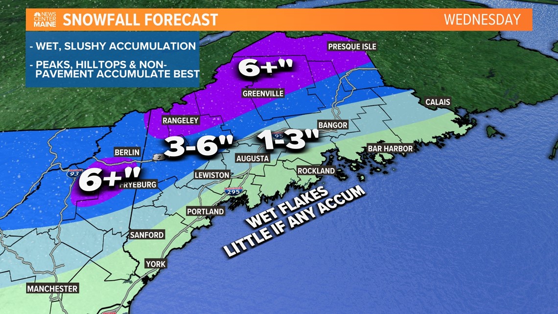
It will be a wet and slushy accumulation. Peaks, hilltops, and non-pavement will get the most and accumulate most efficiently. Along the coast, there will probably be some wet flakes at the onset, but milder air will chew away enough of the cold, so a flip to rain will happen fast, with no accumulation expected at this time.
This is my first snow map since last spring, so hopefully I'm not rusty ;). Check back later today for any updates.
RELATED: NEWS CENTER Maine Weather Forecast


