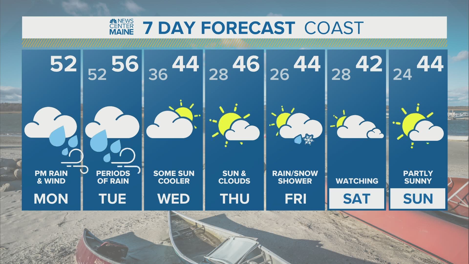
MAINE, USA — Another powerful storm is about to roll in with heavy rain and strong winds. After a quiet Monday morning, things start ramping up during the afternoon. Showers become steady rain and wind starts increasing off the water. By the evening commute many will be driving in windswept rain. Temporary drainage issues will create dangerous hydroplaning on the roads.

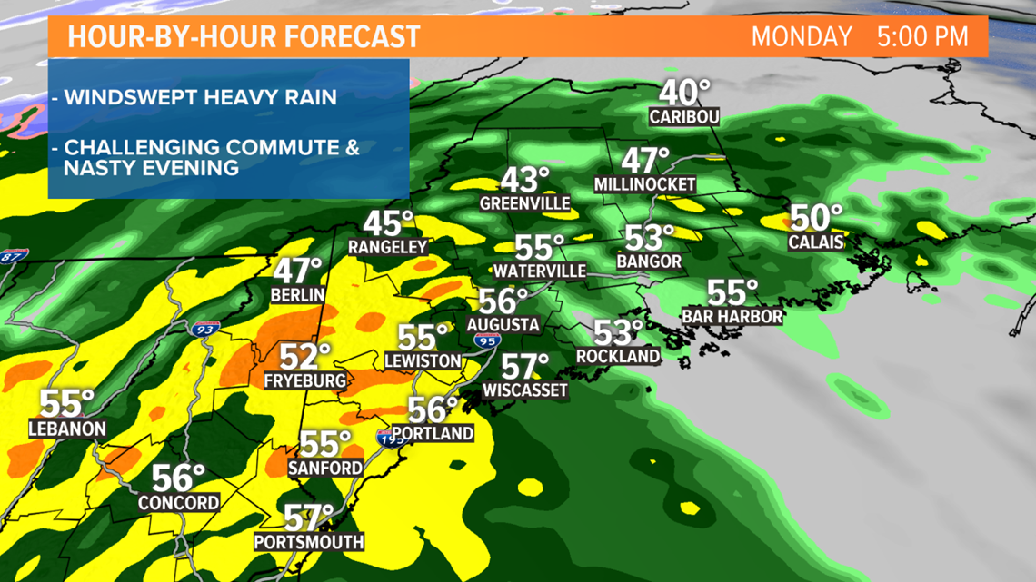
The rain will continue through the night, becoming showery with embedded downpours. Rumbles of thunder are possible too. But it's the wind that will be grabbing the headlines tonight. The low-level jet, a river of very strong wind a few thousand feet above our heads, will pivot through.

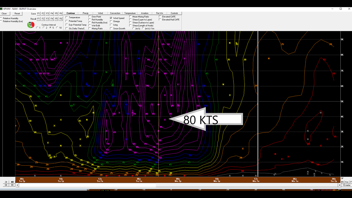
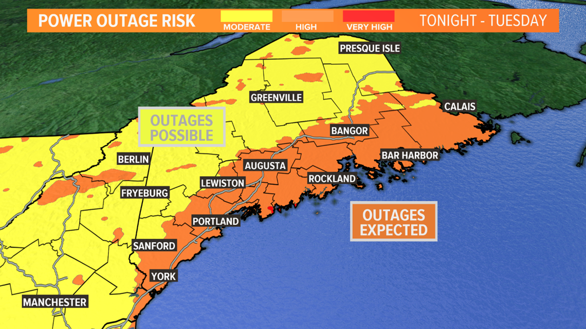
This time of the year the air near the surface is cooler which creates a more protective layer, so I don't expect wind to be maximized. However, the momentum from heavy rain can bring some of that wind down. Also contributing to the threat, will be the risk for thunderstorms. The vertical motion, from up and down drafts within them, accomplishes the same transfer. Gusts over 50 mph are likely through the night for most of Maine, and through tomorrow for Downeast areas.

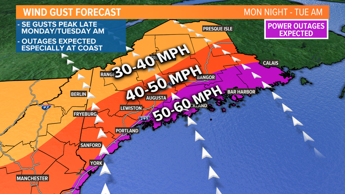
The power outage threat is real. Usually by now, the ground is frozen or close to it, but this November has been mild. The ground is wet and root systems are still susceptible. While trees are bare now, a southerly wind direction is always troublesome, blasting in off the water uninhibited. Charge up your devices and grab fuel for generators.

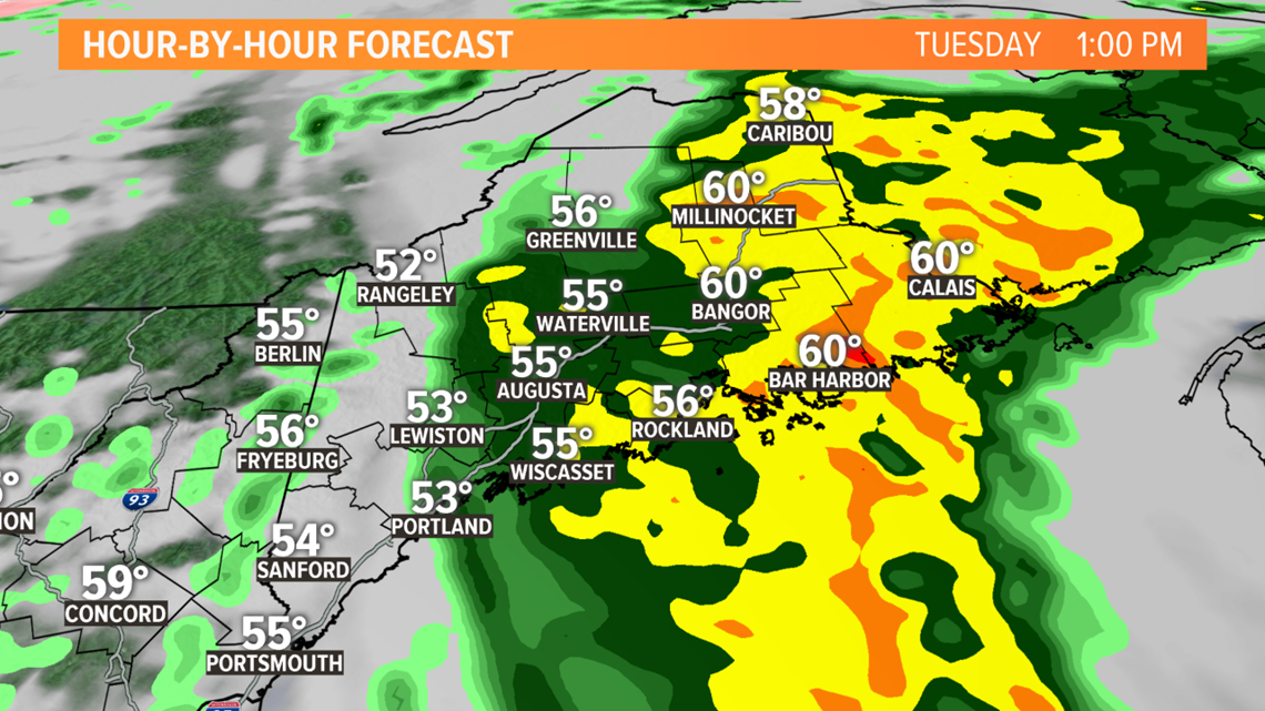
The storm will shift east very early tomorrow with a second wave of wind and rain directed at Eastern Maine for the afternoon. This will push rain totals over 3 inches in some towns. Strong wind gusts will persist but drop off rapidly late in the day.

We'll have updates for you later today.
Todd - https://www.instagram.com/todd_gutner/

