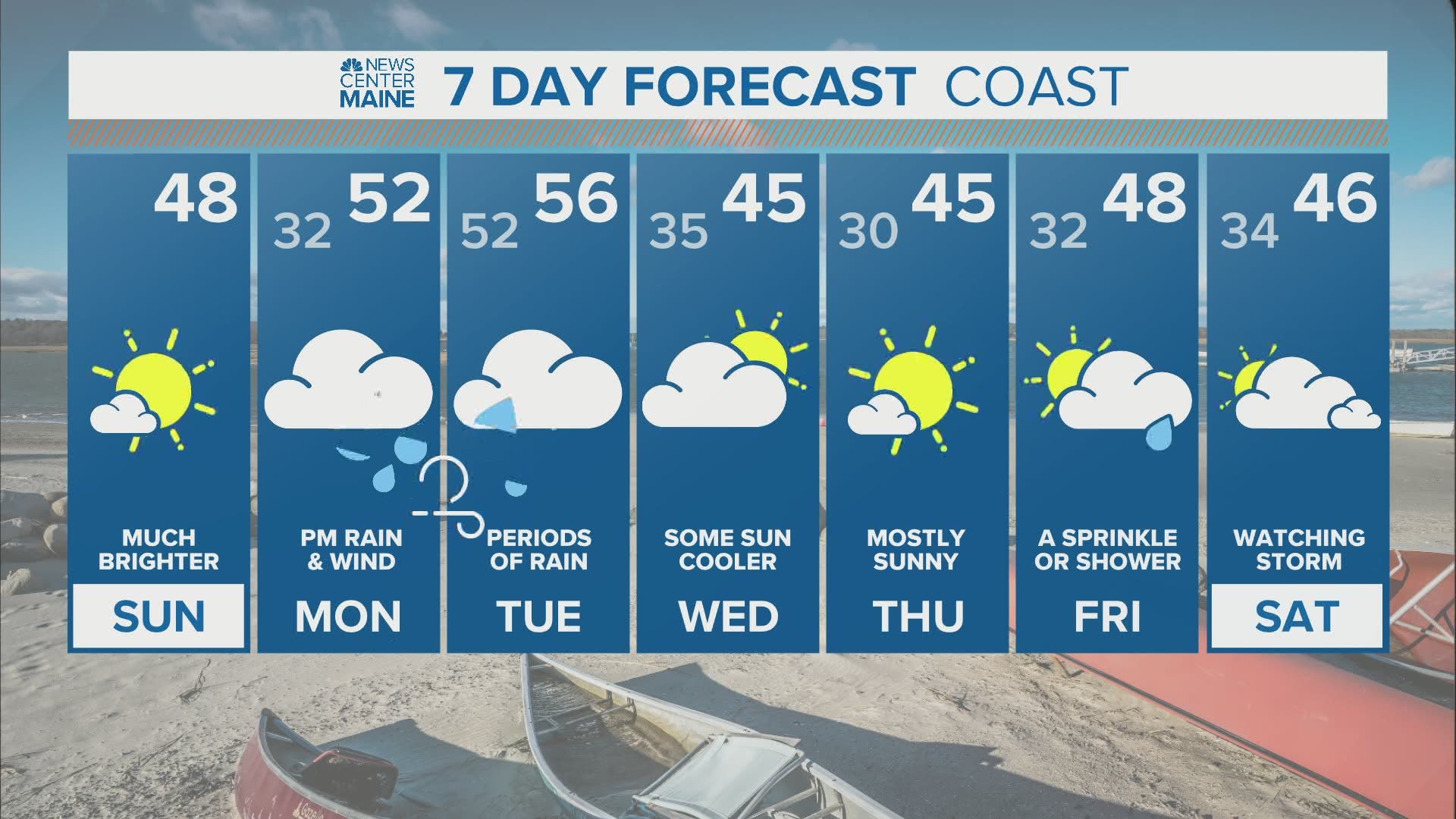
MAINE, USA — Enjoy Sunday's sunshine, because everything is on track for a slow-moving, potent storm to bring us rain and wind Monday into Tuesday.
The worst of the storm in southern Maine will be late Monday afternoon into Monday night. A second surge of rain and wind is expected in eastern Maine on Tuesday, while southern Maine will see the rain taper to scattered showers. Here's an overview of the timeline.

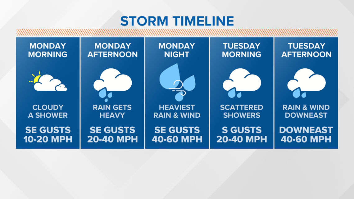
Showers will move into southern Maine late Monday morning. The rain will start in the Portland area around noon. It will start in the Bangor area around 2 p.m.
The evening will be nasty with windswept heavy rain.

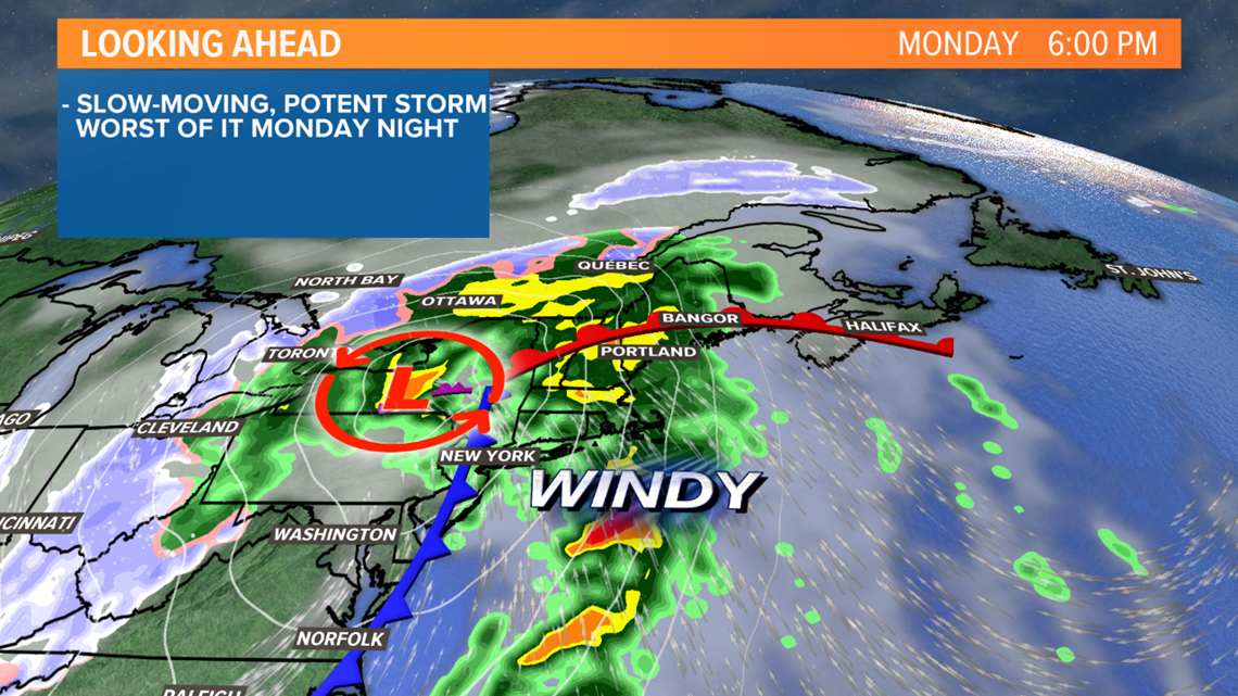
A "low level jet," a current of very strong winds a few thousand feet above the ground, will be passing overhead Monday evening. Many of our wind storms in recent years have stemmed from this. The core of the jet, up to 75 MPH, will be pointed right at coastal Maine. The strongest winds will stay aloft, but when it's pouring rain, the rain is able to transport some of the gusts to the surface.

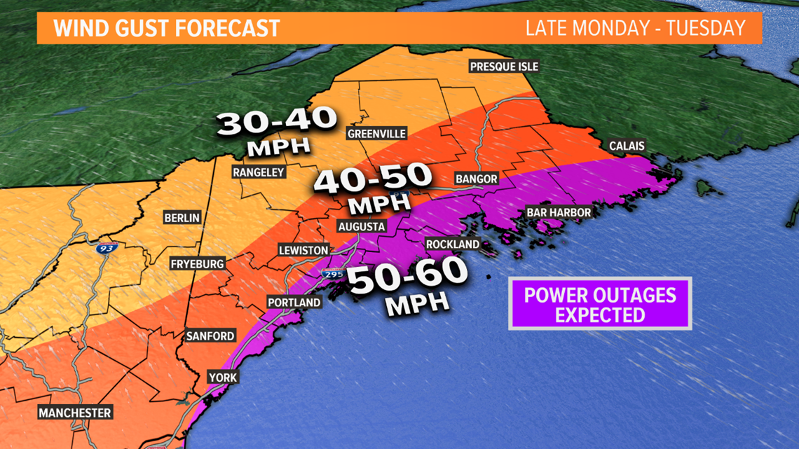
Gusts of at least 50 MPH are expected near and along the coast. The potential is there for gusts to 60 MPH.
We have the benefit of no leaves on the trees now, so we can handle gusts to 50 MPH better than we could a month or two ago. Gusts of this level lead to scattered outages. However, if gusts do push up closer to 60 MPH, outages would become widespread. So, power outages are expected. It's just a matter of how many.
On Tuesday, the storm will start to unravel overhead. In southern and western Maine, the steady rain will be over. We'll have lots of clouds, occasional showers and it will be breezy with gusts in the 20 to 40 MPH range. However, in eastern Maine, a second surge of rain and wind will hit. Gusts of 40 to 60 MPH will continue Downeast with pouring rain at times during the day Tuesday.

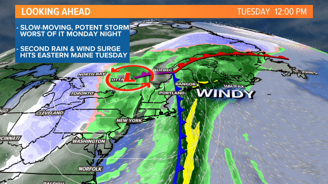
This second surge of rain will push rain totals in parts of Hancock and Washington county over 4". Most of the state will end up in the 1.5" to 3" range in total, less in the western mountains and New Hampshire.

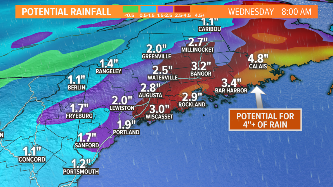
Since it's been such a dry year, river flooding is not expected. Smaller streams and brooks could fill up in the heaviest rain, and some ponding of water or minor flooding is possible in poor-drainage areas.
Keep in touch through the weekend as we get more information.
Ryan - Follow me on Instagram @ryanbretonwx

