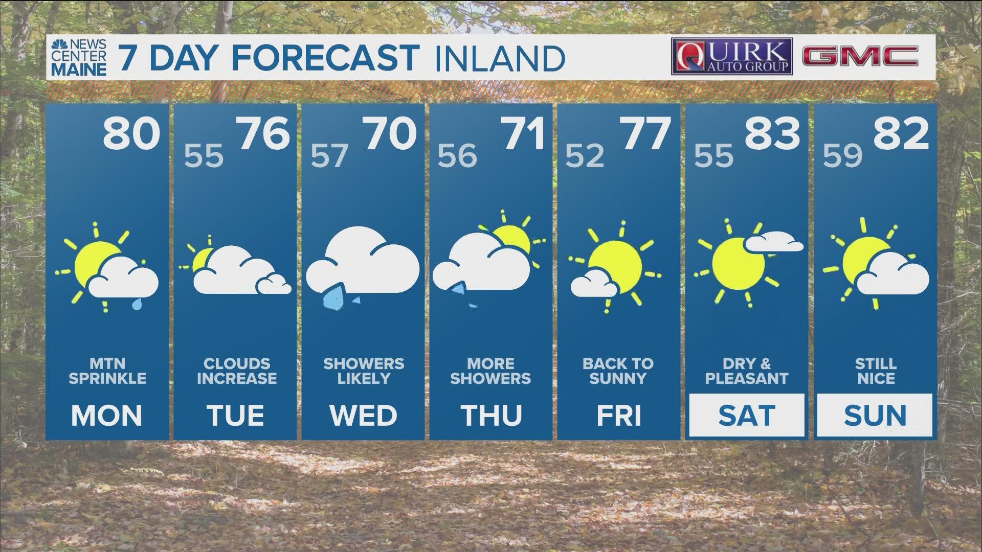
MAINE, USA — Ahhh...the weather models giveth, and the weather models taketh away.
The old adage of "drought begets drought" could not be truer this year. Southern and central Maine have not been able to buy significant rain, while northern Maine sits with a nice surplus.
Part of that surplus in The County is due to the late season snow that fell, while dry conditions settled into other parts of Maine fairly early over the spring.
When the soaking rain chance for Wednesday began to slip away, I was not surprised, but I was disappointed.
I still think there will be some rain this week. I just don't expect it to be the drought buster many had hoped for.
Where we stand now

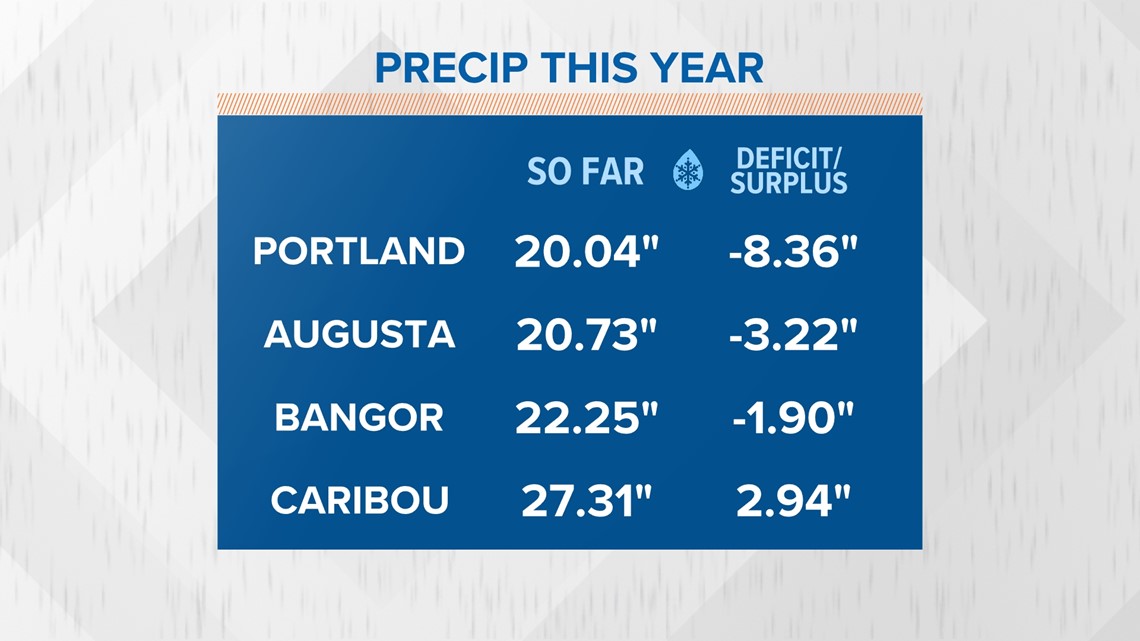
Rain deficits are growing daily, especially for coastal Maine. Portland is quickly approaching an 8.5" rain deficit since January 1.
Normally, the greater Portland area would have seen about 28" of rain, but the annual total sits right near 20".
RELATED: NEWS CENTER Maine Weather Forecast
Augusta is in a similar boat, although the deficit is not as extreme. Still, the Augusta area would normally have seen around 24" of rain by this date, but only around 20" have fallen.
Bangor is in a similar boat, though not as severe.
Caribou, though? Rain has been plentiful. The County is the only part of Maine that has seen normal (and even above normal) precip amounts.

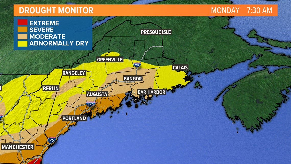
The drought monitor reflects this pretty clearly, too.
While there has been improvement in western Maine, there is still work to be done. The severe drought continues from Kittery to the Penobscot Bay.
The forecast

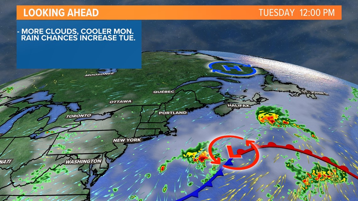
An area of low pressure over the Atlantic will track north on Tuesday, bringing more clouds to the region.

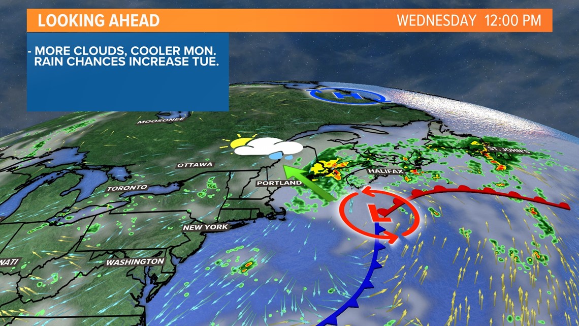
This storm is forecast to move close to Maine, but the exact track of the storm will have impacts on how the forecast plays out.

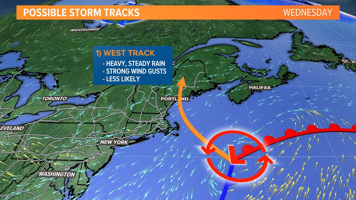
In the first scenario, which is the least likely one, the storm will track west and hit somewhere along the Maine coastline.
This would bring steady, soaking rain to the entire state and New Hampshire. It would be much closer to the "drought buster" scenario, but it comes at a price: power outages.
A storm track like this would likely bring some strong wind gusts to the state, which would be exacerbated by the trees in full leaf.
Thankfully, power outages seem unlikely, since this storm track is less likely to happen. There is still a small chance, though.

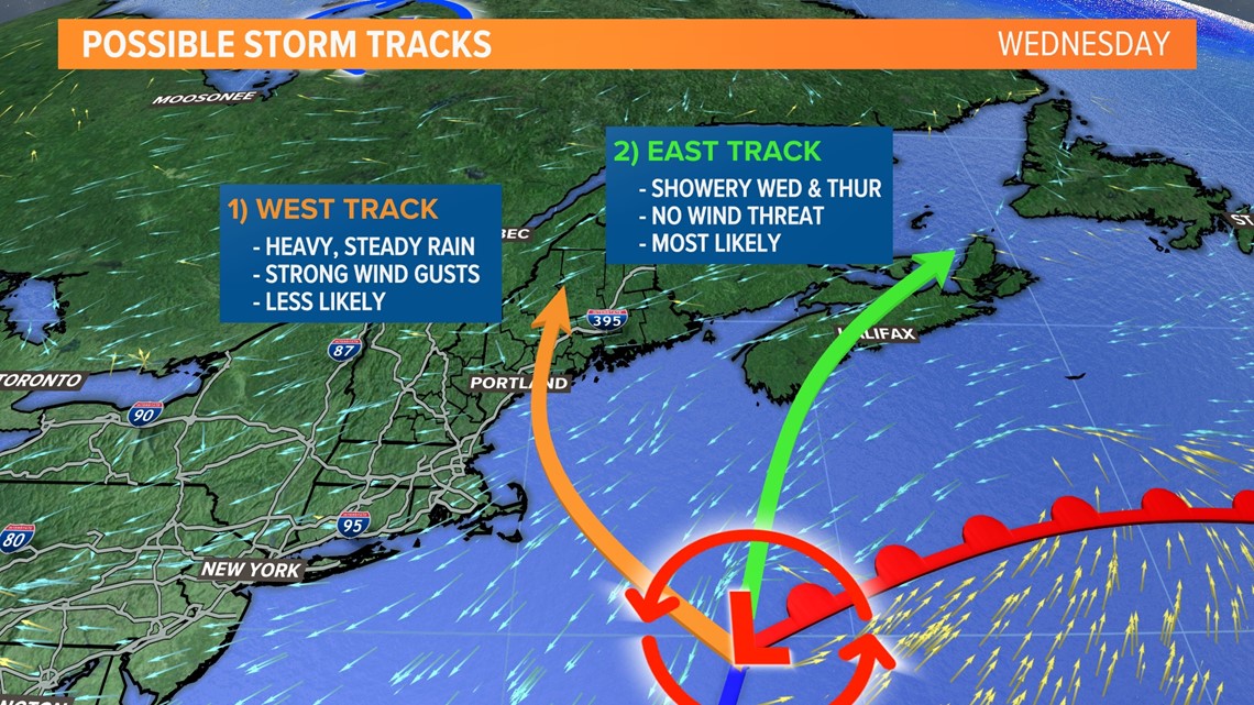
The second possible track seems much more likely to me. This puts the storm out over Nova Scotia and Maine's rain comes in the form of wraparound precip.
While this would mean no power outage risk for us, it would also mean less rain. The coast would still be breezy and it would feel more like fall outside than mid-August.
Rain totals in this scenario are greatest east of the Penobscot, with an inch or more possible. This is still beneficial given the abnormally dry conditions Downeast.
Showers are still expected all the way to the New Hampshire border, but actual rain totals may be closer to a tenth of an inch. Would it be helpful? Sure, anything is right now!
But it certainly would not be the big drought buster we had hoped.

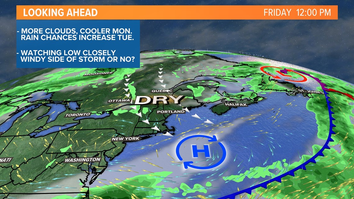
No matter how the storm tracks, the week ends with sunshine and low humidity.
Stay tuned to our newscasts for updates, should they be necessary. You can always get the latest forecast info from our website and mobile app, too.
I'll have some updates as we get closer.
- Mike Slifer, @MikeSliferWX

