PORTLAND, Maine — Winter has unleashed on us recently with a week of Arctic air. Now, a potent winter storm will gash Maine with snow and wind.
Instead of the favored coastal track, low pressure will take the rarer inside route right up the gut of New England. Such storms are known as inside runners, and it will expose Maine to a warmer solution and the damaging low-level jetstream.
While the Arctic cold bit us hard over the weekend, it acts as an insulating bubble from much stronger winds more than 1,000 feet above ground level. With a coastal storm, winds come from the northeast or north, advecting cold air. The protective bubble gets augmented and holds. The low-level jet is dampened. With an inside runner, the wind direction is southeast or south, advecting warm air. The protective cold bubble erodes and the surface is open to the damaging low-level jet.
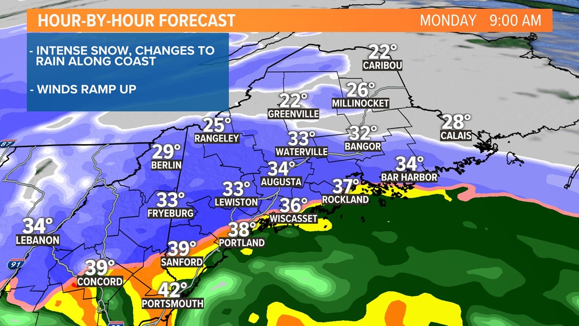
MORNING:

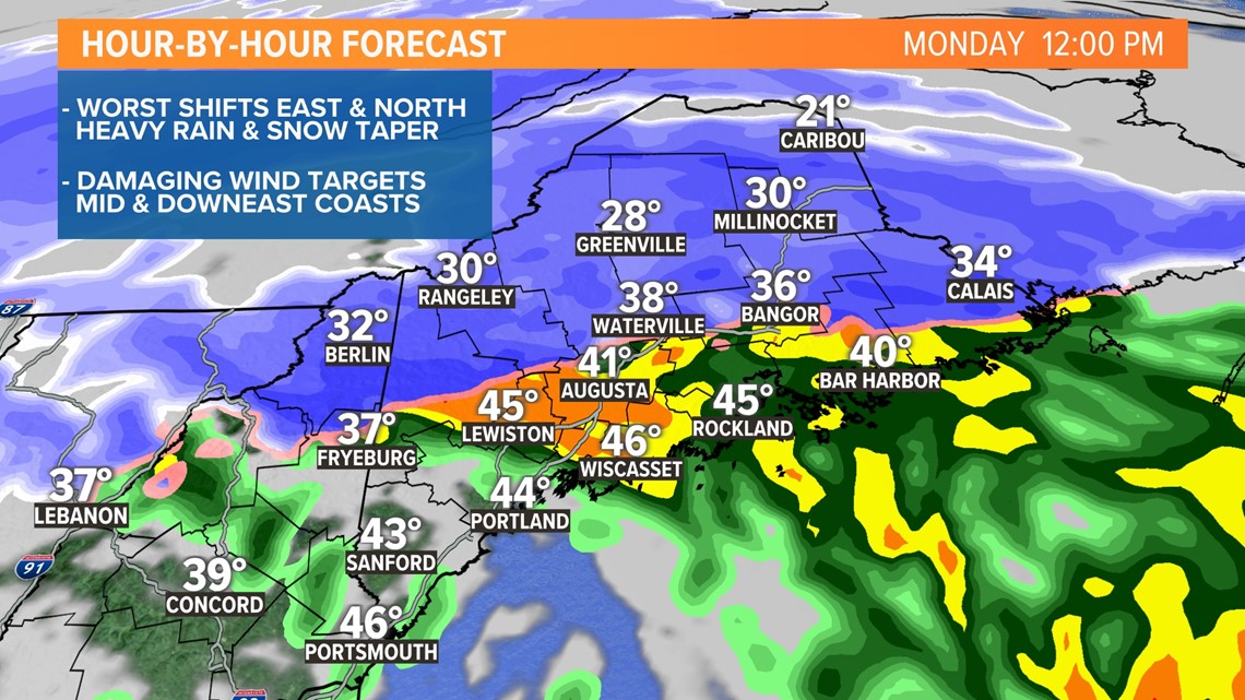
MIDDAY:

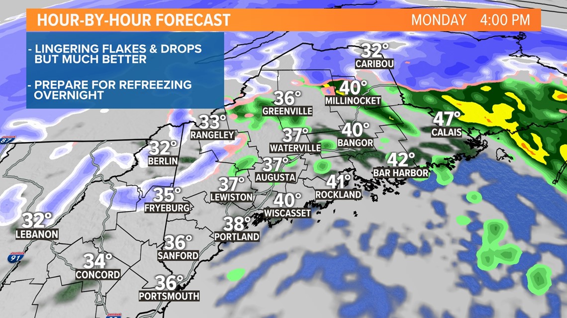
AFTERNOON/EVENING:

It takes time, however, and prior to it, a burst of snow will fall during the early morning. It will be intense and rates will be impressive at over an inch per hour. Thankfully it's MLK Day, so fewer cars will be on the roads. But, if you don't have it off and need to drive, it won't be easy.
The low-level jet will escort milder air in aloft before the surface gets it. Snow will change to sleet and freezing rain along the coast first and then will work inland. While getting thumped with snow, even the mountains will experience a little sleet or freezing rain by the end of the event.

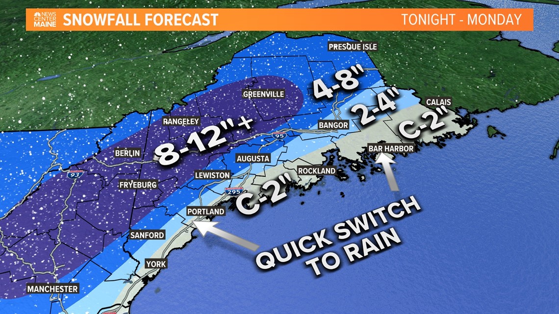
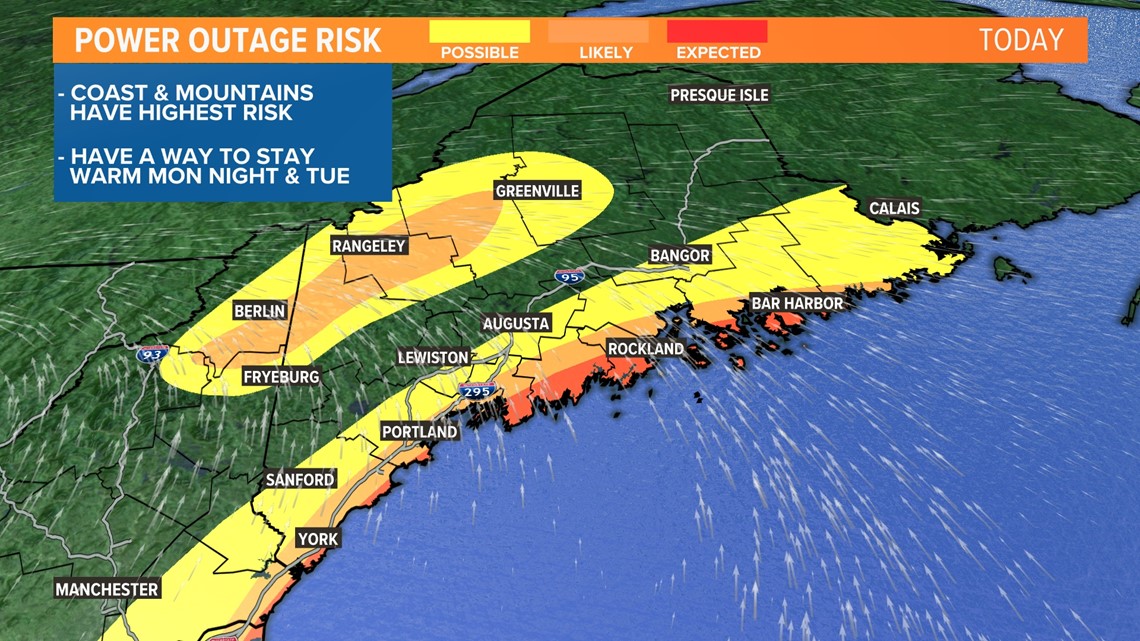
While significant snow isn't a concern for the coast, the wind is. The window will be short, but once the cold surface layer is gone, better mixing will occur. At 3,000 feet, winds will be screaming in from the southeast at over 75 mph. Momentum transfer will be more efficient to bring down a derivative of it. From mid-morning through early afternoon, coastal winds could get destructive, bringing down limbs and trees. Power outages will mount. If you live within a few miles of the coastline, be prepared. It's winter, it's cold, and it's going to stay that way. While I'd love to say restoration will be quick, with COVID, you never know. Personnel and crews may be strained just like every other business and industry right now.

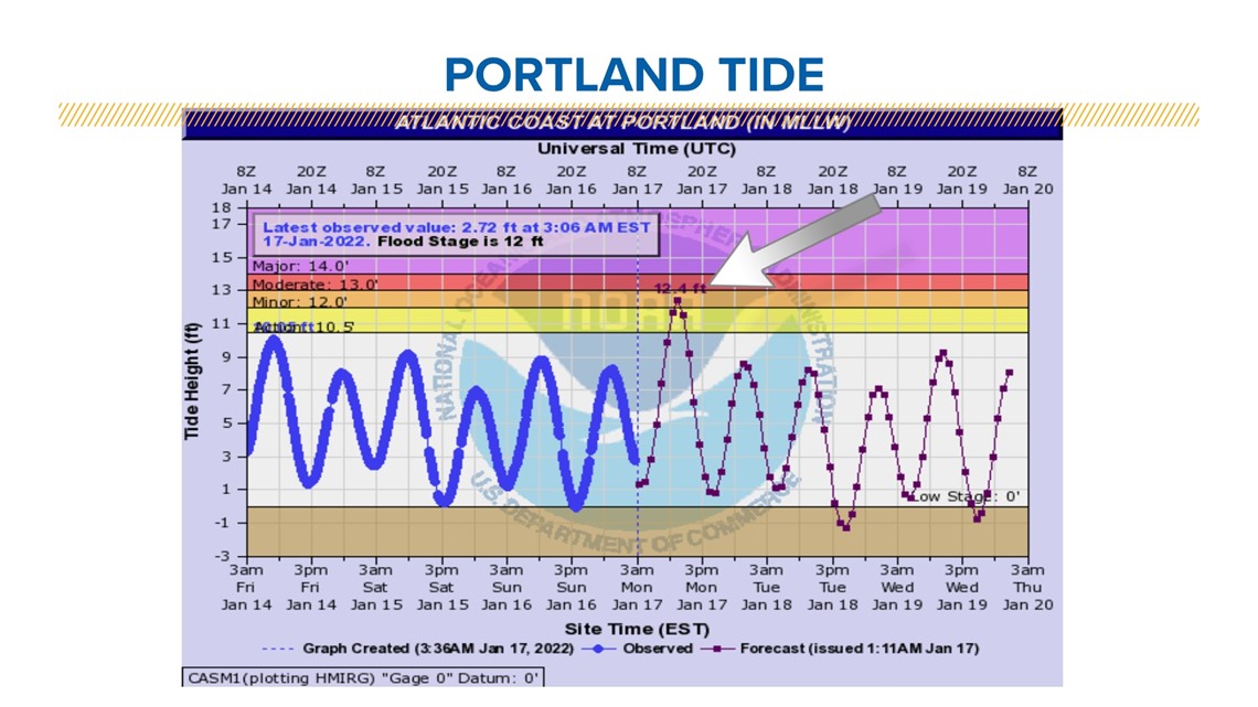
The final concern is also along the coastline. High tide and wind direction mean the strongest winds will line up mid- to late-morning, resulting in coastal flooding and erosion. Because astronomical tides are low right now, we will narrowly miss a very serious situation. But a solid storm surge and large waves will be able to overcome the smaller tides. Water, sand, and other ocean debris may end up on adjacent coastal roads. It's possible that a few may need to close until water recedes or debris can be cleared.

This is looking like one of the more impactful storms we've had in a while. Let's hope for the best but prepare for the worst.
Todd - Follow me on Instagram: https://www.instagram.com/todd_gutner/
RELATED: NEWS CENTER Maine Weather Forecast


