MAINE, USA — Who needs amusement parks when you can just spend some time with Maine's weather?
The past couple weeks have been all over the place. There have been warm days, cold nights, rain and snow.
Today is another part of this ride, too, as temperatures climb to near record highs.
With a strong westerly breeze and some sunshine, temperatures should easily make it into the mid to upper 50s.
Some spots in southern and central Maine will even make it to 60° or higher.
The cold front passes tonight, though, and winter will be back by Thursday morning. A snowstorm follows for Friday.

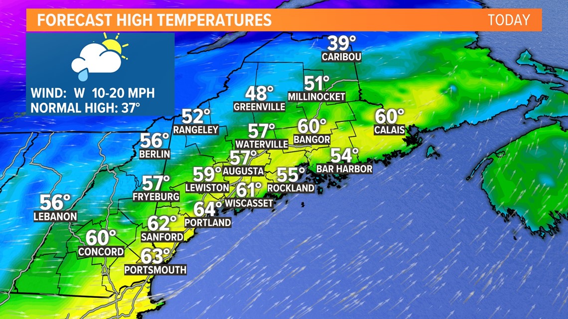
With a westerly wind and some sunshine, high temperatures will jump well into the 50s and even the 60s today.
Both Bangor and Portland stand to set record high temperatures.
While this warm up is welcomed for some, there are a couple of things to watch.

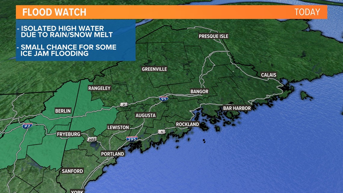
Ice jam flooding and/or snowmelt issues could pop up, especially across western Maine and northern New Hampshire.
Wind gusts will also pick up in the mountains when the cold front crosses.

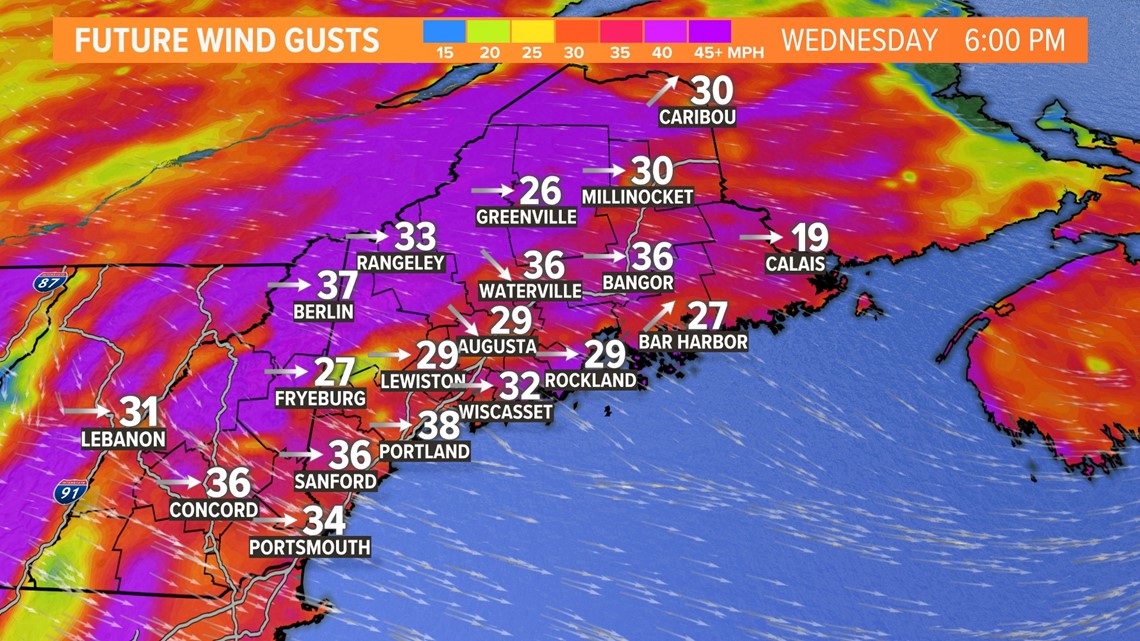
Expect a few isolated gusts to 50 or 55 mph out of the northwest behind the front.
These will relax overnight.

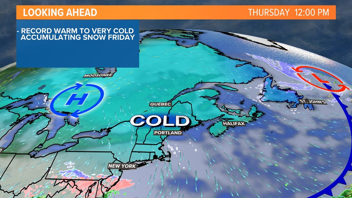
Cold air wastes no time settling in behind this front. Temperatures are going to drop off quickly and significantly.
Most towns will be in the single digits and teens by 5 a.m. Thursday. That means some spots could be 50 degrees colder in just 24 hours!
Thursday will be another transition day for Maine, with cold air establishing itself out ahead of Friday's storm.

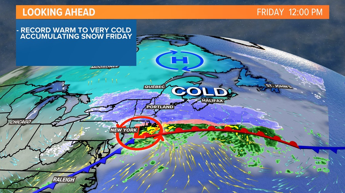
Snow begins around sunrise on Friday. It could be a little earlier in western Maine, a little later Downeast.
It will fall through the entire day, impacting both the morning and evening commutes. Roads will be slick and temperatures support lighter, fluffy snow.
Snow wraps up after dark on Friday, so roads should be in better shape come Saturday.

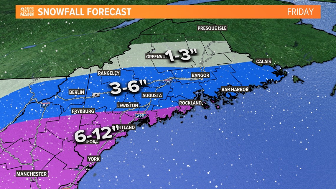
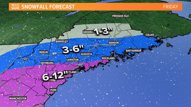
The highest totals with this storm are most likely across southern Maine, especially in York and Cumberland counties.
These areas will see 6-12" of snow, including Fryeburg and the 302 corridor.
Central Maine and Downeast regions will likely end up with 3-6".
The Katahdin region sees 1-3" with only some flurries expected in the County.

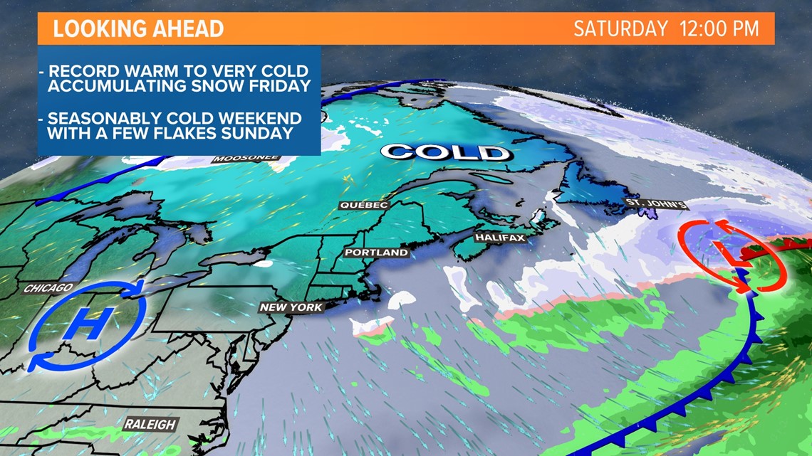
Colder weather stays this weekend, but things should be a bit quieter overall. Maybe we've finally reached the end of the rollercoaster...for now.
At least Maine's weather is never boring!
Follow me on Twitter for other forecast info, @MikeSliferWX.
RELATED: NEWS CENTER Maine Weather Forecast

