MAINE, USA — By mid-month we (the weather weenies and their associates) knew the pattern was going to get fairly juicy for late February into March. But sometimes the pattern is ripe and we don't quite connect on the storms.
That doesn't seem to be the case this time around. Sure, it's not a 2015-style blitz, but it's still a lot more winter than the rest of the winter has been. (That sentence was something).
Our next system isn't particularly heavy, but it's enough to shovel/plow in many spots.
It's kind of a hybrid "clipper." The initial low comes from the Midwest but there's a late phase of some moisture from the south.

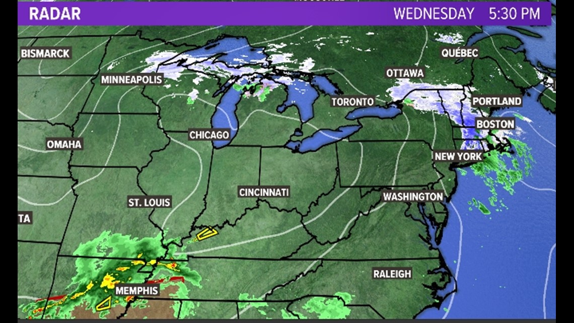
Before it even gets here, there is an area of light snow WAY ahead of the actual storm. You can see it on the above map. That could bring southern Maine a dusting to an inch of snow this evening, but it's technically not part of the storm.
The main part of the precipitation moves in Thursday morning. Initially, it will be too warm for snow along the coastline. So, cold rain will be the result. Inland, it's snow right off the bat.

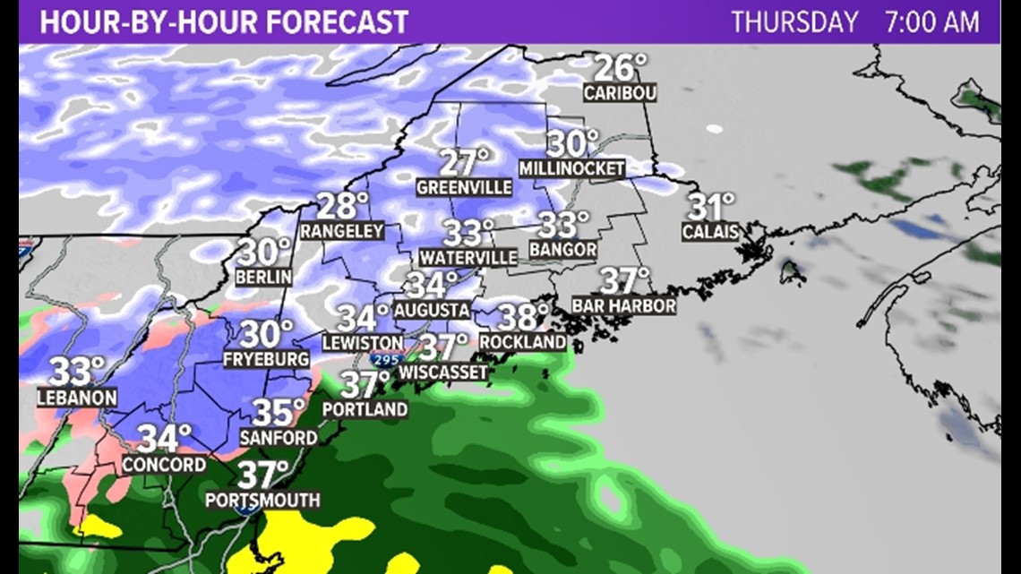
Eventually, the coast may get cold enough for snow, but I think it's going to be VERY hard to accumulate that snow with surface temperatures in the mid-30s, in March, during the day.

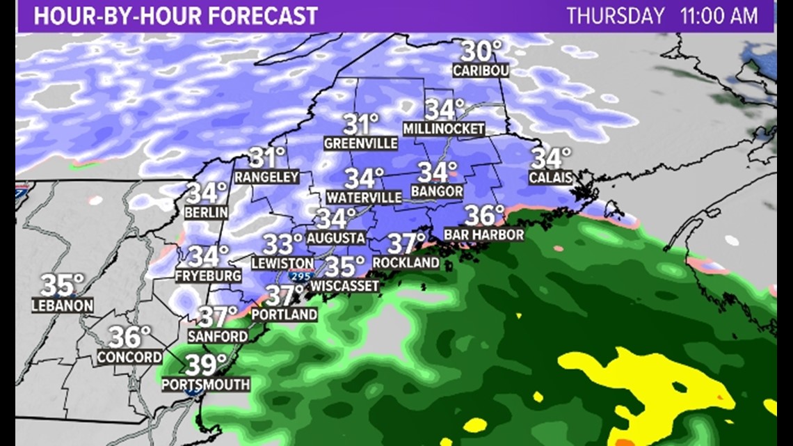
As snow continues off and on inland, snow crashes into Downeast Maine. This will be after sunset, so I think some accumulation is likely with this burst.

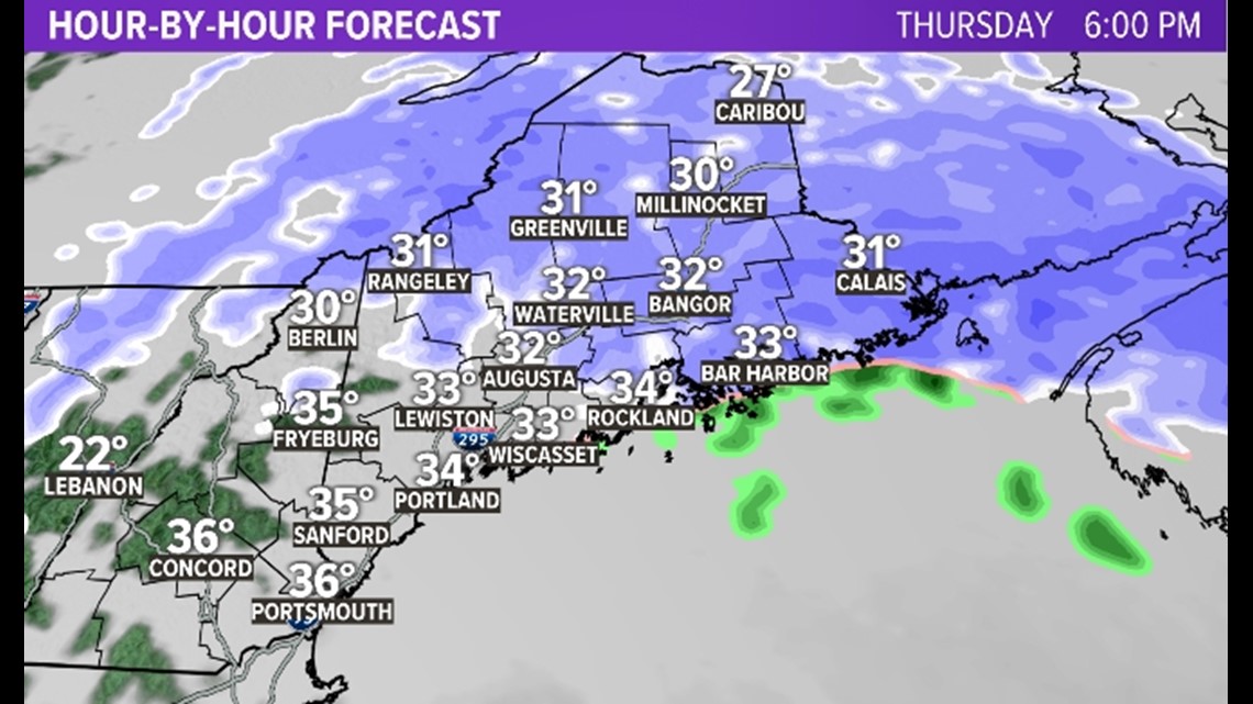
The whole thing wraps up late on Thursday night.

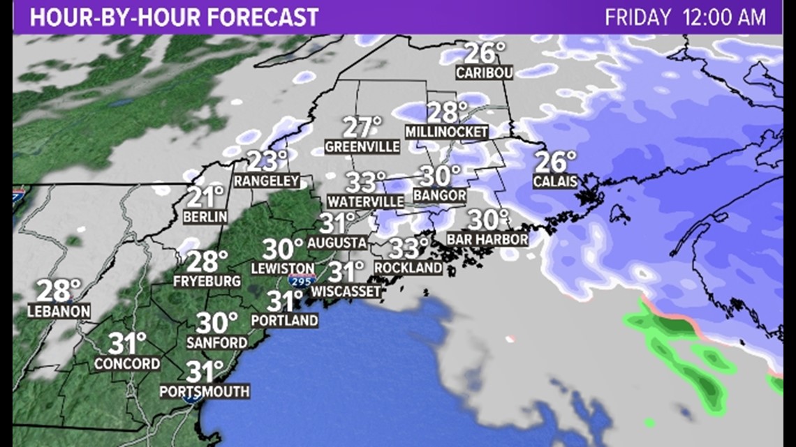
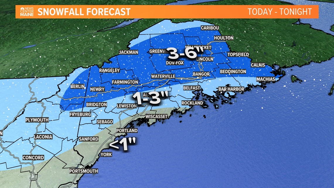
The totals aren't huge here. But the foothills, mountains, and northern Maine should get enough to shovel or plow.

"OK enough stalling, Carson— What about Saturday?"
Sorry, it's just too early, and there's just too much uncertainty.
. . .
Just playing; you know me.
Look, there IS a lot of uncertainty here. But with three days until the event, it doesn't do anyone any good to just put it off for fear of being wrong. You can't make weekend plans on "I dunno."
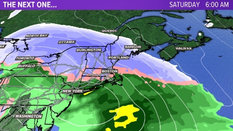
The main area of uncertainty is how far north the snow comes on Saturday. Below is the EURO Model:

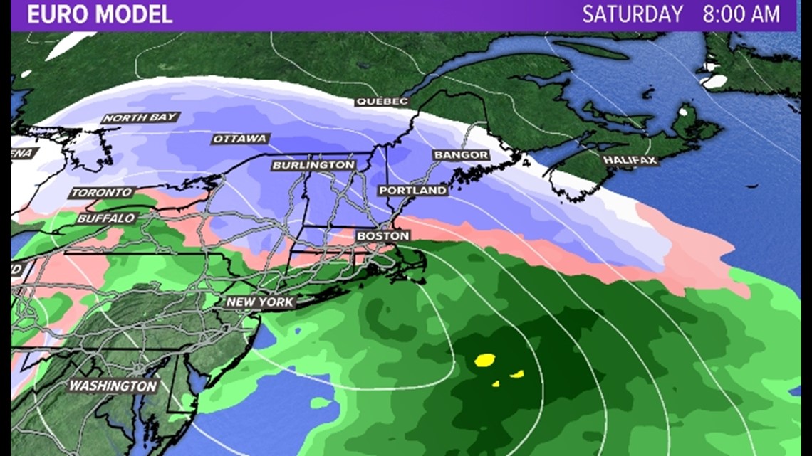
Look at the northern extent of that snow shield. Let's call it Millinocket.
Now, look at the GFS Model below.

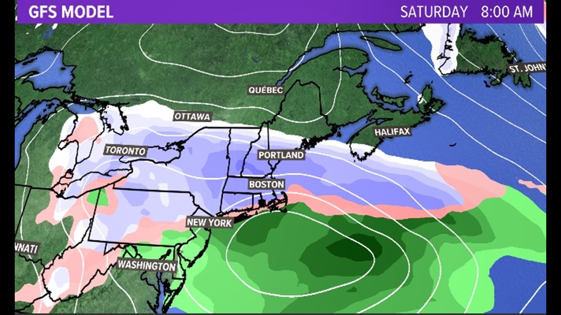
The snow shield ends around Rockland. Ouch.
Todd and I did a speaker phone call this afternoon trying to figure out where this big difference was coming from (these calls should be their own podcast by the way. They are very entertaining, raw, and unfiltered).
Long story short: the GFS has a stronger high pressure to the north, therefore suppressing the low a bit farther south. There are other differences too, particularly, at the mid-levels.
It's hard to say "who" is right here, but eight out of 10 times, I'm going to side with the EURO when it comes to a medium-range, dynamic forecast. So you'll see in my map that I did just that. It's more EURO than GFS.
But you have to be aware that if you are in the Bangor zone, things could shift higher if EURO is totally right (think 3-6 inches) or lower if GFS is right (nada). That's just reality.
Ok, enough hemming and hawing.

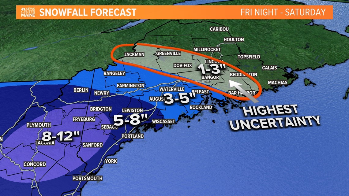
Timing: Snow starts late on Friday night (most plans should be fine) and lasts through the entire day on Saturday before tapering off Saturday night.
That's it. I'm out.
Carson
Find me on Instagram here.


