PORTLAND, Maine — Three storms in one week is a lot. By the end of this week, many of us will have some serious winter fatigue.
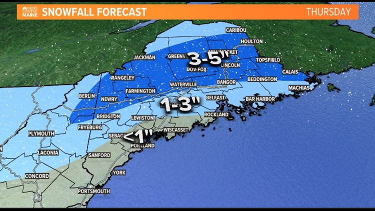
The next storm will probably be the easiest of the three. It's going to be weaker and warmer, so snow amounts will be greatly limited. There won't be much deep cold preceding the storm, and the low will be weak as it moves in late Wednesday night, so the storm will have to manufacture its own cold. That won't occur until the shortwave sharpens up over in the Canadian Maritimes...pretty late in the game. Regardless, wet snow will break out around daybreak Thursday morning. Boundary layer temps may be warm enough for rain instead of snow along the coast.

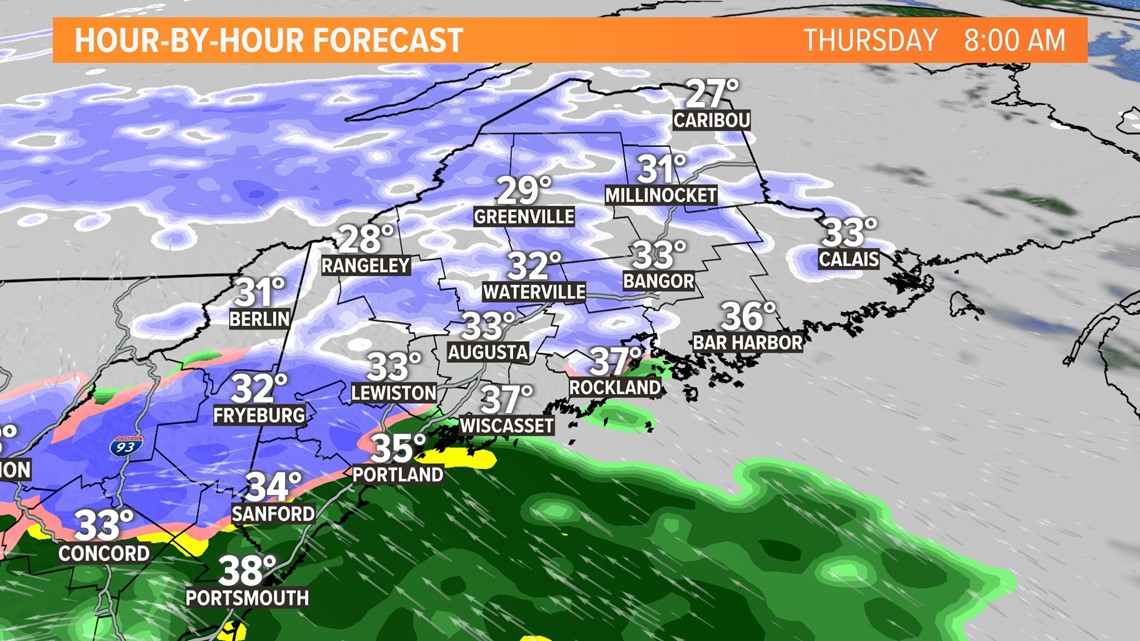
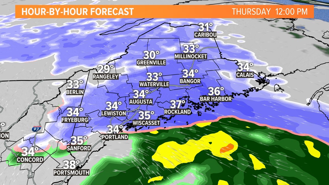
The precipitation will get more intense during the middle of the day as the storm strengthens. Snow will fall intensely and visibility will be poor, but accumulation on roads will be inefficient with surface temps around 32.

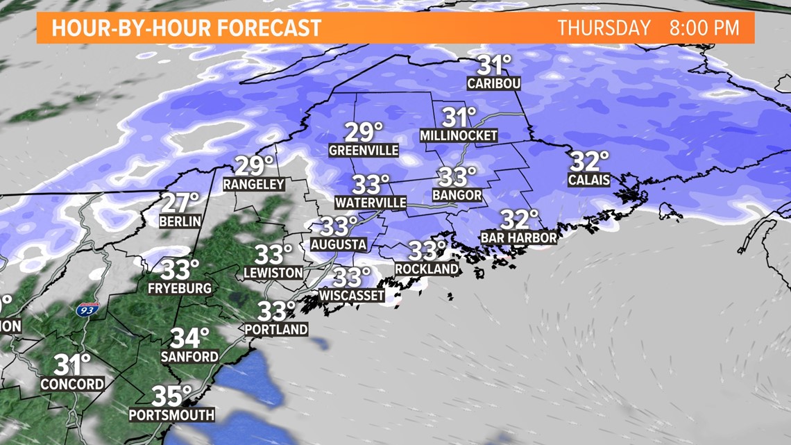
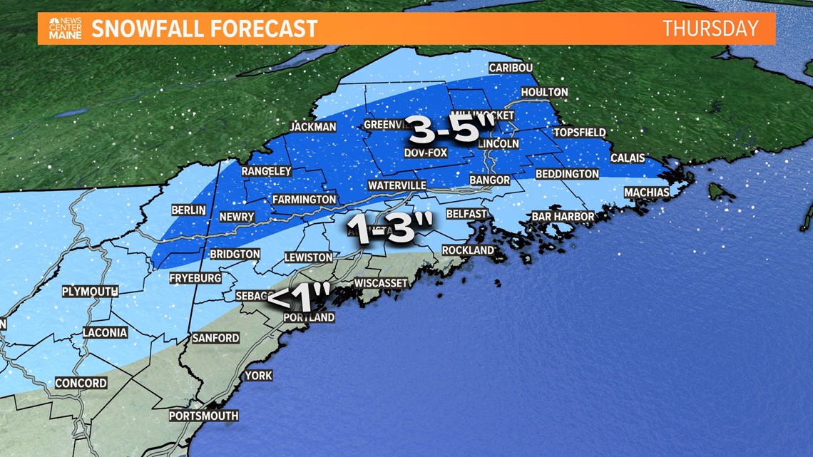
The low will reach its peak, south of Nova Scotia, and throw moisture back at us Thursday evening. This will snow going over eastern and northern Maine into the night before tapering off.

Amounts will be less than the last storm. See for yourself:

Looking ahead to the weekend...
While there's still pretty big snow potential, there are still questions that need answers. I really like the surface setup with a cold high to our north and a fairly strong low to our south. However, I don't like the mid-level setup and the dampening shortwave.

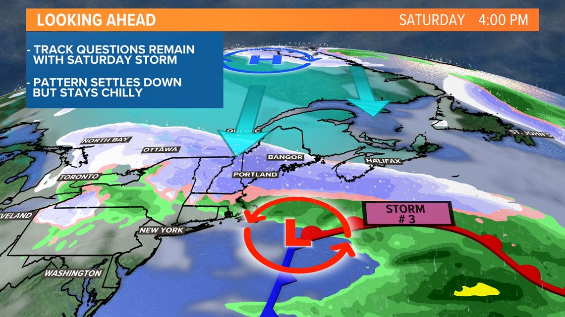
If that occurs, the track would stay flat, keeping northern Maine out of the snow and 6+ inch potential over the southern half of the state. We'll see how this trend evolves over the next 24 hours.
Todd - Follow me on the Gram


