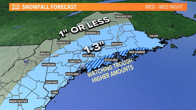
PORTLAND, Maine — No time to dwell on the last storm. It's on to the next! Low pressure will form off the Carolinas and race south of Cape Cod Wednesday. The low's center will actually stay pretty far offshore. One would think we wouldn't see much from it, but upper-level energy will interact with an inverted trough creating a favorable snow environment Wednesday into Wednesday night.
Recently, we've had a tough time keeping storms cold enough. Mixing and changes to rain have been common, but a fresh cold air supply is moving in now and the atmospheric column will stay subzero throughout the event. No mixing is expected. We're looking at pure snow and it will actually be fairly light and fluffy too.
It all starts tomorrow morning. The trough will begin to show up along the south coast of Maine and bursts of snow will break out by midmorning.

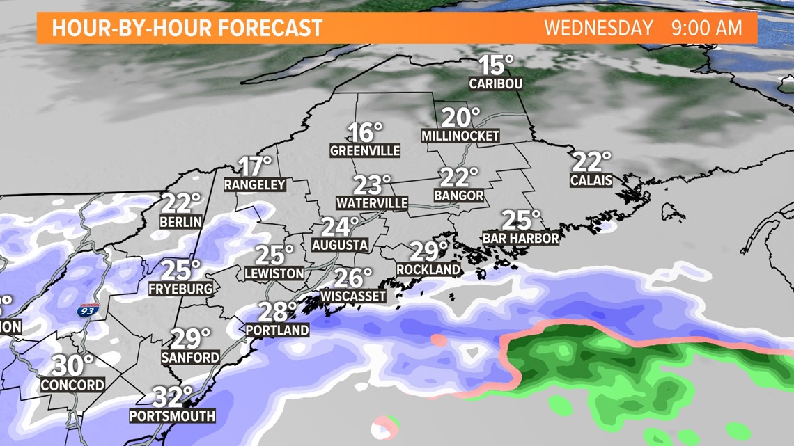
By the middle of the day and early afternoon, the snow will fill in better up the coast and over the southern half of the state.

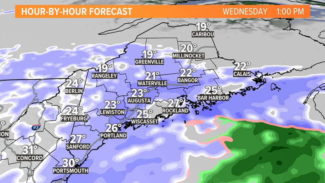
Around the trough, efficient snow-making is expected for a few hours. Flake size will be large and the snow will be quite fluffy. I expect roads to require at least a treatment of salt if not a thorough plow by Wednesday evening.

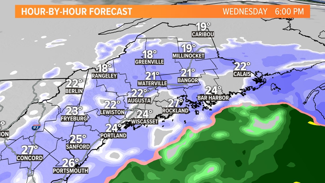
Modeling isn't fine enough to pick up on subtle convergence shifts, making these inverted troughs really tough to pin down. Historically, they overproduce along the midcoast and Downeast coasts. However, impressive ones have been known to form and sit over the south coast too.

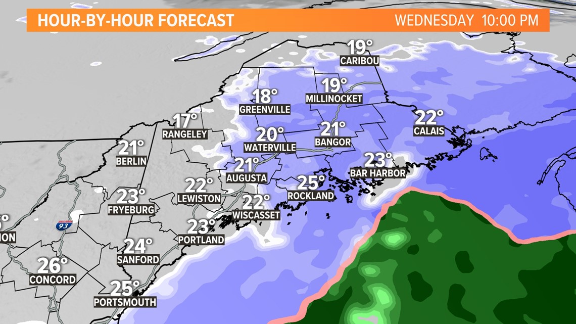
In the end, I expect a few inches of snow for most, 2-3". But, towns located near this inverted trough could see double that, up to 6".

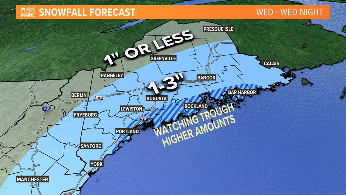
We will continue to evaluate and fine-tune these snow amounts through the day and early tomorrow morning. Keep checking back if you can.
RELATED: NEWS CENTER Maine Weather Forecast
RELATED: Icy travel early Monday


