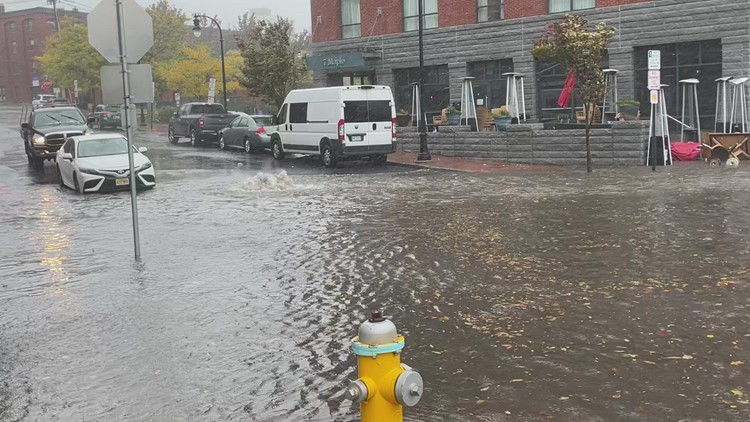
PORTLAND, Maine — Between the fleeting summer heat getting suppressed into the deep South and winter's chill beginning to show up in Canada, the jetstream winds traveling across the country can cut off and trap storms. They become slow-moving and strong, packing a punch for all in their paths. One of those storms is creeping through New England right now.
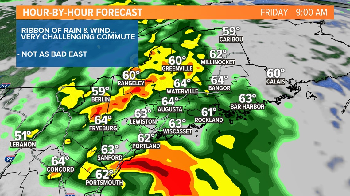
A strong cold front is stalling over Maine. Heavy rain and gusty winds are hugging that front in a ribbon of nastiness. That ribbon won't completely clear the state until Saturday morning. Until then, keep the rain gear close by ... you'll certainly need it over the next 24 hours.

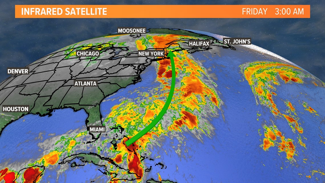
This time of year, excessive rain usually comes from a decaying tropical storm or hurricane remnants. That's not the case this time, but there is a tropical connection. A plume of moisture is being guided north all the way from the Bahamas.
Here's a look at the timeline through Saturday morning:
FRIDAY AM:

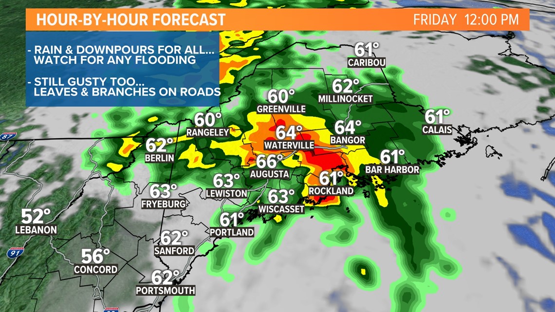
FRIDAY PM:

FRIDAY EVENING:

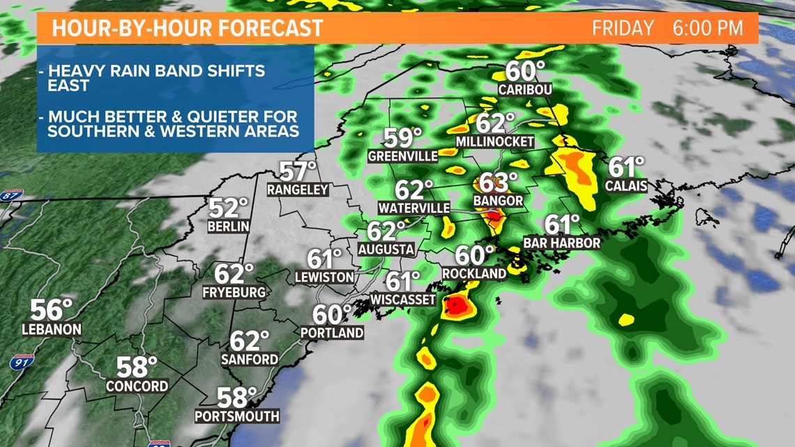
OVERNIGHT:

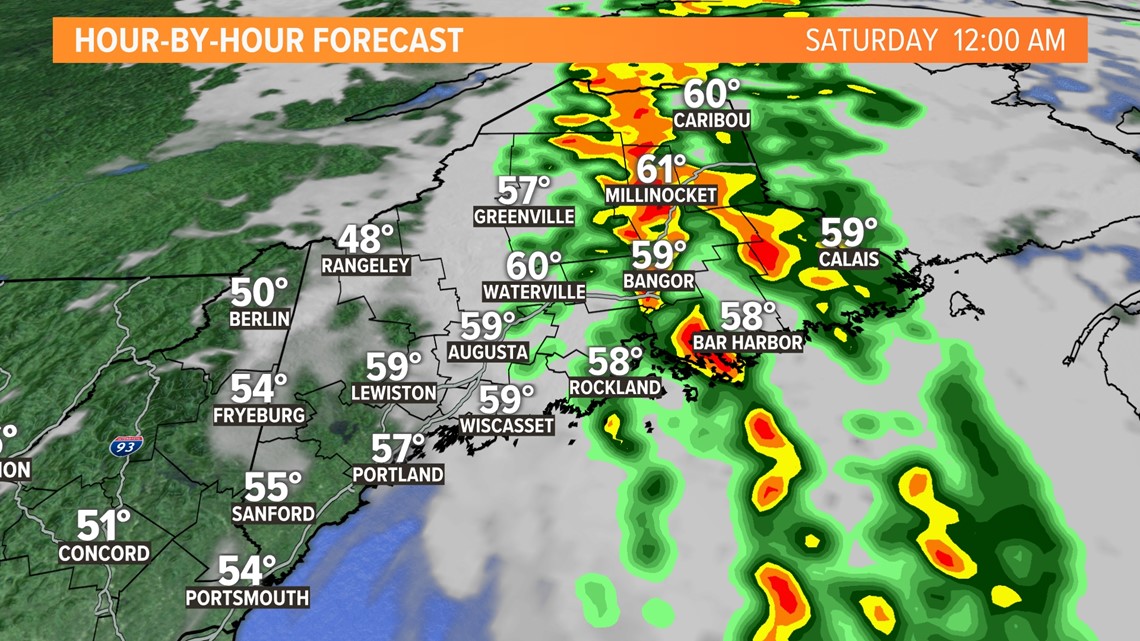
SATURDAY AM:

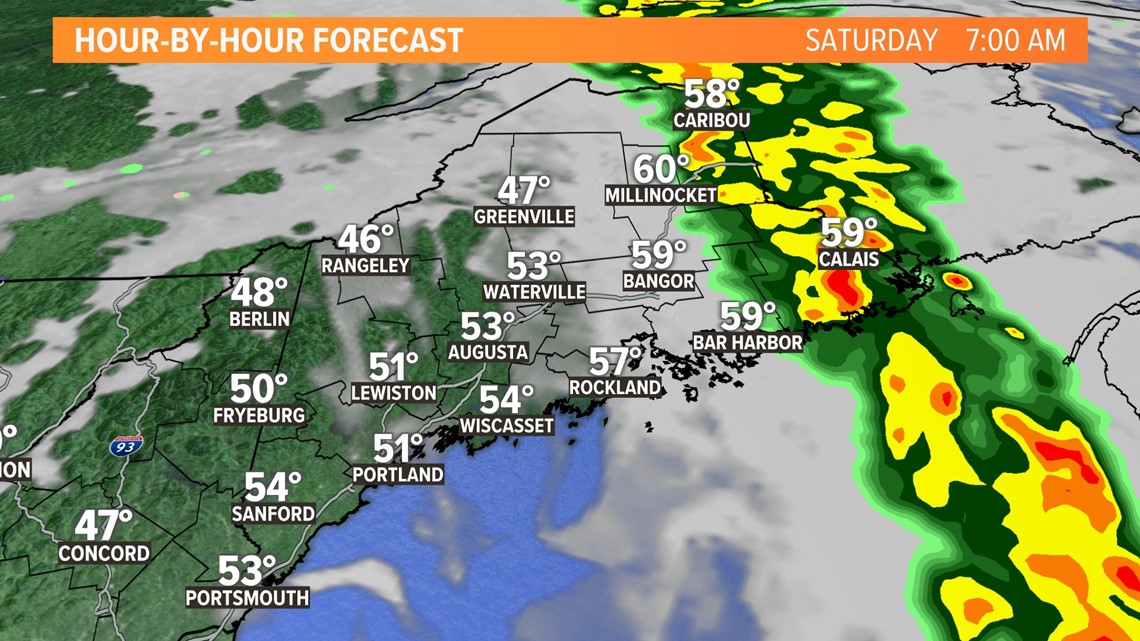
The band of heavy rain and associated gusty wind will shift east through the night and exit Saturday morning into Maritime Canada.

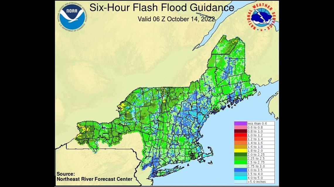
There are a few areas in Maine where flash flooding could occur with as little as 2 inches of rain over a six-hour period. Most are around 3 inches, so flooding will be a problem but probably limited to drainage flooding, especially as leaves clog up storm drains. Rivers will rise, but outside of the smallest streams and brooks, we should avoid big problems. Regardless they'll need to be monitored until they crest sometime Saturday morning.

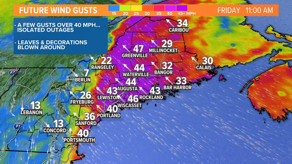
We'll also end up with some gusts that top 40 mph, enough for isolated power outages. There will be a mess of leaves, twigs, small branches, Halloween decorations, and political signs to clean up this weekend.
That's all for now. Enjoy the quieter weekend.
Todd - Follow my doings on Instagram.
RELATED: NEWS CENTER Maine Weather Forecast


