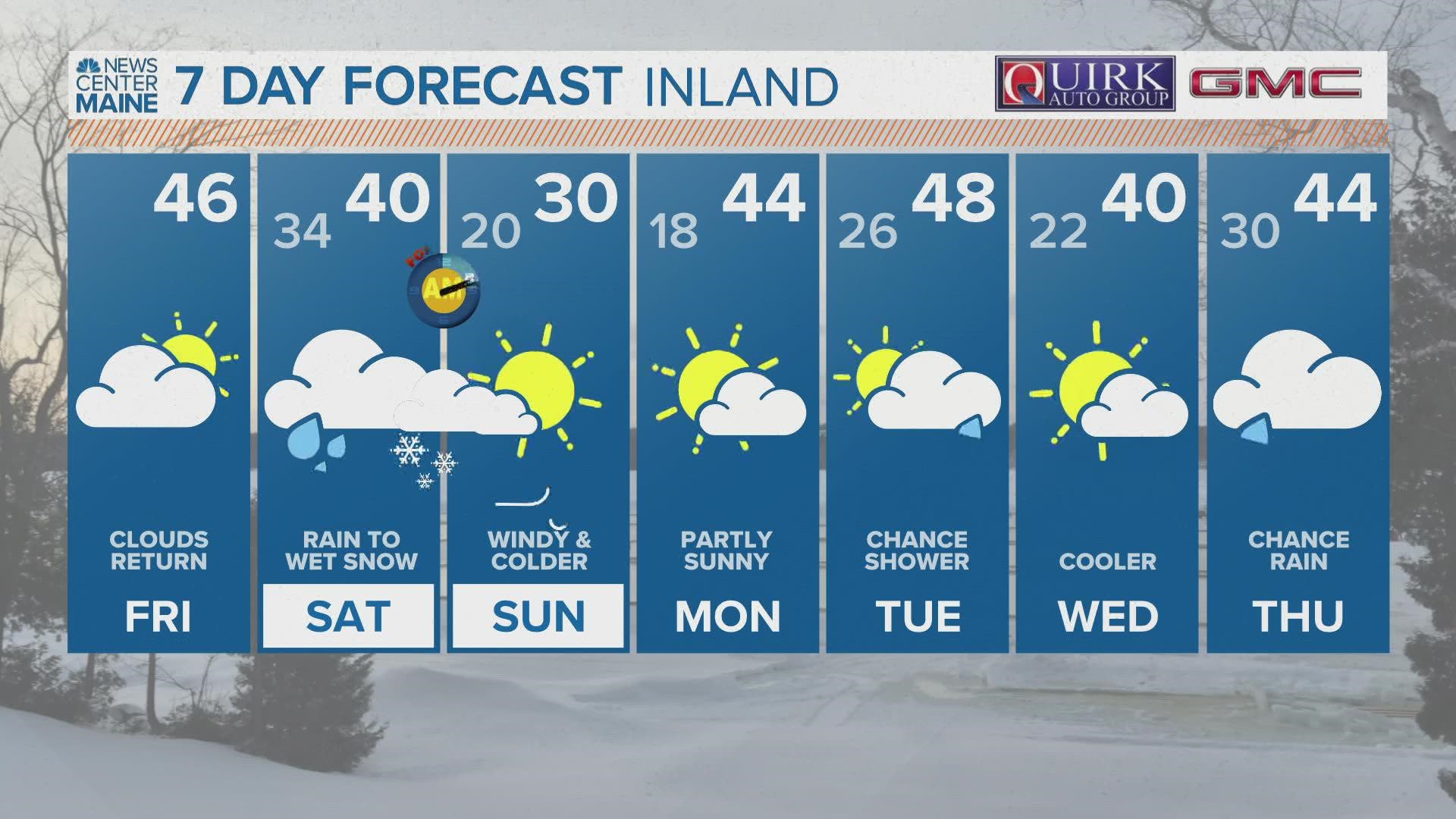
MAINE, USA — Breaks of sunshine and high temperatures near 50° on Friday sure make for a nice end to the work week!
The weekend has something totally different in store, though.
This storm is going to behave like most do in the shoulder seasons. The high elevations and northernmost areas get the most snow, with significantly less as you head toward the coastline.
The best part about this forecast is that a shift southeast in storm track keeps the strongest southerly wind away from Maine.
Strong wind gusts, some localized high water, and mountain snow are still the big impacts coming Saturday.

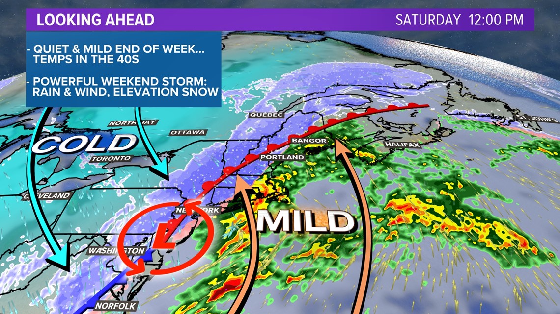
In true March fashion, a big battle of the air masses will spawn a strong storm.
Arctic air will slide into a warm air mass from near the tropics.
The result is a spectacular display of atmospheric dynamics and our resulting storm. (Although, recent trends are admittedly a little less impressive than they looked earlier in the week.)

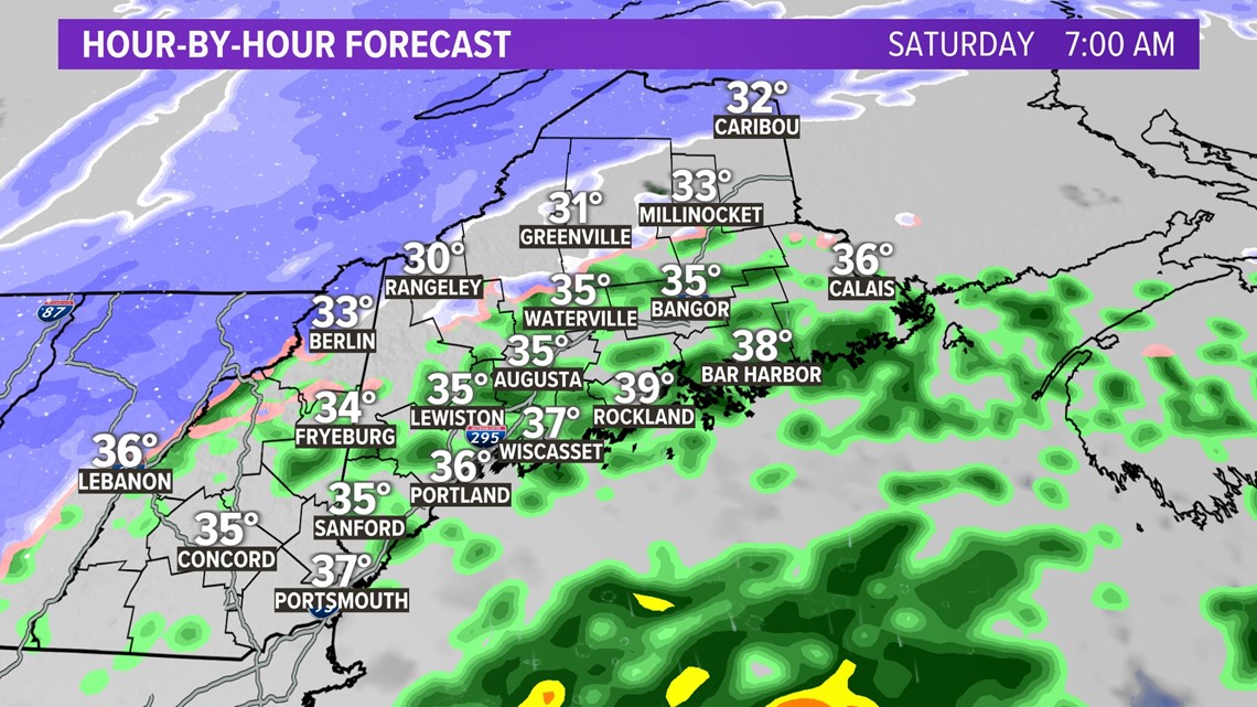
Showers begin right around sunrise on Saturday as warm, moist air moves in on top of colder air locked in at the surface.
Most south of Route 2 will see just rain. North of Route 2, especially across the higher peaks, is where I expect some snow.

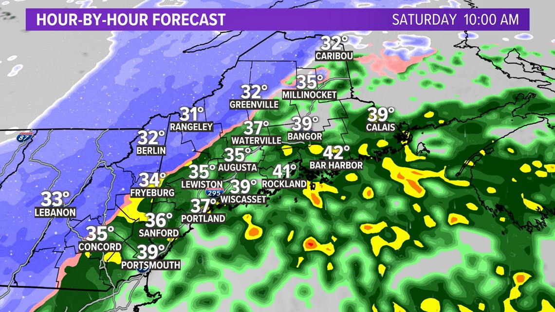
Colder air gets wrapped into the storm with a sharp transition between rain and snow.
At this point, the higher elevations of western Maine into the Allagash will be full-on snow.
The low-lying areas will still be dealing with a bit of mix.

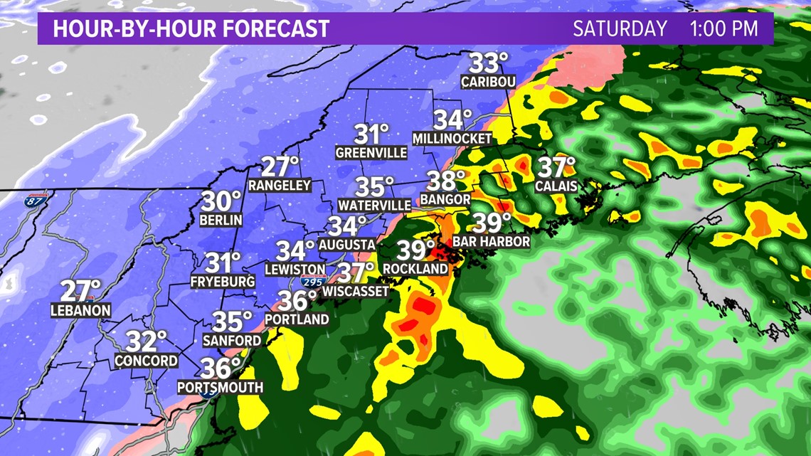
As the low tracks through the Gulf of Maine, colder air keeps pouring in behind this storm.
There will gradually be a transition from rain to snow. At this point in time, the transition looks to take place mainly through the early afternoon hours.

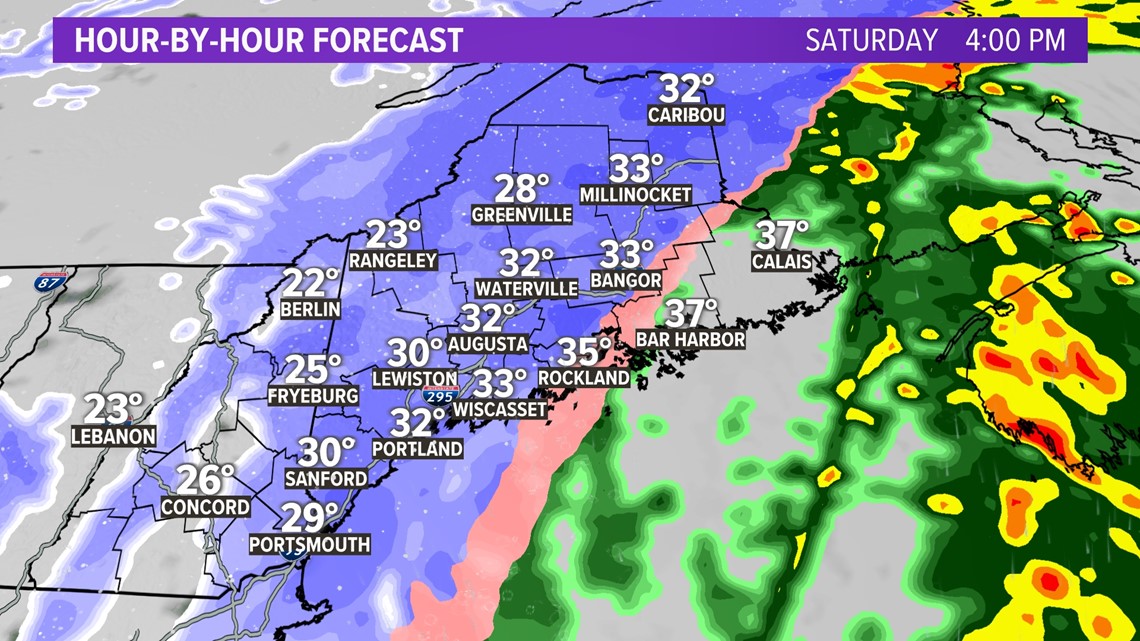
By 4 p.m., the rain-snow line will be racing Downeast.
It might look dramatic at this point for most of the state, but I do not expect too much accumulation for most of central and coastal Maine. The reason for that is the surface temperatures. As colder air rushes in, there's still a lag time between when the ground cools enough for snow to stick and when the flakes fall.
In other words, grassy surfaces will see snow accumulate before the roads.
Slushy accumulations are likely heading into the evening, and there will certainly be low visibility on the roads. Still, the road temperatures will not fall quickly enough to realize the same snow totals as the grass.
This is similar to what happened on Wednesday evening.

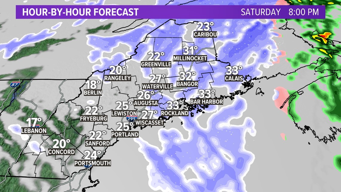
As colder and drier air wraps around the departing storm, snow showers end too.
Sunday stays cold and well below average before milder air slides back in starting Monday.

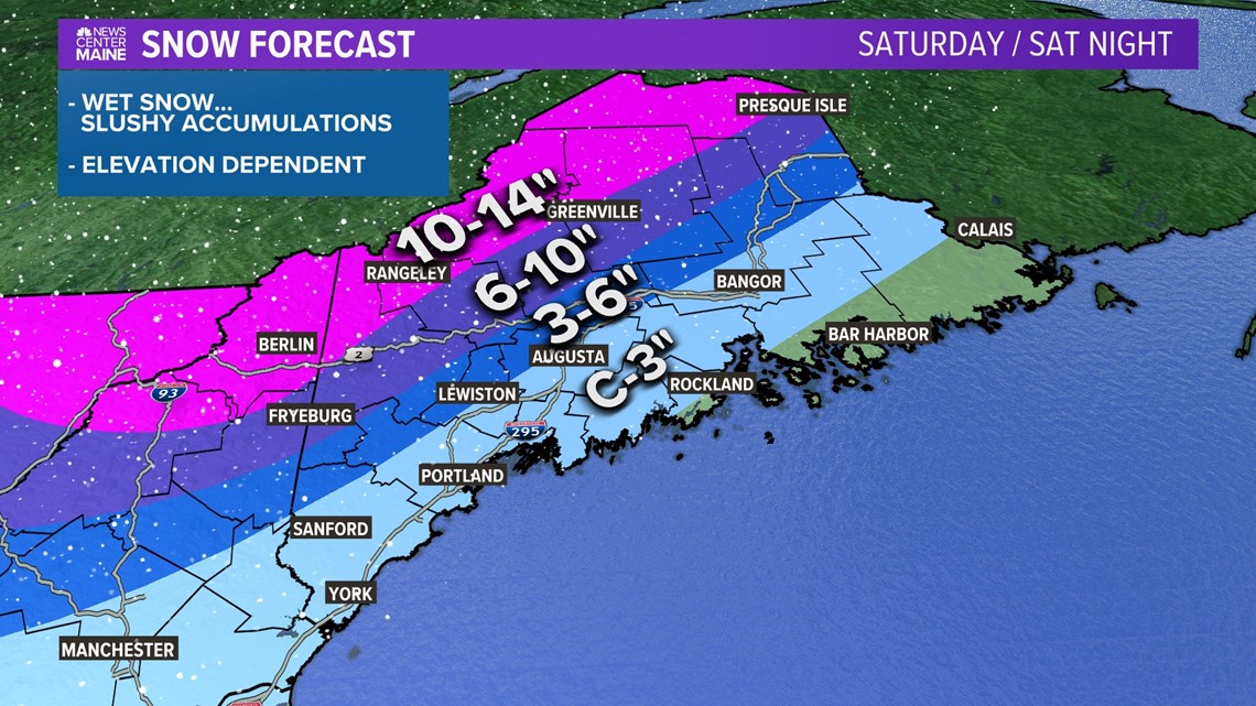
Unfortunately, I think a lot of this snow will be wet and heavy. That means shoveling will be a tough task.
On the bright side, accumulation on roads will not be as significant as grass.
The highest elevations will see the most snow out of this storm. Skiers, rejoice!
At the coast, especially Downeast, the late transition to snow and lack of moisture will mean just a slushy coating or so.
Slick spots are possible heading into Sunday morning, but sunshine in the afternoon should clear roads right up.

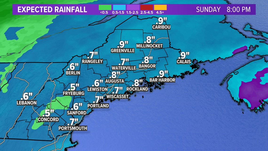
Total rainfall from the storm still comes in right around an inch, give or take a little.
This could be enough for some localized high water issues. That's especially true in areas that end up with storm drains blocked by snow.
The frozen ground will lead to some excess runoff, too.
The overall risk of river flooding and/or ice jams still remains quite low.

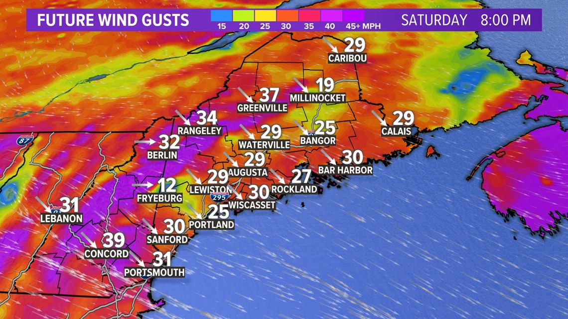
The wind aspect of this storm comes at two separate points in time.
As the surface low strengthens a bit, stronger wind gusts are expected on the backside of the storm.
Gusts will approach 30-40 mph Saturday evening and last for a few hours. The strongest gusts will be in and just downwind of the mountains.
A few outages are possible before wind gusts relax overnight into Sunday morning.

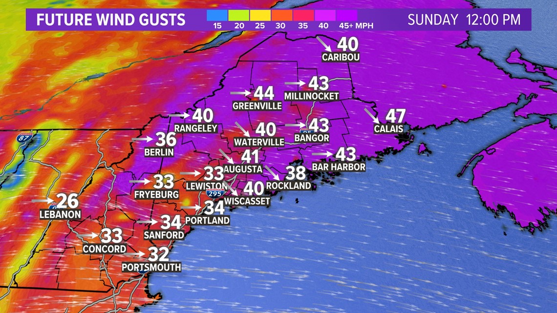
As the day warms up and the upper-level piece of this storm pivots through, wind gusts will pick up yet again.
The highest gusts are likely in the mountains, where they could exceed 50 mph.
Elsewhere, gusts will most likely end up between 35 and 45 mph.
A few outages will be possible again on Sunday. Any outages Saturday night may not be fixed on Sunday if the wind gusts stay strong enough.
Monday looks much, much nicer. Most of next week will be near or slightly above normal with a lot more sunshine mixed in.
If you see damage or want to send in snow totals, you can do that through our app's "Near ME" section. Just make sure you do it safely, please!
I will be here all day Saturday to track the storm with you. Follow me on Twitter: @MikeSliferWX.
- Mike Slifer
RELATED: NEWS CENTER Maine Weather Forecast

