MAINE, USA — As we head into the second week of February, it feels like winter fatigue is beginning to set in a bit.
There are no more big holidays on the way, the snow's novelty has worn out, and heating bills take away from the fun of a cold morning.
I know there is still a large group of Mainers rooting for snow. That number always starts to fade this time of year, though, and the recent bitter cold seems to have accelerated that process.
Thankfully, Monday will be at least a little bit of a break. That warmer weather comes with a price tag, as always.


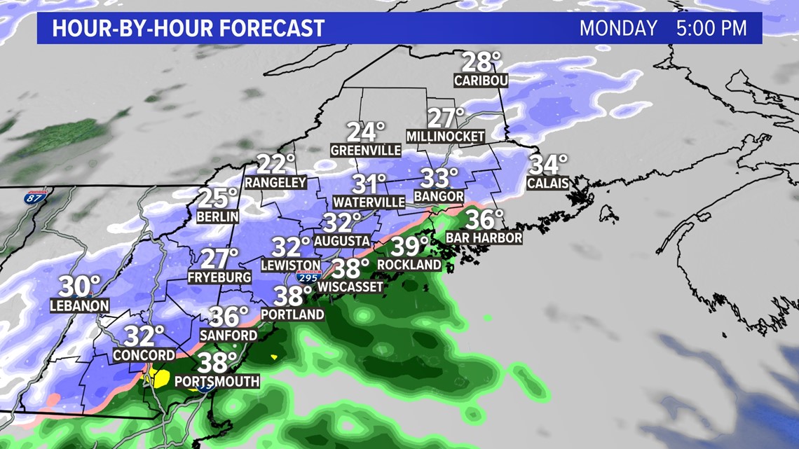
During the afternoon, high temperatures will make it back into the upper 20s and low 30s. This is a solid 10 degrees warmer than the weekend.
It comes at a price, however.
Onshore flow and efficient moisture transport will allow for some drizzle to fall. Inland areas, especially in York county, could see a thin glaze of ice form to make things slick in the late morning or early afternoon.


As the day progresses, showers get heavier. Eventually, rain falls at the coastline while snow falls inland.


This will continue into Tuesday morning.
The commute could be a bit slick Tuesday, especially inland.


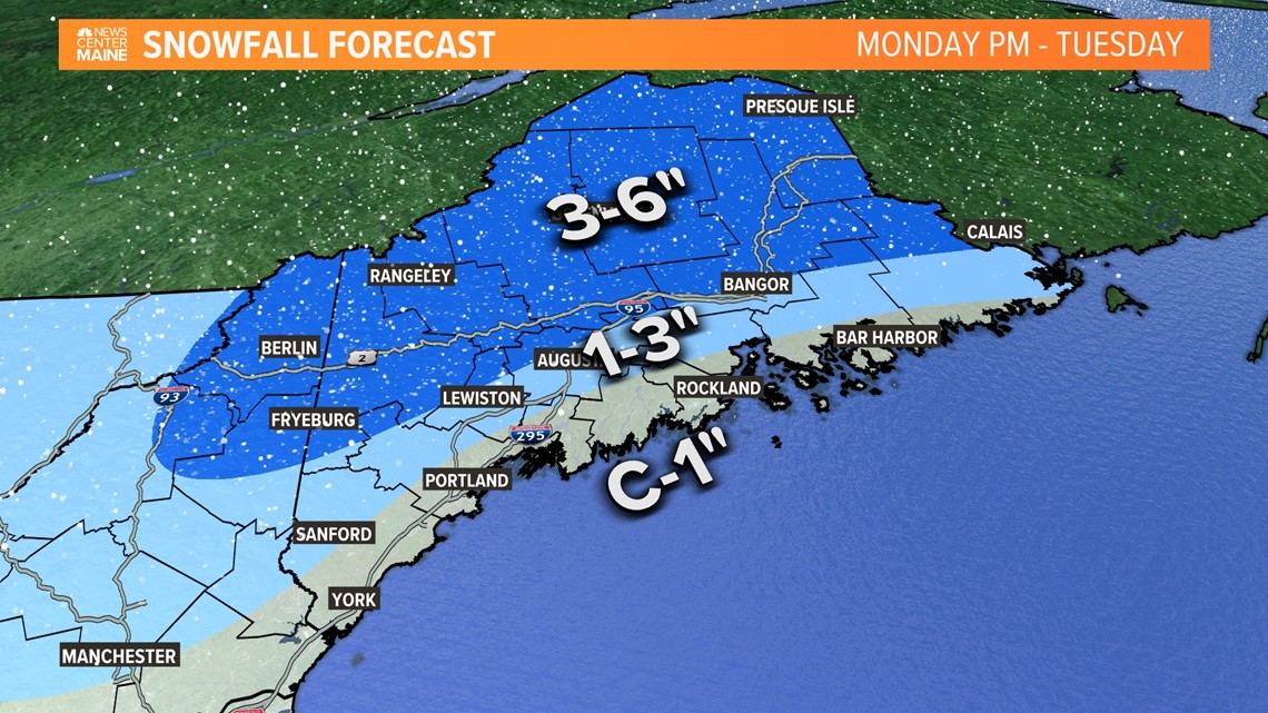
Expect a widespread area of 3-6" of fresh snow, with a couple of locally higher amounts mixed in.
Closer to the coast, amounts will be cut down thanks to rain. Some spots along the immediate coastline may not see any snow at all.


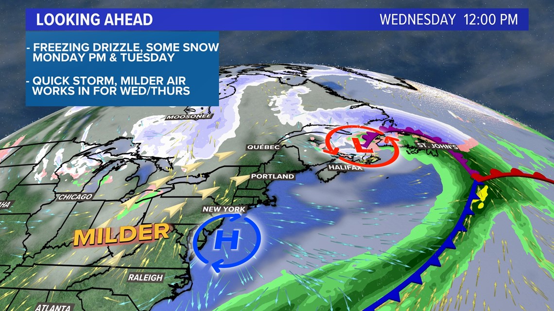
The unsettled weather is short-lived and clears out later Tuesday.
By Wednesday morning, high pressure starts building back in.
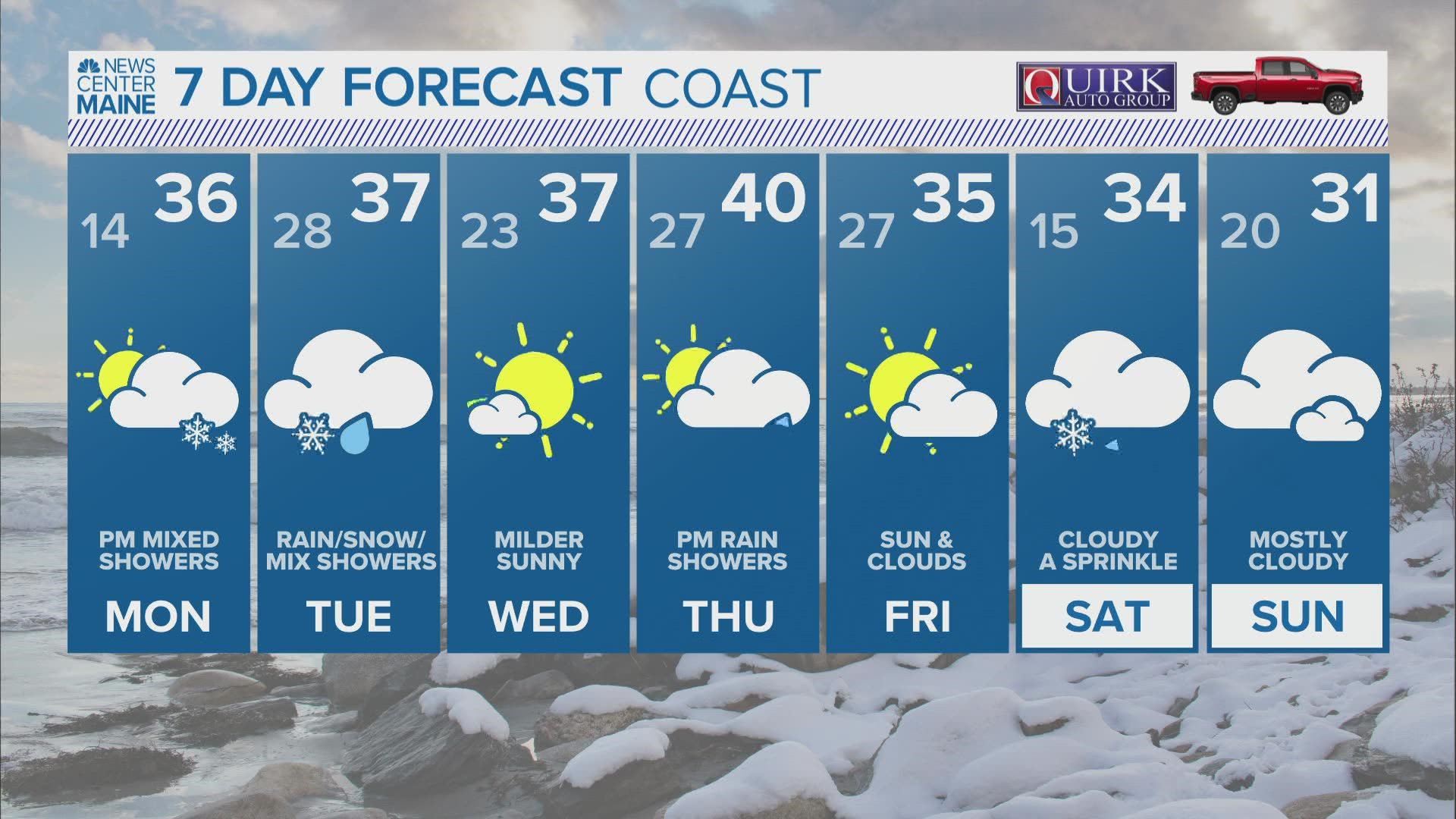
The day will be mostly sunny with high temperatures between 35° and 40°.
Roads will finally start to melt some of the ice and sleet that has built up on them.


Thursday could be even warmer.
You can always get more from me on Twitter, @MikeSliferWX.
RELATED: NEWS CENTER Maine Weather Forecast

