

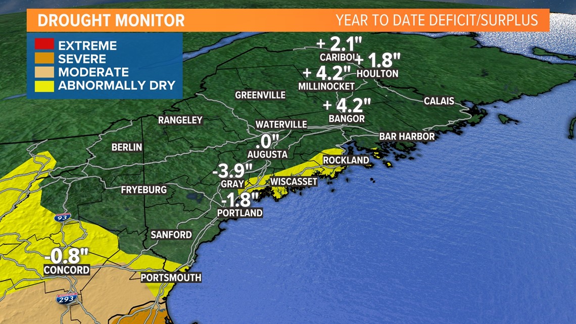
PORTLAND, Maine — Uncle! We've now completely erased the drought conditions Maine had been plagued by for the entire summer. With another round of drenching rain on the way, most of the state will end up with a yearly surplus of rainfall.

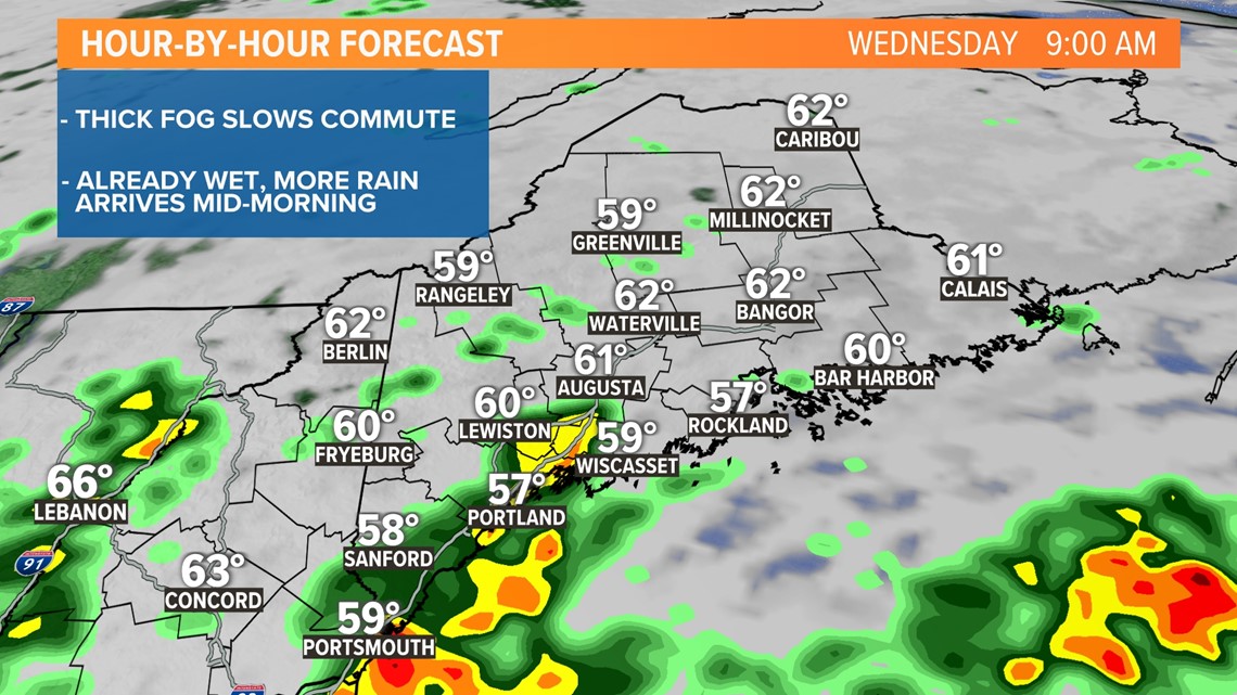
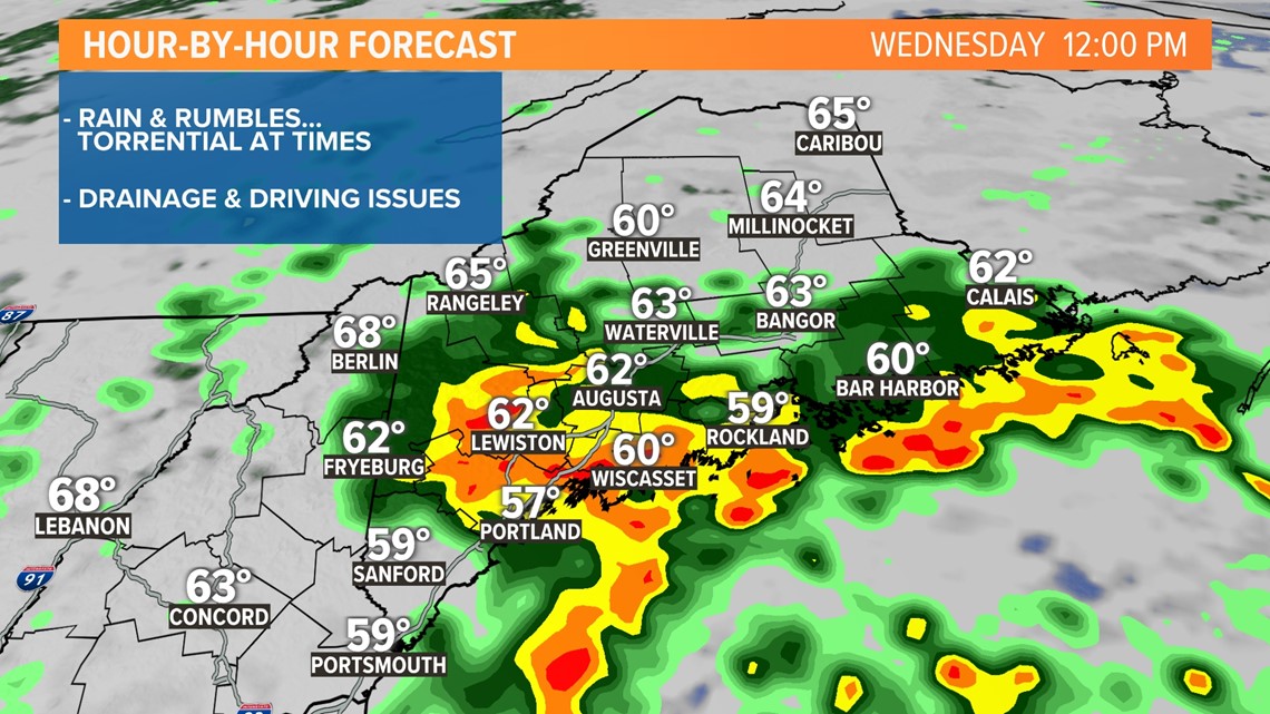
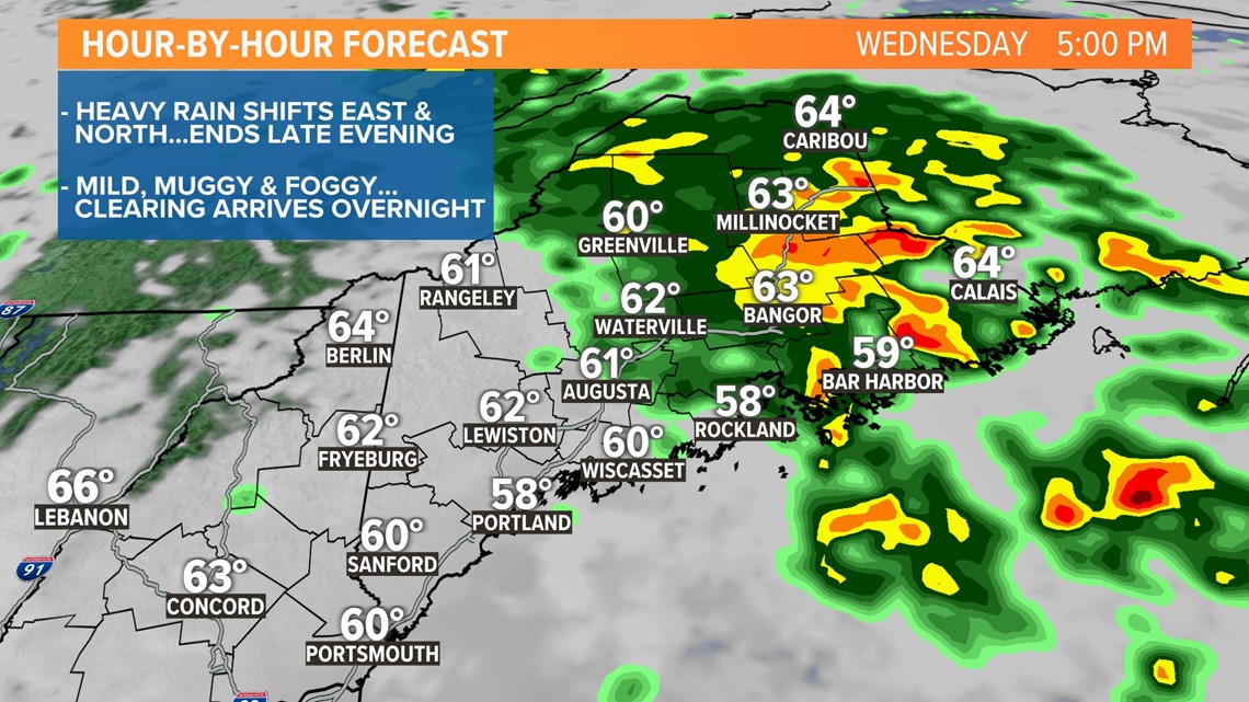
The next round of rain will arrive by mid-morning Wednesday, and it's going to pour through much of the afternoon. Here's a look at the timeline.
Morning:

Midday:

Evening:

Tonight:

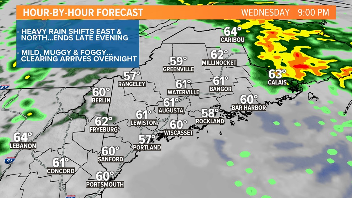
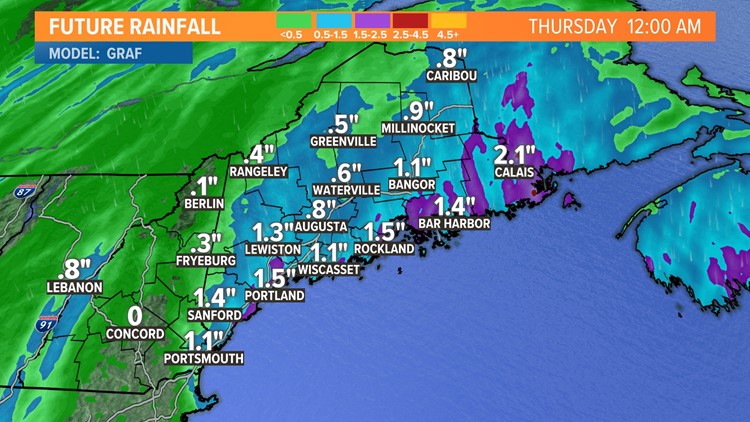
Rain amounts in some towns may top 2 inches, and drainage flooding will end up being a problem again, especially where fallen leaves are clogging up storm drains. During the heaviest rain, some roads may fill up with water, making driving very difficult. In fact, I wouldn't be surprised to hear of some detours until the water recedes and drains.


While today's flood threat is inland, it's worth noting the tide and coastal flood threat. High tide is right around noon, the same time as the torrential rain and heavy downpours. In the past, that combination has spelled trouble for our coastal cities.

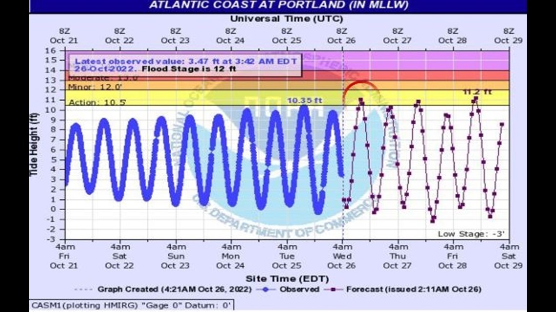
Susceptible flood-prone areas, like Portland's Back Cove and Marginal Way, may see some minor flooding early Wednesday afternoon. Thankfully, this month's tides aren't the biggest of the year.
Todd - Here's my Instagram
For the latest breaking news, weather, and traffic alerts, download the NEWS CENTER Maine mobile app.
RELATED: NEWS CENTER Maine Weather Forecast
