MAINE, Maine — It sure hasn’t felt like February in Maine recently, with record highs and not a lot of snow (except for northern parts of the state). However, that’s all about to change this week with a much colder and snowier weather pattern shaping up. Get the snow shovels and plows ready. Let’s discuss…

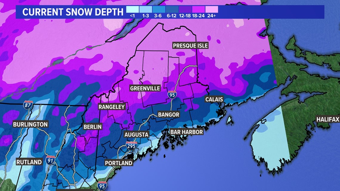
Currently, snow depth across the Pine Tree State is about what you’d expect, but not for the southern coast where there is zero snow on the ground. It’s quite rare for this to be the case in one of our snowiest months on average.

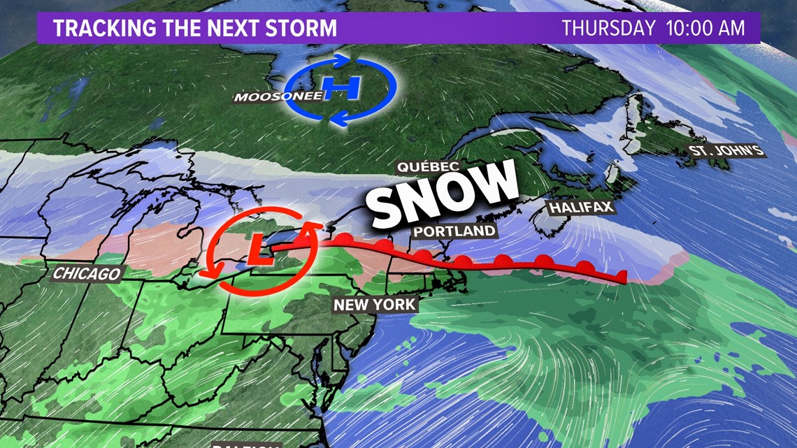
The good news for snow lovers is that will change drastically several days from now as a major winter storm moves into New England Wednesday night. Low pressure will bring plenty of moisture up from the south and run into much colder air with high pressure building in from the north.
But I’m getting ahead of myself.
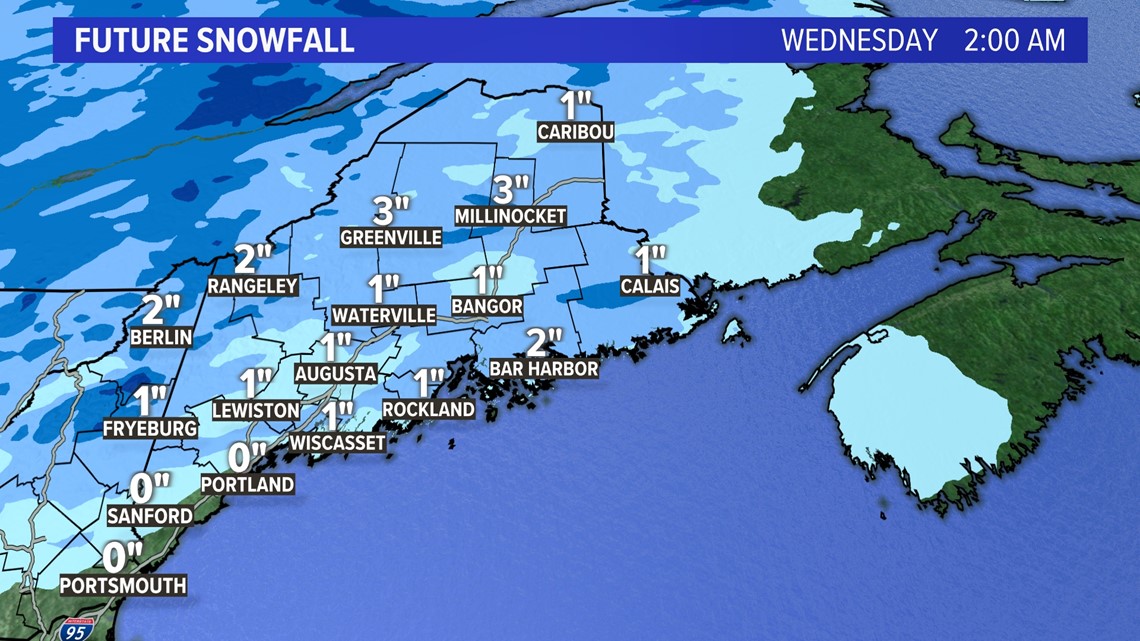
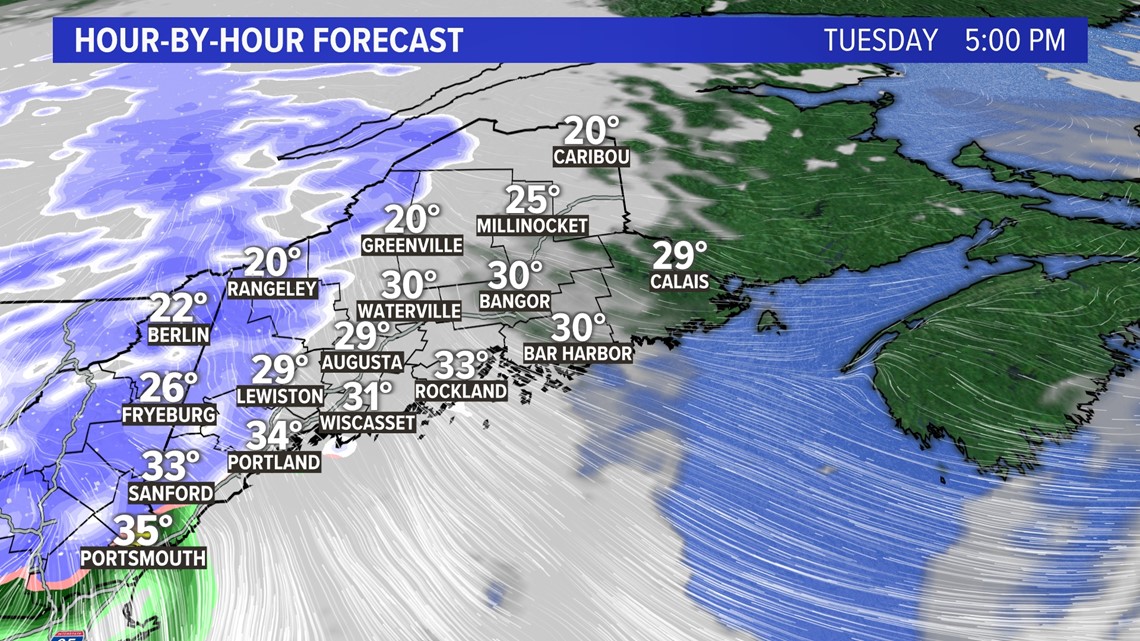
Let’s chat about Tuesday first. A slushy coating to 3 inches of snow is in the forecast for most of the state after the evening commute, moving from west to east. I don’t expect the precipitation to start until after 3 p.m. Tuesday in western Maine.


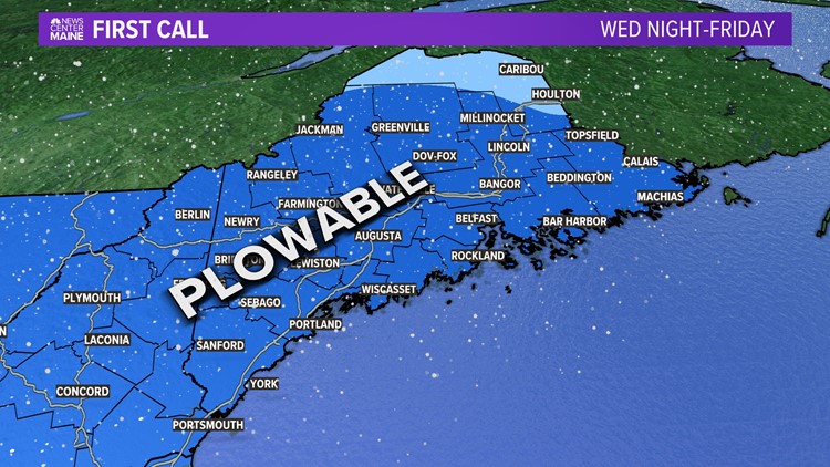
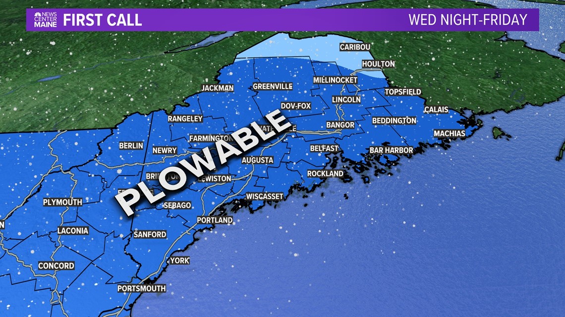
Then we can turn our eyes to the main event, which arrives well after the evening commute Wednesday night but lasts into midday Friday. Look for significant, plowable snow for the entire state.

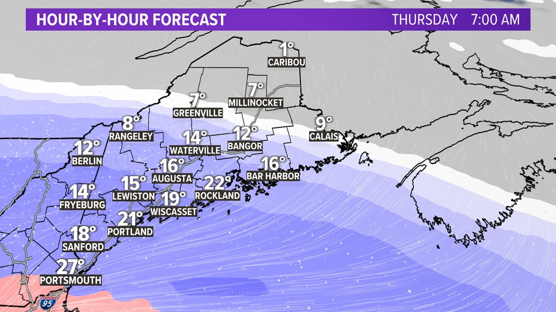
The more cold air we have, the more snow will accumulate. At this time I expect a heavy “thump” of snow overnight into Thursday morning with a change to sleet during the day and back to snow into early Friday.

A snow map will be coming soon, so stay tuned to my social media for updates.
- Meteorologist Jason Nappi
Facebook.com/jasonnappiwx Twitter.com/jasonnappiwx


