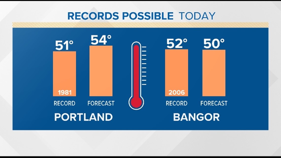
PORTLAND, Maine — Mother Nature took her winter break early this year. Cold temperatures and snow have been tough to come by so far this month, and we're already halfway to March. With recent balmy weather, many have caught that spring fever and are craving a change of season. The #FalseSpring continues Thursday, with many communities reaching 50 degrees or higher. Records are in jeopardy and some will fall.
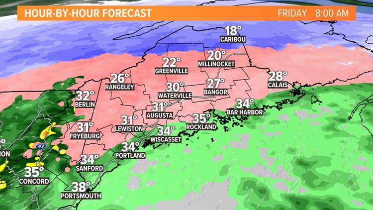
Thursday afternoon, while those records are challenged along the coast, winter cold will be making a return and crossing the Canadian border. The slide begins Thursday evening and continues until we reach the teens Saturday morning.

You know what they say, "timing is everything". Precipitation will return during the temperature slide and rain will change to ice and snow late Thursday night and Friday morning from north to south creating travel and commuting problems.

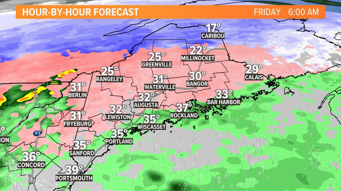
Cold air is more dense and heavier than mild air, so it will be shallow and hug the ground on arrival. Icing will be a problem for several hours Friday over the interior.

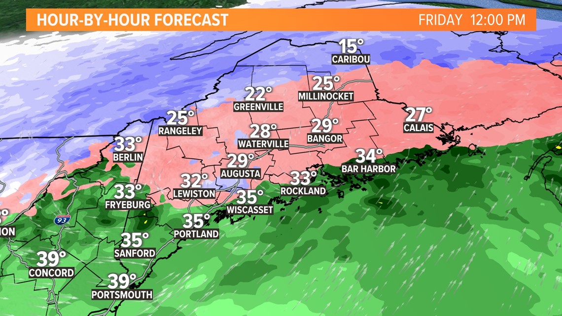
By Friday afternoon, the entire column of air, from the surface to the cloud, will cool below freezing. Ice will change to snow before ending late in the day and evening.

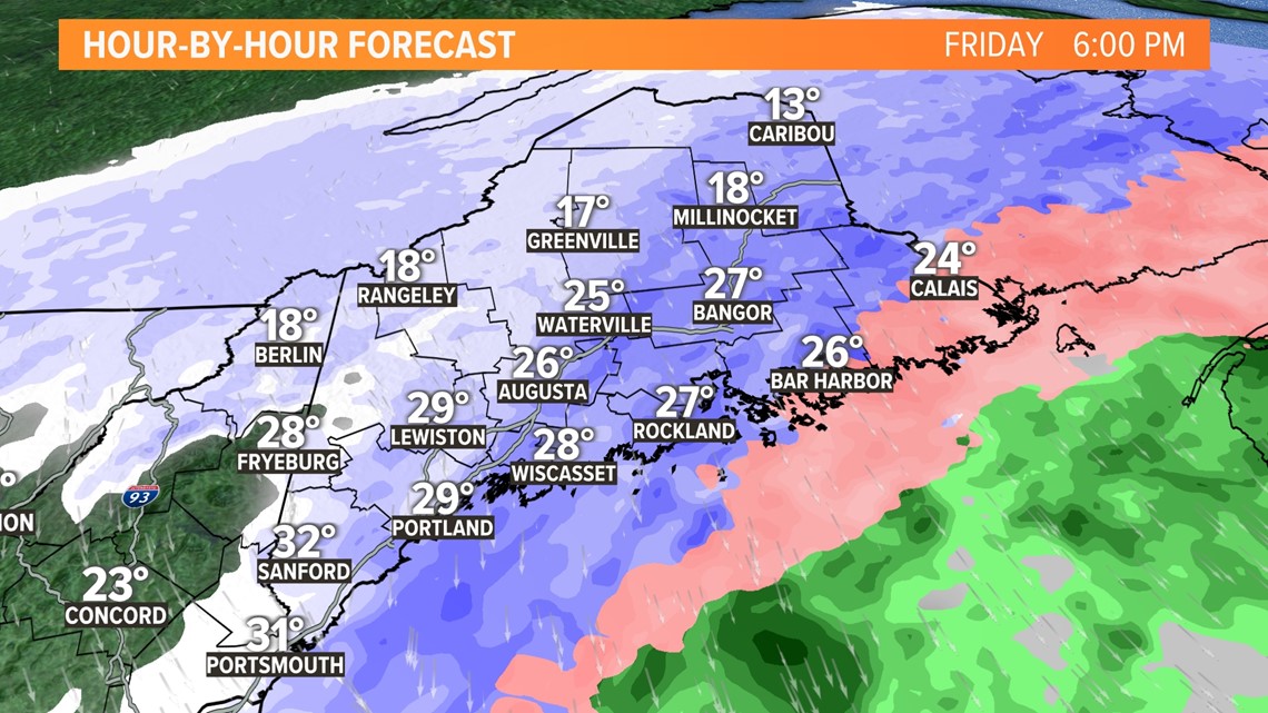
It looks like the coastline will be spared from larger problems. Little or no sleet and snow accumulation is expected at this time.

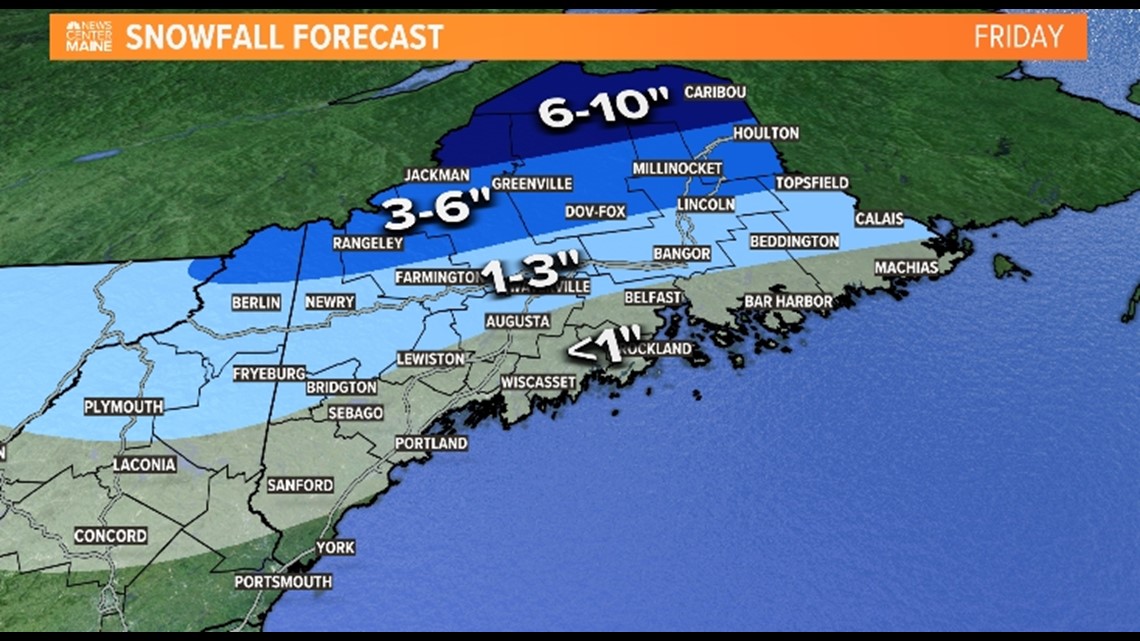
It will be a different story over the interior with the foothills and mountains picking up a few inches of snow. The "Crown" of Maine will get the most, with more than a half foot expected.
With a number of moving pieces, best to check back later on Thursday for any forecast adjustments.
Todd - Check out my Instagram here: https://www.instagram.com/todd_gutner/?hl=en


