PORTLAND, Maine — After weeks of dry and mild conditions, the weather pattern has taken an abrupt turn.
We are looking at two possible storms this week, both capable of big rain and wind. The first is just now starting to develop to our south. It's an area of low-pressure redeveloping off the mid-Atlantic.
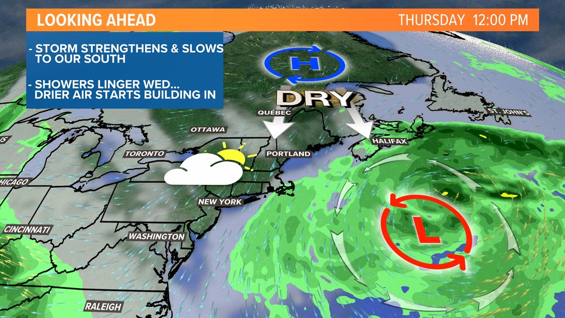
As it moves north, it will get captured by the jet stream and the storm will rapidly strengthen into a nor'easter stalling off of southern New England today and tomorrow.

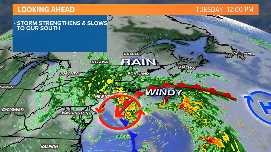
A low-level jet will start directing bands of rain into the New England coast on this morning. That river of heavy rain will hang over coastal Massachusetts through the day before it begins to pivot north up the New Hampshire seacoast and into southern Maine.

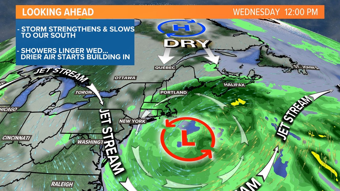
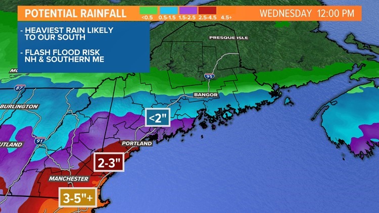
The rain will fall heavily through the night, finally tapering off midday Wednesday. Flooding is likely in southern New England but we may survive unscathed in most of Maine. However, southern Maine needs to remain on guard. Some of the heavy bands could cause drainage flooding.


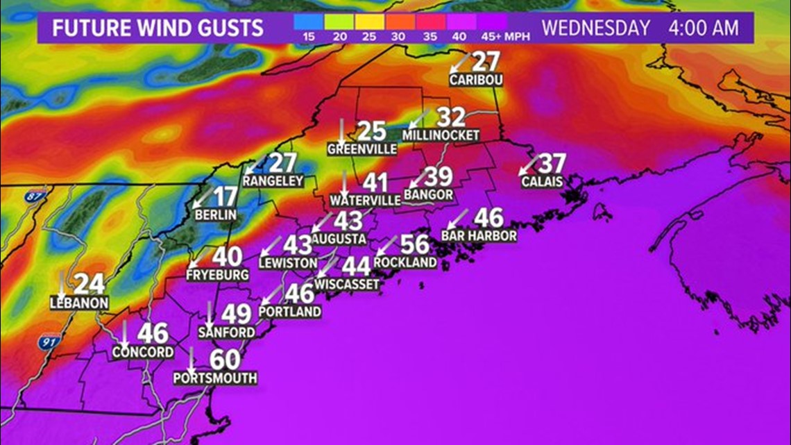
The pressure gradient from the strong low near Long Island to the strong high in Canada will be big creating gusty winds from the northeast. The threshold for power outages is lower this time of year because trees are still holding their leaves and the ground is soft and wet.

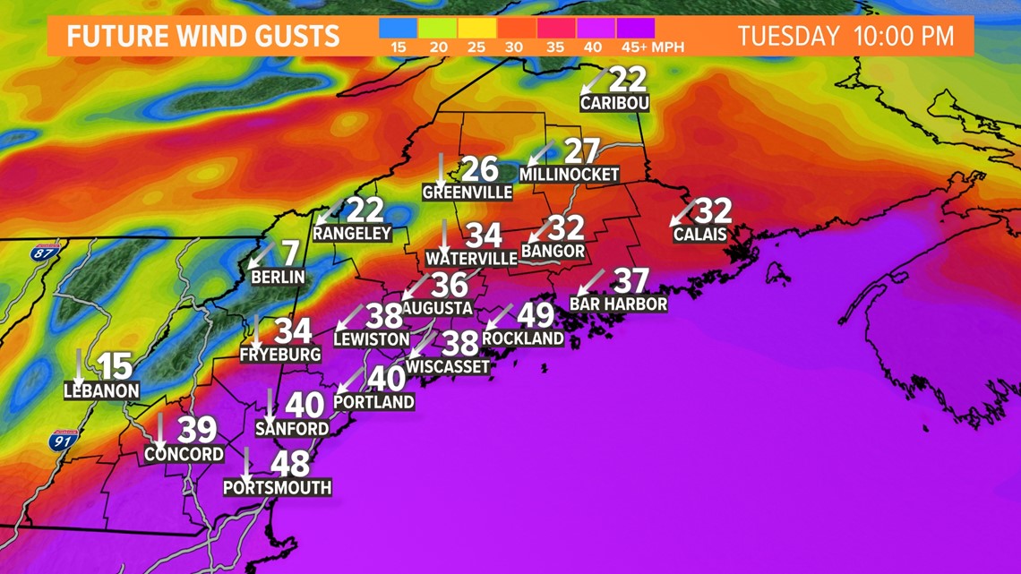
Gusty winds start this afternoon and continue through the overnight hours into Wednesday morning. The highest wind gusts will be along the coast, especially in southern Maine. Wind gusts could be as high as 45-50 mph. Scattered power outages are possible.

The weather turns nice again for the end of the week with the storm sliding away and high pressure nosing in. But another potent rain event is possible over the weekend.

Keep checking back for adjustments and updates throughout the day from the rest of the weather team.
RELATED: NEWS CENTER Maine Weather Forecast


