

MAINE, USA — November is one of those months that is usually pretty dreary. It's getting colder, it gets dark earlier, it's stormy and unsettled...
But the past eleven days have been wonderful. Top-notch. Gorgeous.
However you want to describe it, that all ends Friday. Gear up for another bout of heavy rain, potentially strong winds and a fair amount of cold air behind the storm.
Thankfully, I think the impacts from this storm will be pretty manageable. I don't anticipate widespread or large issues.
There could certainly be some problems here or there, though. This will mostly be an issue through the afternoon and into the evening.
Storm Timeline

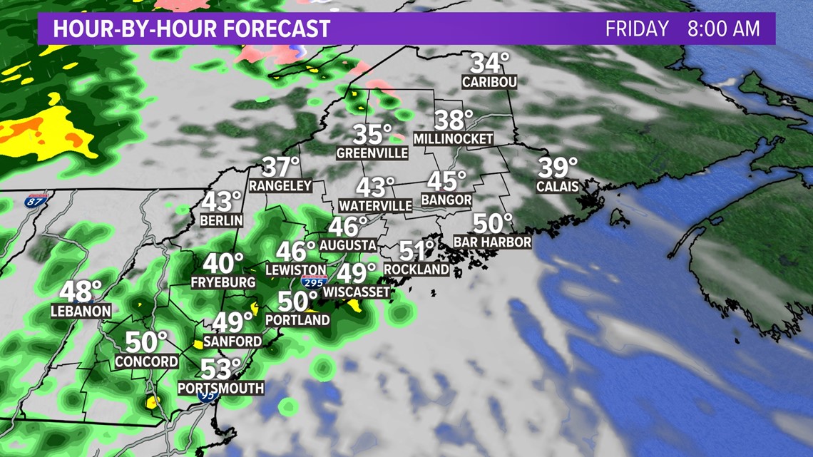
A moisture-loaded cold front will be the culprit on Friday.
In western Maine, showers begin shortly after sunrise. These will be more like an appetizer to the heavy rain later on, though.

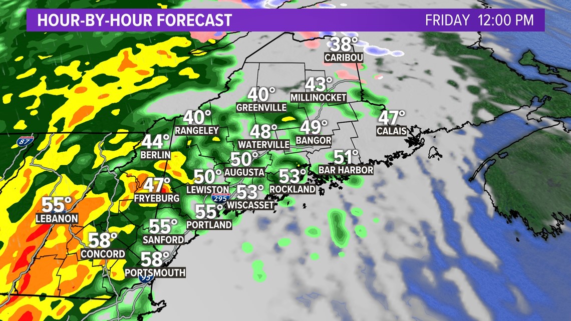
By noon, heavy rain will be building across New Hampshire and into western Maine.
Wind gusts will pick up a bit, too.

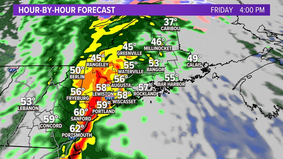
Around 3 p.m. or 4 p.m., a line of wicked heavy downpours will advance through. It will almost appear like a summertime squall line on the radar.
In fact, there might be just enough juice to get a couple rumbles of thunder.
This will be nasty to drive through, from Kittery to Rumford to Augusta. Flash flooding will be possible under this, especially with any drains that clog up from leaves.

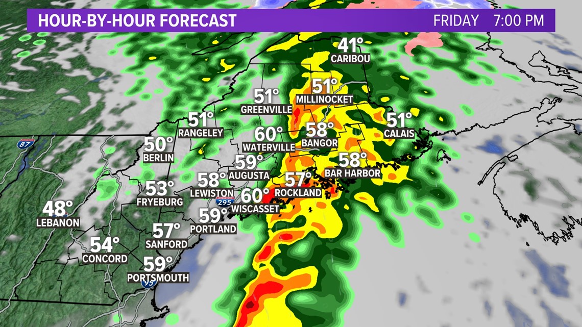
By 7 p.m., the heaviest rain will be moving over the Midcoast, through Bangor and points north.
Flash flooding will be possible on Interstate 95 from Pittsfield to Houlton. Coastal US 1 may also see some water issues, mostly from Rockport and east toward Machias.

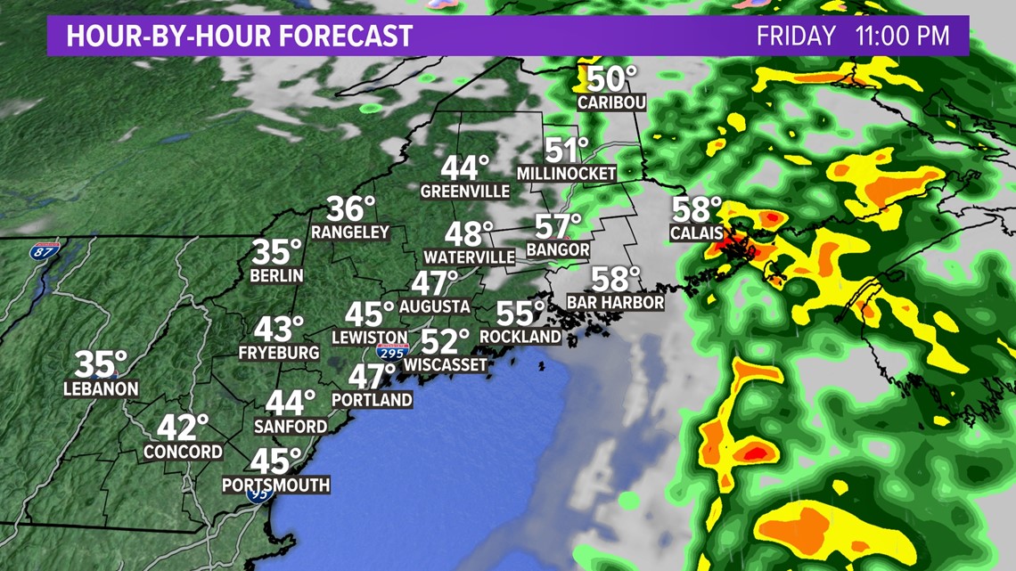
This does wrap up pretty quickly, with rain tapering shortly after 10 p.m. or 11 p.m. All towns should be done with rain by midnight.
All in all, this is a pretty short event.
The problem with lots of rain in such a short period of time is flooding.
Impacts

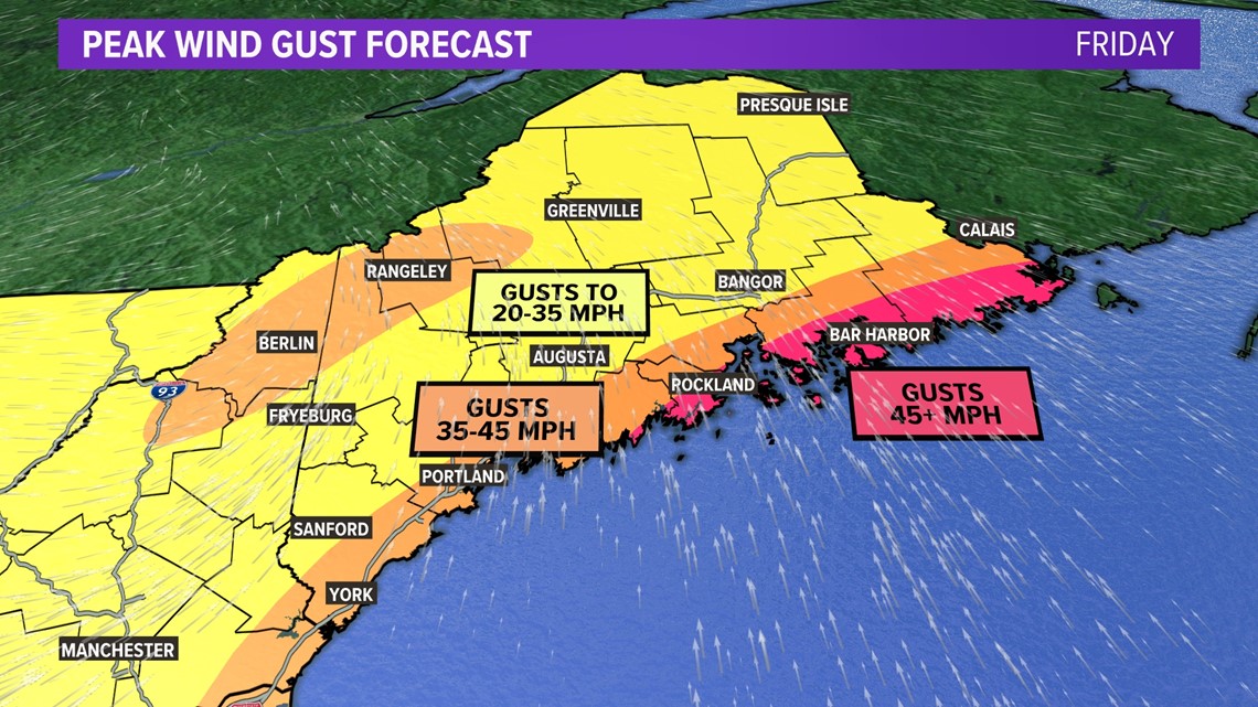
Here's the question everyone has been asking: what are the maximum wind gusts expected?
Well, the trend has not been our friend in this case.
I think we're looking at 35-45 mph for most of the coastline, and this will coincide with a lot of the heaviest rain.
Parts of the Midcoast, through the Penobscot Bay, and along the coastline Downeast will see the strongest gusts. This storm will likely produce gusts up to 45 mph and higher.
Some isolated power outages are possible, maybe scattered for coastal areas east of Wiscasset. Elsewhere, the wind shouldn't cause many issues.

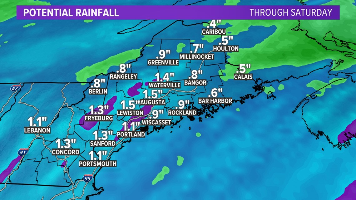
Most rain totals will be in the 1-1.5" range. Across northern Maine, totals could be even lower.
However, south-facing slopes and the immediate coastline will be in prime spots for some enhanced rain rates.
This will bring a couple of localized spots close to, or maybe even over, 2" total.
Flash flooding is certainly possible in heavy downpours. Clogged drains will be an issue for some, too, as the remaining leaves get pulled off the trees from wind and rain.
Drive slowly and with care!

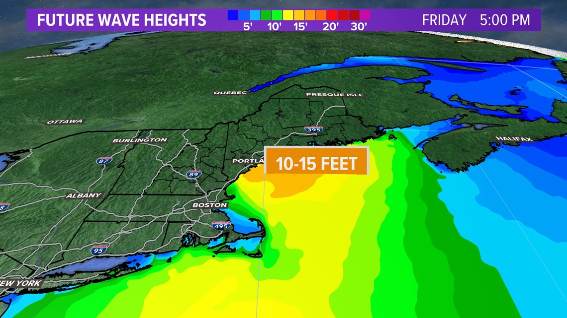
Since the high tide tomorrow coincides with a strong onshore wind, expect some splash over and beach erosion.
Wave heights will approach and exceed 10 feet through the afternoon and evening, so typical trouble areas should be prepared.
Coastal flooding seems unlikely, though, since this will be quick-moving. And it's not the astronomical high tide.
Beyond the Storm
There will be quite a bit of sunshine on Saturday. Temperatures will be pretty mild, too, with most climbing up into the mid-50s.

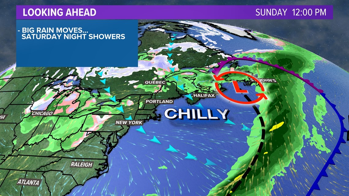
Cooler air is reinforced Sunday. This will push temperatures down into the upper 40s, but it opens the door for even chillier air next week.

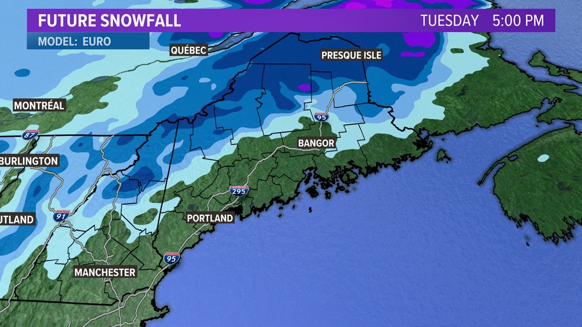
Don't look now (or do if you ski), but the first measurable snow might be on the way for western and northern Maine next week.
'Tis the season, I guess!
You can get more weather updates by following me on Twitter, @MikeSliferWX.
RELATED: NEWS CENTER Maine Weather Forecast