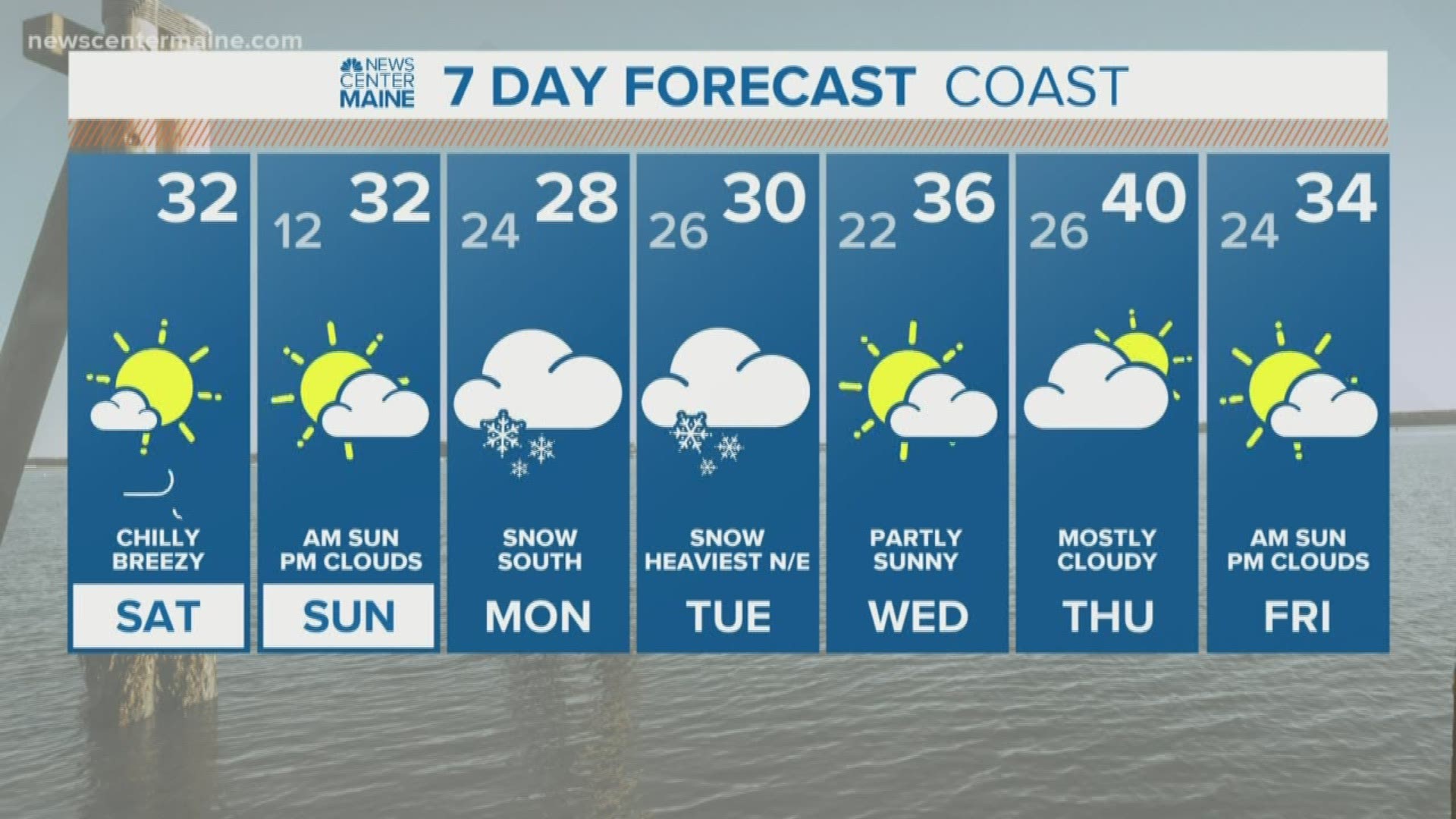
MAINE, USA — Everyone's anticipating the storm that's coming after the holiday weekend, but the weekend itself will be fine.
If you want to see Ryan's extended discussion of the forecast, scroll to the end of the story for his full YouTube LIVE discussion.
We'll have sun today, and even Sunday starts off with sunshine. Clouds increase from southwest to northeast Sunday afternoon. Highs on Sunday will be in the low 30s.
A long, drawn out system impacts us in two parts: First, Sunday night into Monday morning, in southern Maine only. Repeat... southern Maine only.
Second, later Monday into Tuesday, as a coastal low develops offshore and moves north. This is what will lift the precipitation northward into central and northern Maine, but it takes a while to get going there.

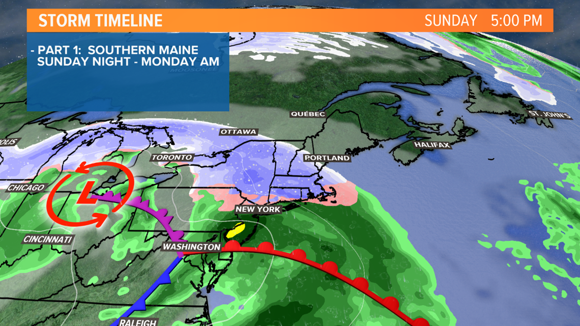

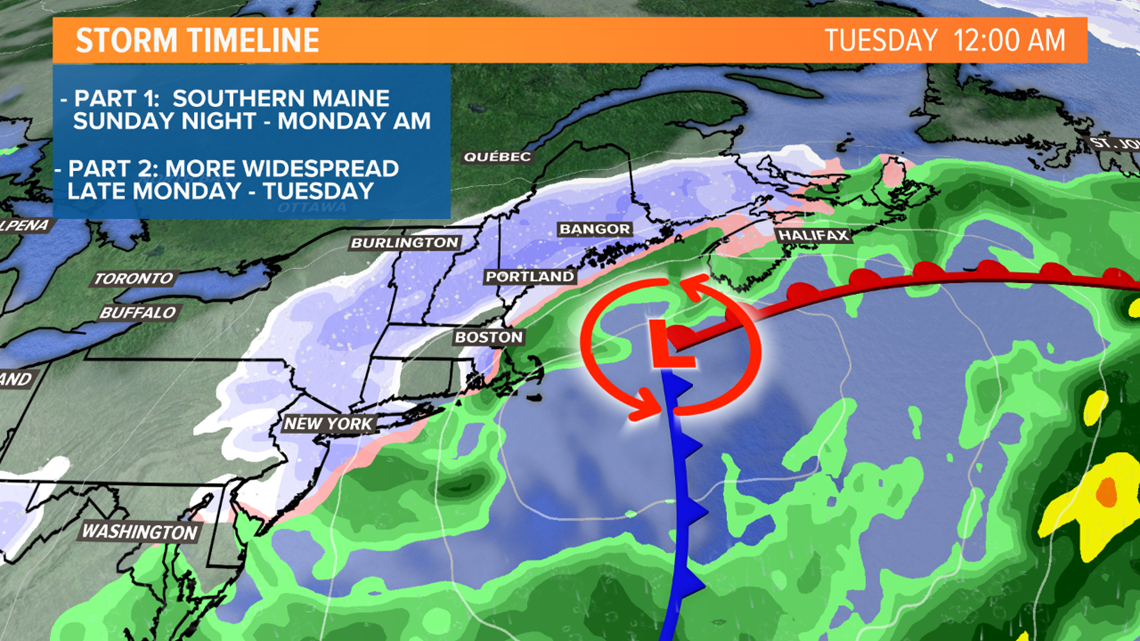
Keith put it best yesterday, it's a funky weather set-up, certainly not a classic nor'easter or snowstorm.
But even weird weather patterns can result in snow.
Here's my best shot at the timing and amounts. Know that this is subject to change -- especially the second half of it.
Light snow will develop in southern New Hampshire later Sunday, moving into southwestern Maine (York, Cumberland, Oxford counties) Sunday evening. I'd say the first flakes are possible near the New Hampshire border around 5 p.m. and maybe after 7 p.m. in Portland.

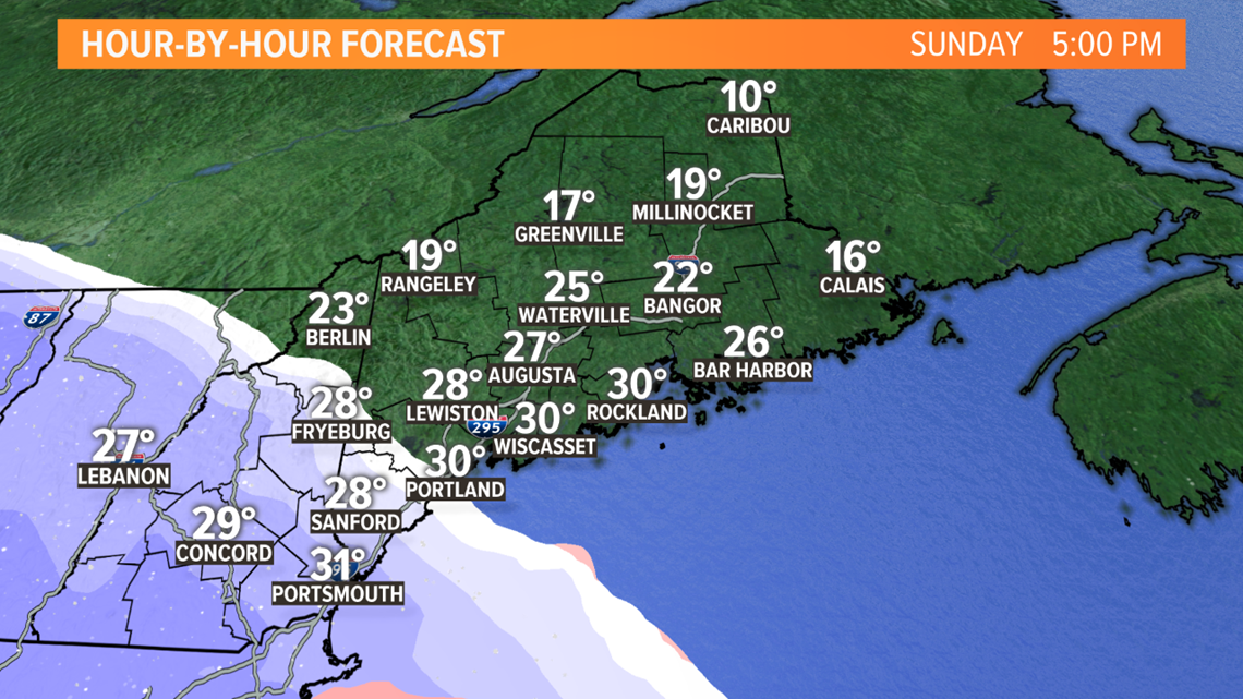
Snow continues overnight into Monday morning in the southern part of the state, while central and northern Maine stays dry. The morning commute will be most impacted from Portland south. School delays and/or cancellations are possible in Cumberland and York counties Monday morning.

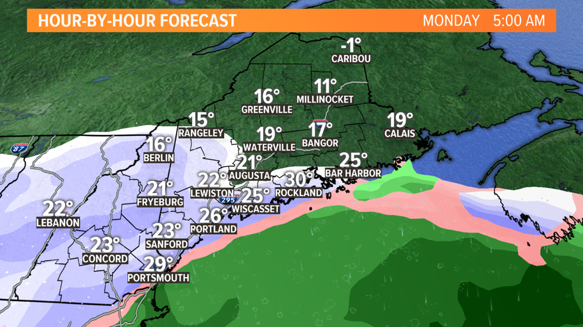
We'll get a bit of a lull during the day Monday before a coastal storm develops, bringing another round of snow from south to north starting Monday afternoon and night.
When the precipitation lightens up, it may be some sleet or "snizzle" (like drizzle, but snow).

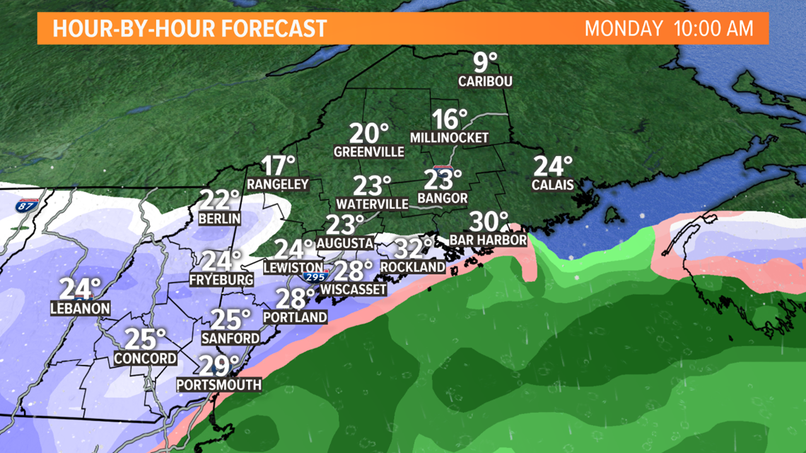
The Monday evening commute again looks a little tricky in southern Maine.

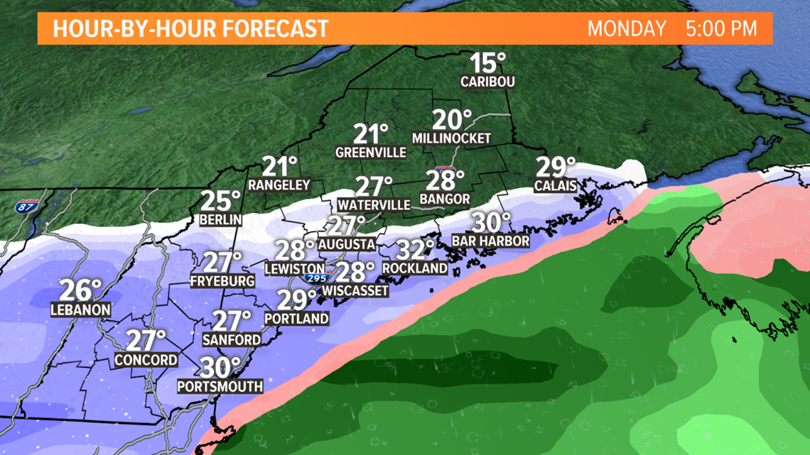
Snow finally gets going in central and northern Maine overnight Monday night.

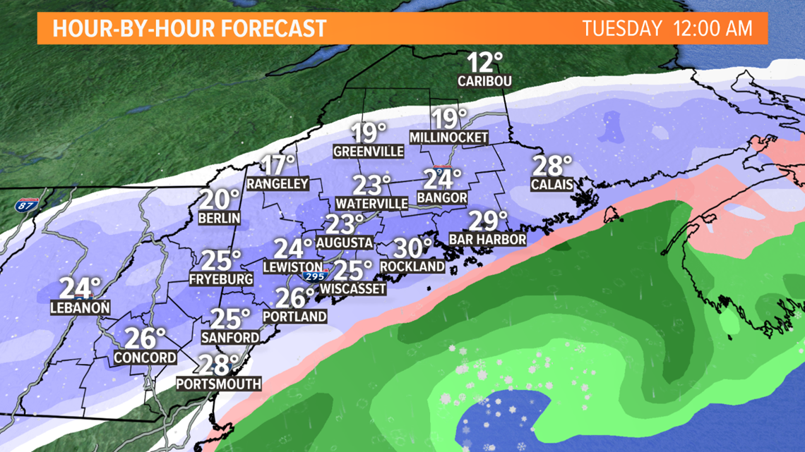
By Tuesday morning, the storm will be unraveling in the Gulf of Maine. The precipitation will become a bit more broken up. This means there will be snow around for the Tuesday morning commute, but likely some breaks too. Sleet or a little rain could mix in along the coast.

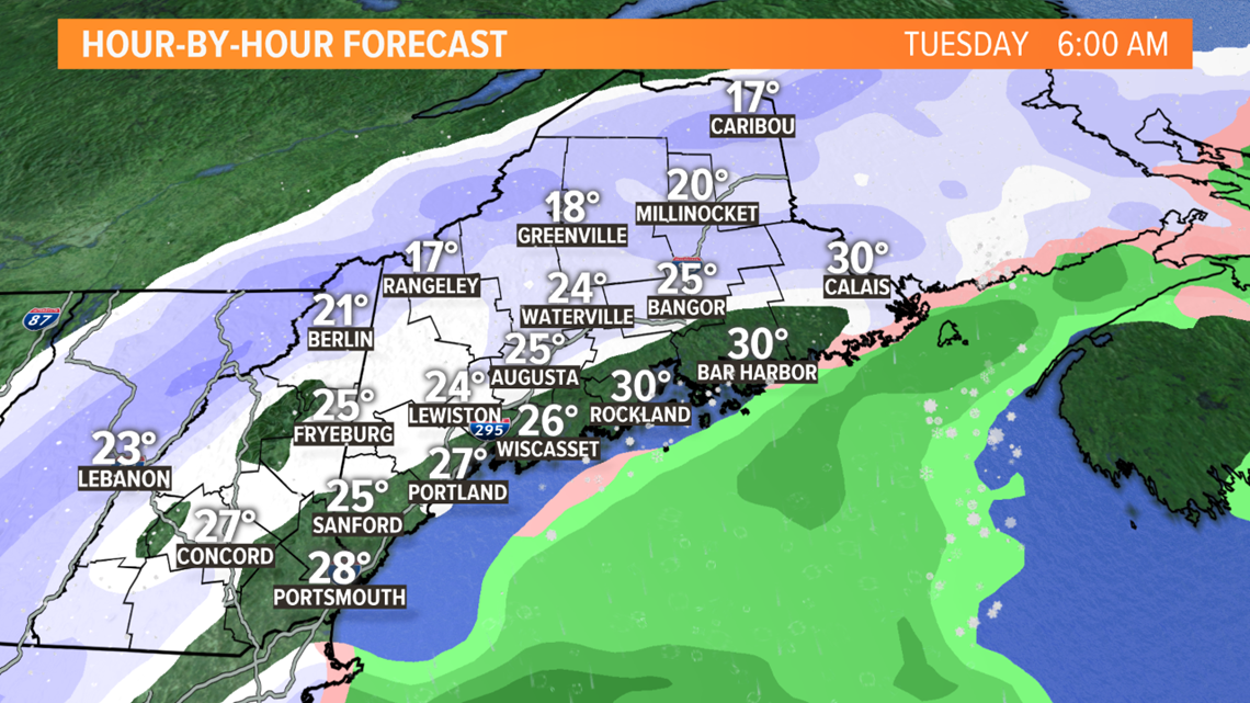
To be clear, if we were taking the computer models at face value, hook, line and sinker, we'd be calling for a foot of snow from Portland south.
But experience tells us it probably won't shake out that way.
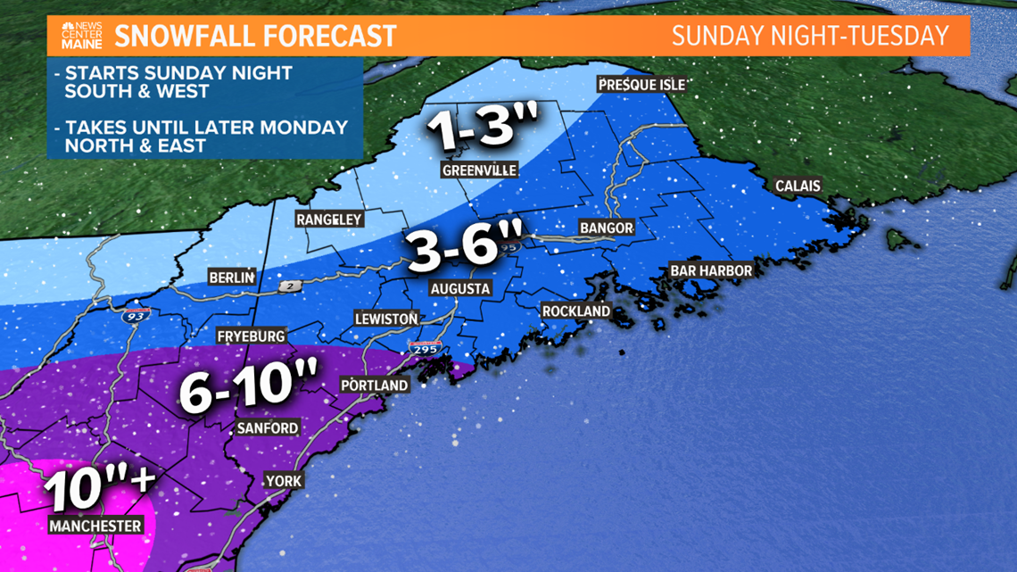
So I'm going with 6-10" of snow in Cumberland, York and southern Oxford counties. A few inches of that will be on the ground by Monday morning. The rest falls with the second round.
Elsewhere, including Lewiston, Augusta, Waterville and Bangor, 3-6" falls mostly later Monday into Tuesday morning. The mountains and northwestern part of the state will be farther removed from the storm, with 3" or even less by Tuesday.

Check in with Mike tonight and me tomorrow morning for updates. This one is certainly subject to change, but the bottom line is southern Maine will be most impacted, for a change.
Have a nice weekend.
RELATED: Funky storm on its way for Monday

