MAINE, Maine — Being an "Elder Millennial" I've seen a decent amount of snowstorm setups by this point in my career. (I use "career" loosely here.)
I've seen the Alberta Clipper, the Inside Runner, the Miller Type A, the Miller Type B, the cut off spinner, the warm front thumper, the Downeast back-in. etc.
That's why this storm on Sunday is hitting me weird: I'm quite certain I haven't seen a storm just like this one.
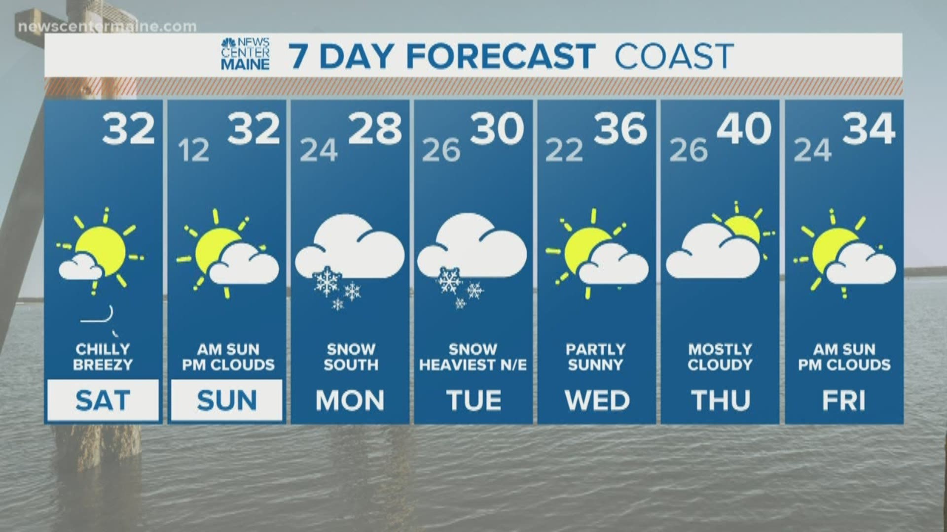
What makes it unique? Well it's trying to give us snow from Sunday night through Tuesday afternoon without a big, deep low pressure system or a blocking high. It's trying to do it with a warm front followed by a middling coastal low.
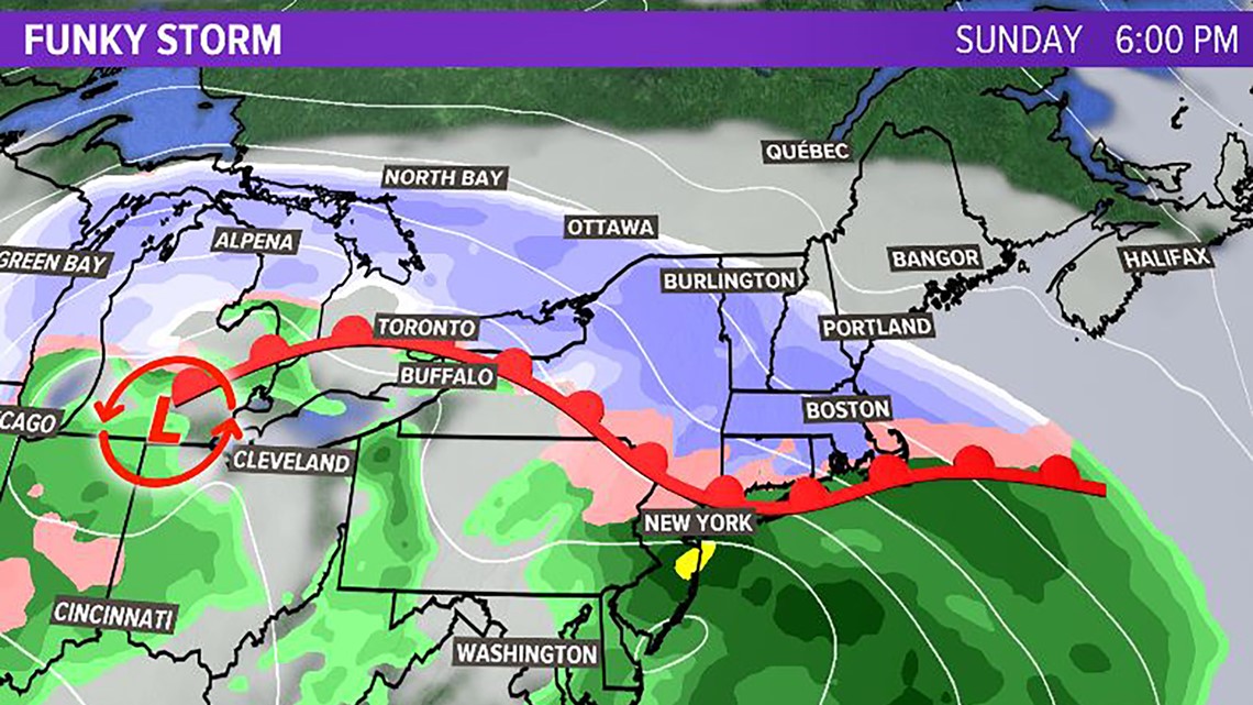
The first punch is the warm front:


Because of the position of the front the best dynamics will be down in MA, CT and RI. But most guidance agrees some of those juicy profiles will make it into York, Cumberland and southern Oxford counties. This will start on Sunday night, but likely wait until late evening into early Monday to make much of an impact
During this time period there will be almost nothing going on inland and across central and northern Maine.
Then there will be a lull.
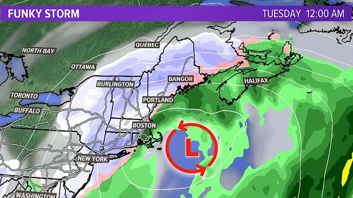
This as the coastal low develops and becomes the main driver:


Once that happens on Monday afternoon into Monday evening more of the state gets into the snow. This includes even northern Maine and the mountains. Snow then continues in varying intensity until Tuesday mid-day when the storm spins away.
Now the thing that gives me pause about this thing is that the second part relies on a pretty wimpy low in meteorological terms. It's not a bomb, it's not even wrapped up really. It's just kinda there.
So with this lack of true dynamics the EURO tries to spit out about a foot of snow for many of us. Is it possible? Sure. But it just doesn't seem quite right.
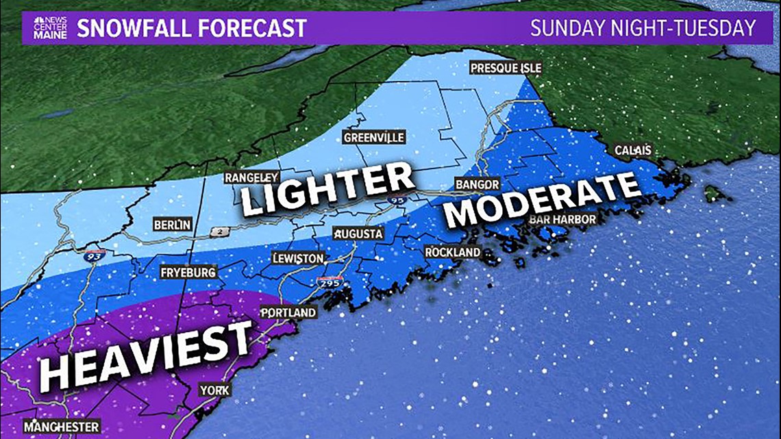
So this is what I'm thinking:


"Boo! What a cop out! No numbers!"
I don't trust this storm, so it seems to early for a snowfall map. BUT since you're one of the few that is taking the time to read the words that come with the article, if you made me throw numbers out right now I'd say: Purple is 5-10", Blue is 3-5" and Light Blue is 2-4."
But a real map will come out tomorrow. When I'm not working. And Ryan has to deal with it.
Carson Out
Do it for the gram: https://www.instagram.com/keithcarsonweather/
NEWS CENTER Maine STORIES
RELATED: Active events in a Santa suit

