
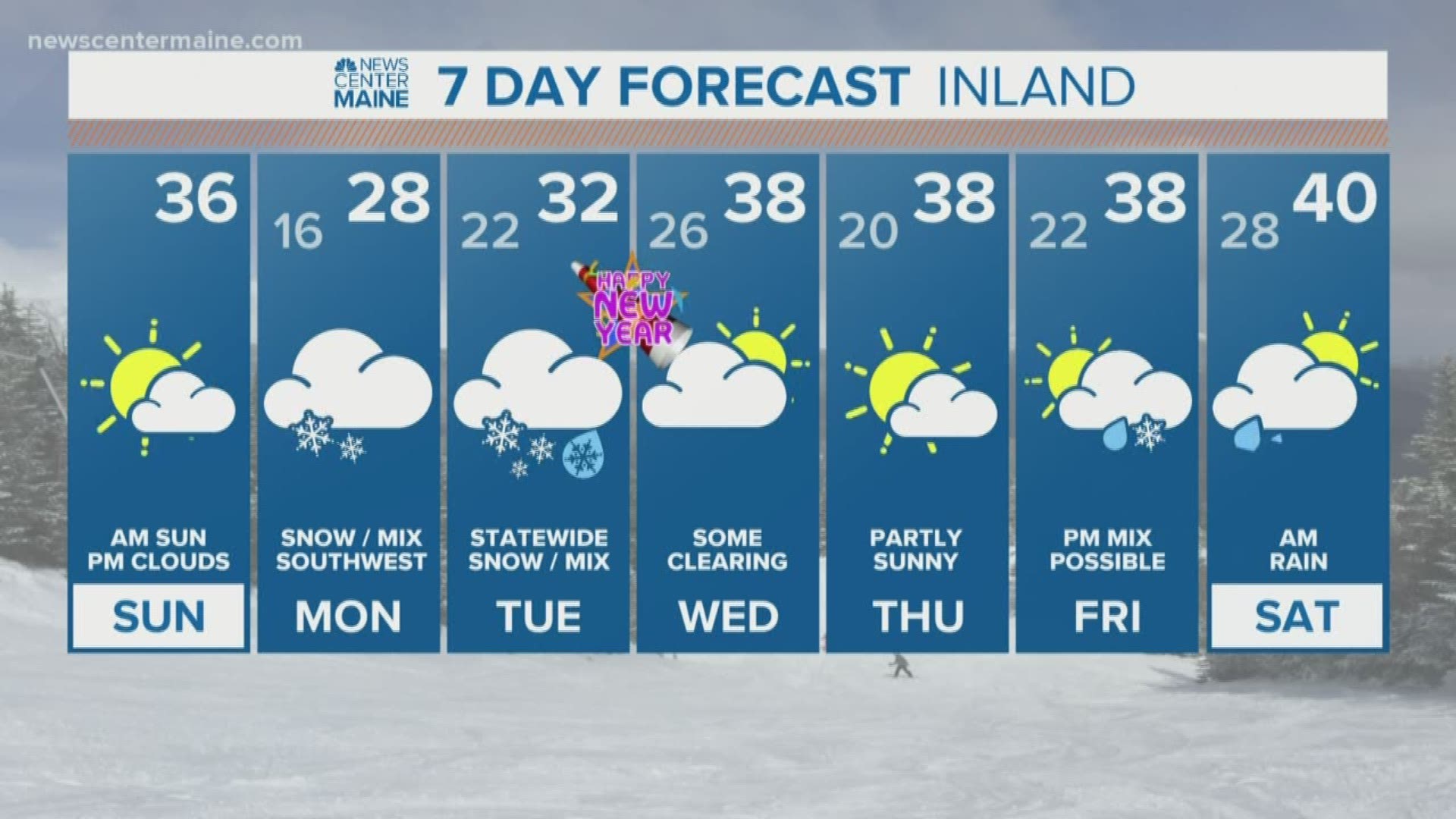
MAINE, USA — Snow, ice and rain are all on the way to Maine.
In the scope of Maine winter storms, this will be manageable. But it comes in two rounds, and its timing around the New Year's Eve holiday will cause issues.
Southern and western Maine will deal with it both Monday and Tuesday. But eastern and northern Maine will wait until round two, which begins Monday night.
Here's my best estimate on the timing:
Light snow moves into southwestern Maine around midnight. York county will be most impacted, with some accumulation on the ground by Monday morning. There won't be much at all north and east of Portland. The sun will even be out Monday morning in northern Maine.

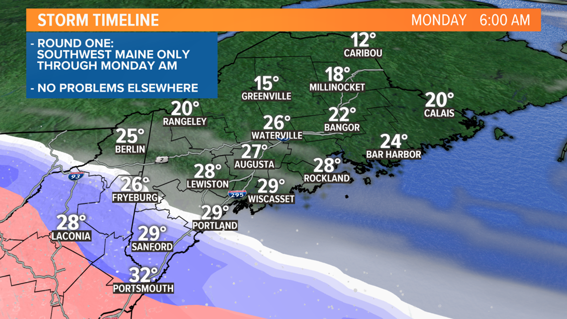
Dry air to the east and north will prevent the precipitation from moving much at all Monday morning.
Off and on light snow continues in western Maine. Some sleet may mix in, especially when the precipitation lightens up. There will be quite a bit of icing in New Hampshire.
Even at noon Monday, there's nothing going on in central and eastern Maine.

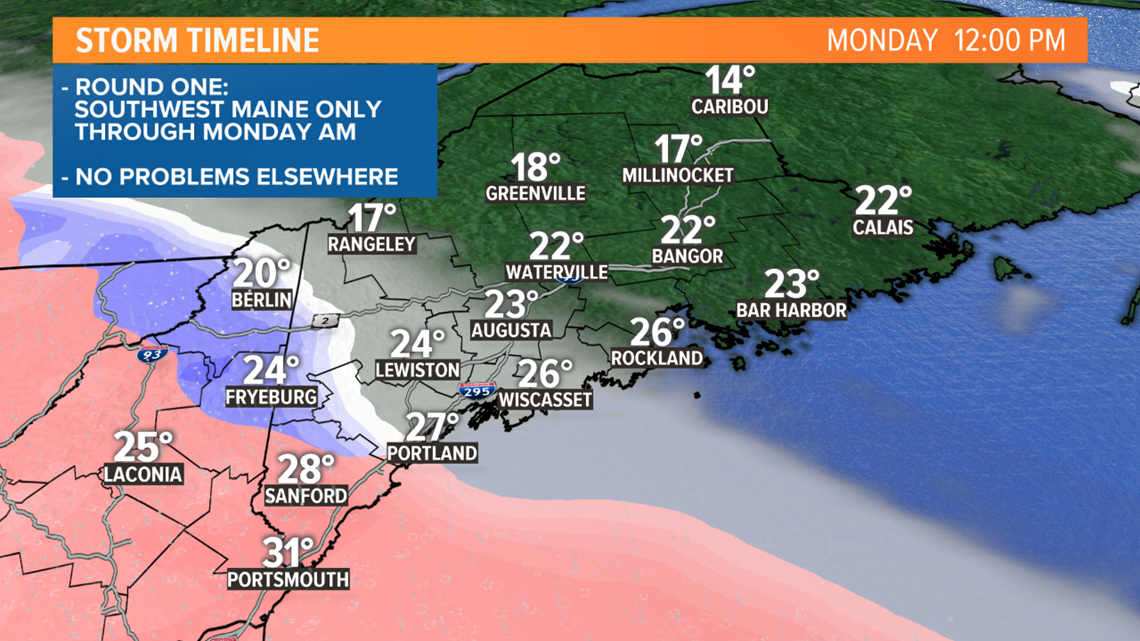
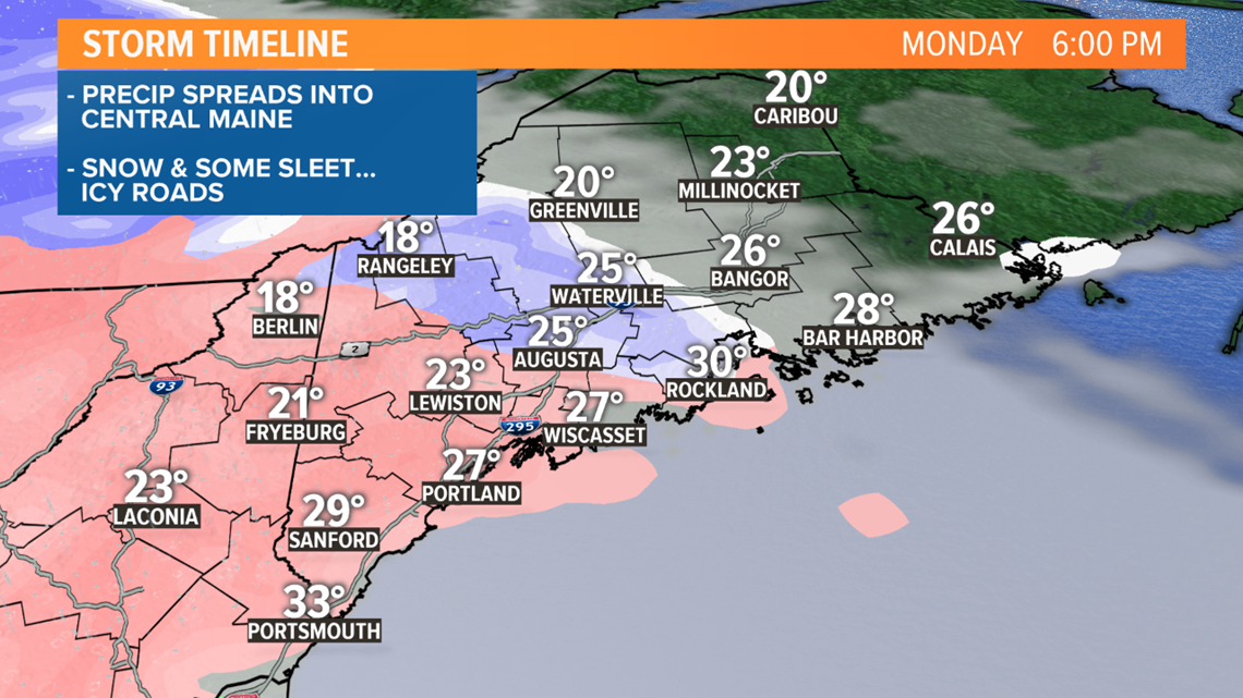
During the mid to late afternoon, the snow will start to move into central Maine. The pink on the map represents a mix or chance for sleet (ice pellets). While it won't be falling at a fast rate, the snow and sleet will make for icy travel in western and parts of central Maine by Monday evening.

By sunset Monday afternoon, here's the expected accumulation:

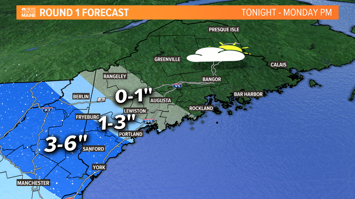
Most of it will be in York County; 3 to 6 inches. 1 to 3 inches of snow/sleet is expected in Portland. A coating to 1 inch is expected for parts of central Maine, nothing east of Augusta.
"Round two" begins Monday night.
Snow finally makes it to Bangor and Bar Harbor after 9 p.m. Monday.

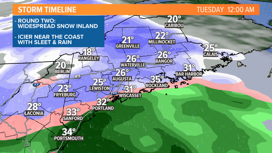
The precipitation becomes heavier after midnight, with snow across the interior and a mix of snow, sleet and freezing rain near the coast.

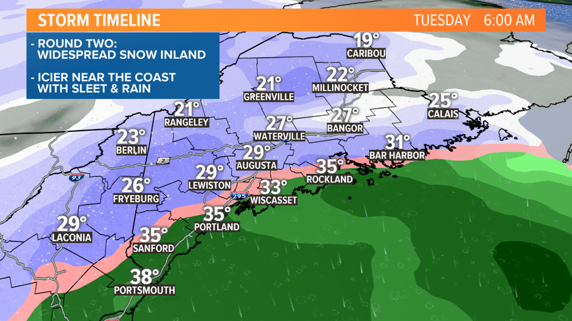
Plain rain would likely be limited to the immediate coast, islands and far southern York county. I have a hard time believing temperatures at the ground will rise much above 32 degrees, even though models are insisting they will. That means it'll be quite icy Tuesday morning.

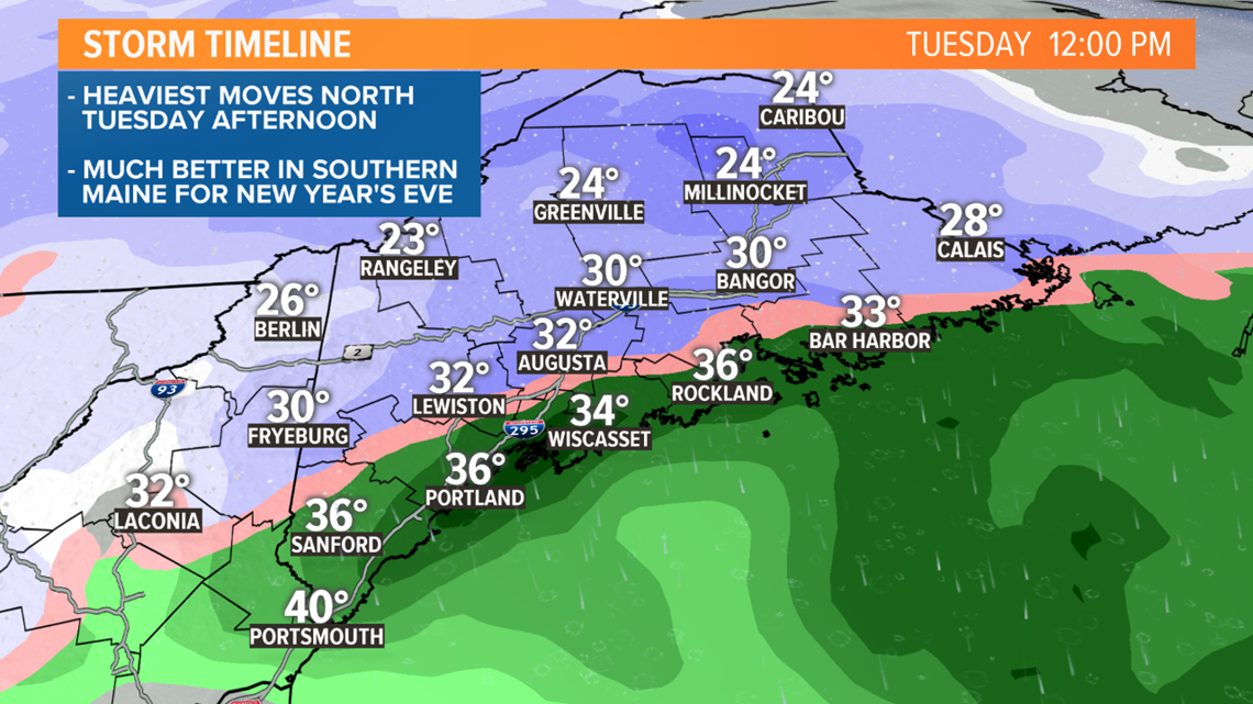
The storm wraps up from southwest to northeast Tuesday afternoon and evening. In western and southern Maine, conditions should improve for New Year's Eve.
Lighter snow will linger into Tuesday night in the mountains, eastern and northern Maine.
Then this is the additional snow that will come from round two, Monday night into Tuesday:

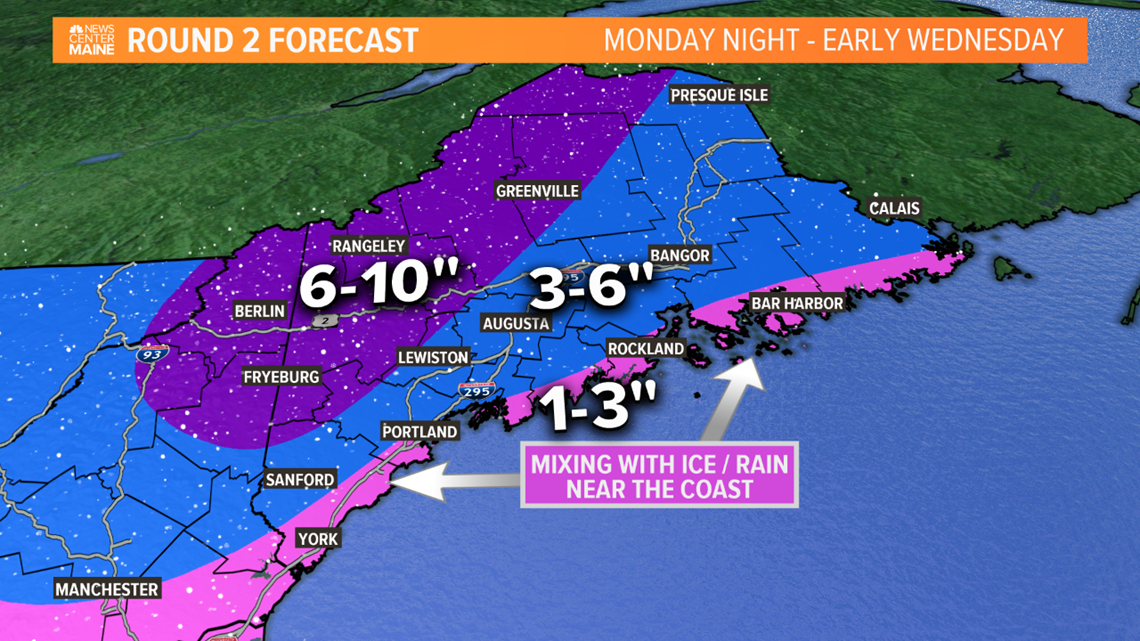
It looks like a solid 6 to 10 inches for the mountains and foothills. 3 to 6 inches for a lot of the rest of the state. Mixing with sleet and rain will keep amounts down to 1 to 3 inches near the coast, but I expect it to be pretty messy in spots.
If you add both rounds up, somewhere in western Maine or northern New Hampshire will probably get close to 18" of snow. I like to call this the "pivot point" -- in other words, where the round one precipitation barely ends and then round two moves in.
Check with Mike tonight for an update and I'll see you again tomorrow morning.