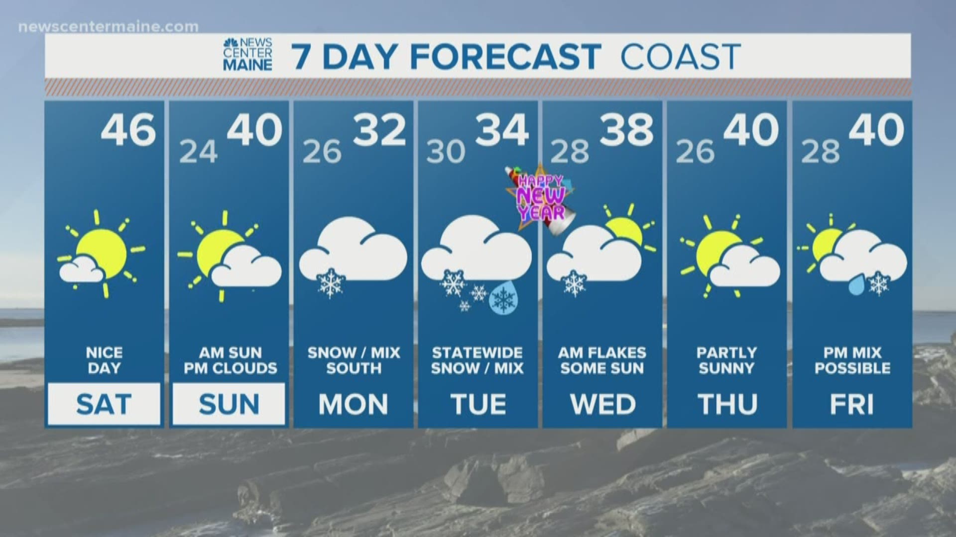
MAINE, USA — I know you're here to read about the storm, but I don't want a nice weekend to get lost in the hype:
Temperatures today rise into the 40s with sunshine. Sunday starts with sun, some clouds arrive in the afternoon, with highs between 35 and 40.
Now, the storm: It comes in two rounds. Some parts of the state will be impacted for over two days, while others miss the first round and only get the second. Here are my thoughts as of Saturday morning:
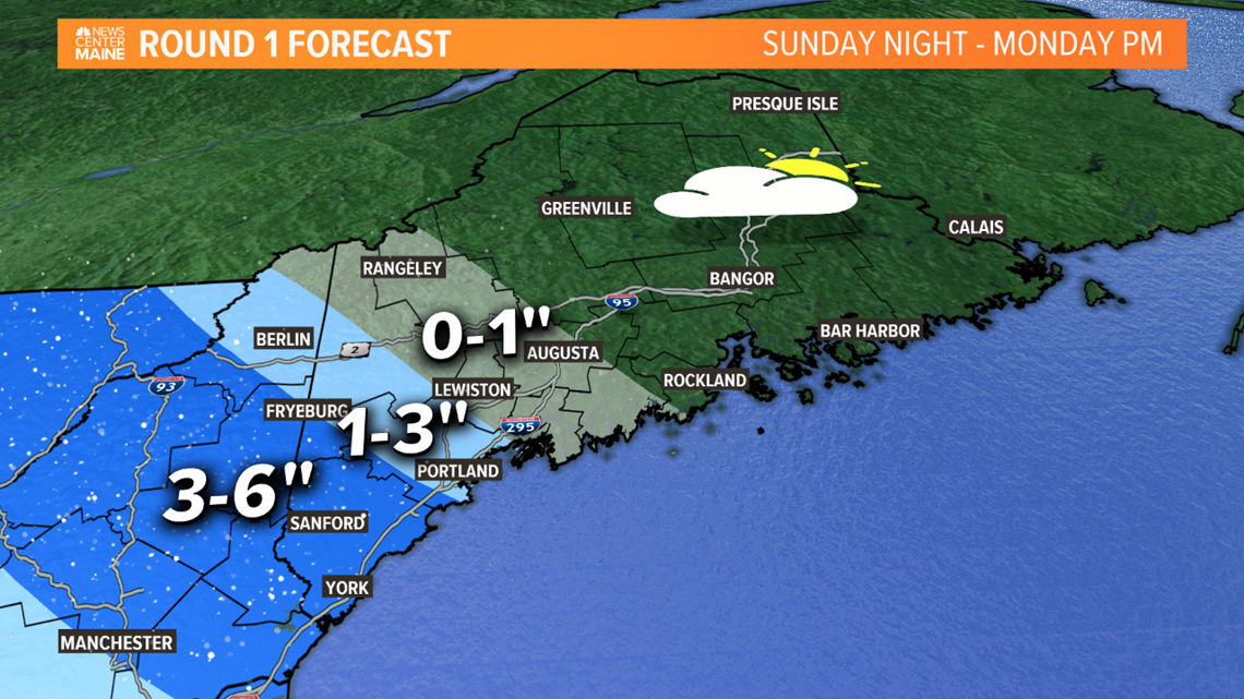
Round 1 will impact southern and western Maine only, starting Sunday night.
Snow moves in ahead of a warm front approaching from the southwest. It will battle with high pressure to the north. The closer to the high you are, the drier the air is. So the snow will try to move north and east Monday morning but fail to do so as the dry air eats it up.
But in southern and western Maine, back into New Hampshire, some of the snow will be heavy enough to drop several inches. How much of that gets into Maine is still in question. If the high is weaker, we'll get more snow. If it's stronger and dry air wins out, the heaviest will be in New Hampshire.

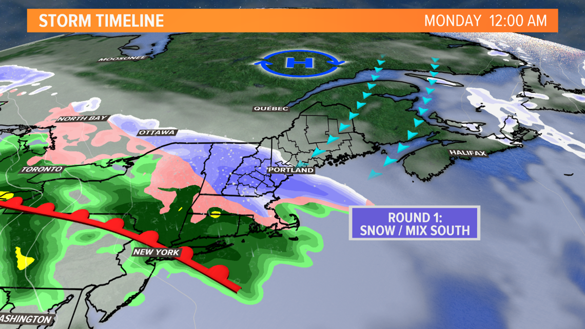
In Maine, Oxford, Cumberland and York counties will likely be the most impacted in round one. It will stay dry through much of Monday in central, eastern and northern Maine.

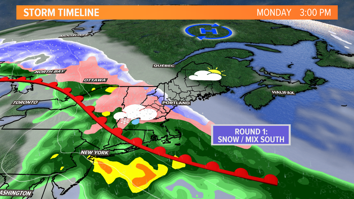
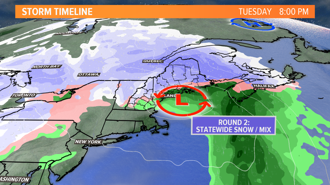
Round 2 gets going Tuesday morning, with the heaviest precipitation moving through the state Tuesday afternoon.
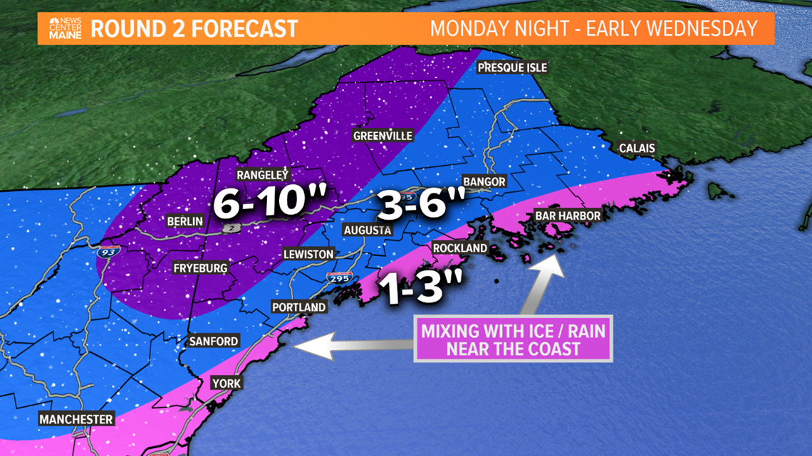
As the warm front washes out a new low forms south of New England late Monday. On Tuesday, this tracks into the Gulf of Maine, but close to the coast. That'll mean a snowstorm for the mountains, but some mixing with sleet or rain is likely to happen near the coast Tuesday afternoon.
I doubt outside of the immediate coast it'll become warm enough at the surface for plain rain, so sleet or freezing rain seems more likely when mixing occurs. In other words, a mess.

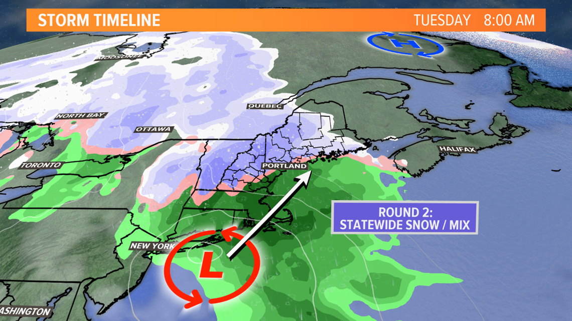
This will start to wrap up Tuesday evening. In western and southern Maine, conditions should improve for New Year's Eve. Lingering flakes are likely, but the heavy stuff will be over.
Snow will linger into Tuesday night in the mountains, eastern and northern Maine.

Here are my thoughts on snow totals. Split into two maps, mainly because Monday is a southern Maine/New Hampshire only deal.

Then this is the additional snow that will come from round two. It looks like a solid 6 to 10 inches for the mountains and foothills. 3 to 6 inches for a lot of the rest of the state. Mixing would lower amounts near the coast, but also mean a bit of an icy glaze.

If you add it up, somewhere in western Maine or northern New Hampshire will probably get close to 18" of snow. I like to call this the "pivot point" -- in other words, where the round one precipitation barely ends and then round two moves in.
Check with Mike tonight for an update and I'll see you again tomorrow morning.
RELATED: Another weirdo storm for Monday

