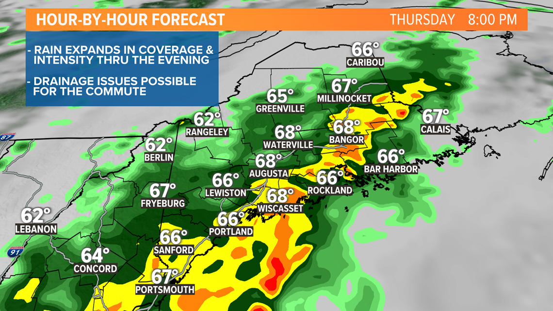
PORTLAND, Maine — A stalling front will drift through New England over the next 24 hours. Ahead of it, tropical air is surging north and pooling, waiting to be lifted into heavy downpours. At first, the showers with this front will be scattered, but still capable of being heavy. However, later today an area of low pressure will ripple along the front and rain will expand in coverage and the intensity will ramp up even more too.

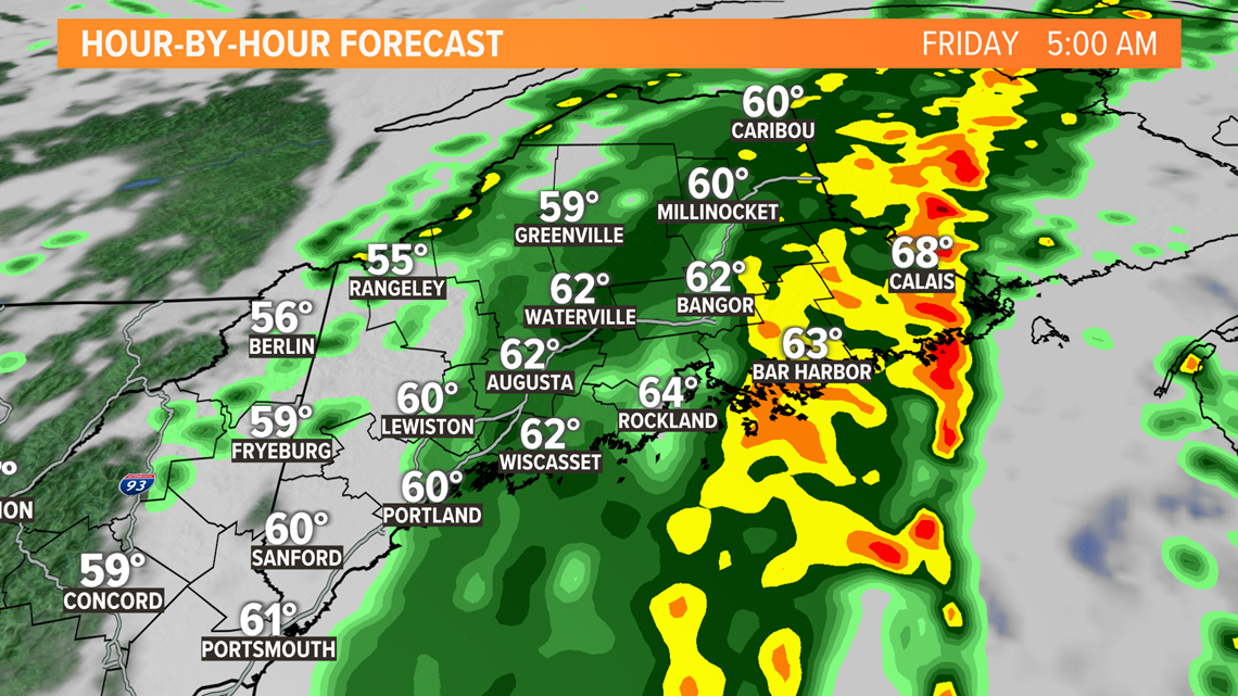
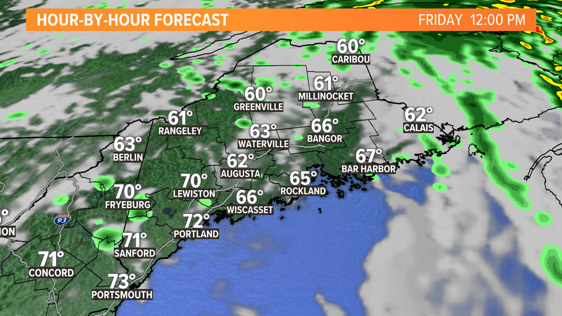
The rain will remain steady through the night, tapering finally by morning. By the middle of the day, sunshine will burn through the clouds and the region will begin to dry out.

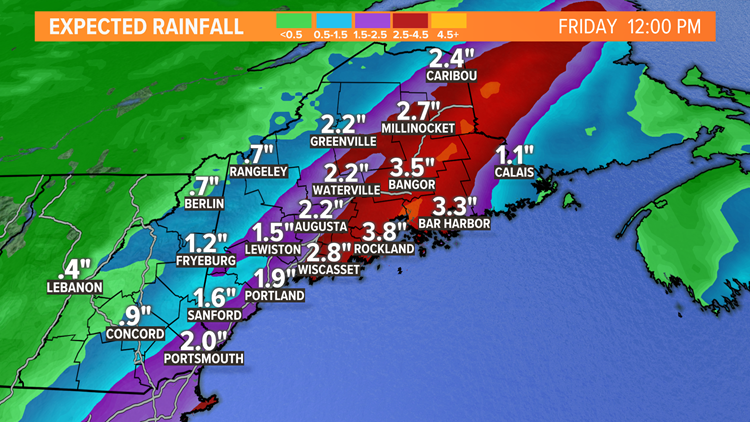
Rain amounts will top an inch in most areas and be as high as three inches. At the moment there are no flood watches but they may be needed at some point. At the very least we'll see some drainage issue during the heaviest downpours.

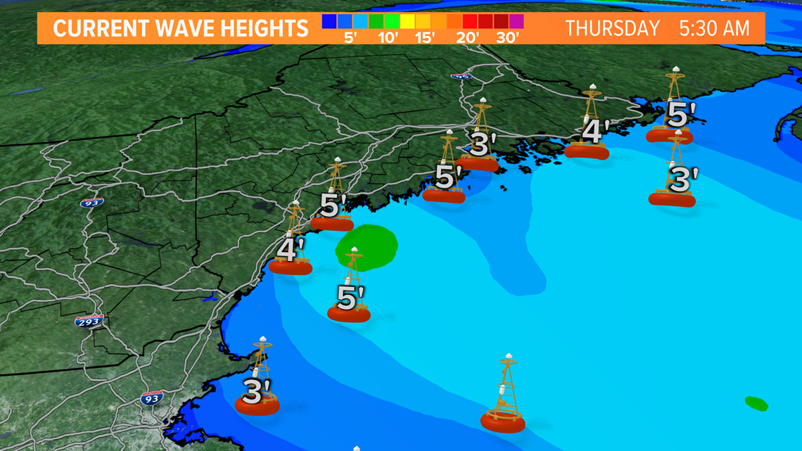
A lot of the weekend looks great and while it may not be quite beach weather, the water is still warm and I expect people to be there. If you plan to hang around the ocean's edge the next few days, please be careful. Hurricane Larry is sending large waves and rip currents our way.

RELATED: NEWS CENTER Maine Weather Forecast


