MAINE, USA — We're used to categorizing hurricanes by their strength.
But what about winter storms and nor'easters?
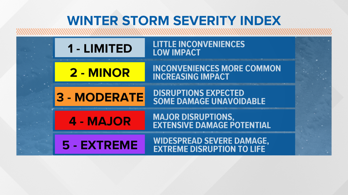
A new scale implemented by the National Weather Service this winter aims to communicate the potential impacts of storms.
There's a large difference between the Saffir-Simpson Scale, used for hurricanes, and this new index. Hurricanes are ranked based on their wind speed, and can be tracked for days or even weeks.
Winter storms evolve over time, and their severity differs greatly by state.
The purpose of the Winter Storm Severity Index (WSSI) is to provide NWS partners and the general public with an indication of the level of winter precipitation (snow and ice) severity and its potential related societal impacts.
The index takes into account the forecast precipitation type and amounts, plus non-meteorological factors, including population density, region of the country, and forestland to determine the impact.


The success of the index is rooted in an accurate forecast, of course.
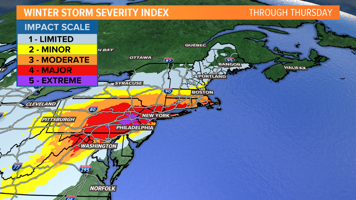
But it demonstrates how the impact of a storm can vary by area. For example, in the upcoming storm, double-digit snow totals early in the season are quite rare in the Philadelphia suburbs. That's where an extreme impact is projected, and some places could see close to 20 inches of snow.
A large swath of the northeast from central Pennsylvania to southern Connecticut is expected to have a major impact.
But in northern New England, a limited to minor impact is anticipated, even if the storm shifts north some.


