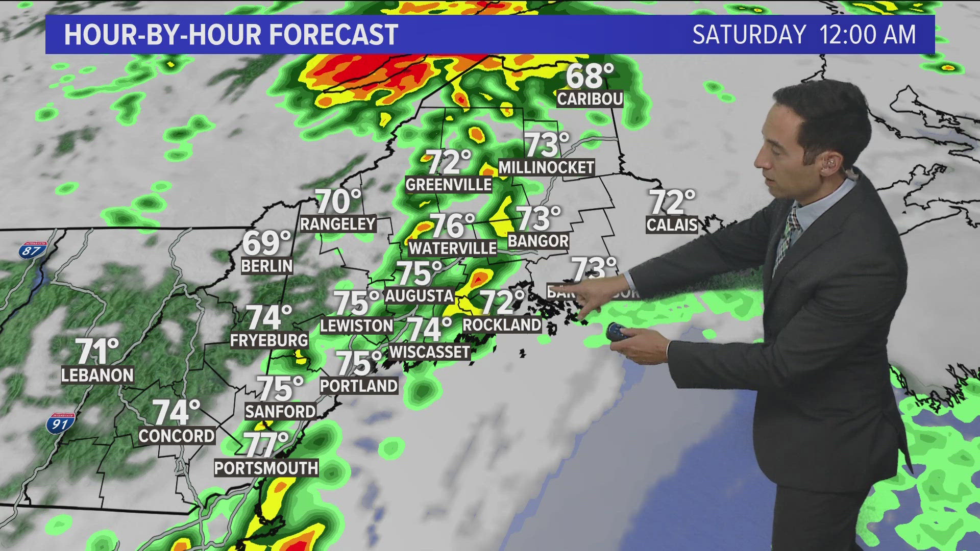
PORTLAND, Maine — The moisture from what was once Tropical Storm Debby has moved into Maine (in case you didn't notice). That has resulted in showers and periods of heavy downpours—truly tropical downpours at that.
The radar right now shows a few of those downpours but I can tell you from experience there are some heavy pockets of rain that are barely showing up as a return right now.

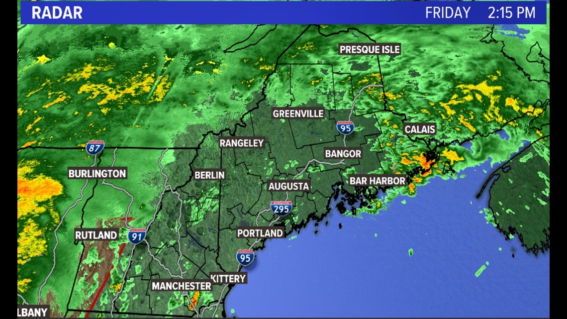
Zooming out you'll see a red box to the southwest of Maine. That's a Tornado Watch. For reasons we won't get into in this blog (you only signed up for Weather Weenies for Dummies), tornadoes are fairly common with Tropical Storms and Tropical Depressions.

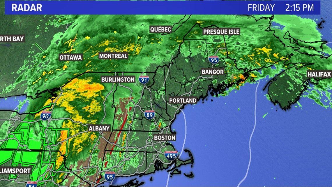
So the Storm Prediction Center is "boxing" the areas right in front of, and along the cold front that marks the edge of the tropical moisture.
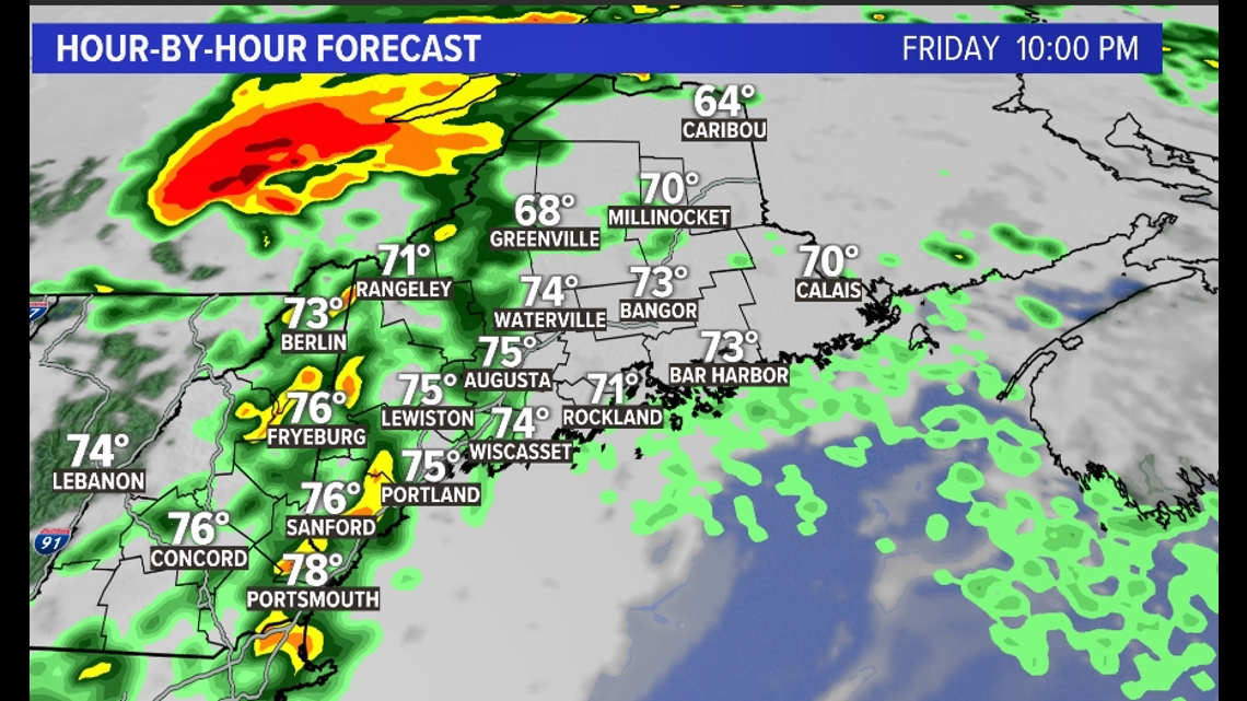
It wouldn't surprise me to see parts of Maine in a Tornado Watch later this evening when that line moves into the state.
According to the Mesoscale models that looks to be around 9 p.m. or 10 p.m. This would be the best chance of a few storms going severe with an isolated tornado or two.

Now I don't ever want to downplay tornadoes, but I will say typically those that develop in a tropical system are very weak. That, combined with the fact that most tornadoes in Maine are weak by default...there's no need to panic.
Still, if a tornado WARNING is issued for your area, take cover in a basement or interior room. A tornado WATCH does not require any of that action.
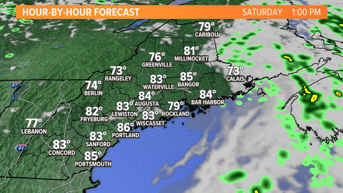
One positive change in the forecast is that the second batch of rain has sped up. That means we will clear out by 8 a.m. to 10 a.m. in most areas of Maine. After that, we've got a sneaky hot afternoon, with some spots spiking into the upper 80s.

Keith

