MAINE, USA — Rain continues to move through Maine. As of 6 p.m. Sunday, the heaviest showers are located in central Maine and are racing east to Bangor and the international border.
There could be a lull in the rain for western Maine in the late evening before a weak line of showers or thunderstorms moves through.
That line of showers or storms will mark the leading edge of the cold air. As the storm departs, winds shift to be out of the northwest to move colder air in. With that comes the threat of some stronger wind gusts.
Northwest winds will also force some light snow showers through the western mountains of Maine.

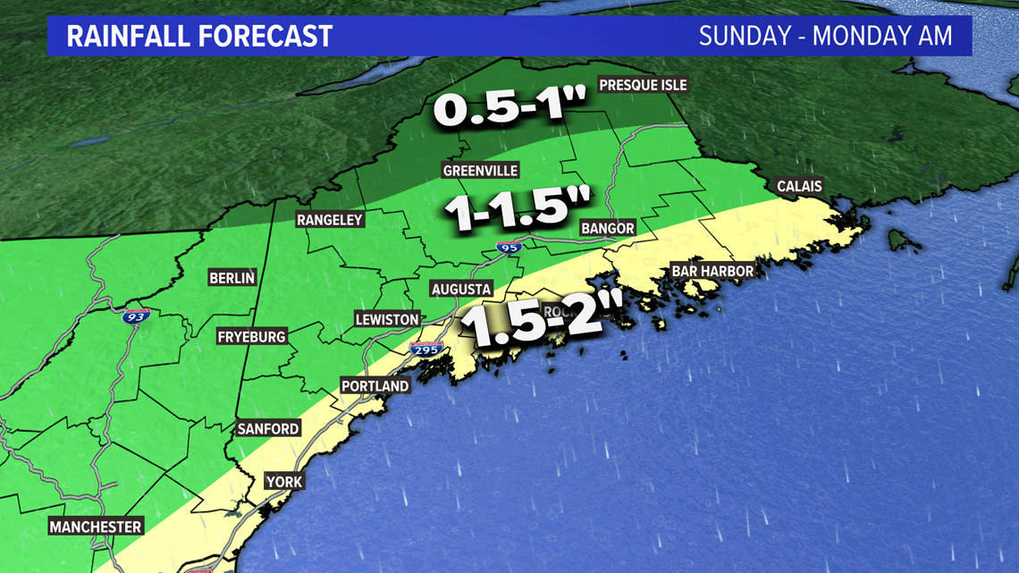
By the time all is said and done on Monday morning, most Mainers will see between one and two inches of rain.
There could be a couple of higher reports mixed in, especially along the coastline or southeast facing slopes.
The County ultimately sees a 2-4" of slushy, wet snow. Most of this will not make it through the day Monday.

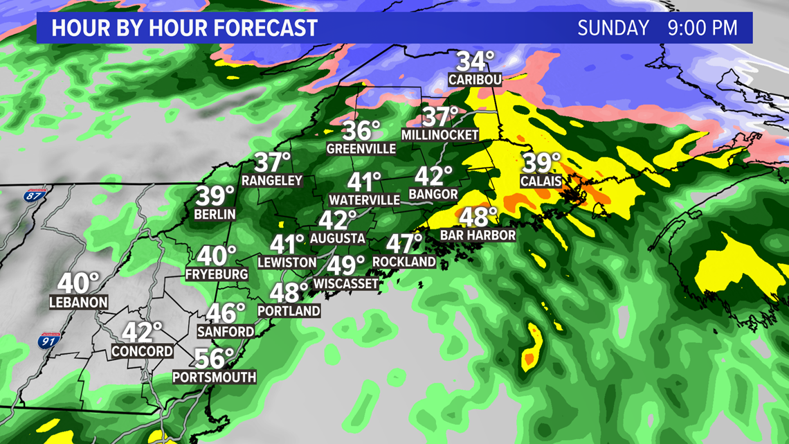
With the strong southerly and southeasterly wind, some of the heavy showers Downeast could bring wind gusts with them. A few outages are possible, I'll detail that below.

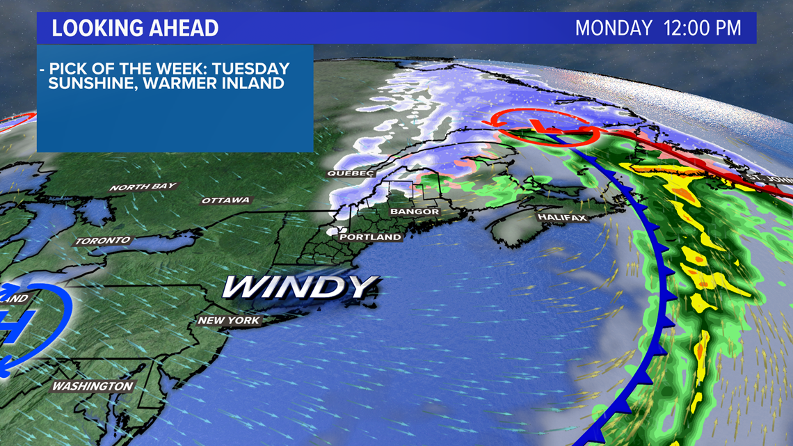
Colder air slides in on Monday. Since it is also drier, blue skies return with some sunshine.
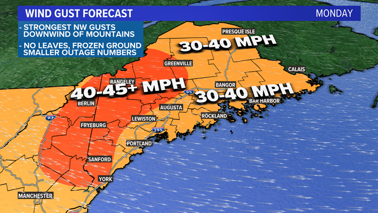
Wind gusts are going to pick up by sunrise, too, and will remain fairly high through the day.


The forecast favors gusts between 30-40 mph for most of Maine, including almost the entire coastline.
Higher elevations, parts of northern New Hampshire, and parts of southwestern Maine could see gusts as high as 50 mph.
Wind gusts will subside a bit on Monday evening before relaxing entirely by sunrise Tuesday.

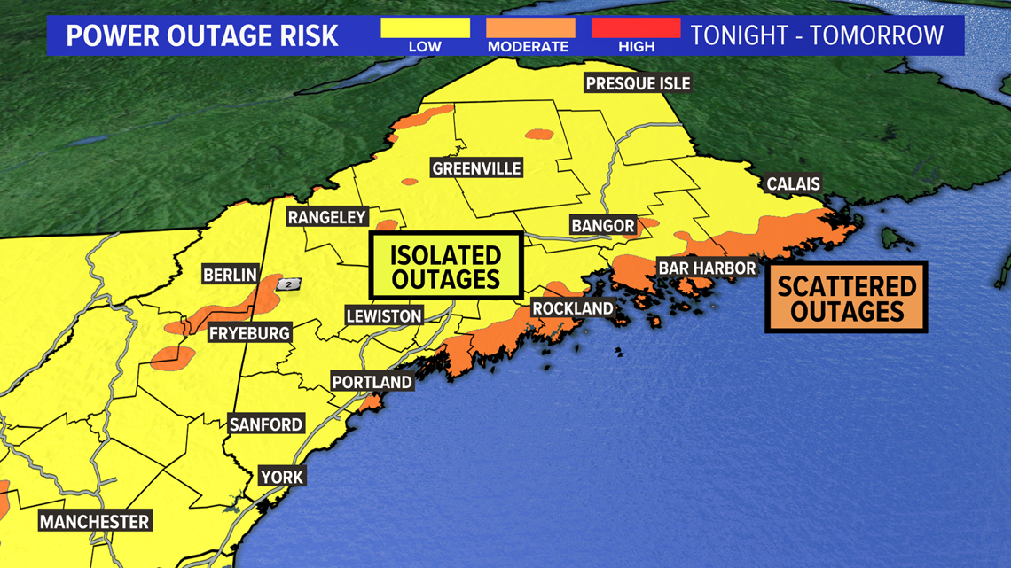
The area highlighted Downeast is mostly from the heavy showers on Sunday night. Scattered outages will be possible, due to the strength and direction of the wind gusts. Gusts could approach as high as 45 mph.
Elsewhere, isolated outages are expected on Monday. The best chance for outages will be in the high elevations down through southwestern Maine.

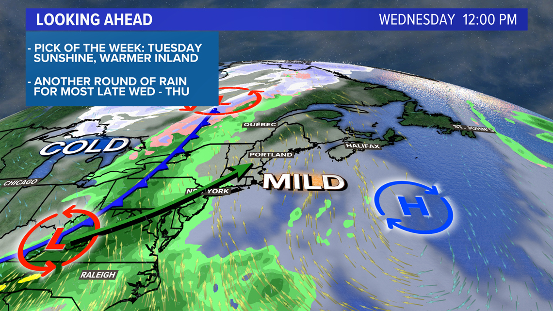
Another storm approaches Wednesday, strengthening as it moves in.
Current forecast favors: rain to start, mountain snow to end, more wind, and maybe some thunder.
More details on this one as we get closer...we'll take our week one storm at time.
For more, check out my Twitter, @MikeSliferWX.
RELATED: Heavy rain late today and tonight

