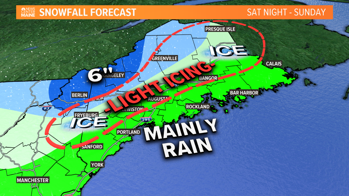
MAINE, Maine — For a moment back on Monday, the weekend storm was showing a solid snow thump. But that moment was brief, and since then, it's been getting warmer and warmer. Now, many of us will see just rain with snow and sleet confined to the foothills, mountains and far north.
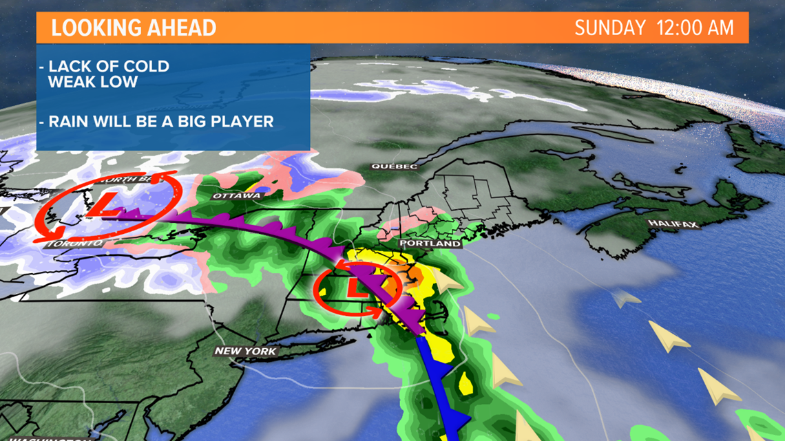
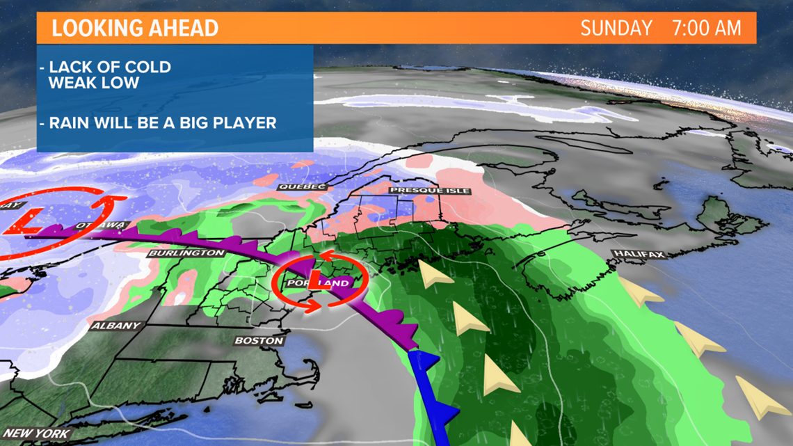
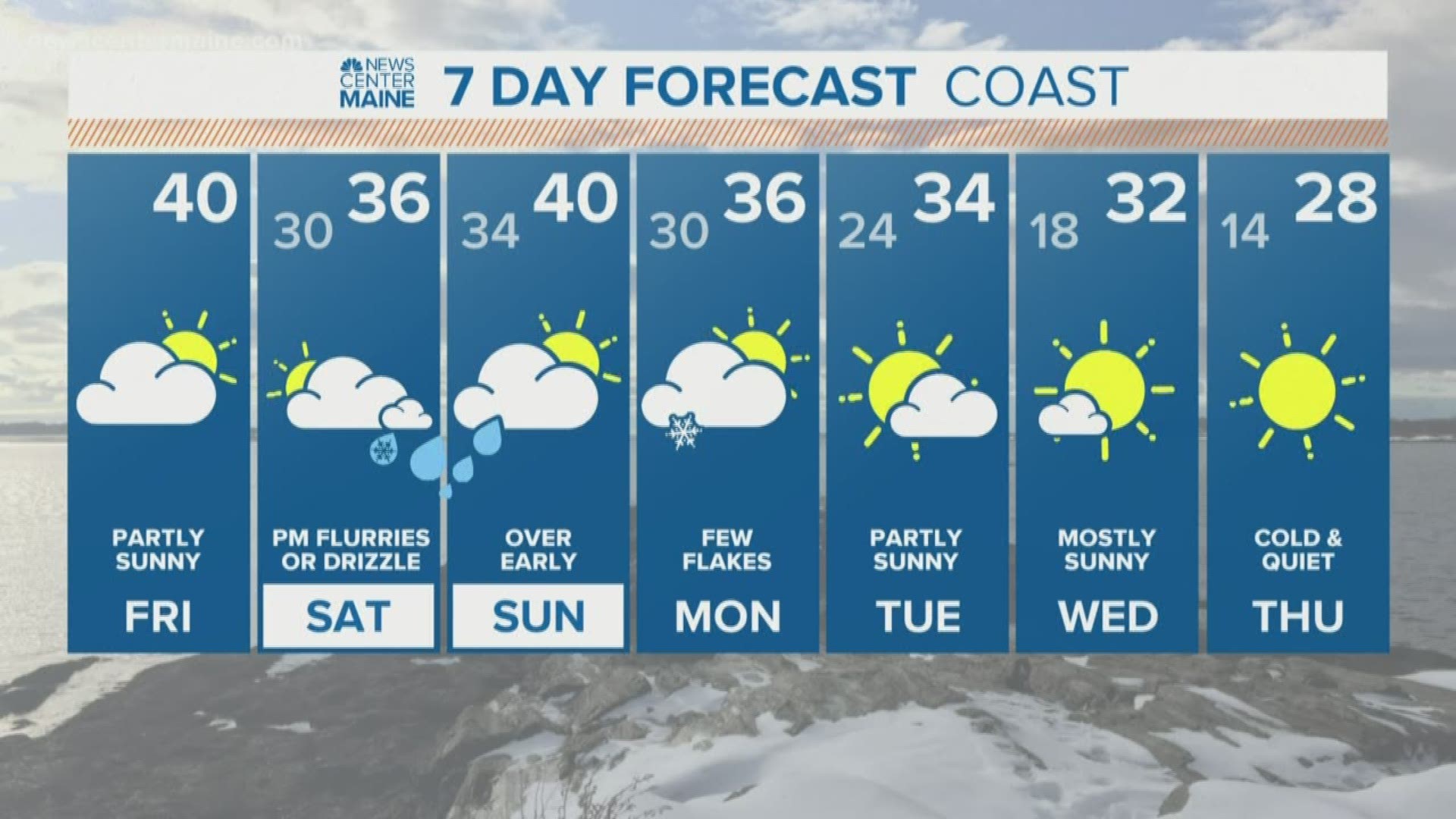
There may be a little drizzle or some flurries Saturday afternoon but the steadiest precipitation will hold off until around midnight. With temps above freezing at the surface and aloft rain will be the predominant precip type and it will fall heavy at times overnight. It won't last long. With only a weak surface low this is more of a glorified frontal passage. The rain will shutdown around dawn over Southern Maine and mid-morning for Eastern areas. There may even be a little sun in the afternoon.


Even the mountains have trended warmer and staying all snow seems unlikely. There will be some ice that mixes in after a few inches of snow. Anytime rain is in the forecast during the Winter months I get concerned for icing. Thin glazes are possible away from the coast all the way up through the mountains and far north. There won't be any power outages, but slippery stairs, sidewalks and handrails will be possible.


-Todd
RELATED: Tips to keep snowmobilers safe

