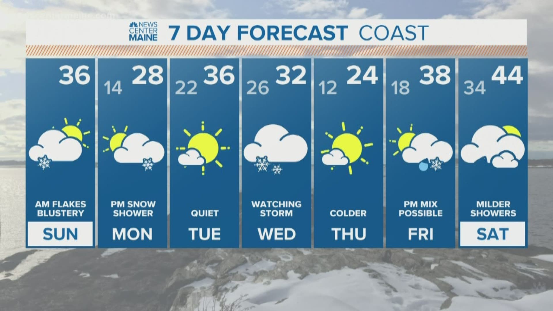
MAINE, USA — Snow is ending from west to east this morning. The coast of southern Maine saw very little accumulation, but most inland towns picked up an inch or two.
We've been talking about a potential storm for the middle of the week for a few days now. We know that a storm will likely form over the ocean, but how close it comes to Maine is still in question.
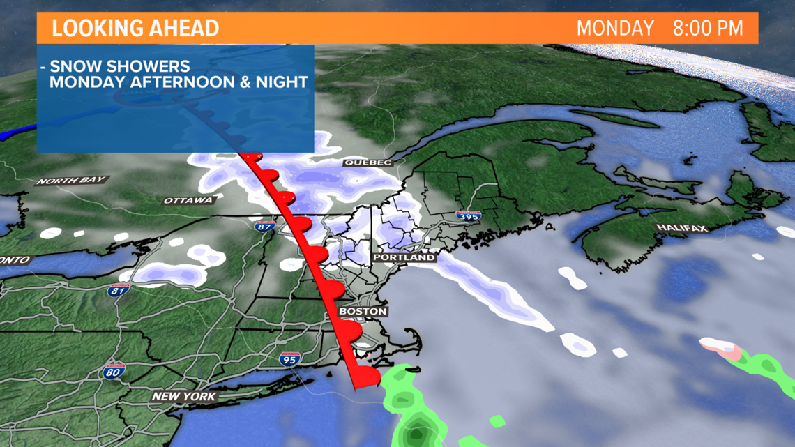
Before we get to Wednesday's snow, a warm front will bring some flakes to the state later Monday.
Monday starts with sun, but clouds will move in during the afternoon. Flurries and snow showers will cross through the state late Monday into early Tuesday. Little or no accumulation is expected. Impacts will be minimal as these are just scattered light showers that roll through.


On to the bigger storm threat:
Right now, a direct hit with statewide heavy snow does not seem as likely as it did a couple of days ago.
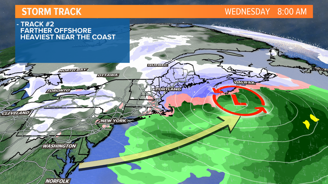
Computer models have backed off on quickly strengthening the storm in the Gulf of Maine. Instead, over the last day they've trended toward a bit of an offshore track.


But even still, some snow is expected on Wednesday. The highest amounts would favor southern and eastern Maine, with lighter snow back into the mountains and north.
Is this a true trend or models waffling back and forth? We probably need another 12-18 hours to say for sure. It's still possible future runs move the storm back toward the coast, which would bring heavier snow into play for more of the state. We can't write off that possibility just yet and that's why it's too soon for specific totals.
Mike did a nice job laying out the potential tracks and impacts here.
Stay with us for updates over the next few days.
RELATED: Weekend Mountain Report: 01-04-2020

