There aren't many layups when it comes to snowstorms in Maine.
There's always something that makes them a little bit challenging. We've been talking about this storm since last Thursday (which I'm sure I'll get no credit for. I'm not bitter. I'm just insecure). But the devil has always been in the details. In this case, the details are where EXACTLY is that rain/snow line.
Of course, most storms in Maine have some version of this rain/snow line issue, but this one is particularly high stakes because the line is basically right over Portland. (It's okay, not like anyone lives there or anything).
I took an early stab at the storm on Tuesday afternoon, and I leaned a little warm. There haven't been major changes, but between that map and the final map you see today, there was a lot of hand-wringing, sobbing, and listening to "Endless Love" in the dark.
Let's start with snowfall totals and work backward because I know you're gonna scroll right to the bottom and look for that map either way.
Kids these days... instant gratification.

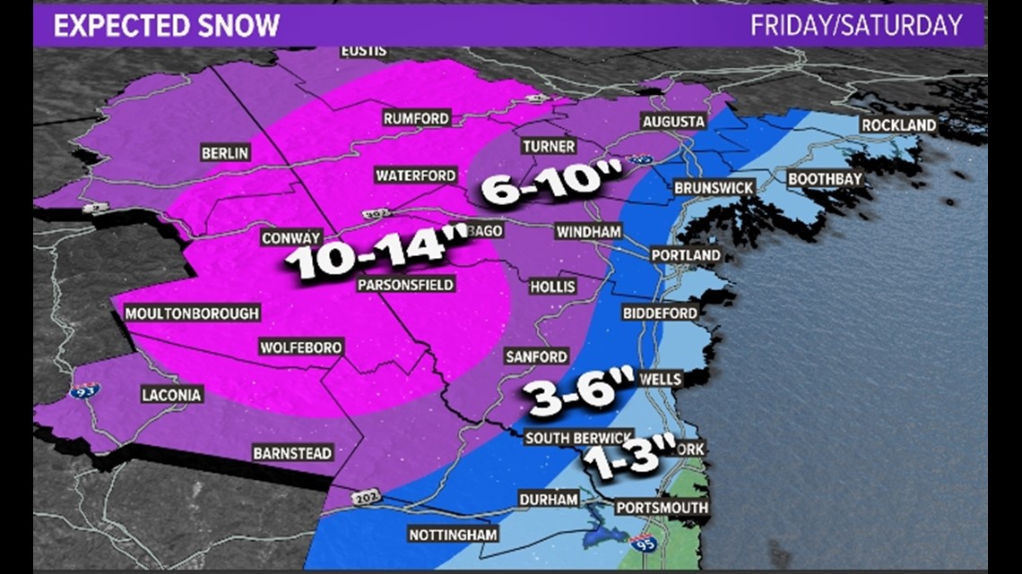

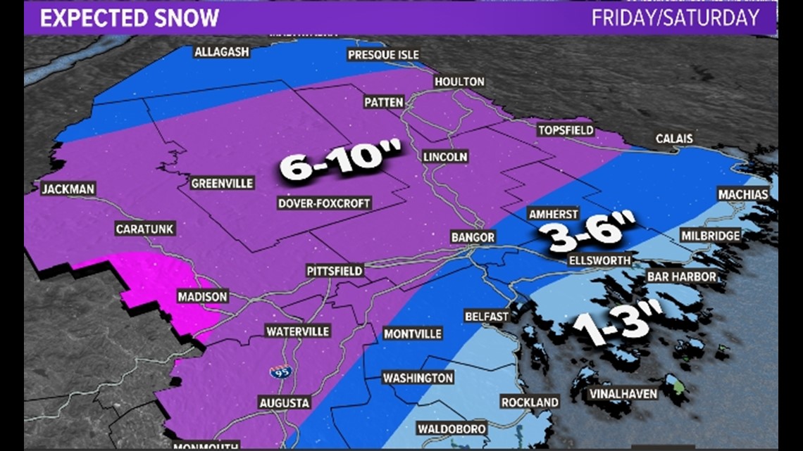

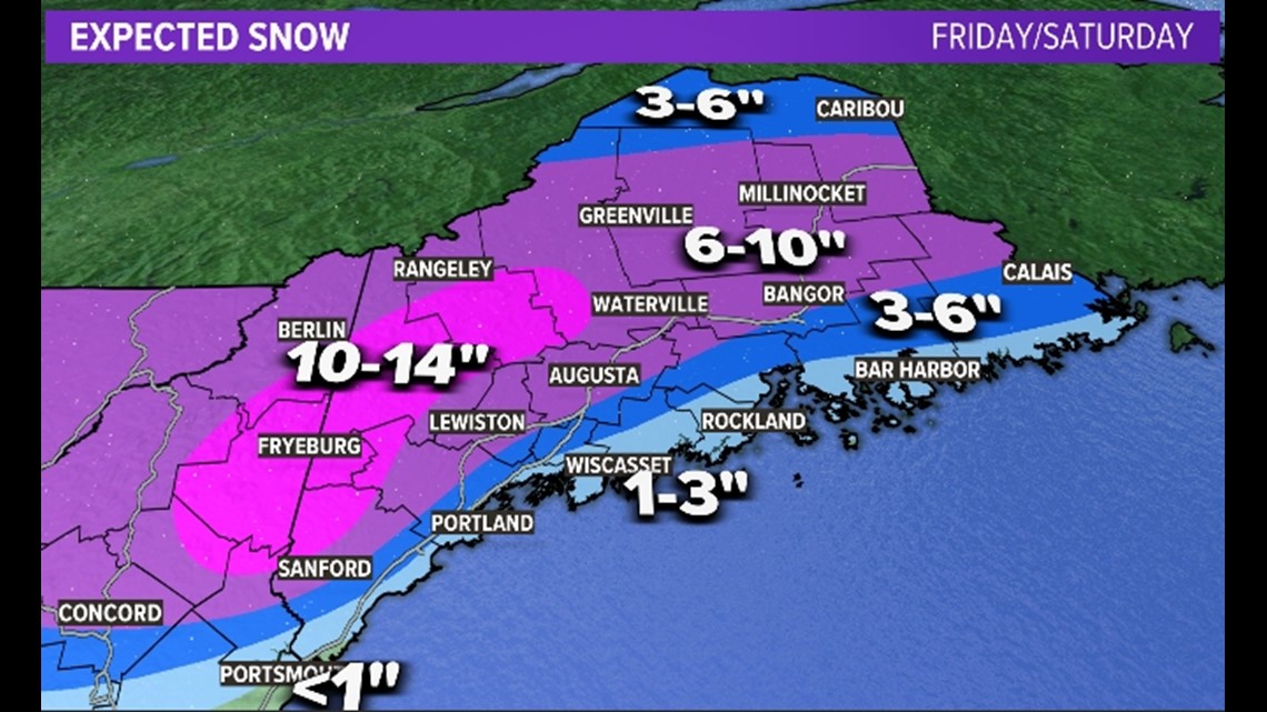
So that's the expected result. How do we get there? Well, pretty slowly, to be honest.
Late Thursday into very early Friday morning there isn't a whole lot of action. There's only light snow developing along the coastal front. The fact that the coastal front is setting up BEFORE the storm is a sign of how important this feature will be for the snowfall totals.

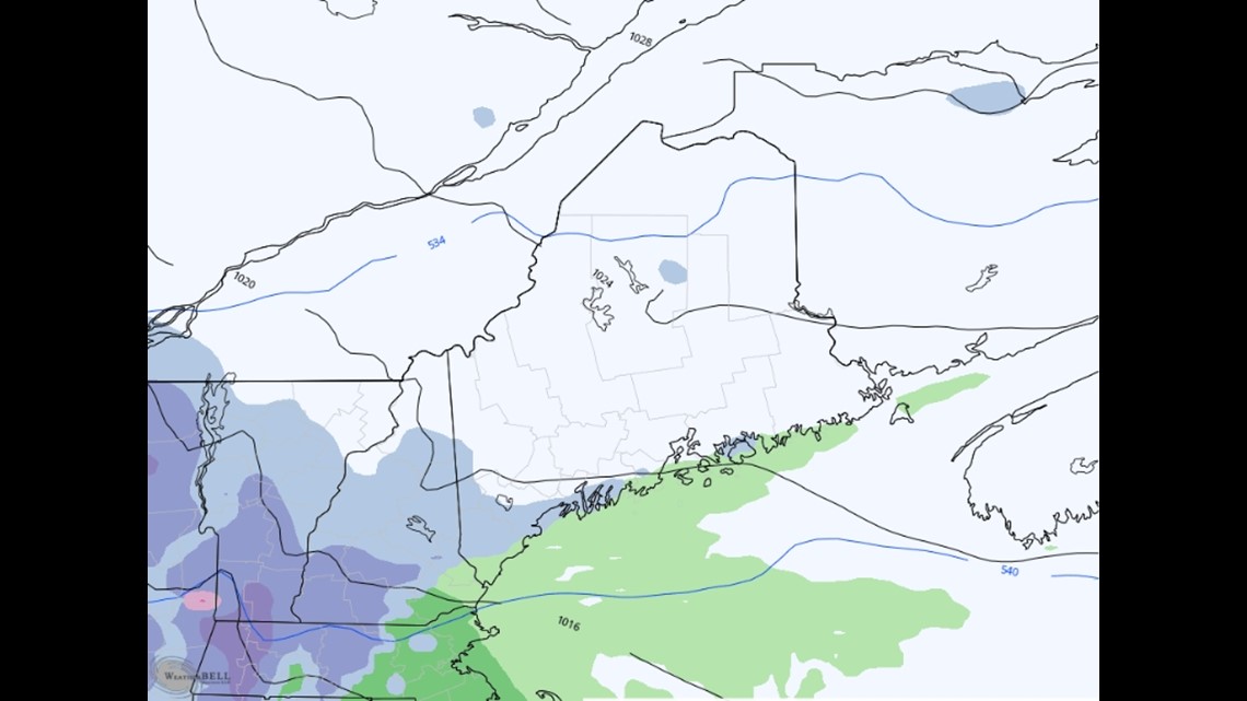
The system continues to approach on Friday morning, but it does so slowly. I want to be clear that as of 6-7 a.m. tomorrow there isn't a whole lot of heavy snow going on. (So do your homework!)

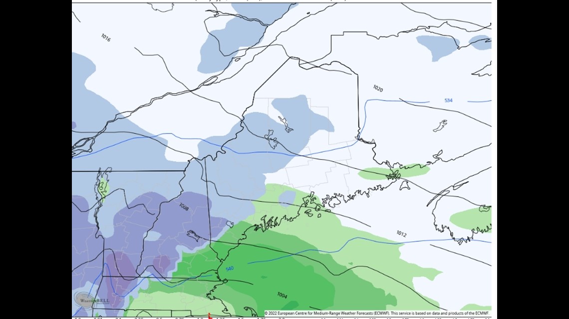
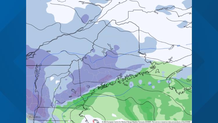
The above image is a projection of the storm at 4 p.m. on Friday. Notice snow is barely in Bangor. And the rain/snow line is an issue along the coast. It's worth noting the model I'm showing you is one of the warmest on this storm, but it's also the EURO and you know I love me some EURO.

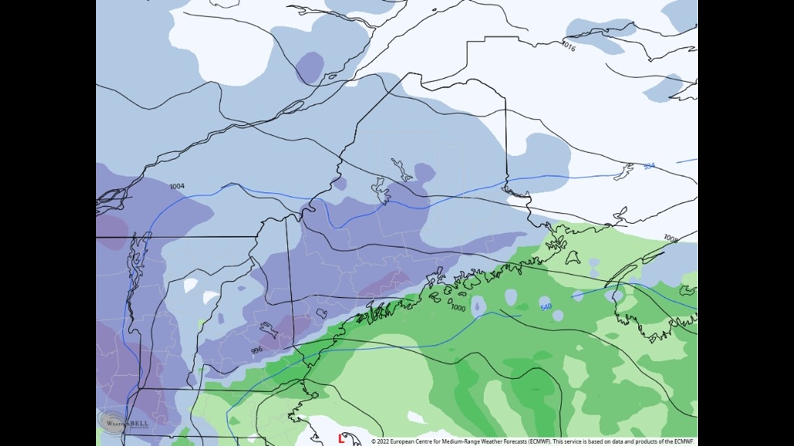
The snow keeps moving northeast, and the above map is 1 a.m. on Saturday morning. The storm is ripping pretty good inland with one or two-inches-an-hour snowfall rates. Notice the rain/snow line actually collapses back toward the coast. So, if you start as rain with this one, don't assume it's all over. Cold air will be draining in from the north.

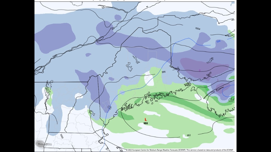
Snow falls at a pretty good clip through the first half of Saturday. By the afternoon, the storm gets vertically "stacked" and loses a lot of the dynamics. The result is a much lower snowfall rate and even some drizzle on the back end before this all wraps up on Saturday night.
Author's Notes:
- Places like Falmouth, Cumberland, and Portland are WILDLY close to being on the cold side of the coastal front and getting hammered with snow. But I'm using past experience, my favorite computer models, and analysis of the surface temperatures that seem borderline to me to keep totals in the one to three-inch range even though it might be scary.
- The snow will be an absolute paste close to the coastline and just inland and then transition to a more "normal" and drier snow in the foothills and mountains.
That's it. Carson out.
Follow Carson on Instagram here.


