MAINE, USA — A complex storm is moving in today. Here are the main points:
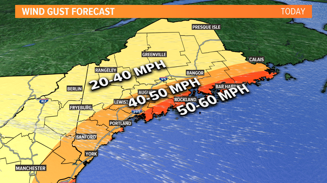
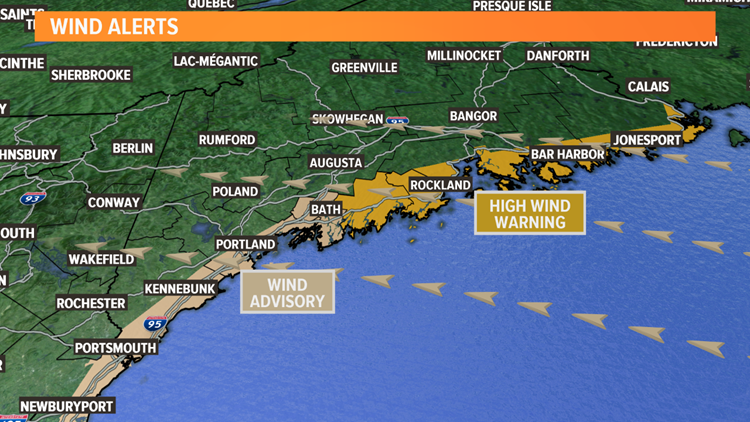
- Rain and wind is the issue for the coastal plain. 1" to 2" of rain is expected. Wind gusts of 40 to 60 MPH are expected, highest on the Midcoast and Downeast. Isolated to scattered outages are possible.
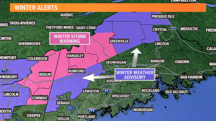
- Snow will be elevation-driven. Heavy, wet, pasty snow will accumulate more than a foot in the highest peaks, less in the valleys where some mixing with rain will occur.
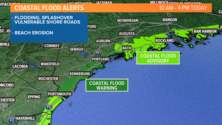
- Coastal flooding is a concern around high tide. Splashover will lead to flooding of vulnerable shore roads, any time between 10 a.m. and 4 p.m. Considerable beach erosion is expected from large, breaking waves. In Portland, city streets that often flood in East Bayside and on the wharfs will be inundated with water.
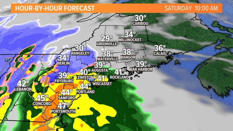
Rain is moving into southern Maine this morning. It will be cold enough in the foothills and mountains to begin as snow.
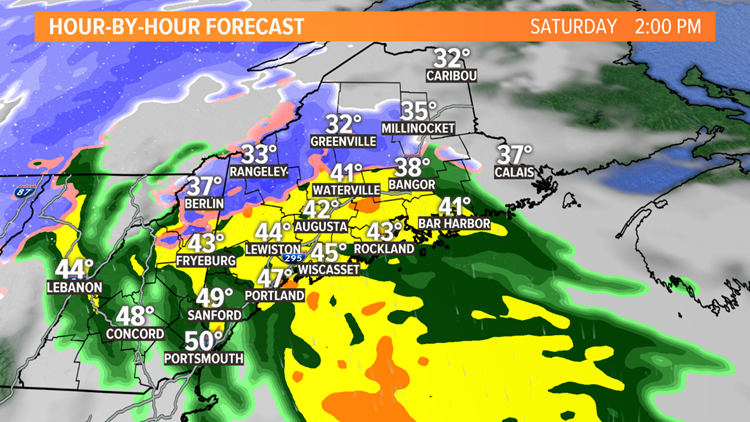
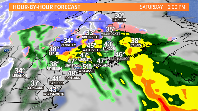
The rain/snow line will move north during the late morning and early afternoon, with snow becoming confined to the mountains along and north of Route 2 during the afternoon.
It will take until around noon for the precipitation to begin in the Waterville area, and until closer to 2 p.m. in Bangor. So, eastern and northern Maine will have the most dry hours today.
Saturday storm maps


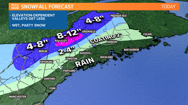

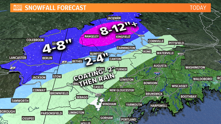

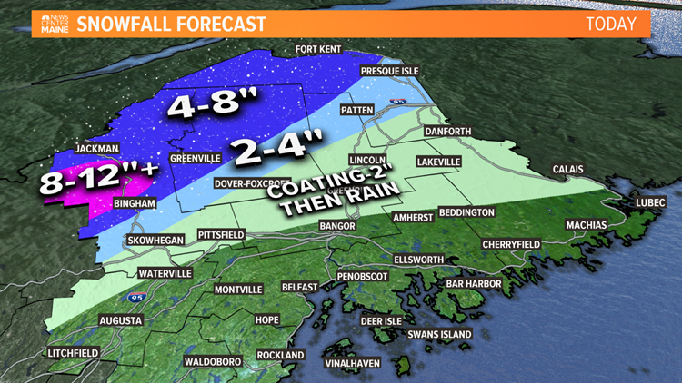
Snowfall amounts will increase quickly from the hills to the mountains.
A slushy coating to 2" of snow is possible this morning from northern York County into the Oxford Hills. That will become washed away by the rain late this morning and this afternoon.


Closer to Route 2, 2" to 4" of snow is expected in the lower elevations, while 4" to 8" of snow is expected along and north of Route 2, in the higher terrain.
Places like Saddleback and Sugarloaf should be among the jackpots, with 8" to 12" of snow expected. More than a foot will accumulate in the highest elevations.
Power outages are a concern on the coastal plain, and also in some of the higher terrain locations that see several inches of heavy, wet snow.
The strongest wind gusts will be from late morning into the afternoon at the coast. The peak gusts, over 50 MPH, are most likely in the Midcoast counties and along the Downeast coast.