PORTLAND, Maine — They say "comparison is the thief of joy"—but it's also human nature. Like, I think I'm pretty good-looking until I have to shoot a promo standing next to Todd "Dorian Gray" Gutner. But I digress.
My point is this stretch of unsettled weather wouldn't seem that unusual if it weren't for the seemingly constant string of hot, dry weather we've had so far during Summer 2024. It's been all right so far.
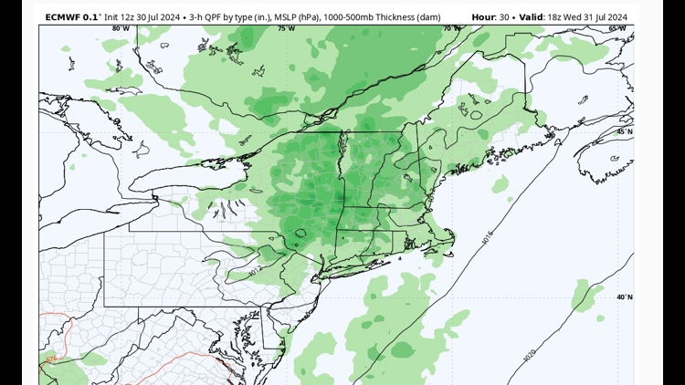
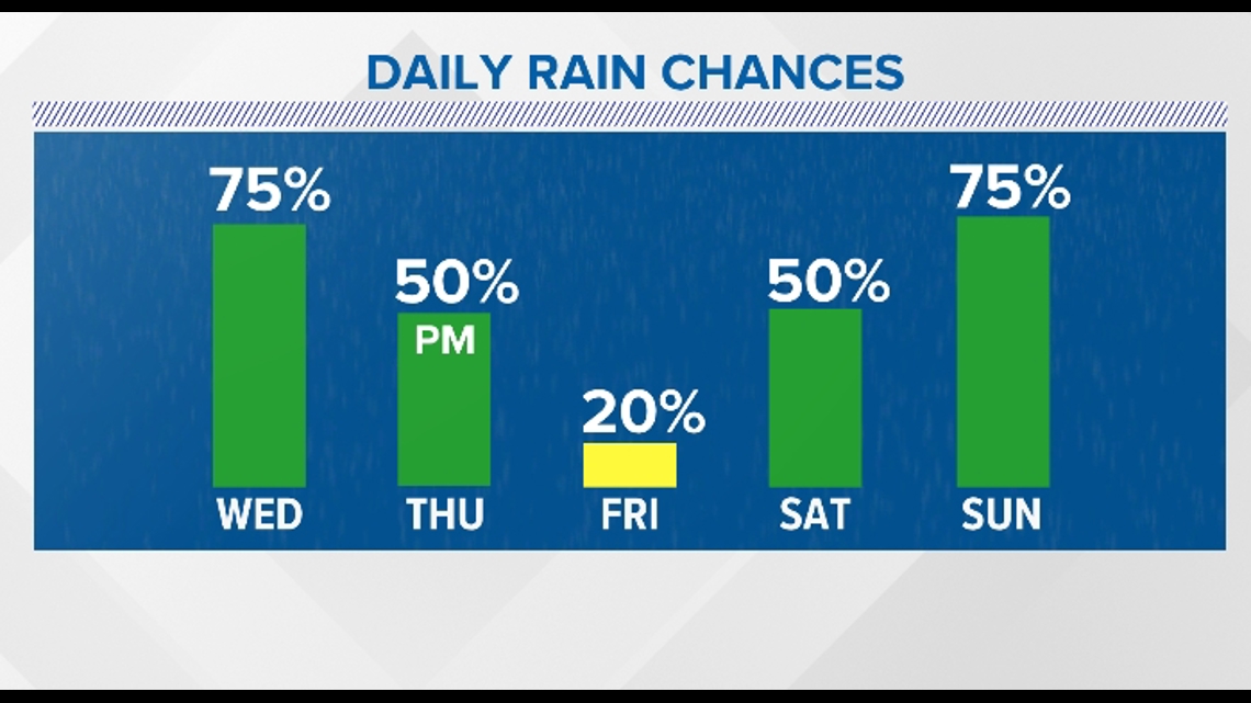
However, our pattern has at least temporarily shifted into one in which several troughs lift through Maine. Those troughs provide the focus for more shower and thunderstorm activity than there would be on a typical summer day. That means Wednesday, Thursday, Saturday, and Sunday ALL have shower chances. But each day is not created equal in that regard.
Wednesday: Of the next few days, this looks like the most unsettled. There's a pretty robust little shortwave moving through.
That means we aren't likely to see much sun on Wednesday and the shower activity will pick up through the late morning and last through much of the afternoon.

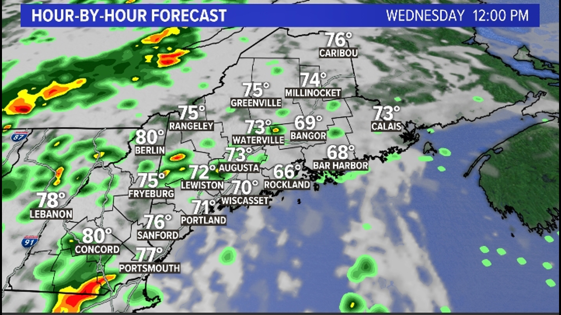

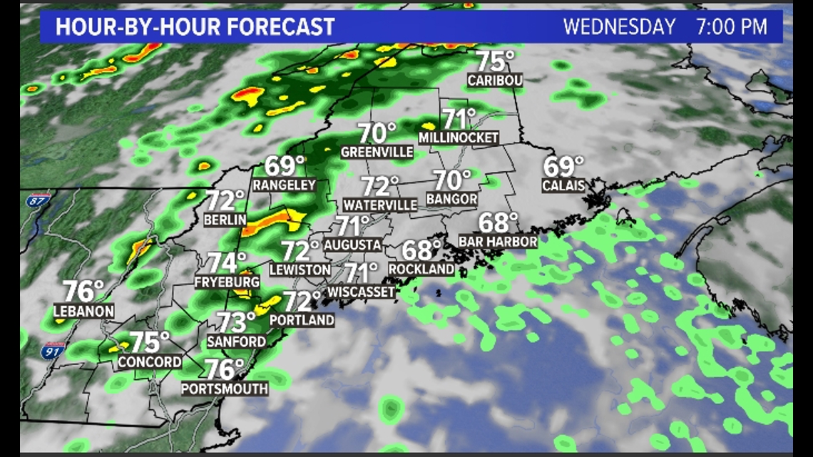
Some of the showers and storms could have really heavy downpours since the atmosphere is pretty juiced. An isolated severe storm can't be ruled out.
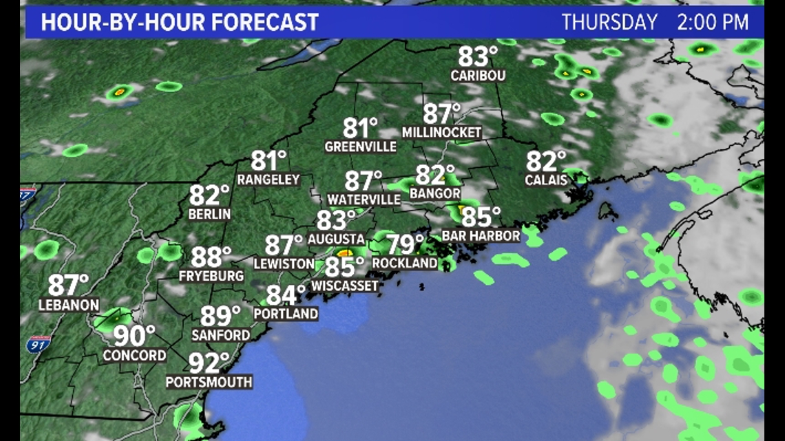
Thursday: I think we do a bit better on Thursday with more breaks of sunshine, especially through the mid-morning and into the early afternoon.

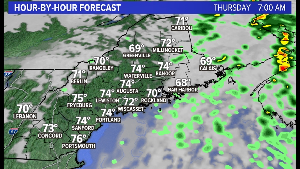
There will still be enough instability in the atmosphere for some pop-up storms on Thursday afternoon, but the coverage doesn't look too intense. These breaks of sun will also allow temperatures to push into the mid- and upper 80s all the while the dew point will be oppressively high.

Friday is likely the only day of this stretch that almost everywhere stays dry. Sunshine should be pretty abundant and temperatures will respond.
Shower chances continue through the weekend, with Saturday looking like the better of the two weekend days to me right now.
If all these words aren't your thing, here's a helpful graph I made using 1998 Microsoft Paint:

Have yourself a lovely day.
- Keith Carson


