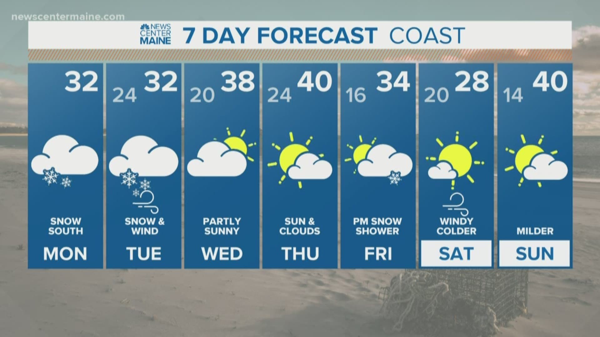
MAINE, Maine — It's no secret, this has been one pain in the rear storm to pin down. Multiple phases and rounds have complicated the forecast landscape but we're finally starting to get some clarity.
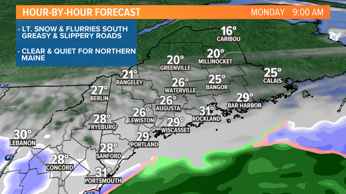
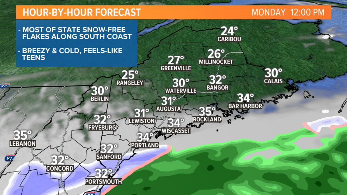
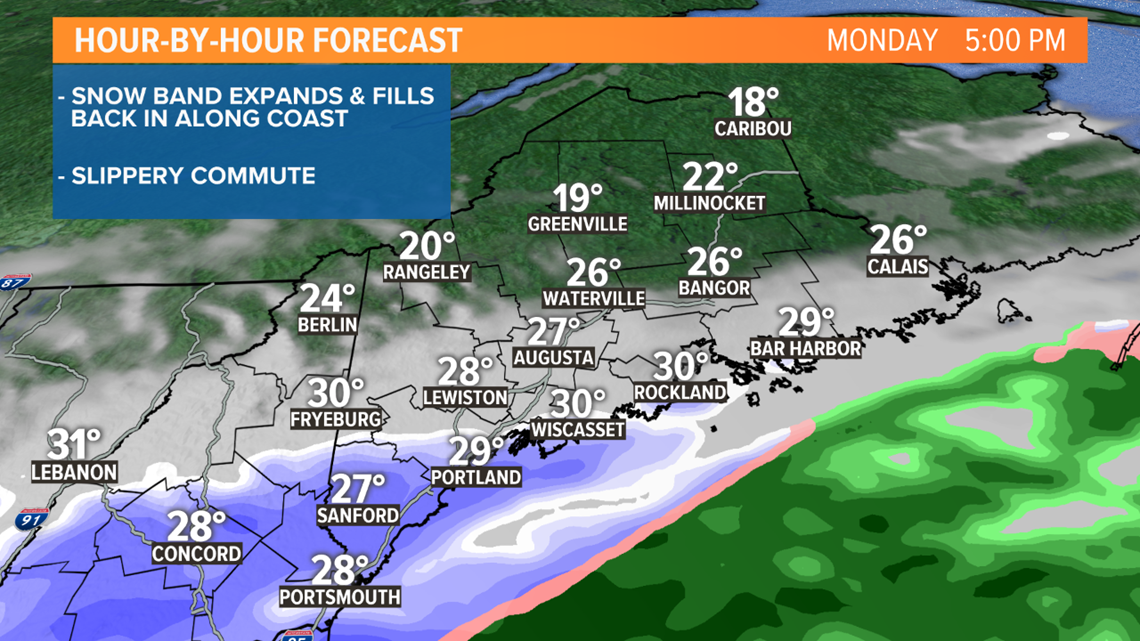
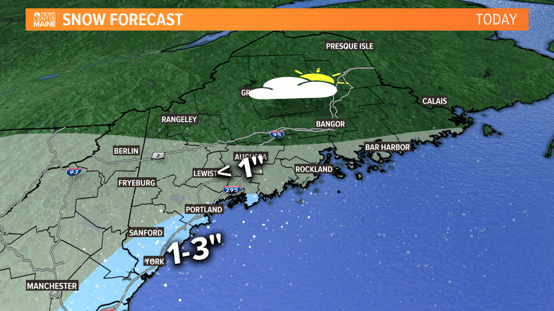
Last night, steady snow fell over Southern Maine. Most communities picked up an inch or or so, but parts of York County saw over 6 inches. That first wave of snow was caused by overrunning, warm air surging over the cold continental dome. This forcing is greatest to our south, and will remain there for the majority of the day. In fact, I don't see much more snow falling in Maine today, most of the state will be snow-free.
Here is a timeline for today and how much snow to expect now through sundown:
Morning Timeline:

Midday Timeline:

Evening Timeline:

Monday Snow Forecast:

The second phase of the storm looks to be the biggest. Low pressure to our south will move north into the Gulf of Maine and intensify into a sizable Nor'easter late tonight and tomorrow. Snow will rotate west and get thrown back into the State. The atmosphere will get stretched and pulled and a deformation band will set-up with snow rates around or over 1"/hr. Where it aligns will be critical but it appears most of Maine will get in on some of those heavy snow rates for at least a couple of hours Tuesday morning.

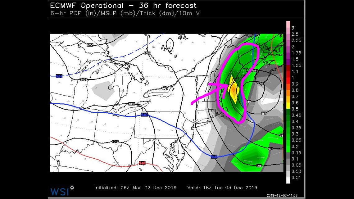
This is when we get the majority of our snow and travel will be very difficult. Wind will complicate things too, lots of blowing and drifting.
The storm will pull away early in the afternoon and the snow will taper to scattered snow showers and flurries.

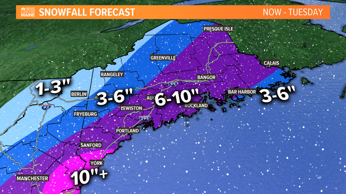
A big swath of 6-10" is expected and it includes Portland, Lewiston, Augusta, Bangor and Presque Isle. The Downeast Coast may mix a little, holding amounts down a bit. There will be a sharp gradient to the northwest and amounts will drop off quickly through the western Maine mountains and parts of northern New Hampshire.
We will be following the track of this very closely through the day. Make sure to check back for any adjustments or updates.
-Todd

