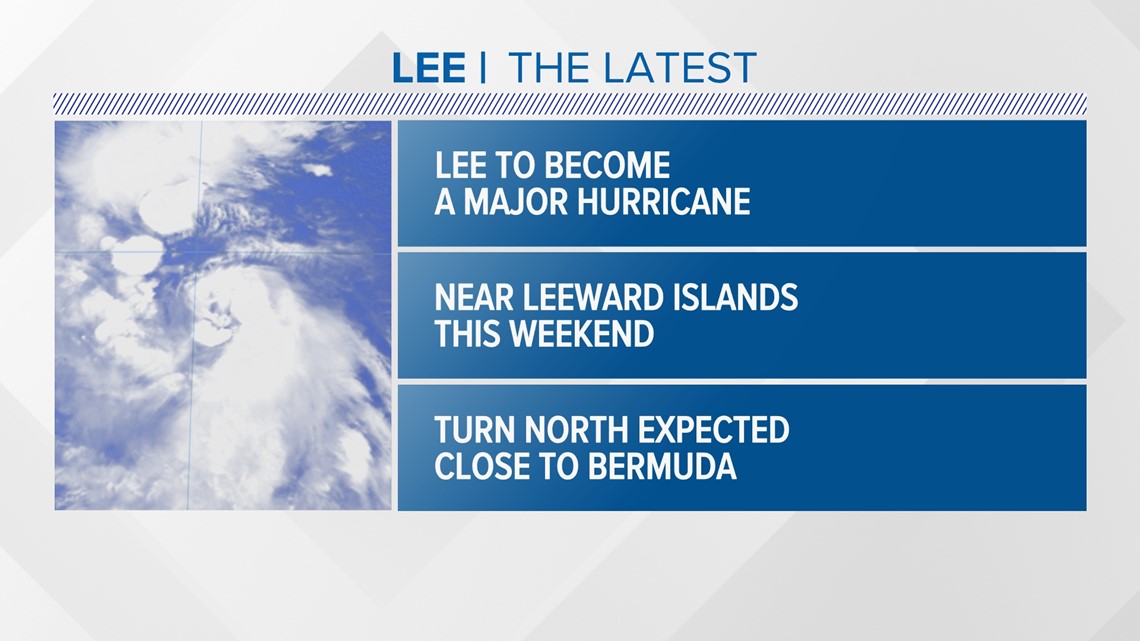
PORTLAND, Maine — The National Hurricane Center in Miami is forecasting “Lee” to become a hurricane Wednesday as it moves westward towards the Leeward Islands.
The hurricane is expected to rapidly intensify in the warm, open waters of the Atlantic Ocean, classified as the MDR or Main Development Region for tropical systems.
Over the weekend, it will be south of Bermuda as a category 4 out of 5 major hurricane. A turn to the north is forecast next week, which would keep the entire East Coast of the United States on guard.
Let’s discuss the latest probability of an East Coast strike. It’s like trying to predict what you will have for dinner next weekend. There are a lot of variables and scenarios.

It’s peak hurricane season in the Atlantic Basin and everyone on the East Coast should have a hurricane plan in place, even Mainers. Even though it’s been a very long time since we’ve seen a hit from a tropical system, it does happen once in a while, and we should all be prepared every season.

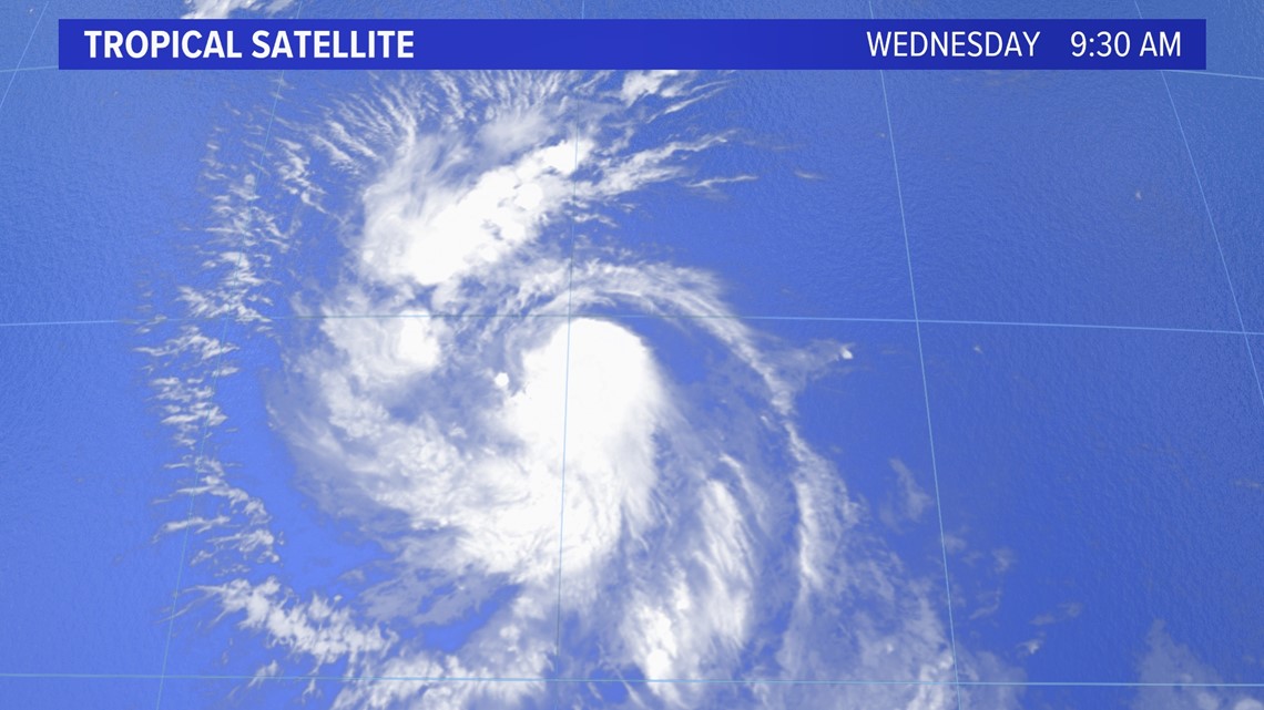
The latest tropical satellite shows Tropical Storm Lee a few hundred miles east of the Leeward Islands.

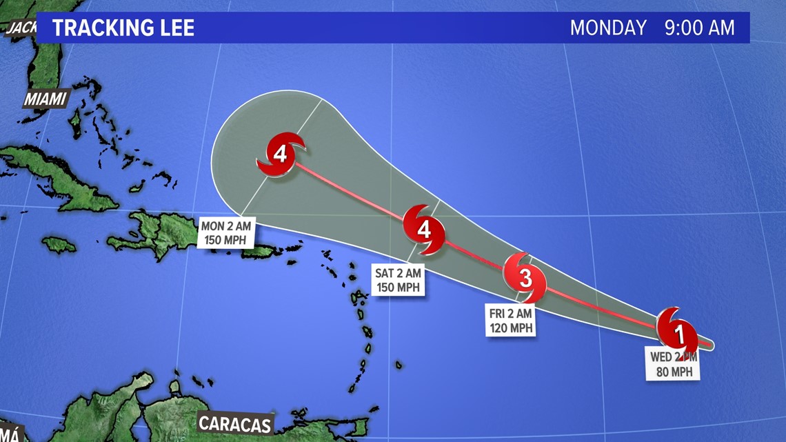
The National Hurricane Center's official track shows at least a category 4 storm moving north of the leeward islands and south of Bermuda late into the weekend and early next week.

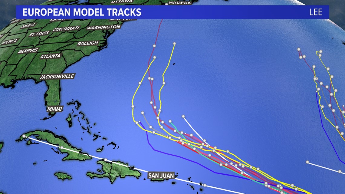
Taking a look at the computer model scenarios, Lee will turn north early next week and either hit Bermuda directly or move just to the west of the island.
At this point several scenarios come into play with the storm.
It could hit the East Coast near the Carolinas or move up to a more likely scenario of the Cape Cod area by the end of next week.

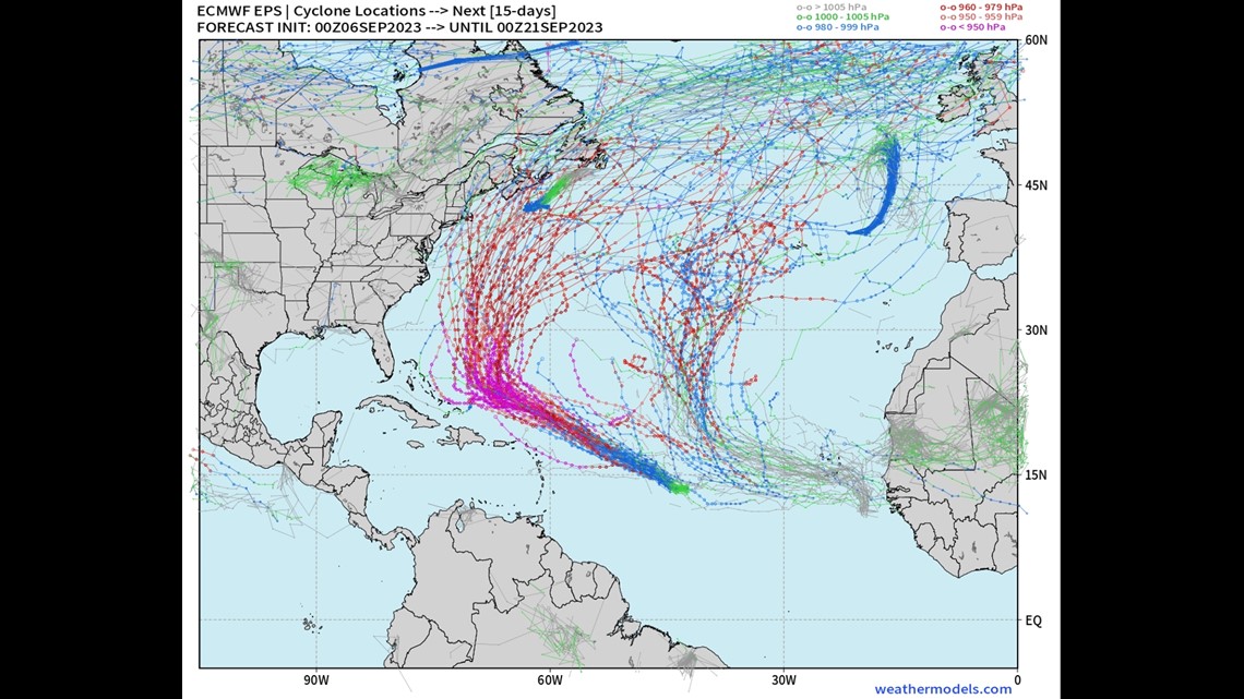
The forecast hinges on the steering currents around Lee next week. Will a trough of low-pressure scoop Lee up and pull it north or kick it out to sea? Will high pressure build in from the northeast and steer Lee into Cape Cod, Maine, or Nova Scotia? Think of it like planning a meal several days out ... How much money will you have to spend? What will be available at the grocery store that day? A lot can and will change before that day gets here.
I’ll be tracking the storm for several days so be sure to check back frequently and follow my social media for the latest.


