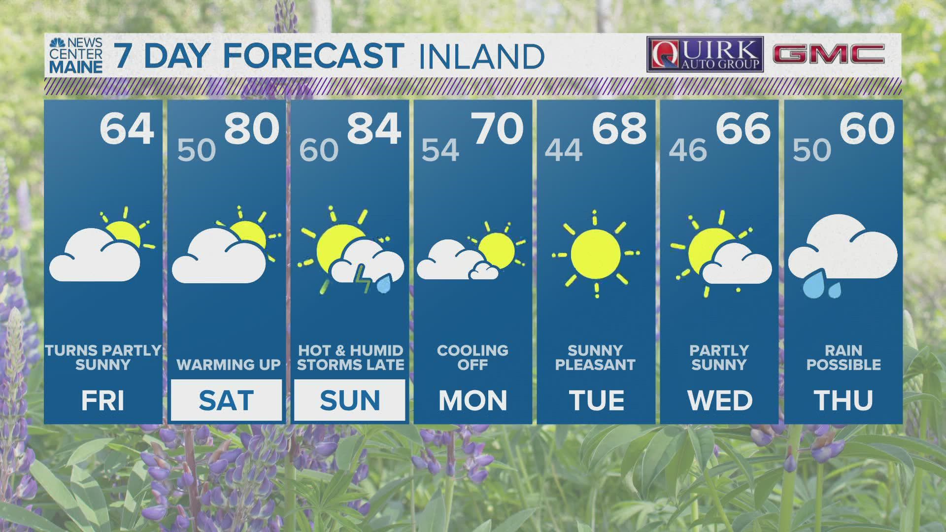
MAINE, USA — There's a threat of severe thunderstorms in Maine on Saturday and Sunday.

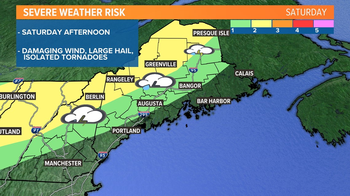
The risk for Saturday is a level 1 out of 5 (1 being the lowest, 5 being the highest) from interstate 95 down through Bangor and into Augusta, including the southwest interior.
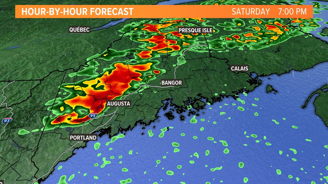
A level 2 out of 5 has just been added from Presque Isle down through Greenville and Rangeley. As a cold front advances into the Great Lakes, scattered showers and thunderstorms will develop and move into the northeast. A line of potentially severe thunderstorms will move into western Maine during the afternoon. Some of those storms have the potential to become severe.
Damaging wind and large hail are the primary threats if the storms hold together as they move east. A tornado cannot be ruled out, especially out ahead of the line of thunderstorms, but also watch for embedded supercells in the main line.

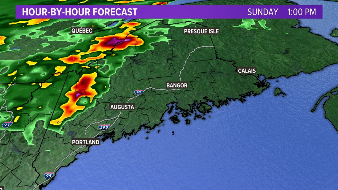
On Sunday, clusters of thunderstorms with line segments will push into western, northern, central, and southern Maine. The end of the weekend will bring a greater threat of severe weather, with a level 2 out of 5 from Greenville to Rangeley down to Rumford, Sebago, and Shapleigh. A level 1 out of 5 risk exists west of Presque Isle down to Skowhegan, Augusta, Portland, and York.

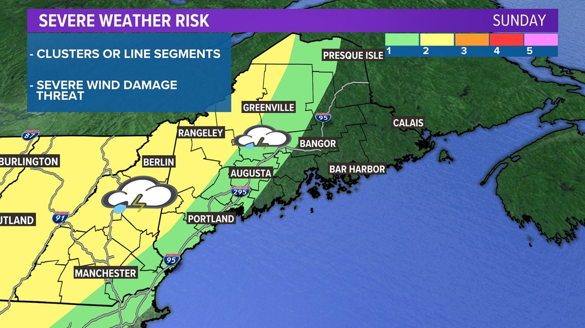
Look for a severe wind damage threat as the cold front advances from the west throughout the afternoon hours.

NEWS CENTER Maine's meteorologists will have updates with the latest details all weekend long, so keep checking back in on our website, app, and social media pages.

