MAINE, USA — SUNDAY MORNING UPDATE: Most Mainers received a coating of light fluffy snow.
The snow should pull out of central Maine by 9 Sunday morning. Eastern and Northern Maine should see snow through mid morning.
ORIGINAL BLOG
This winter has featured a lot of unique systems...we've had mixing concerns with almost every storm, localized high snowfall totals with short distances to areas that saw no snow and have mostly kept the bitter cold away.
Tonight's winter storm is not one of these weird events. Finally. Let's talk about why:
- The placement of the low favors almost exclusively snow for Maine.
- All Mainers get some accumulation from this one.
- Bitter cold will follow this system with Arctic high pressure and some sunshine.
Expect snow showers to increase Saturday evening with steadier, heavier snow overnight into Sunday.

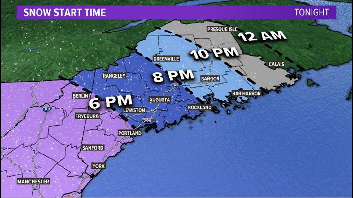
Timing for this event is a progression from west to east. Southwestern Maine sees the first flakes. It will be in Lewiston around 7 p.m., Augusta by 8 p.m., and Bangor around 9 or 10 p.m. The last spots to see snow will be far eastern and northern Maine. Presque Isle and Calais will end up with flakes around midnight.
The storm progression is pretty quick. Southwestern Maine clears out flakes pretty quickly. Kittery sees snow wrap up around sunrise. Portland clears out the snow by 8 a.m. and Augusta will be done by noon.

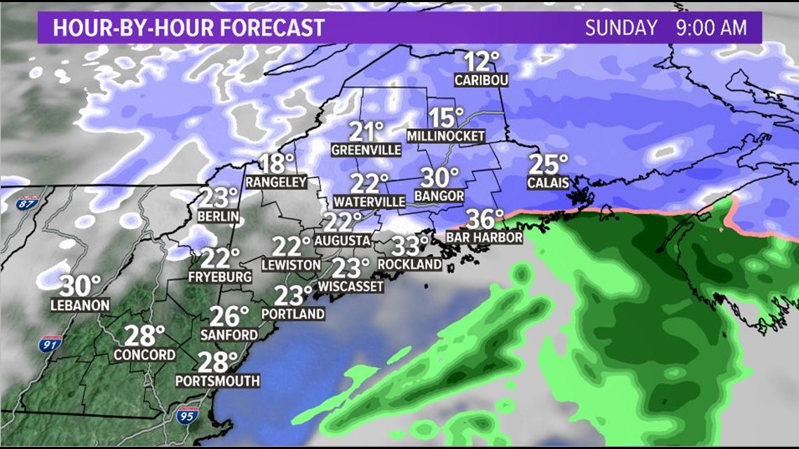
The last spots to see snow will be far eastern Maine and the County. Snow showers linger into the late afternoon Sunday before wrapping up entirely.
Most of Maine will be in the 5-9" range. Since there is a small chance for just a little bit of mixing along the coastline, expect totals to be closer to 5" right on the water. Northern Maine also misses out on some of the heavier snow bands, so that will result in some lower snow amounts.

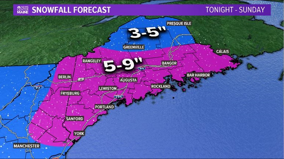
The snow will be just about done Sunday night. A handful of snow showers could roll through on the backside of the system, but it will not add much to the forecast totals and will be light, fluffy snow as the system exits.

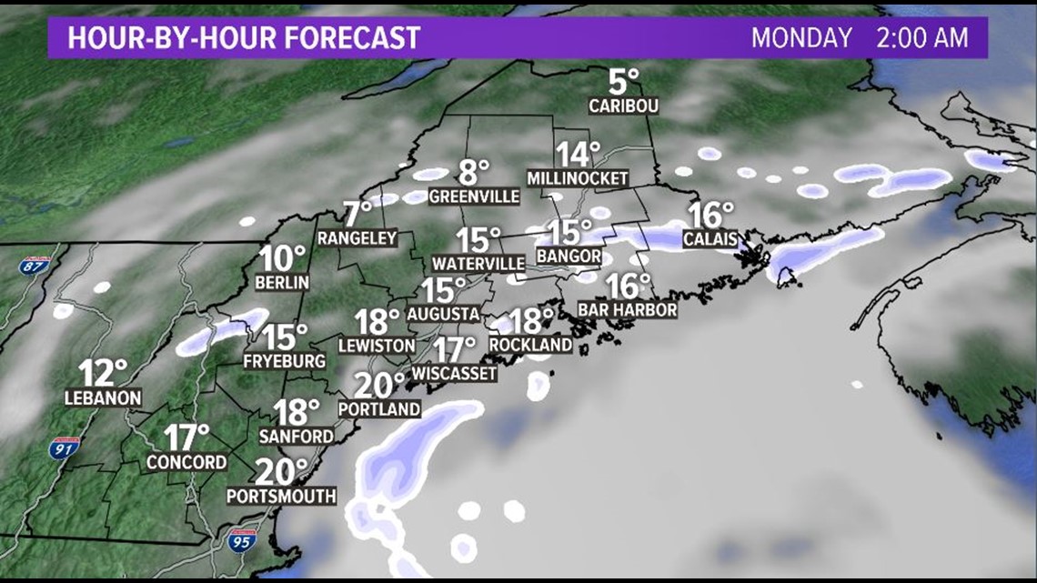
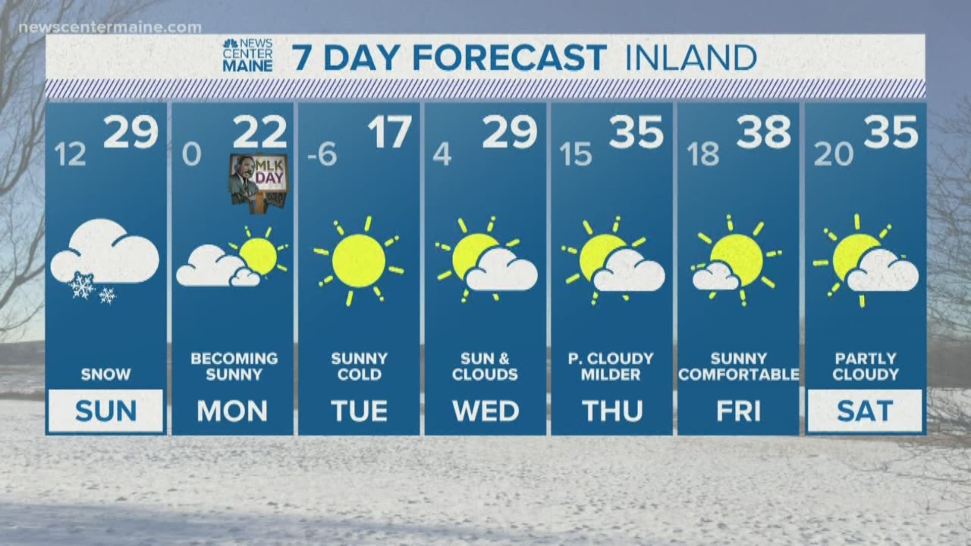
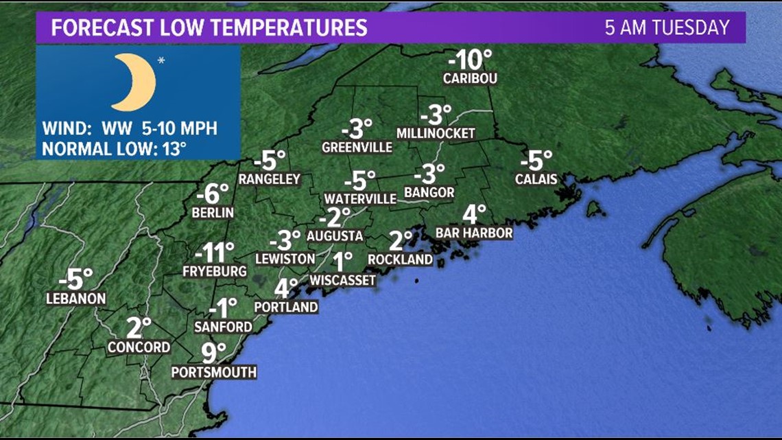
After this, it gets cold. Like, really really cold. Tuesday morning will be the coldest morning for most Mainers so far this cold season; lows will be below 0 inland and in the low single digits at the coastline.

Beyond this, we actually look to warm back up. The pattern definitely favors a bit of warmth come Thursday and Friday. The long range forecast looks quieter, too. We'll see just how long we keep it quiet, though....we've still got about 2 and a half months left of winter.

