PORTLAND, Maine — NEWS CENTER Maine's weather team is tracking a storm that could impact Thanksgiving travel plans. We'll be updating this story throughout the week with details from the latest models so you can be prepared for whatever the weather brings.
Setup (and airing of grievances)
On Monday, we were in the difficult position whether to make a call: Would there even BE a storm for Thanksgiving at all?
The EURO model had it, but literally every other model said, "Meh, there's nothing to worry about." We decided to side with the EURO. (It was a gutsy call that I'm sure will go unnoticed and uncelebrated. I'm not bitter—it's fine.) That turned out to be the right decision.
Now all major models are onboard, as a strong, impactful storm will be ramping up throughout the day and into the evening on Thanksgiving.
Here's what the storm looks like, as of Wednesday afternoon.

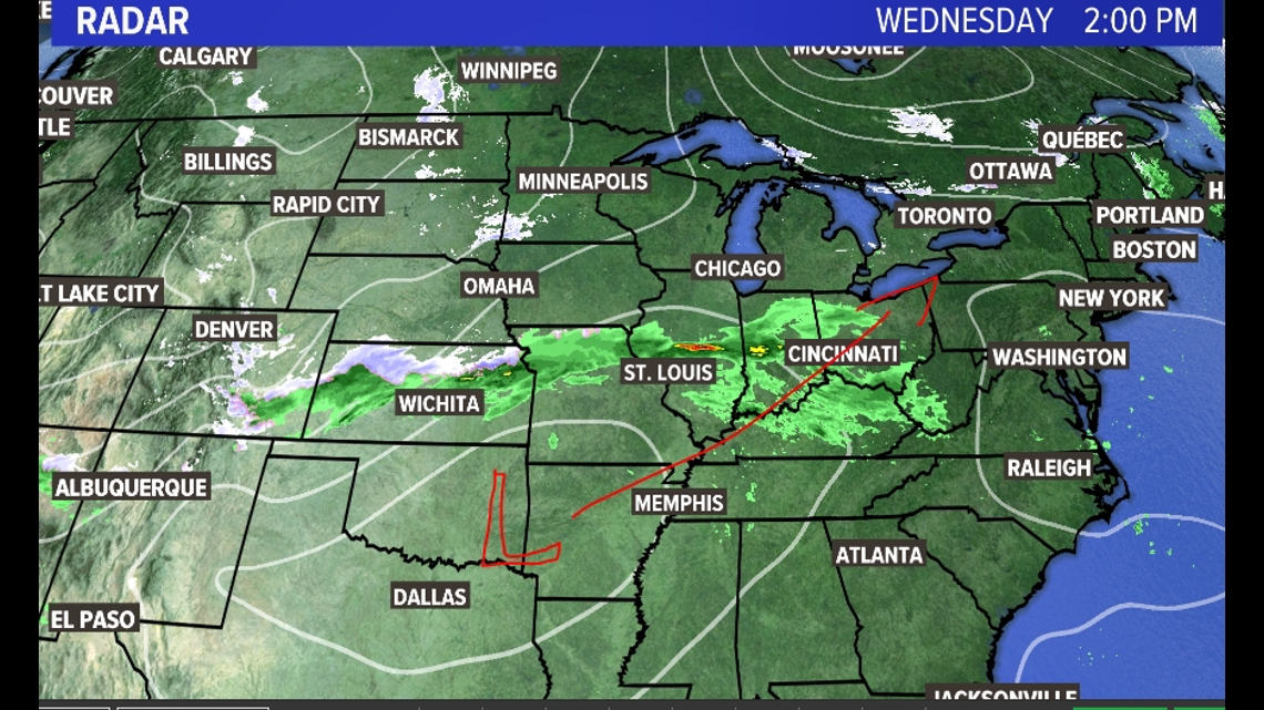
The low-pressure system sitting in eastern Oklahoma, and as of Wednesday afternoon, it's not particularly impressive. But as it moves Northeast over the next 12 hours, it will rapidly intensify, crossing over the Mid-Atlantic and into the Gulf of Maine.
(Y'all are really gonna let me get away with my Microsoft Paint "L" drawn on there like I'm a 12-year-old doing the weather from his parents' basement? OK, OK. It IS the holiday season, I guess.)
The large-scale details are well agreed upon by the models, and they make good sense to me meteorologically. Now it's down to the timing and exact amounts.
Timing
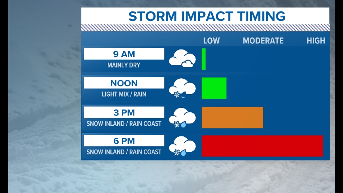
There's nothing to worry about early in the day. The skies will be cloudy, and there will be a few rain and snow showers around southwestern Maine. But that's about it.

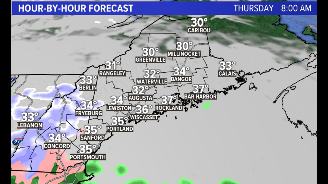
Rain is expected to begin midday along the coastline, with a mixture of rain and snow inland. At this point, however, I think travel will still be mostly fine, unless your Thanksgiving dinner is held on the top of a mountain.
The fact that it's still daytime should make accumulation on the roads inefficient at the very least and nearly impossible closer to the coast.

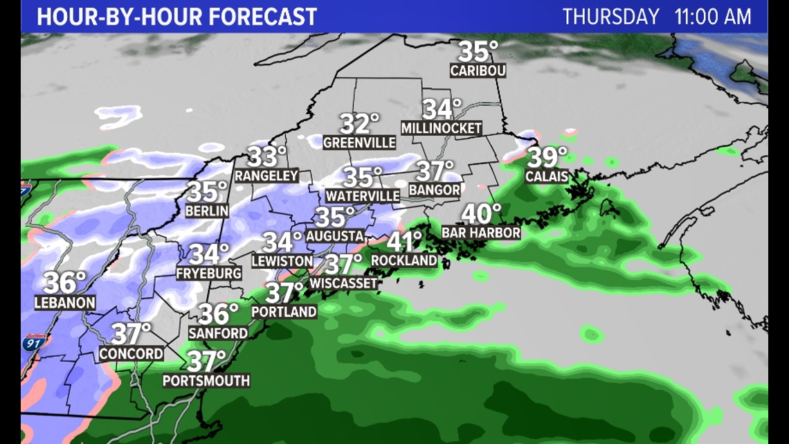
The rain intensifies along the coast by the afternoon. The snowfall rates will pick up inland and into the mountains. Still, I think travel is doable at this point.

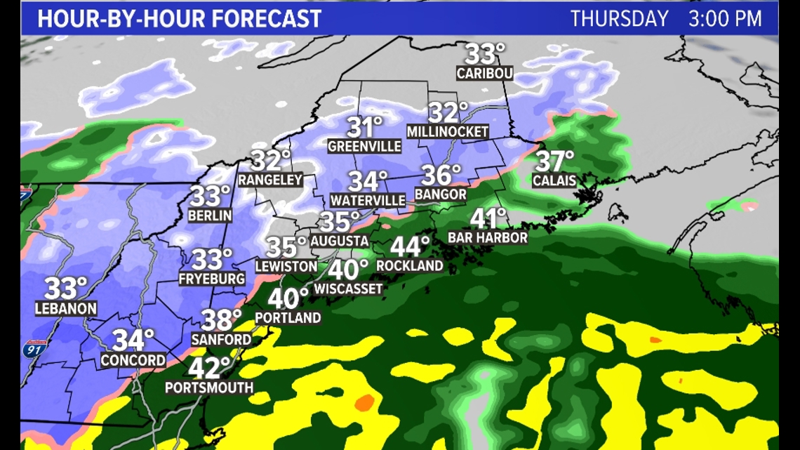
Things get dicey after sunset
With the loss of daytime heating PLUS winds turning north because of the intensification of the storm to our south, accumulation will rapidly become more efficient—that includes on the roadways.

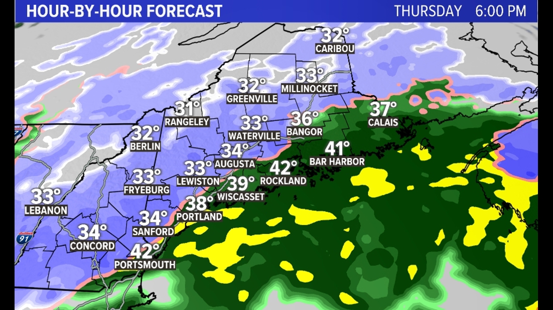
By later evening, we could have snowfall rates of 1 to 1.5 inches per hour just away from the coastline and even the coast will likely crash over to snow for a few hours.

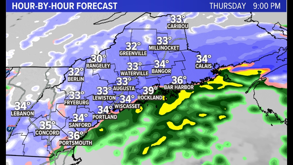
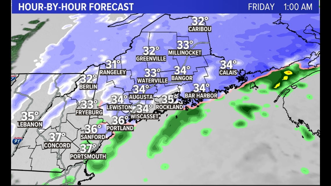
The snow is expected to continue until around 2 a.m. Friday, when it will begin to lighten up from southwest to northeast.

By the time it's all wrapped up Friday morning, here's what I think we will have for snow totals.

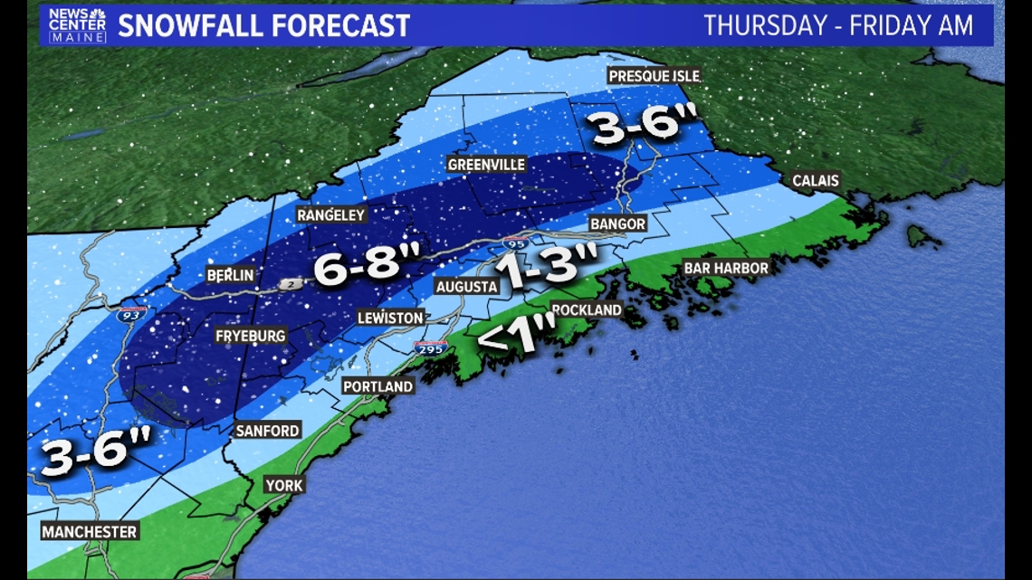
I've expanded the 6- to 8-inch zone as the latest models are even deeper and colder in the last few runs. It's a tough call because there's sufficient moisture for truly big snowfall totals but the airmass is marginal pretty much all day.
In addition, we are unlikely to get the "normal" 10:1 snowfall ratios, meaning we will get less total snow out of the moisture than you'd imagine if you looked at it casually. (Is it casual now?)
In the end I took all this into account and that map is what I came up with. Again, the bulk of that snowfall accumulation is happening between 4 p.m. Thursday and 1-2 a.m. Friday.
Traveling? Here's what to expect
I start with the assumption that we are Mainers, and we can drive in the snow pretty well. That being said, getting home AFTER Thanksgiving dinner will likely be the trickier task.

Direction matters, too. If you're driving down to Massachusetts, for example, you'll encounter a lot of wind and rain for most of the journey. But if you have to drive to New Hampshire or Vermont, that's a horse of a different color. Most of that drive would be in the snow.
Either way, I hope this ill-timed storm doesn't reduce your enjoyment of this Thanksgiving!
Carson
Follow ya boy on Instagram.

