PORTLAND, Maine — On the one hand, I live for forecasts like this: huge model disagreement for a storm during one of the busiest travel stretches of the year. On the other hand, I'm less of a glutton for punishment than I used to be, now at the ripe old age of 41.
Still, there's plenty of intrigue here. Let's start with the basics. The EURO computer model, which I have a well documented, long and torrid love affair with, has been consistently spitting out a relatively major storm for Thanksgiving.

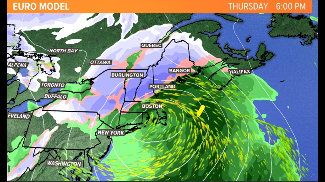
It approaches from the southwest on Thanksgiving morning and gives us driving rain along the coastline with snow across the interior and mountains. (Eventually the rain/snow pushes farther North, but that's a detail that we aren't really in a position to worry about right now.)
The other major global model, the GFS (American model!) has the following solution for Thanksgiving:

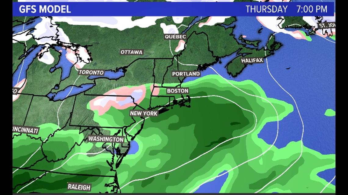
Within reason, that's nothing. It's some light rain over far southern Maine on Thursday evening, but not a big deal. (Let me just say that if this is how the computer models are going to behave this winter I will turn this car right around!)
So which is it? As my wife pointed out this morning while drinking coffee, "Just so you know, Keith, people need to know by today. Thanksgiving is too big a deal." Jeez, let a man wake up first! But also, she's right.
My gut here is the EURO is going to be a lot closer to correct than the GFS. It's one thing if one or two EURO model runs show a storm, it's certainly not an infallible model (especially when it comes to the tropics). But when the EURO basically INSISTS on a solution, it's usually wise to listen. In addition, I've seen little "blinks" by the GFS over the last few model runs. Meaning, the GFS was originally very progressive and fast, pushing a storm offshore and basically never developing anything major. But recently the GFS has ticked Northwest a bit with its track and, crucially, shown signs it now wants to blow a bigger low up off the coast too.
Exhibit A: The GFS most recent run has a storm... on Friday instead of Thursday.

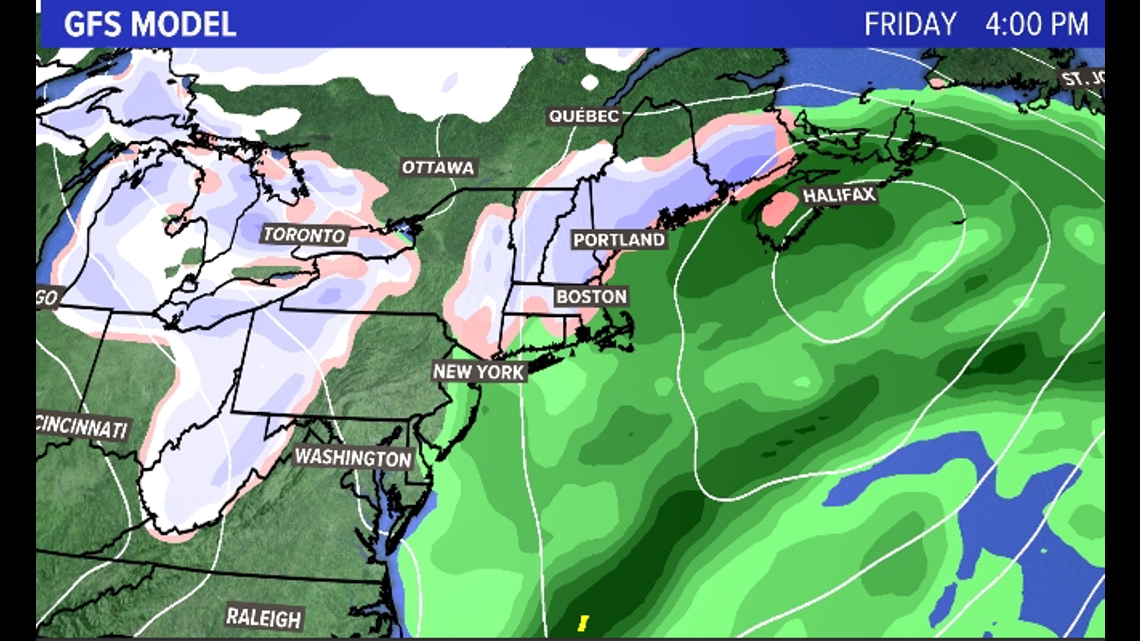
Blink, blink, blink.
That doesn't mean there won't be some corrections by the EURO, probably Southeast with the low if I had to guess, but I believe it will end up the closer of the two.
So what does that mean for Thanksgiving travel?
Well, it looks pretty nasty. Rain would begin along the southern coastline in the late morning, snow would begin inland in the late morning and by midday or so the map could look something like this:

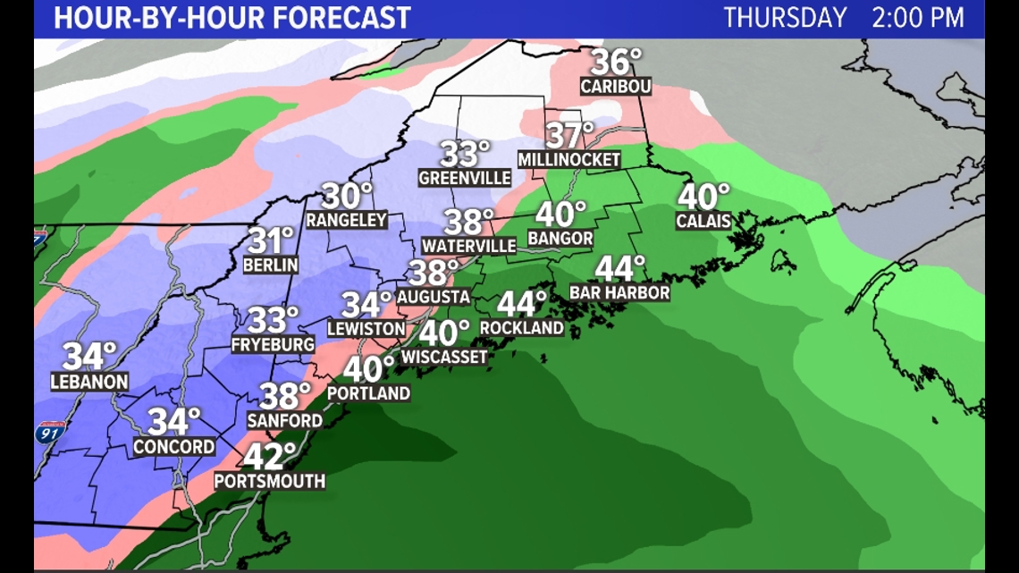
Rain and snow would continue through the evening before wrapping up early Friday morning.
Clearly it's fairly impossible to talk snow totals when half of the model suite doesn't even have a storm. But the rain/snow line as projected by the EURO this afternoon looks like this:

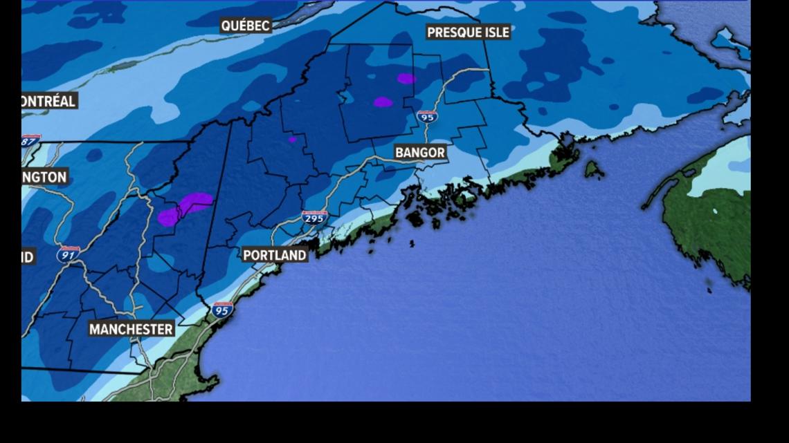
(That's right, no numbers. I can't trust you all with numbers! "Oh, Carson said we're getting 10" on Thanksgiving." ((It's always the top end of a range people talk about. You say 6-12" and they hear a foot, you say 3-6" and it's always 6".)) Sorry, I'm done.)
So, as it stands I'd plan for a rain/inland snow event on Thanksgiving. As soon as things become more clear you'll get more details on timing and snowfall amounts from us.
And if the GFS is right...well, I'll be chowing down on a NothingBurger for Thanksgiving dinner with a side of humble pie.
Carson

