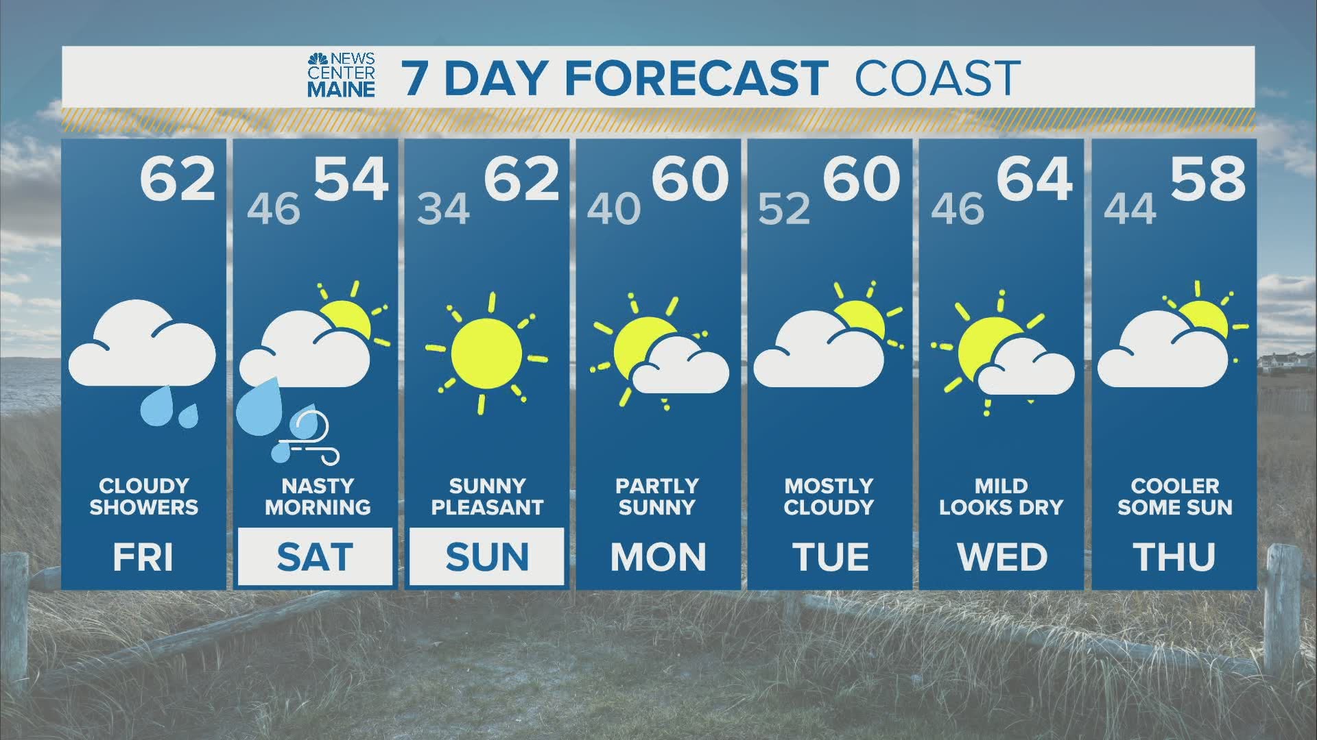
MAINE, USA — Another round of rain is on the way Friday night and it will be heavy at times.
This beneficial rainfall will cut the deficits that have been growing over the last five months.
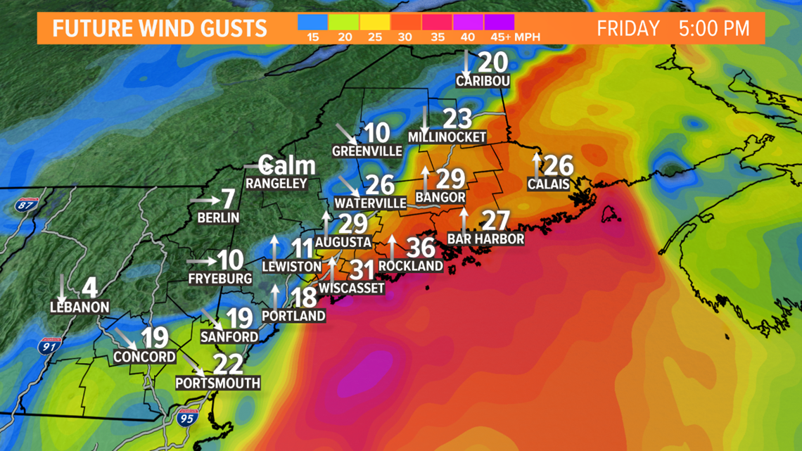
Wind gusts will pick up and coincide with the astronomical high tides. Thankfully, the trend has favored weaker wind gusts. This should help prevent coastal inundation and wind damage related to the storm.
Saturday afternoon will feature a drying trend as gusty northwest wind takes over. Given the wind direction and cold air this time of year, some flakes will be possible in the high elevations.
By Sunday, high pressure returns with cooler and drier air.
The Forecast

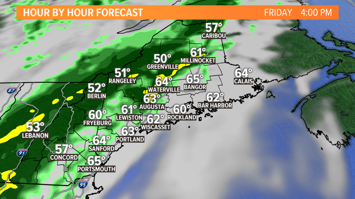
Moisture starts moving in through the day on Friday. Spotty showers will slowly be overtaken by steadier, heavier rain after sunset.
The first round of heavier rain will fall through western Maine and New Hampshire.

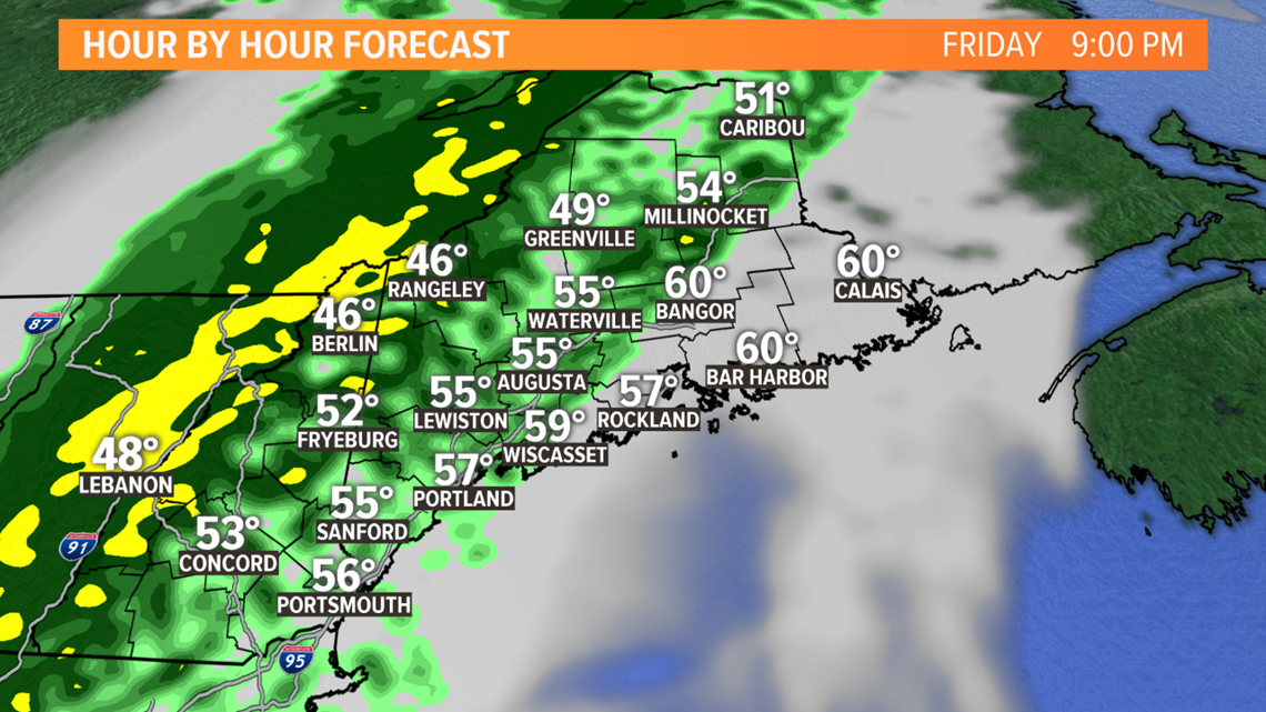
As the stalled-out front sits draped across Maine, a second area of low pressure forms south of New England.
This low pressure starts to move north along the front. Moisture transport continues, and a round of heavy rain is on the way for Saturday morning.

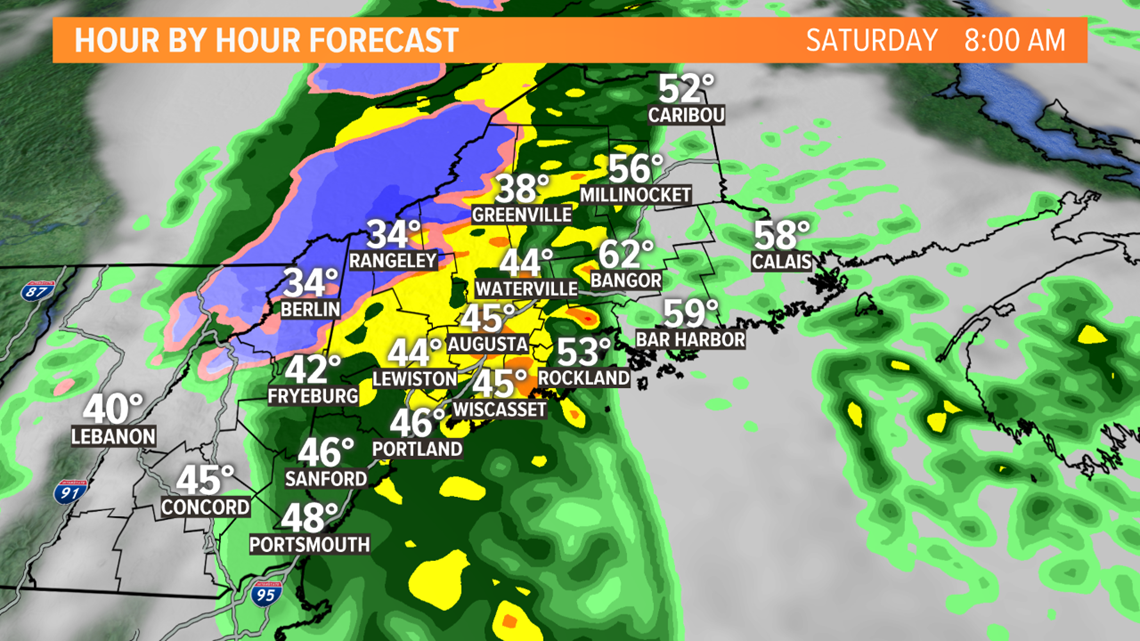
As the storm develops, wind gusts will pick up a bit. Expect gusts to approach 30 miles per hour on Saturday morning. The wind will be coming out of the south ahead of the strengthening storm.

Cold air wraps around this developing system. High peaks in Maine and New Hampshire will see some minor snow accumulation.
Given just how cold this air is, and the dynamics at play with a strengthening low, some spots in northern Maine could see a wintry mix on Saturday, especially in the morning.

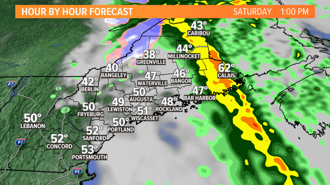
The wind remains gusty after the rain wraps up. Rain totals will likely reach the two-to-three-inch range across inland sections. Closer to the coastline, it will be closer to an inch. Some locally higher amounts are possible under heavier rain bands.

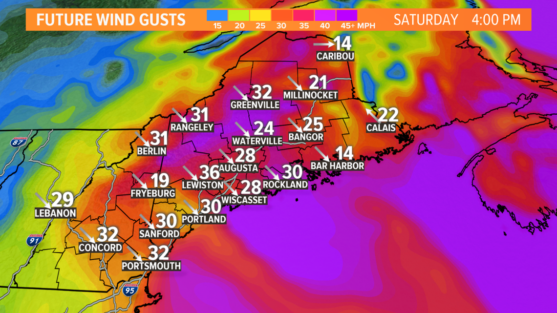
Wind gusts out of the northwest will be in the 30 - 40 mile per hour range. Given the stronger gusts are expected north, where the trees have lost their leaves, wind damage still looks unlikely. As always, a couple of power outages are on the table.

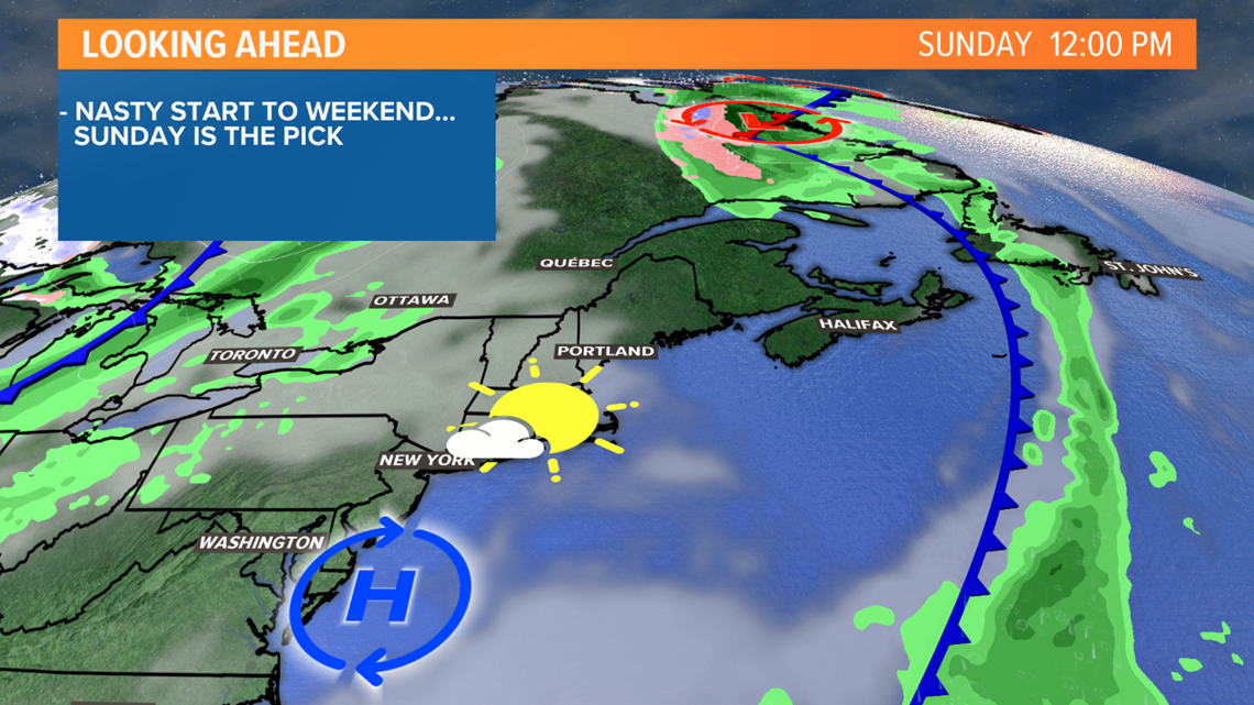
The stronger gusts rapidly wind down Saturday night. Sunday looks like a very pleasant October day. Sunshine pushes high temperatures into the upper 50s north and low 60s south. Definitely the pick of the weekend!
The Drought and Rain Deficits
Earlier this year, NEWS CENTER Maine reported on Mainers with wells that had dried up.
Rain deficits have been moving in the correct direction, though. With the rain that fell earlier this week included, deficits are still in the four to six inch rain in most areas.

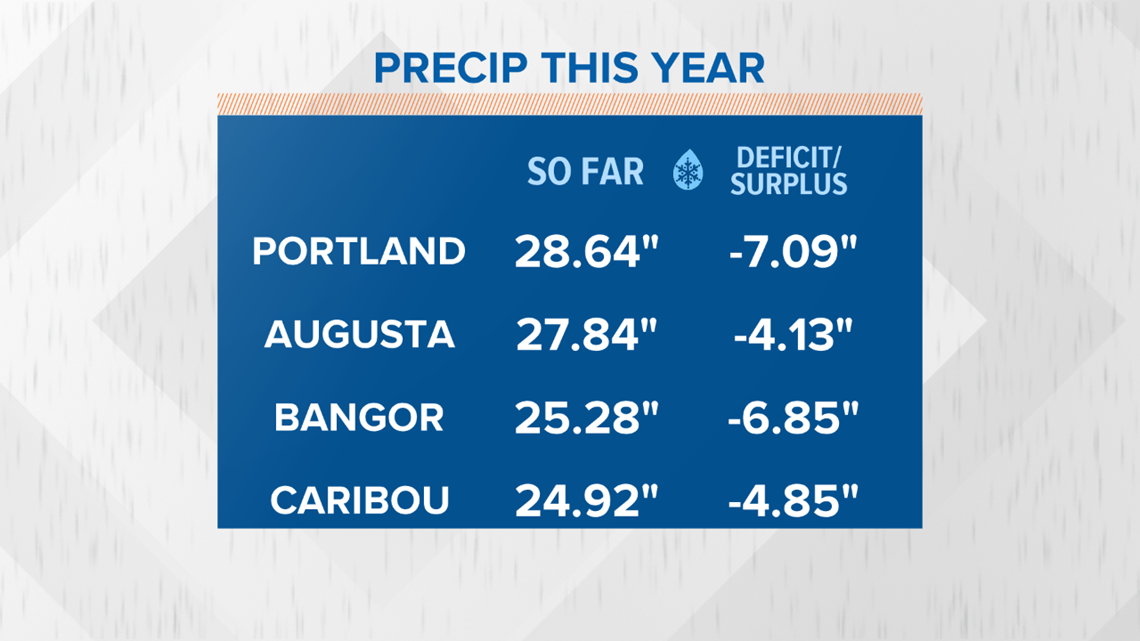
For anyone who regularly fishes or hikes, it's no surprise at just how low the rivers and lakes have been.

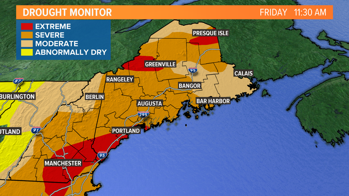
The drought monitor still has a few spots in the "extreme drought" category. There are a couple of caveats with this: data collection ended at 8 a.m. Tuesday, before most of the rain had fallen locally.
On top of that, the drought monitor does not accommodate for forecast rain.
I think the drought monitor will be in much better shape when the update gets released next Thursday.
Ponds and rivers are starting to rebound from their low levels earlier this year. Aquafers will follow suit, and wells should be replenished of their water.
The pattern remains somewhat active in the long range, too. With a bit of luck, the rain deficits will be a thing of the past as we start winter.

