PORTLAND, Maine — Editor's note: The video attached to this story was published Oct. 14.
You know the saying by now: “Wait 15 minutes, and the weather will change in Maine.”
We’ll have to wait a little longer than that, but by the time you wake up Sunday morning, our weather will have drastically changed from the short sleeves and boating weather recently.
A strong cold front is diving south from Canada with the reality check we’ve mostly avoided for the duration of fall so far.
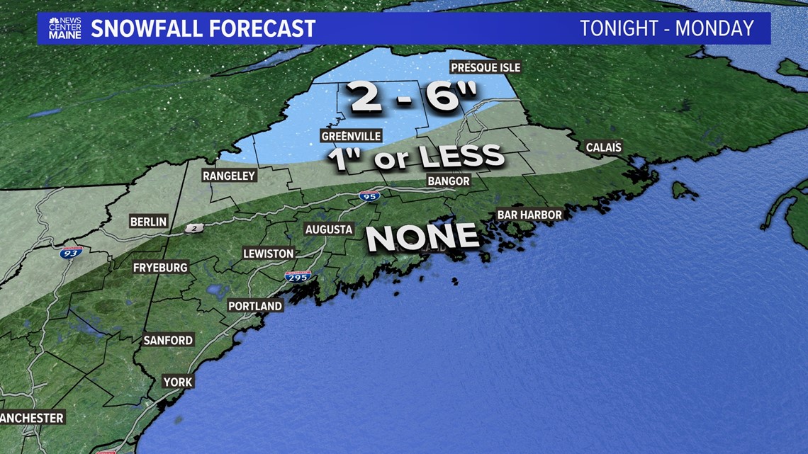
As cold air spills into Maine from the north it will set the stage for accumulating snow, especially Sunday night into Monday in part of the Pine Tree State.
Let’s discuss the details:

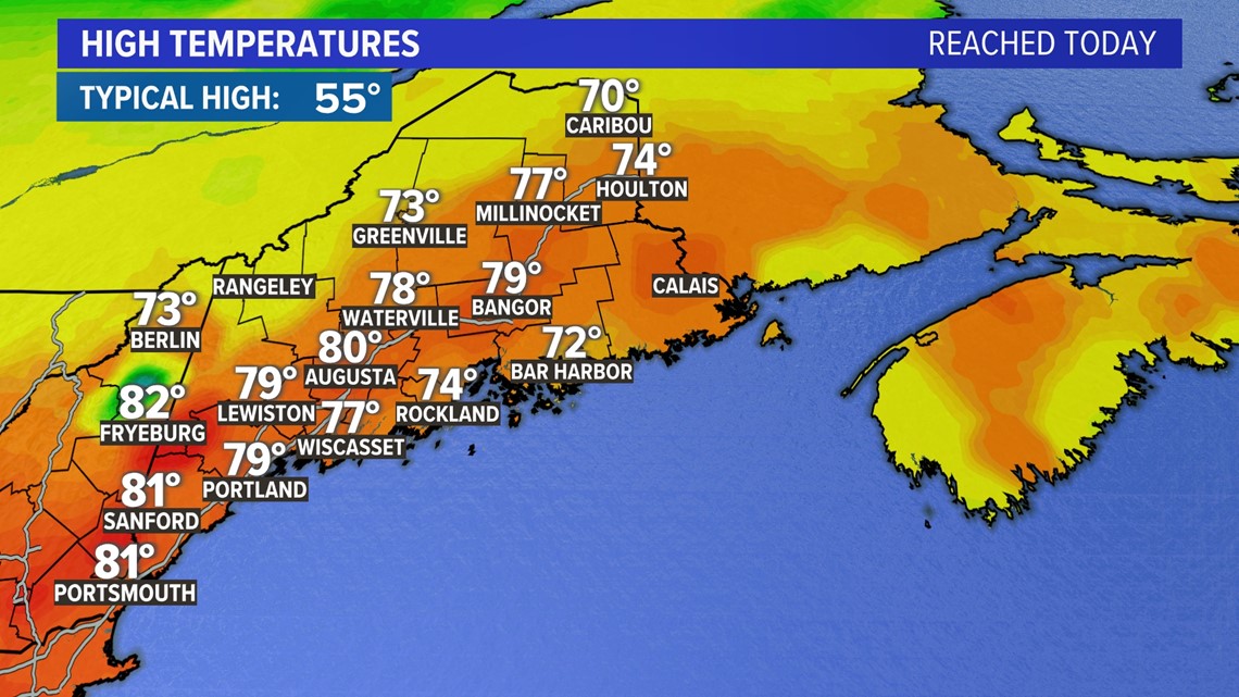
It was a late October day like no other in Maine. From 70s in the crown of Maine to 80s in Augusta and up to at least 82 in Fryeburg, it’s like the weekend that we’ve waited for all summer and fall, wrapped into one day. But that’s about to change.

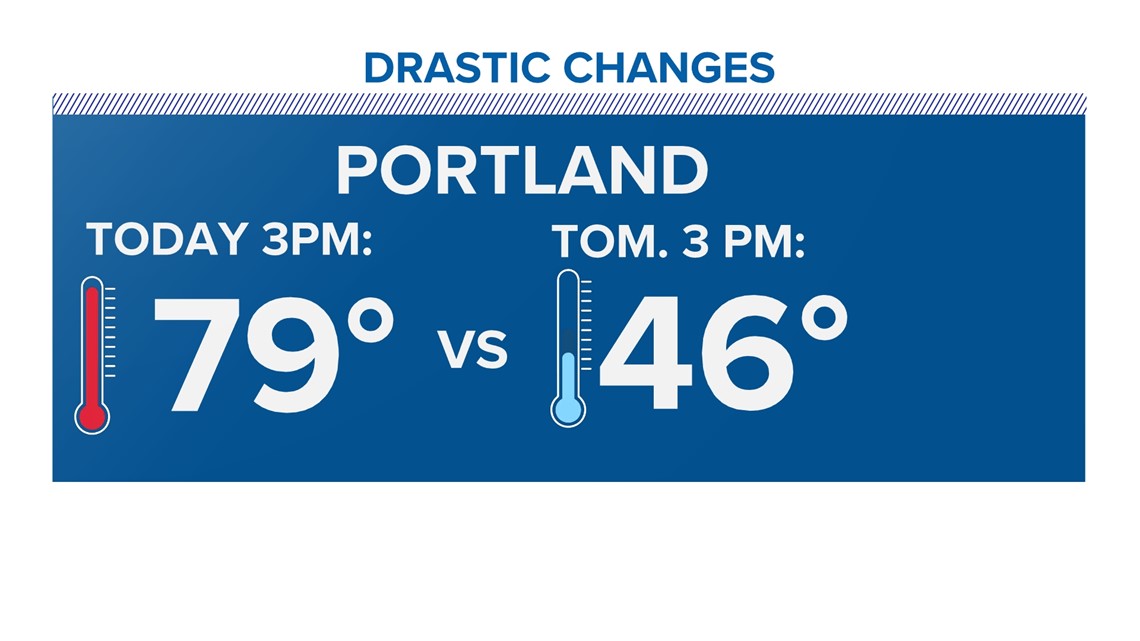
At 3p.m. Saturday, it was 79 degrees in Portland; Sunday, it will be 46 at the same time.


In Bangor it was also 79 degrees at 3 p.m. Saturday. On Sunday, we will be lucky to see 45 degrees at that time.


We go from record-shattering heat to rain and snow in less than 24 hours, thanks to a cold front.
The first batch of precipitation will be light tomorrow, and I’m not expecting any accumulation.

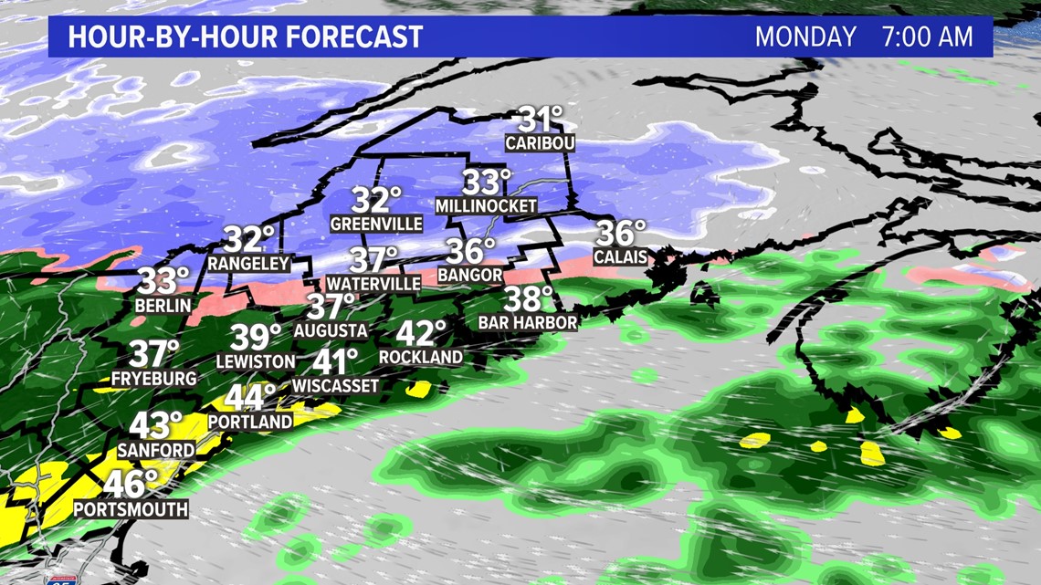
By Monday morning the heavier precipitation will allow the ground to cool and snow accumulation of up to 1 inch in the valley passes is expected.
Here’s the timeline:


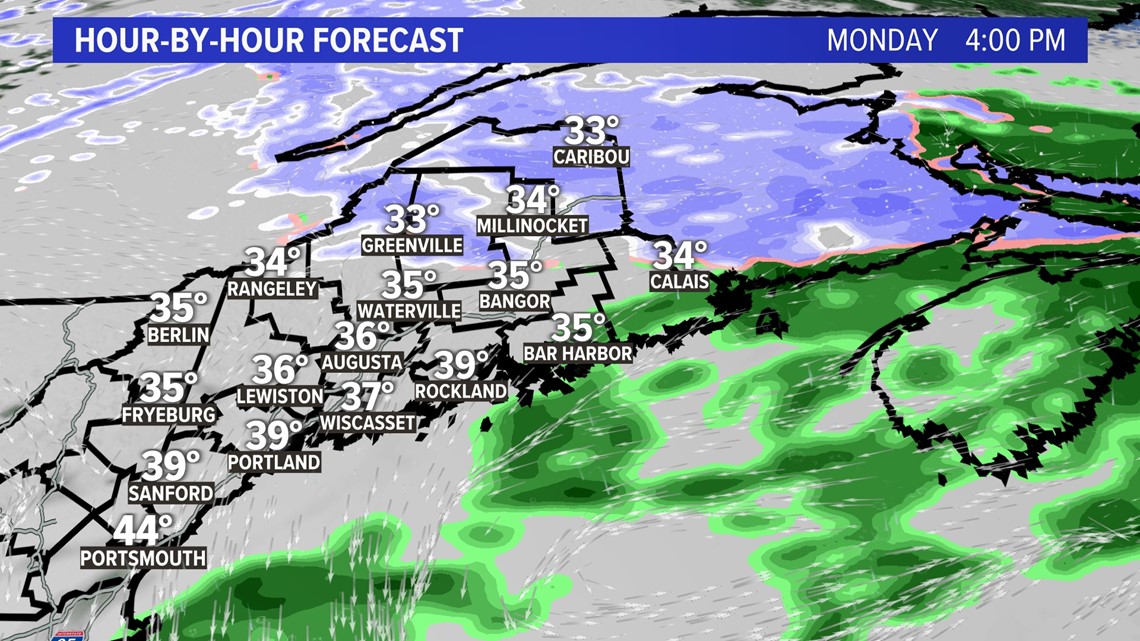
The storm wraps up Monday afternoon with up to 6 inches of snow on the higher summits in the western and northern mountains.

Good news is that Halloween will be dry and clear for trick or treating, but the snow depth record of 2 inches could be in jeopardy so the kids will need the boots up north.


Happy Halloween!


Follow along for more weather blogs and pizza discussion.

