
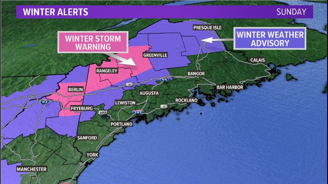
MAINE, USA — Winter storm warnings have been issued for parts of western Maine, including northern Oxford, northern Franklin, and central Somerset counties.
A nor'easter is in the forecast. The low tracks through the Gulf of Maine on Sunday morning.
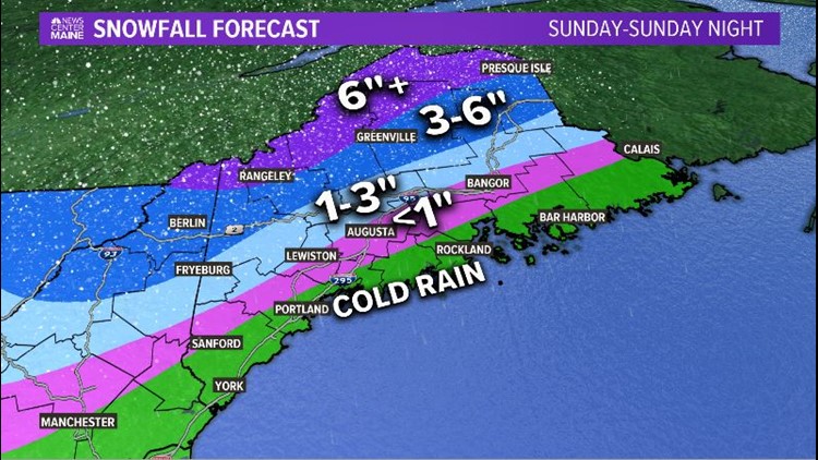
Warmer air along the coastline means cold rain. Temperatures will be too warm to support snow. It will feel raw, due to the breezy and wet conditions.
Colder air is trapped inland. Along a line from Lewiston to Augusta to Bangor, some minor slushy accumulation is possible. There will be periods of rain and wintry mix.
The foothills of Maine see more snow. Colder air will be in place and warmer air takes a bit longer to infiltrate, so snow accumulation is more likely. There still could be some mixing that takes place, and sleet would keep totals on the lower end of the forecast range.
The bullseye for higher snow totals is the western Maine mountains and into Aroostook county. This is where the National Weather Service has issued winter storm warnings and winter weather advisories.

Moisture moves into southwestern Maine around 8 a.m. and keeps spreading north and east through the day. By noon, most of Maine will see some type of precipitation.

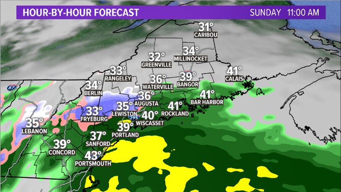
The snow is a bit slower to start up. Still, the impacts will be noticeable as soon as it begins.
Reduced visibility and slick roadways are the biggest concerns, especially throughout northern Maine on Sunday afternoon and evening.
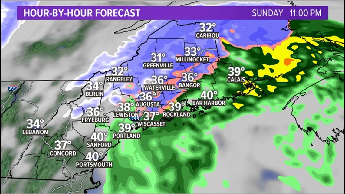
The storm pivots through and moves out late on Sunday night. With cold air wrapping around on the backside of the storm, a transition to snow is possible in eastern Maine. This could allow for a minor accumulation as far south as Bangor, though the coastline remains cold rain.

Most will wake up to a quiet morning commute on Monday. Some stray squalls are possible in the mountains and in northern Maine, but they will be isolated in nature. Check out the forecast snow totals below.


If snow isn't your thing, Tuesday will bring sunshine and high temperatures above 50 degrees. Until then, travel safely, and watch for slick roads and blowing snow.
-Meteorologist Mike Slifer
