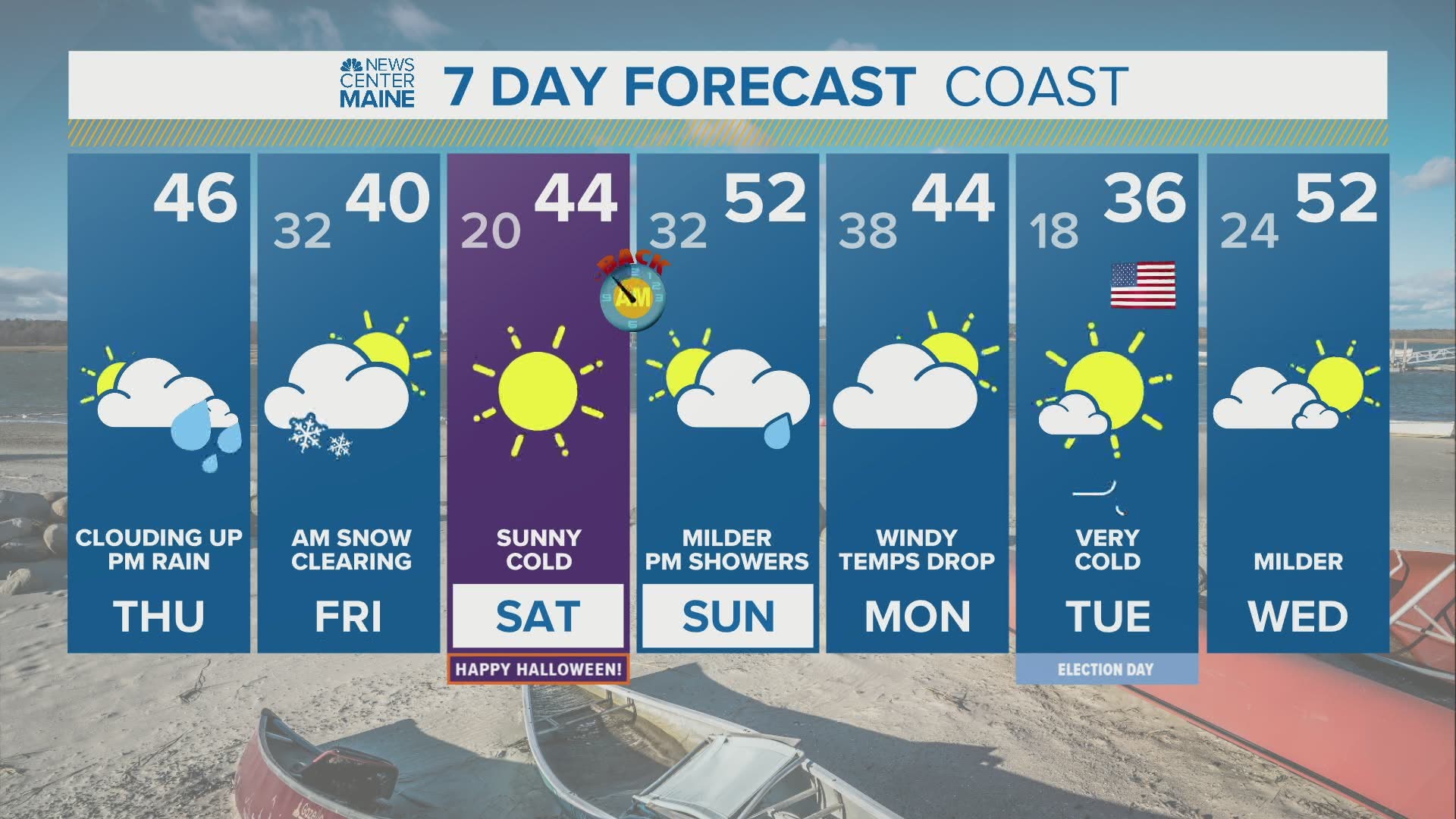
All the pieces are there for the first notable snow chance of the season for many towns in Maine. Plenty of moisture is surging north from Tropical Storm Zeta. Abnormally cold air is pooling north of the border. The timing looks perfect too with most of the precipitation falling at night. Here we go!

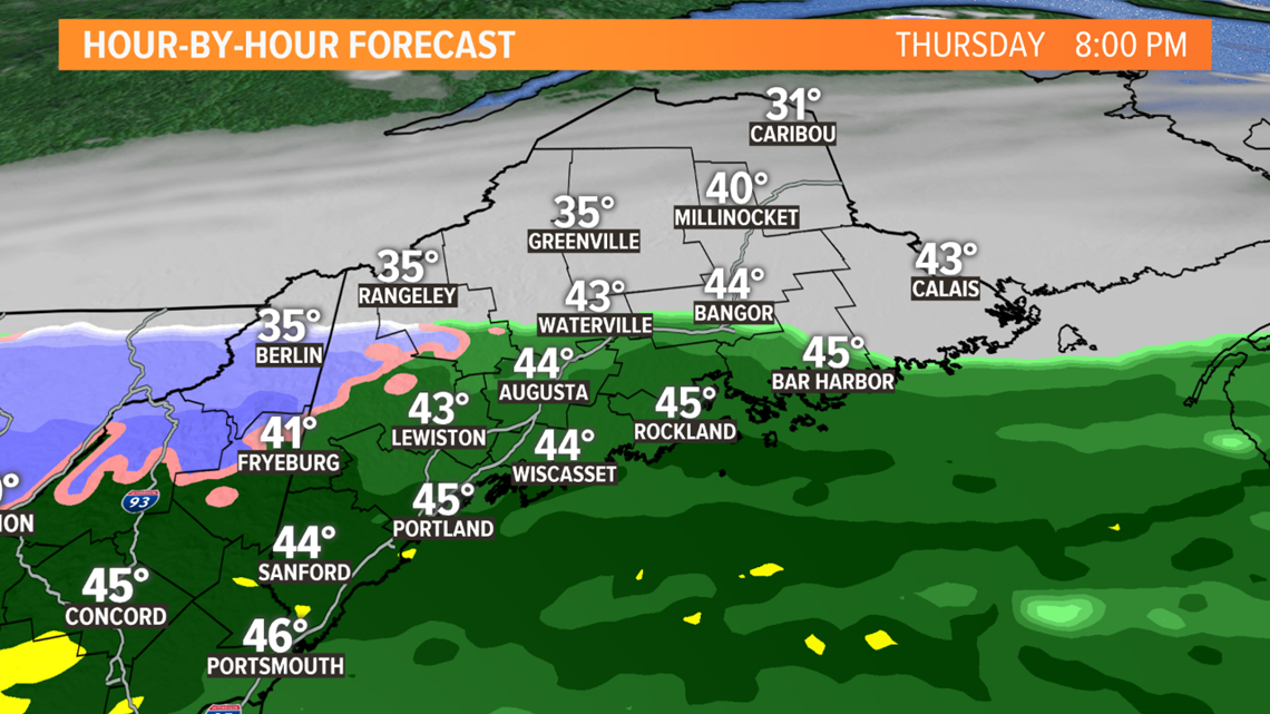
Cold rain will spread in this afternoon and will remain rain through the evening. After the sun sets, cold air will bleed south from a large area of high pressure in Canada. Cold rain will start changing to snow, first in the higher elevations but eventually down to the coast in the valley floors.

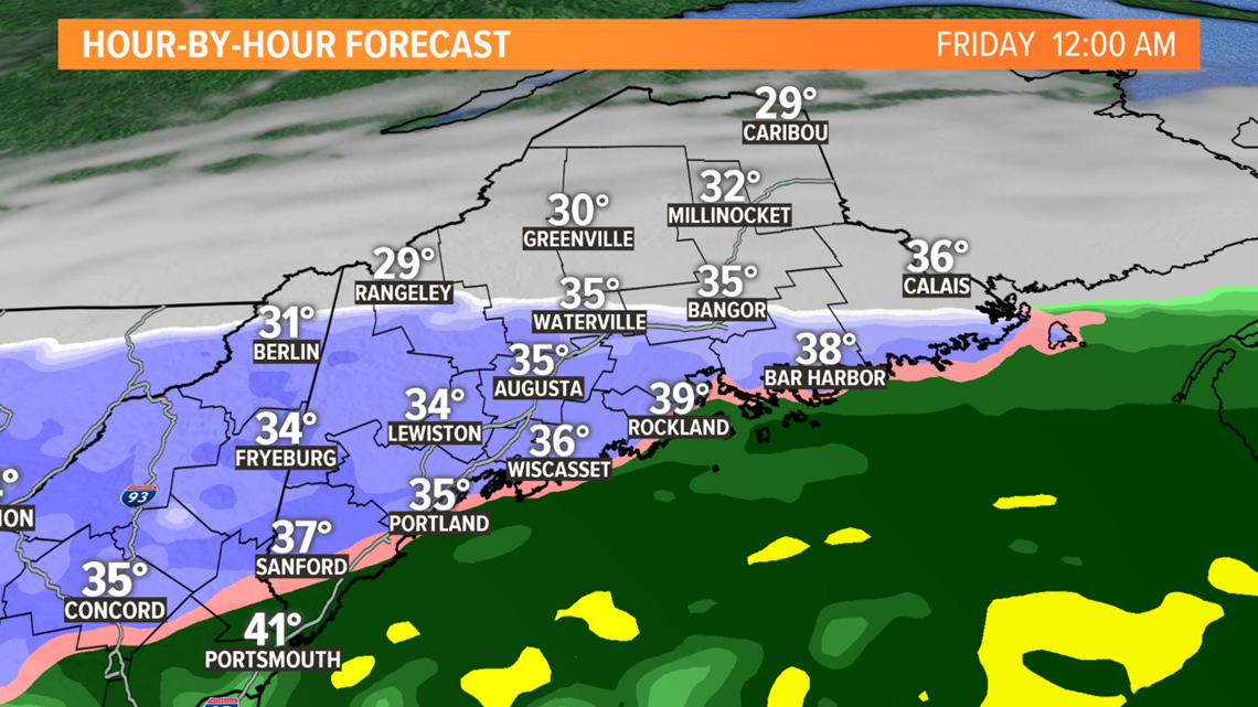
Surface temps will take some time to get to freezing or below, especially with an unfrozen ground. Accumulation will first appear on the grass, trees, and cars. But by tomorrow morning, temps will be cold enough for snow to accumulate on roads and some will get slushy and slippery. Salt trucks and plows should be on standby.

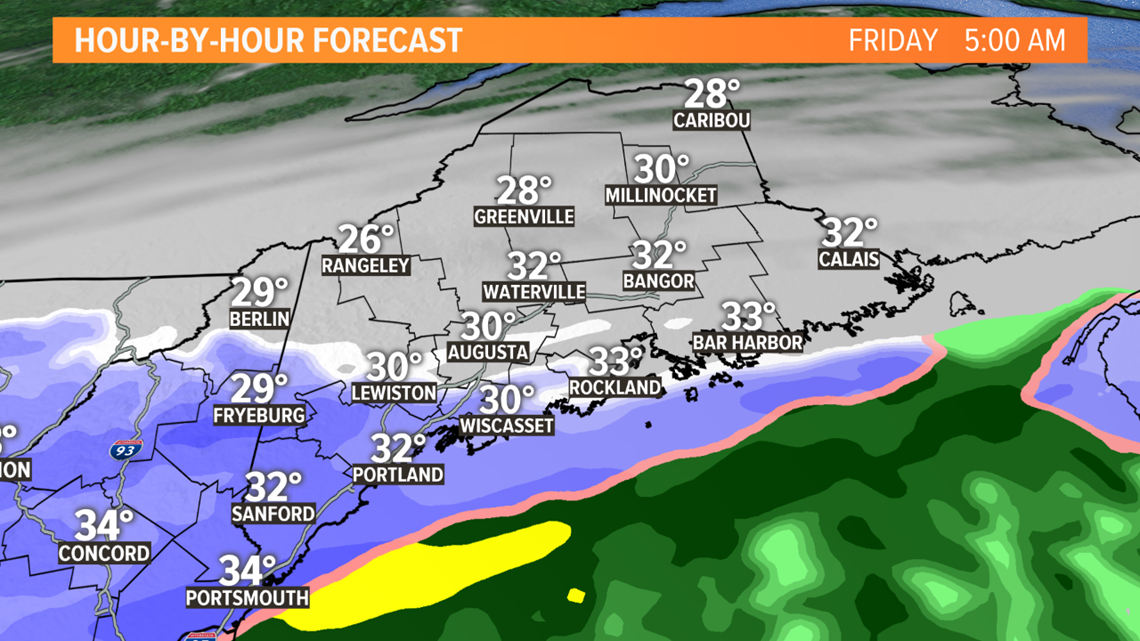
The final flakes will fall by noon tomorrow, with clearing expected during the afternoon. Temps will remain unseasonably cold the departure.

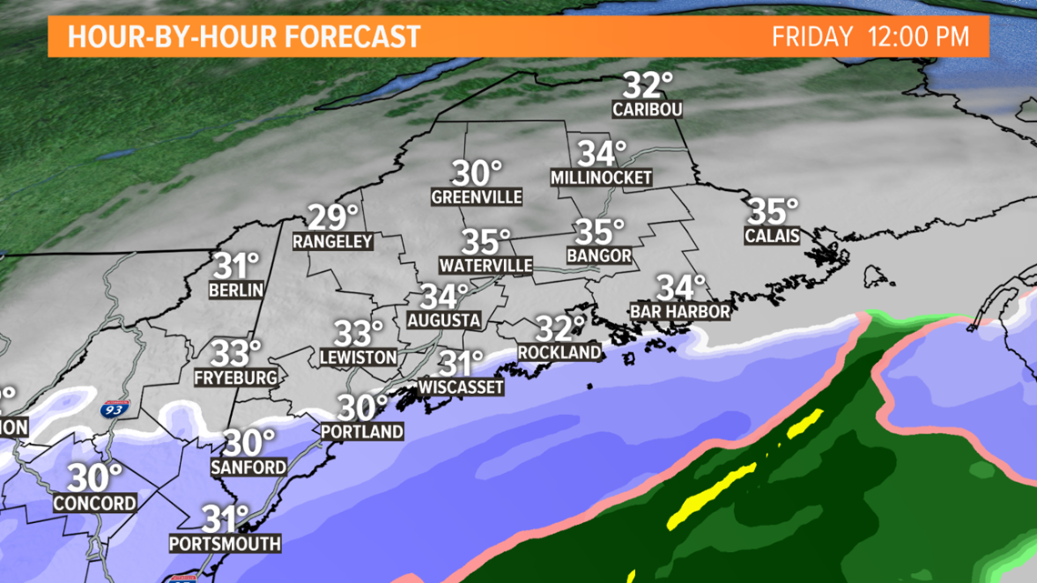
I still don't think we get to the power outage snow threshold of around 4 or 5 inches. But shoulder-season snow events, especially one this complex, always throw out surprises. We'll need to be on our toes because I can honestly make a case for higher snow amounts or even lower ones at this point.

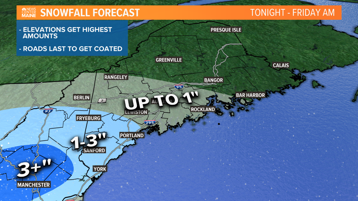
More info will trickle in throughout the day so check back for adjustments.

